In the mountains – Roof of the World


Panoramic views from Laurebina Yak (3,930m), Langtang/Helambu

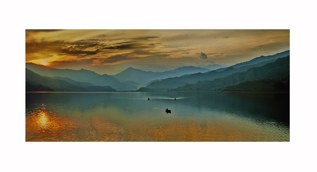
Sunset on Lake Phewa, Pokhara (915m)

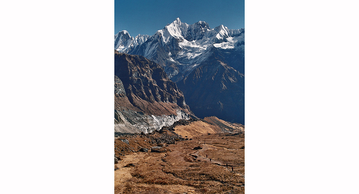
Looking back down Annapurna glacier, from Annapurna Base Camp

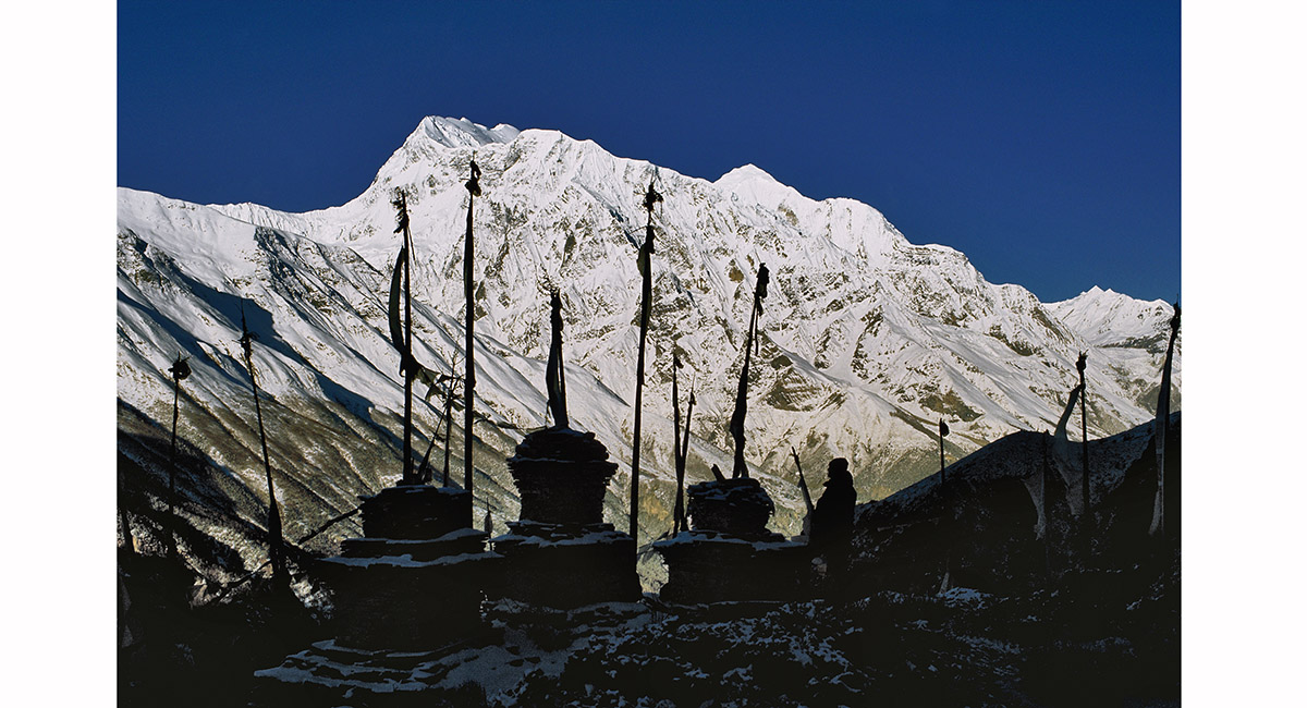
A short climb above Ghyaru lies a group of chortens and prayer flags – the perfect spot to watch the sun rise in a crystal clear sky over the Annapurnas, Annapurna Circuit

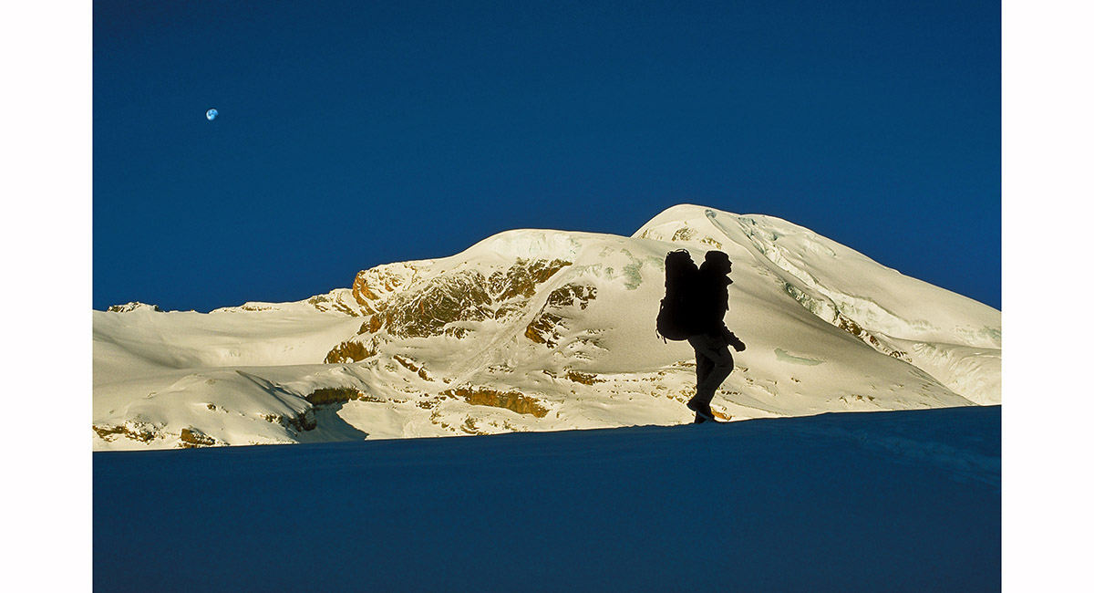
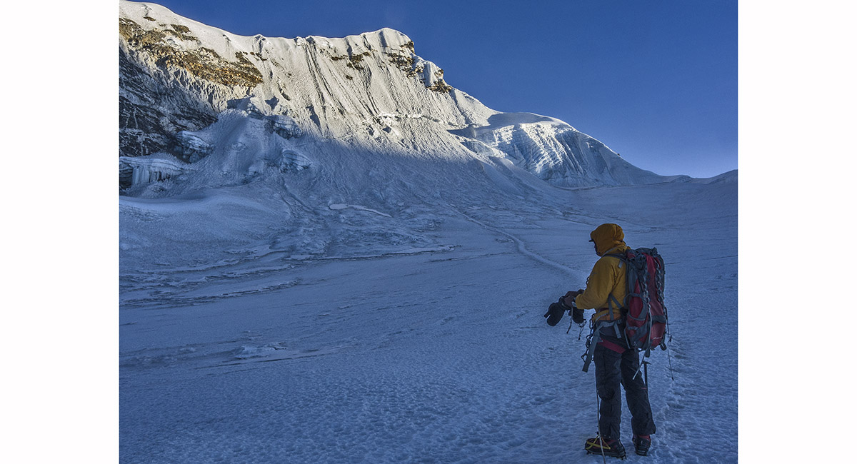
Onwards and upwards on the snow-bound trail from High Camp to Thorung La, Annapurna Circuit

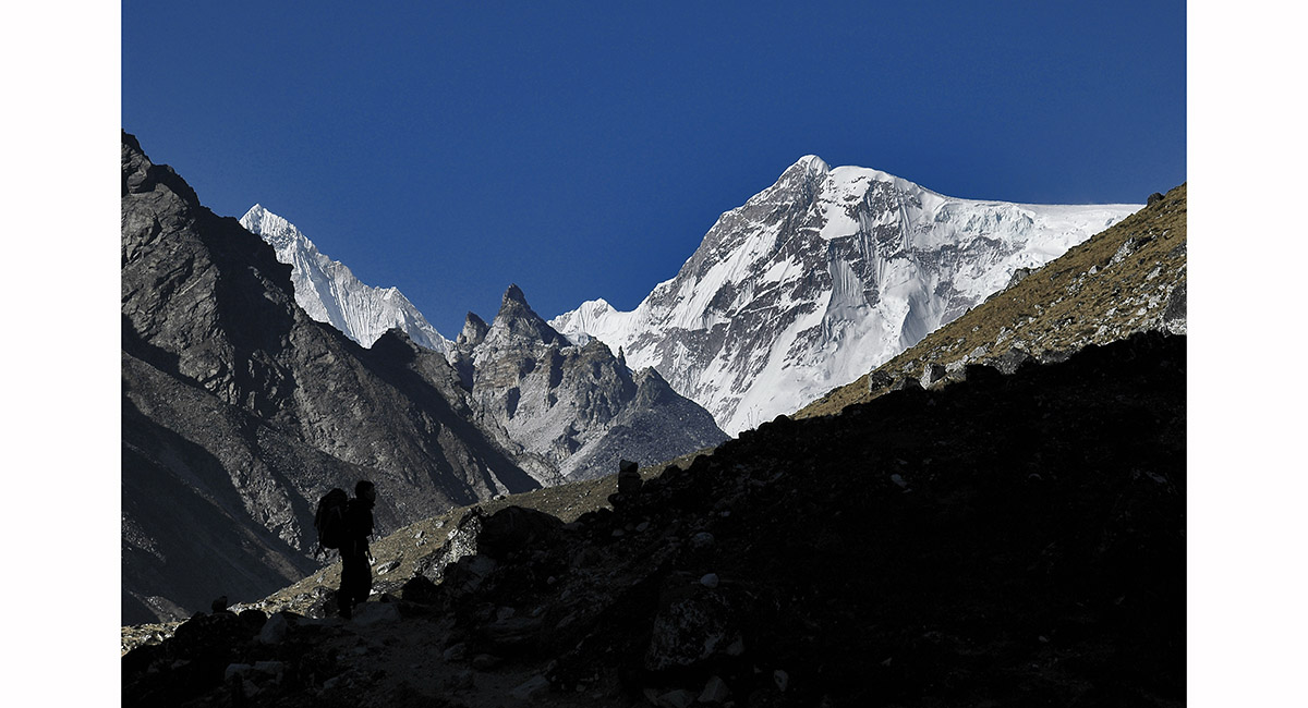
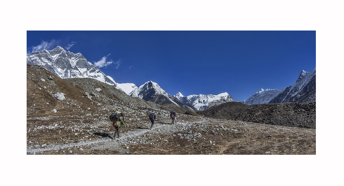
Nearing the end of a day's walk on the approach to Gokyo, with the Frozen Fingers and Cho Oyu providing a striking view, Khumbu

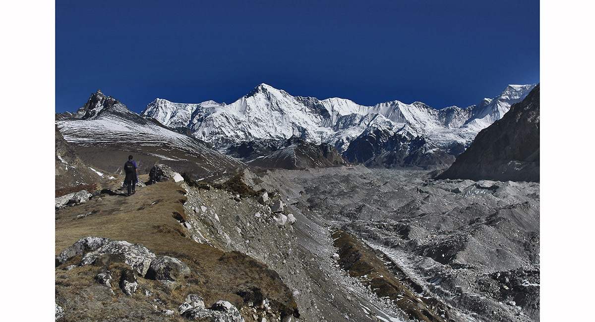
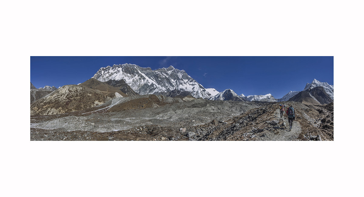
Following the moraine of the Ngozumpa Glacier, above Gokyo towards Cho Oyu, Khumbu

A view below Cho La towards Dzonglha (4,843m), with Ama Dablam (6,856m - distant right of centre) and Cholatse (6,440m - near right), Khumbu


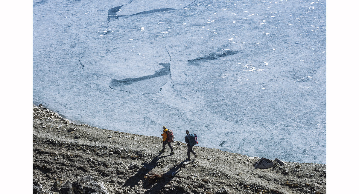
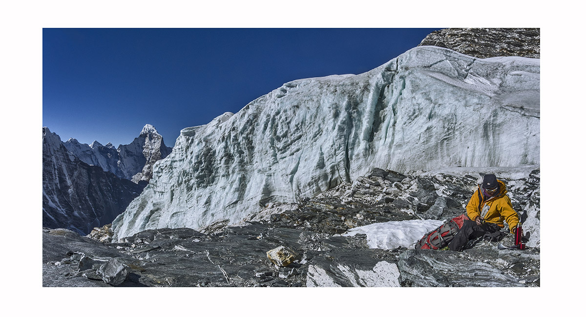
Finding the way through a labyrinth of ice and rock on the Khumbu Glacier, between Lobuje and Kongma La, Khumbu

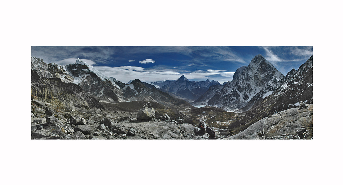
The lake beneath the east side of Kongma La, Khumbu

Just above Chhukung, on the way to Imja Tse Base Camp. This view is up the Lhotse Glacier to Nuptse and Lhotse, with Imja Tse right of cente. Below Nuptse to the left are Chhukung Ri (5,550m) and Peak (5,833m), Khumbu

Leaving the moraine of the Lhotse Glacier, Imja Tse dead ahead, Khumbu

The 200m headwall giving access to the summit ridge of Imja Tse (Island Peak - 6,189m), which is another 90 or so vertical metres, Khumbu

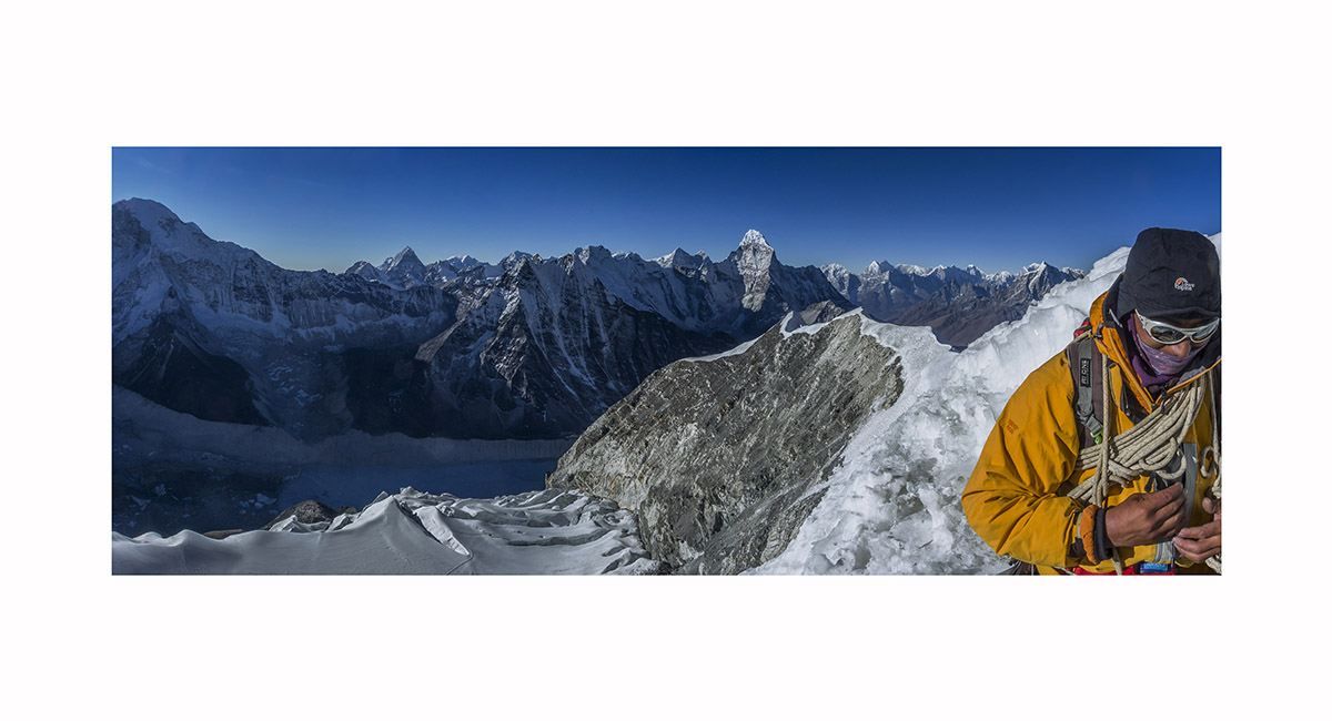
Looking south along the lower section of the summit ridge of Imja Tse (Island Peak), towards Ama Dablam, Khumbu

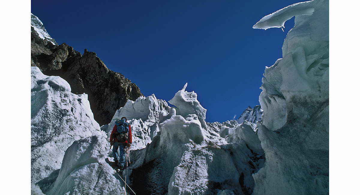
On the rock just beneath the icefall of Imja Tse (Island Peak), Khumbu


From Tumling (3,000m) on the Singalila Ridge. From left - Kumbakarna/Janu (7,710m), Kabru North (7,338m), Kanchenjunga (8,586m - the highest point), Kabru Dome (6,600m), Simvo (6,811m, in shadow) and Pandim (6,691m)


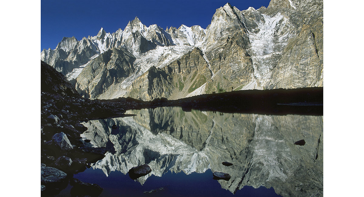
Reflected ants - the "A Team" departing Daltsampa in the direction of Shaishcho, Baltistan

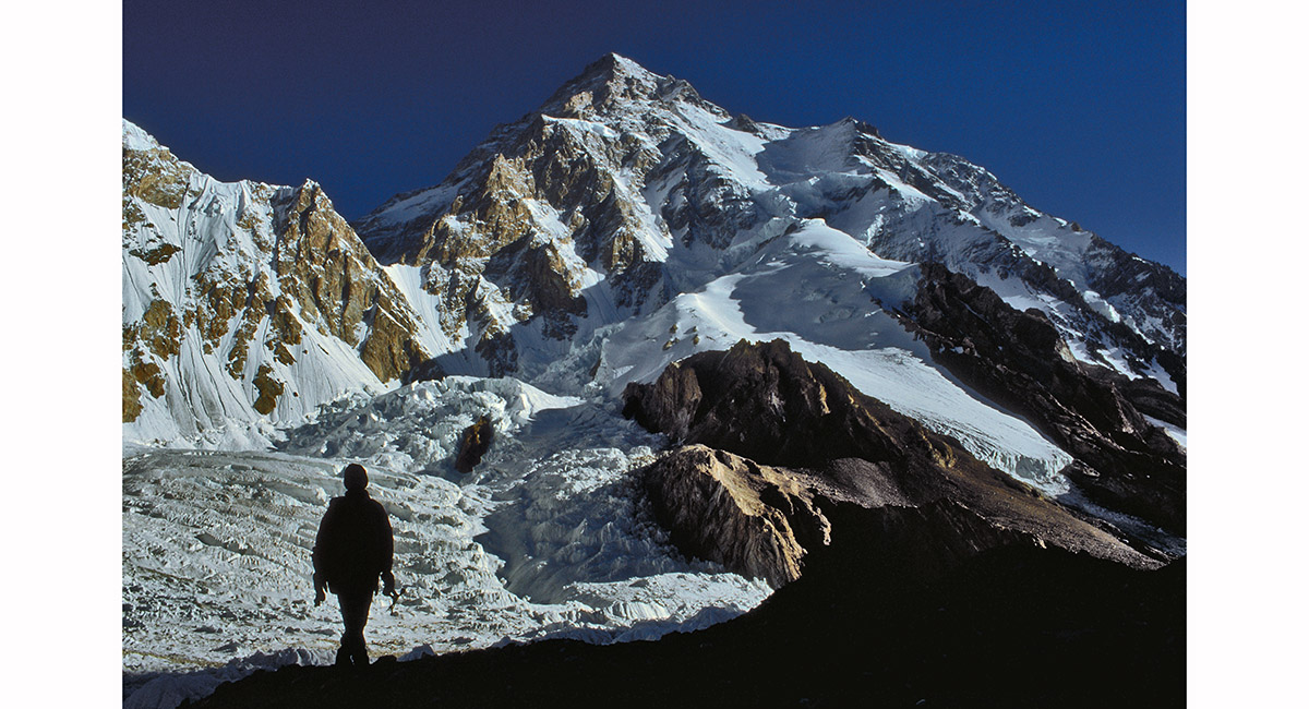
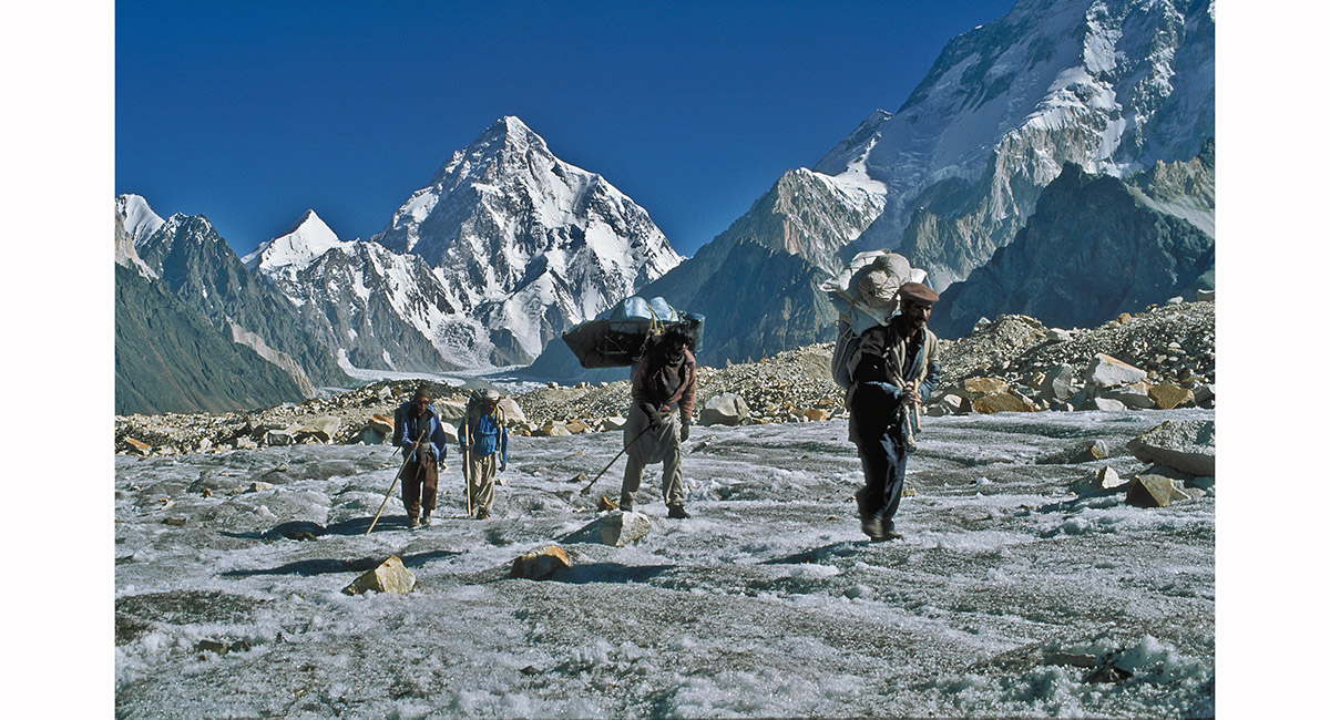
The South face of K2 from Base Camp, Baltistan

Near the shoulder leading to the Abruzzi Ridge, Godwin Austin glacier, Baltistan

On Vigne glacier, with K2 behind, Baltistan

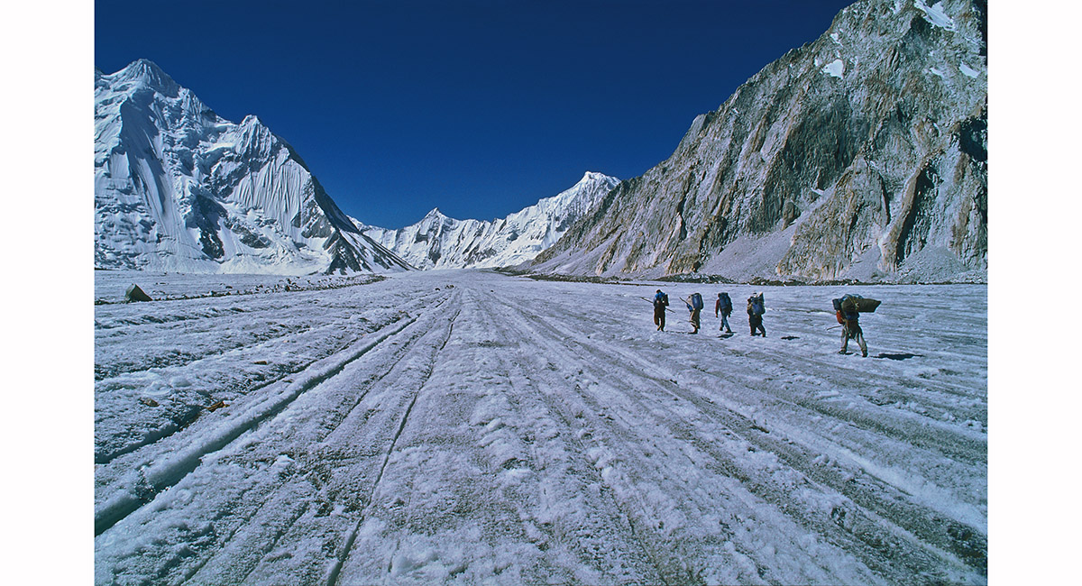
Vigne glacier - like an ice highway, complete with centre lines, Baltistan

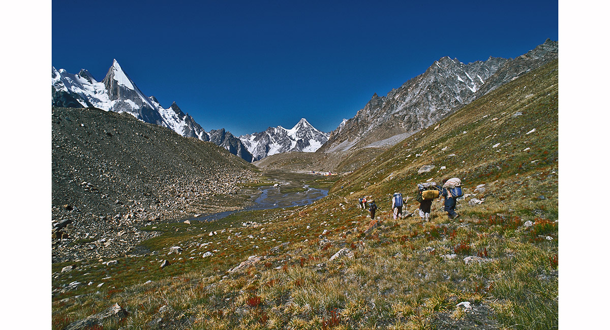
The first vegetation in many days – a welcomed relief to the stark rock and ice. Seen on the trail above Xhuspang, Baltistan In the Mountains > NZ North Island > NZ South Island

To order a print or web resolution file of any image you see in this slide show, just right click the image, click “Copy Image URL” and paste in to the “Your message” box of our Contact Us form. Please also note, for each image, if you want a print or web resolution file. We will get back to you as soon as possible to confirm price and payment details.
Open Contact Us in a new window to paste Image URL(s) easily