In the mountains – NZ South Island

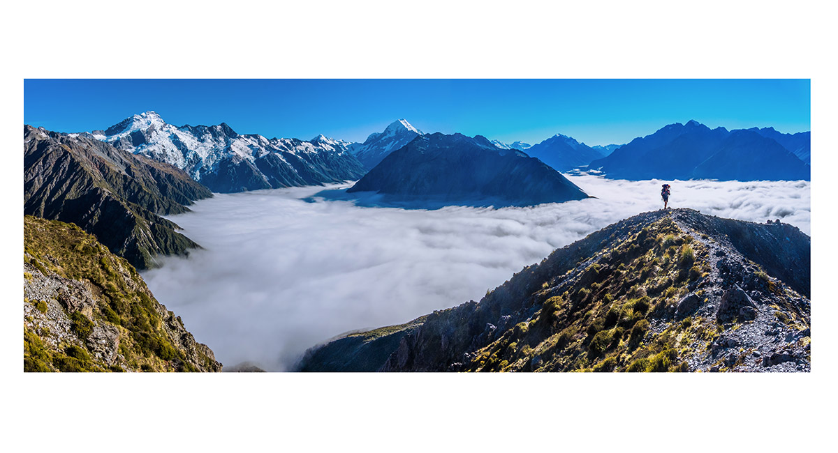
Red Divide - from Mount Mallory (left) to Mount Tasman (right), West Coast side of the Southern Alps


Douglas Peak left and Haidinger right, West Coast side of the Southern Alps


Slightly south of Temple Col (1,774m), with the ridge leading to Mount Temple (1,913m). Mount Oates (2,041m) to the right, Arthurs Pass


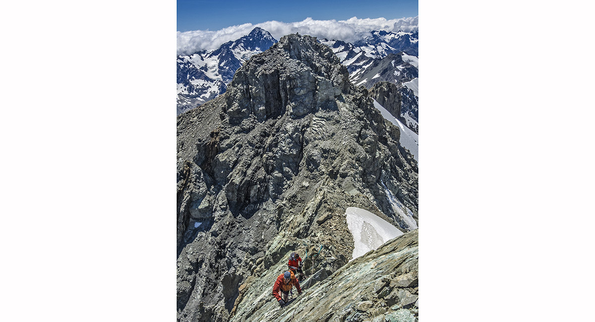
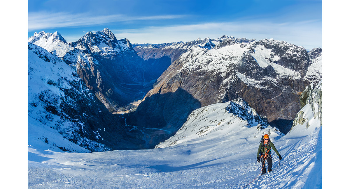
At about 1,850m, heading north along the exposed ridge of Mount Temple, Arthurs Pass


Pitching up the final section below the summit of Mount Temple, Arthurs Pass


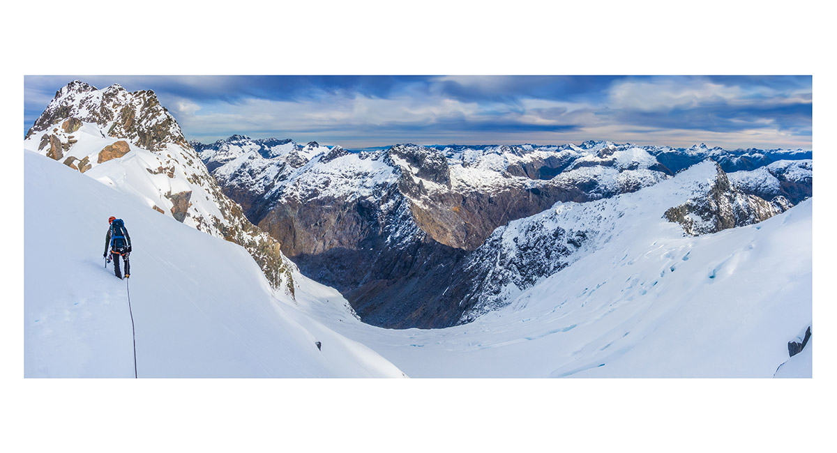
View east, down the Otira Stream, to Phipps Peak, Arthurs Pass


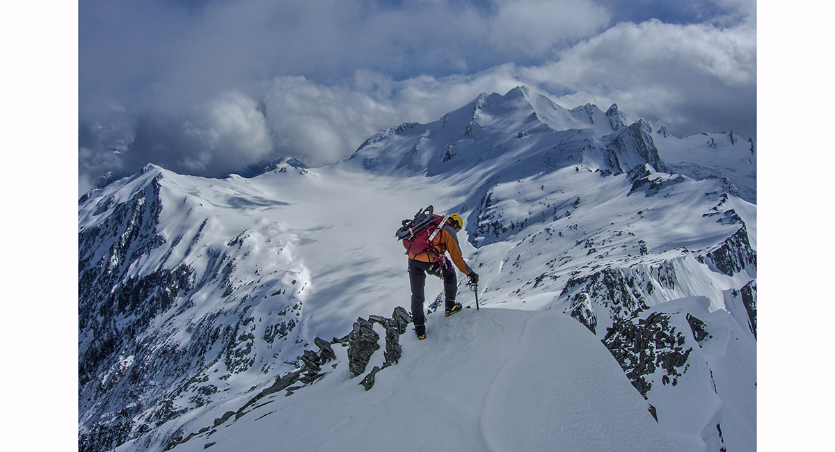
Heading to Mount Cupola, in deep snow and deteriorating weather, Nelson Lakes

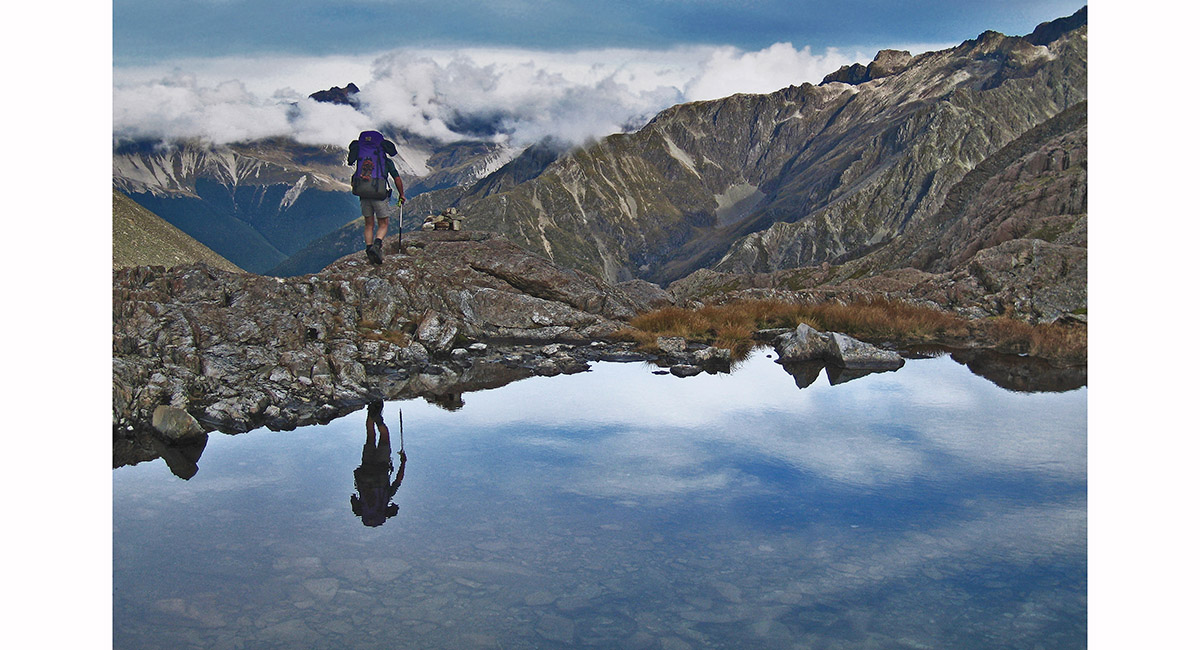
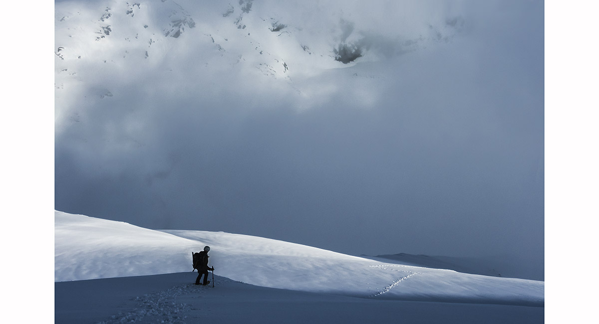
Descending Sunset Saddle, towards Hopeless Hut, Nelson Lakes


About to depart the rock bivy. Cloudy Peak living up to its name behind, Canterbury mountains


At the base of the South West Ridge (right side), Cloudy Peak, Canterbury mountains


In pitch four, (1,830m), SW Ridge of Cloudy Peak, Canterbury mountains

Climbers descending Mount Dixon, Mt Cook National Park


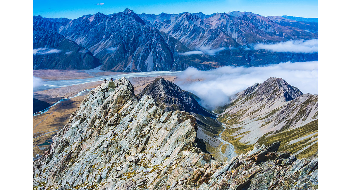
On the ridge above the Summit rocks, with the Malte Brun range below, Mt Cook

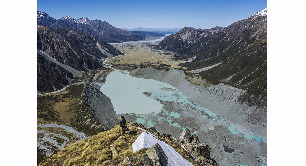
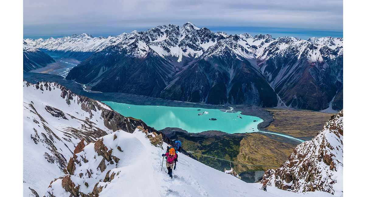
The view back to Mueller Glacier Lake and Mount Cook Village, from about 1,300m on the rocky spur below Mt Footstool, Mt Cook National Park


Skiers ascending beneath the Footstool. Mount Sefton at left, Mt Cook National Park


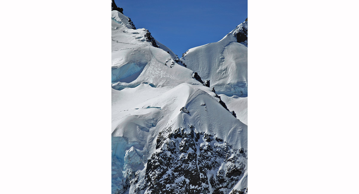
Dawn, Eugenie Glacier at about 2,150m, Mt Footstool, Mt Cook National Park

Descending the Red Arete, Mount Cook National Park


Descending the Red Arete, Mount Cook National Park

On top of Mount Sebastopol (1,468m), looking north over Wakefield Ridge to Mt Sefton and Mt Cook, Mount Cook National Park

At about 1,700m on Sebastopol Ridge, looking back over the craggy upper section to Mount Sebastopol below, Mount Cook National Park

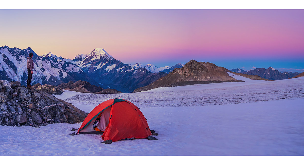
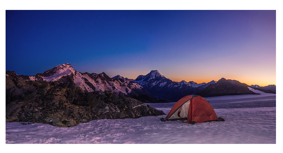
A camp site (2,150m) at sunset, on the west side of Annette Plateau, affording a superb view of Mounts Sefton, Footstool, La Perouse, Hicks and Cook, Mount Cook National Park

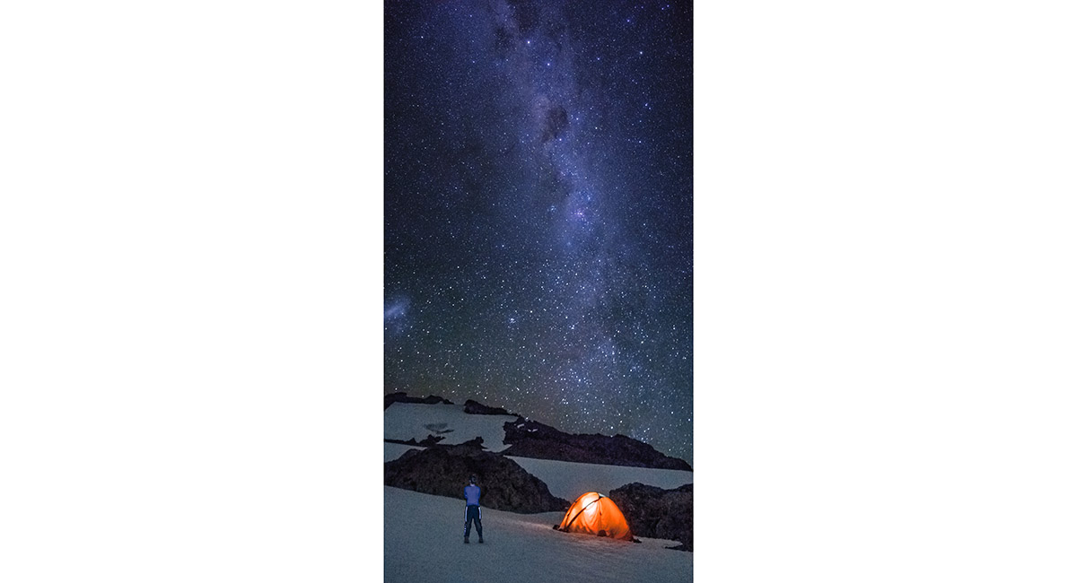
The Milky Way, viewed from Annette Plateau, Mount Cook National Park

Dawn view of Mounts Sefton and Aoraki Mount Cook, viewed from Annette Plateau, Mount Cook National Park


The suns first rays strike Mounts Sefton, Footstool, Cook, the Minarets and Elie De Beaumont. La Perouse and Hicks remain in shadow. Viewed from Annette Plateau, Mount Cook National Park


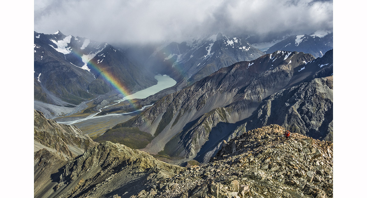
At about 2,350m, climbing towards Barrow Col, Annette Plateau, Mount Cook National Park


At about 1,700m on the eastern side of Mount Kitchener, Aoraki mount cook and the Hooker Glacier in the distance, Mount Cook National Park


At about 1,500m on Wakefield Ridge, looking to Mount Sefton and the Footstool, Mt Cook National Park


At about 1,500m on Wakefield Ridge, looking north east to the Malte Brun Range, Mt Cook National Park


At about 1,600m on Wakefield Ridge, looking north east to the terminal lake of the Tasman Glacier with, from left, the Minarets, Elie De Beaumont, The Malte Brun Range, Murchison River and the Liebig Range (Nun's Veil with a cloud plume)


Near 2,000m on Wakefield Ridge, looking down to Mueller Lake, Mount Sefton and the Sealy Range, Mt Cook National Park

Approaching 2,000m on Wakefield Ridge, looking north east to Nun's Veil and the Liebig Range, Mt Cook National Park


The 850m scree slope we chose to take as our "shortcut" down to the Hooker River from Wakefield Ridge, Mt Cook National Park


One of several small tarns beside the moraine of Tasman Glacier, Mt Cook National Park


View from the terminal moraine of Tasman Glacier, looking south to Lake Pukaki, Mt Cook National Park

Approaching the terminal face of the Separation Glacier, beneath Mt Forbes, Mt Cook National Park


On the ridge at about 2,000 m, leading to Mt Sibbald, Mt Cook National Park

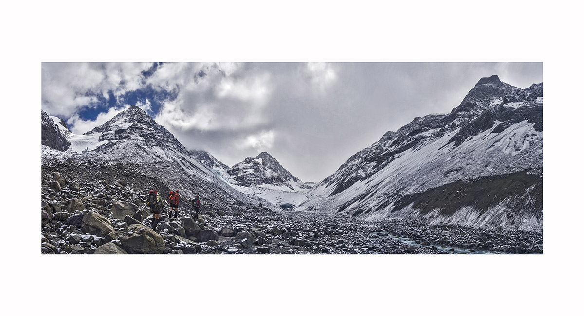
Terminal Lake of Classen Glacier, en route to Mt Sibbald, Mt Cook National Park

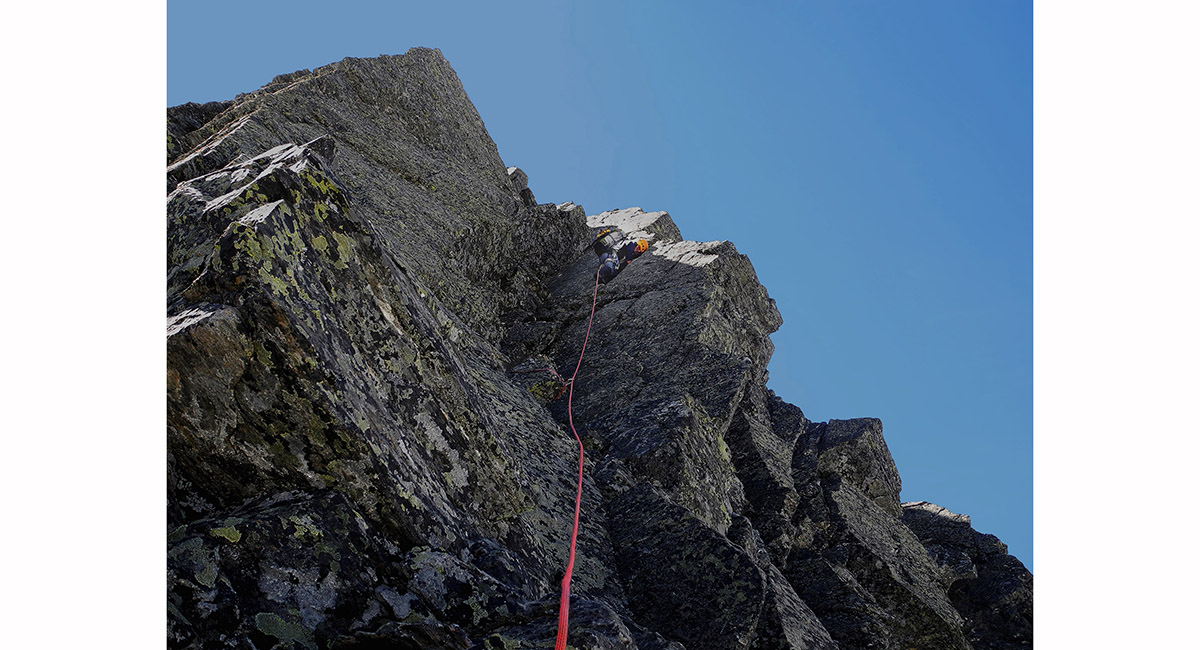
The crux of the climb of Mt Sibbald, Mt Cook National Park


On the ridge below Brewster Hut. Mount Brewster is left on the furthest skyline and Mount Armstrong (2,174m) is the point second right from the climber, Aspiring National Park


On the summit of Mt Armstrong (2,174m). From left - Haast River, Top Heavy, Brewster Glacier, Mount Brewster, with Mount Wray and Tole in the distance, Aspiring National Park

On the summit of Mt Armstrong (2,174m). Mount Brewster (right) and Top Heavy (left), with Brewster Glacier between, Aspiring National Park


On the descent of Mt Earnslaw, with Mount Tutoko and Pluto Peak, Aspiring National Park

View northwest from Key Summit (918m), to Mount Crosscut (2,263m), Marian Peak (2,102m) and Mount Lyttle (1,899m) on the left and the Ailsa Mountains on the right, Fiordland


Descending Talbots Ladder, Darran mountains, Fiordland

Descending to Gertrude Saddle, Darran mountains, Fiordland

Below the summit of Mount McPherson, with the Milford Road stretching south. Mount Crosscut is far left, with the head of the Gertrude Valley below. Darran Mountains, Fiordland

On Traverse Pass, with Mount Talbot ahead, Darran Mountains, Fiordland


On Traverse Pass, with Mount Talbot ahead, Darran Mountains, Fiordland


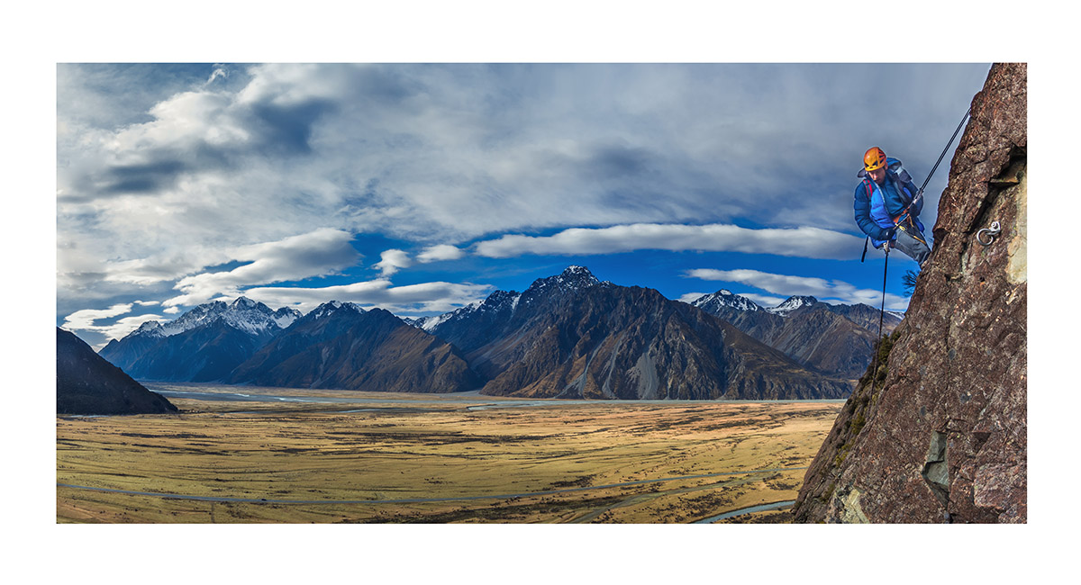
Below Double Cone, with Telecom Tower behind, Remarkables Range, Queenstown

The crux pitch on Double Cone, Remarkables Range, Queenstown


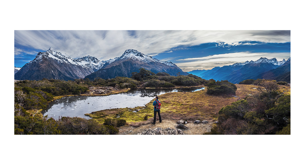
The view from the north western end of Lake Hayes, Queenstown In the mountains > NZ North Island > Roof of the World

To order a print or web resolution file of any image you see in this slide show, just right click the image, click “Copy Image URL” and paste in to the “Your message” box of our Contact Us form. Please also note, for each image, if you want a print or web resolution file. We will get back to you as soon as possible to confirm price and payment details.
Open Contact Us in a new window to paste Image URL(s) easily