Khumbu – Climbing Sundur Peak
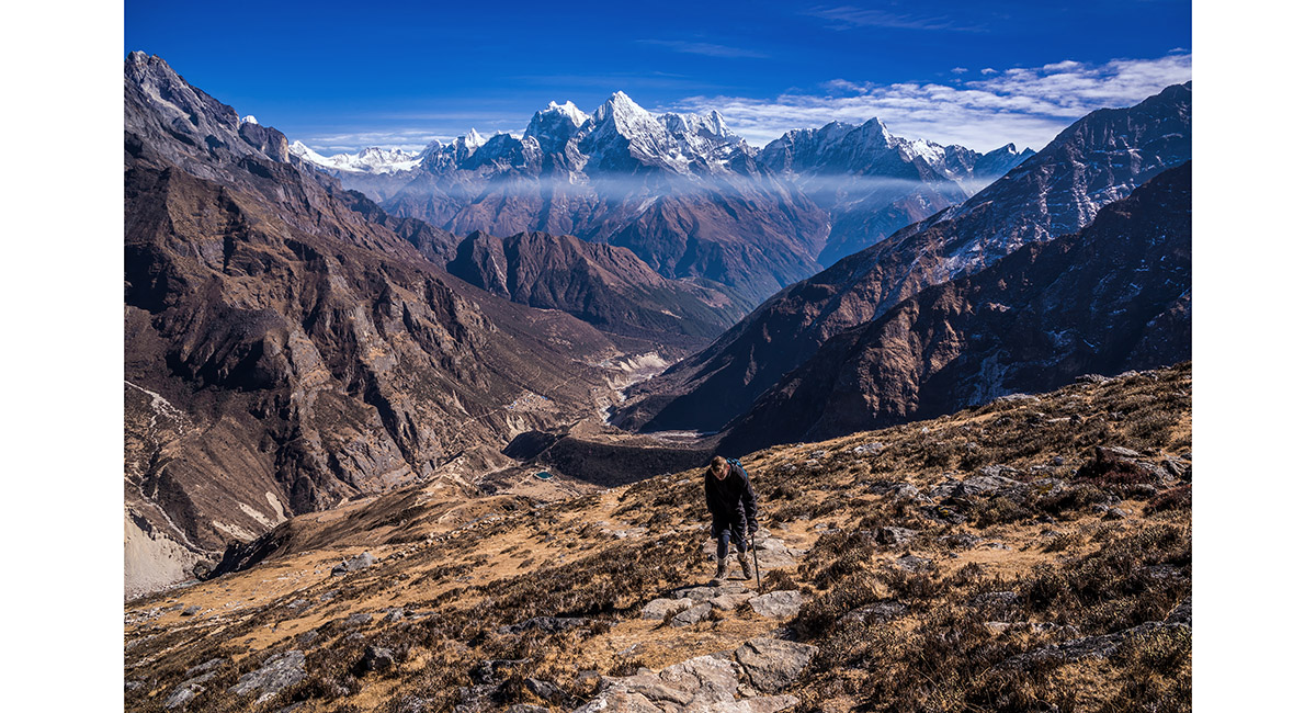
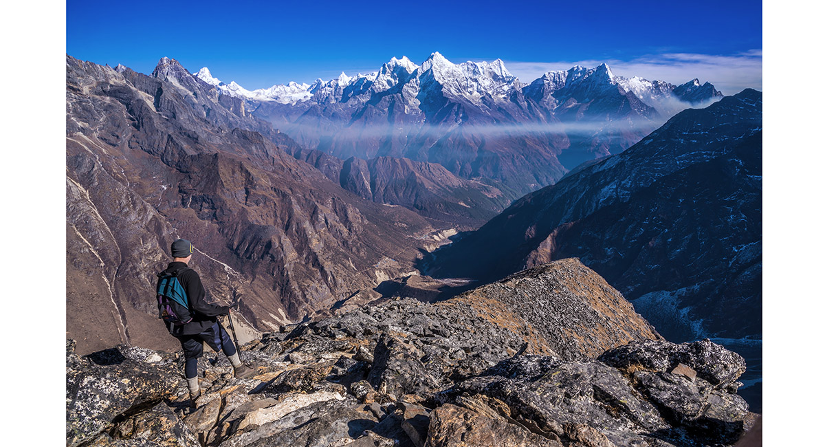
At about 4,600m, above Thame Gompa with, from left, Kangtega (6,779m), Tamserku (6,608m) and Kusum Kanguru (6,369m)

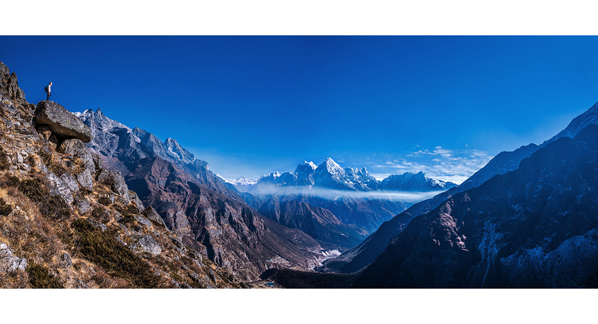
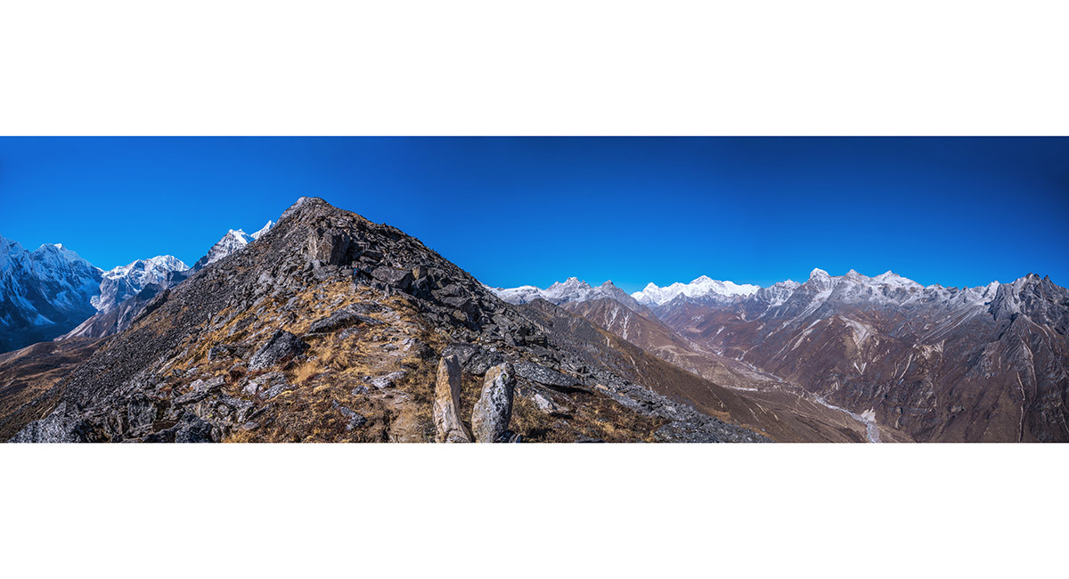
A panorama from the broad ridge leading to Sundur Peak. To the left is the Bhote valley leading to Renjo la and Nangpa La. The the right is the valley leading on to Namche Bazaar

Climbing higher towards Sundur Peak, here at about 4,800m, with Kangtega, Tamserku and Kusum Kanguru behind

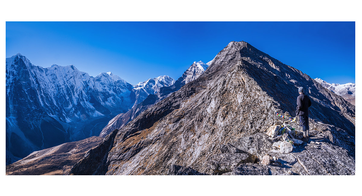
Approaching the trekking high point (5,000m), with the summit of Sundur Peak another 370 metres higher, but involving an exposed rock climb

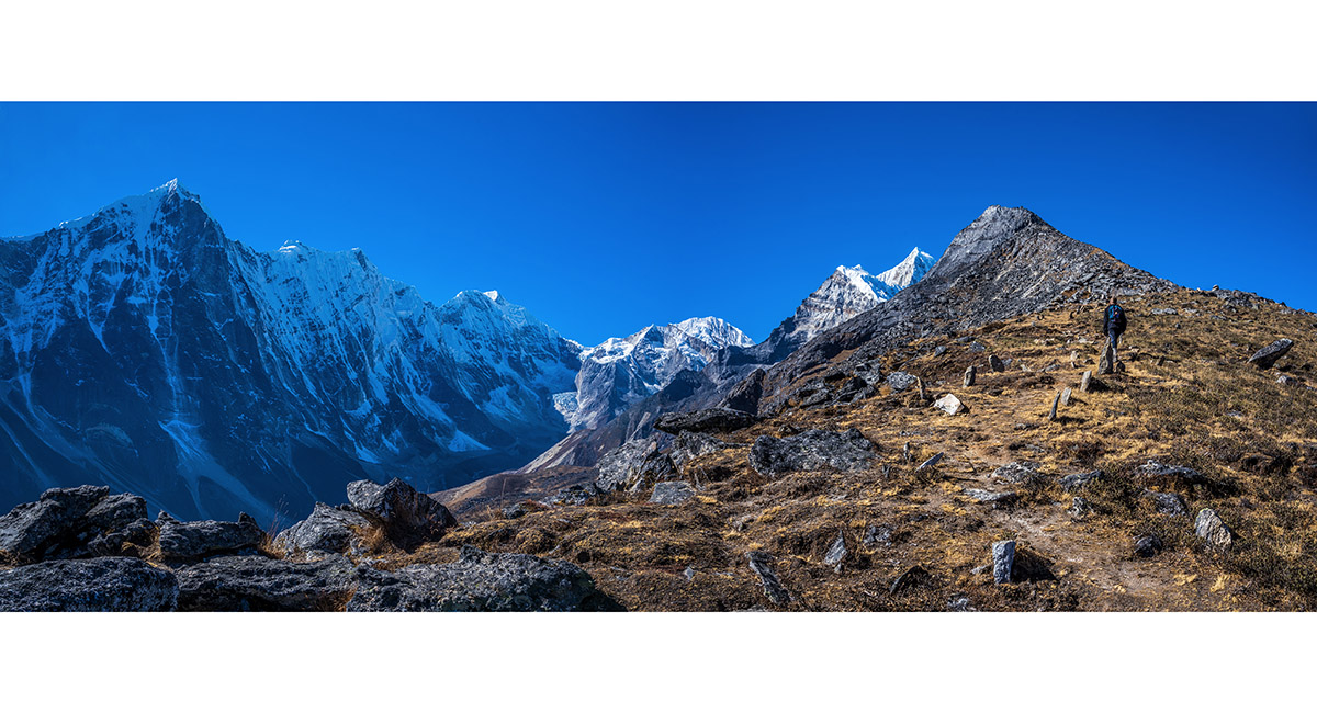
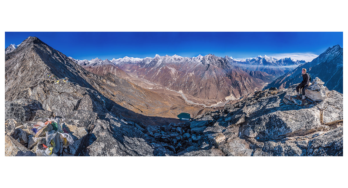
The view just got better and better as we reached the trekking high point. Now Cho Oyu is in view to the right

This view shows the rocky section leading between the trekking high point (5,000m) and the summit of Sundur Peak (5,377m). The mountains between span Cho Oyu on the left through Chomolungma, to Kusum Kanguru and Kwangde far right

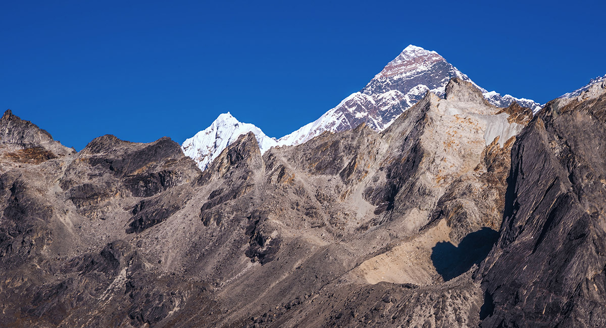
A view of Chomolungma from the trekking high point

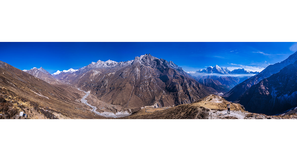
Looking to Sundur Peak (right) and the chain of peaks including, from left, Tengkangboche (6,490m), Panayo Tippa (6,696m), Bigphera-Go (6,730m) and Parcharmo (6,273m)


To order a print or web resolution file of any image you see in this slide show, just right click the image, click “Copy Image URL” and paste in to the “Your message” box of our Contact Us form. Please also note, for each image, if you want a print or web resolution file. We will get back to you as soon as possible to confirm price and payment details.
Open Contact Us in a new window to paste Image URL(s) easily