Khumbu – Mong La to Lusa
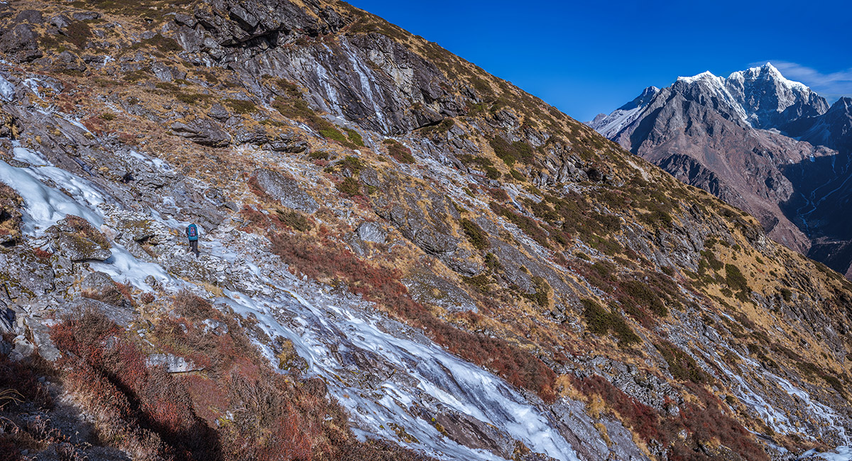
At about 4,500m on the high route between Mong La and Dole. The first of three steep ridges is ahead. Cholatse and Tawoche are top right

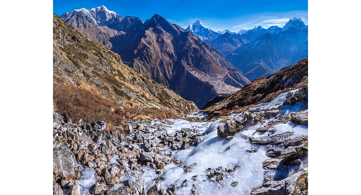
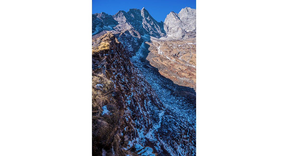
Crossing a frozen stream, with Phortse in the distance

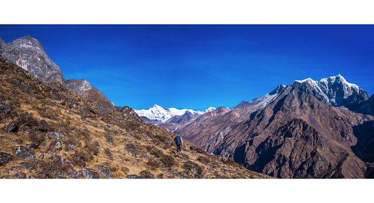
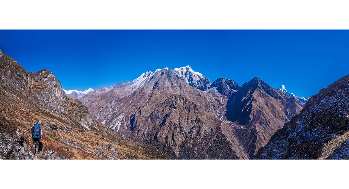
Approaching the second steep ridge on the Mong La - Dole high route. Cho Oyu (8,201m) is centre

Crossing the second steep ridge on the Mong La - Dole high route. Cho Oyu (8,201m) and Gyachungkang (7,922m) are at right

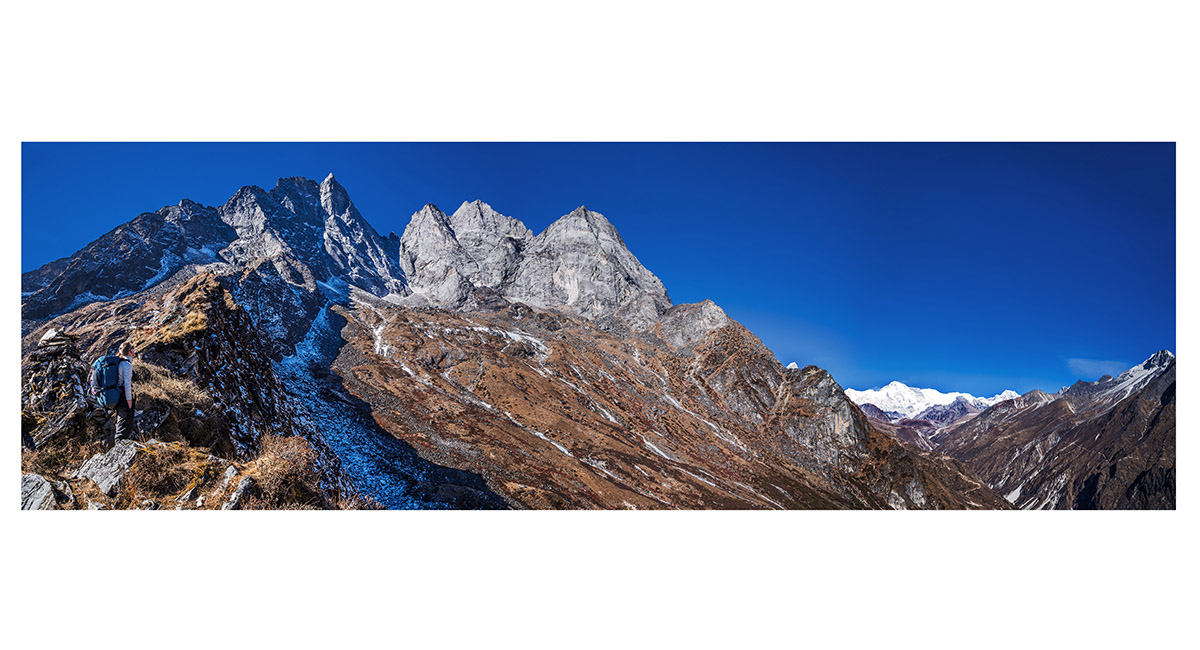
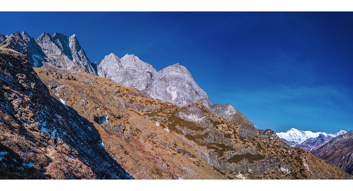
On the third and steepest of the three ridges on the Mong La - Dole high route. Khumbila's summit (5,781m) is above

A view down the crux of the high route. This sees little sunlight and is steep, icy and very exposed - crampons definitely required

Looking across a wide juniper and frozen stream covered expanse before Dole

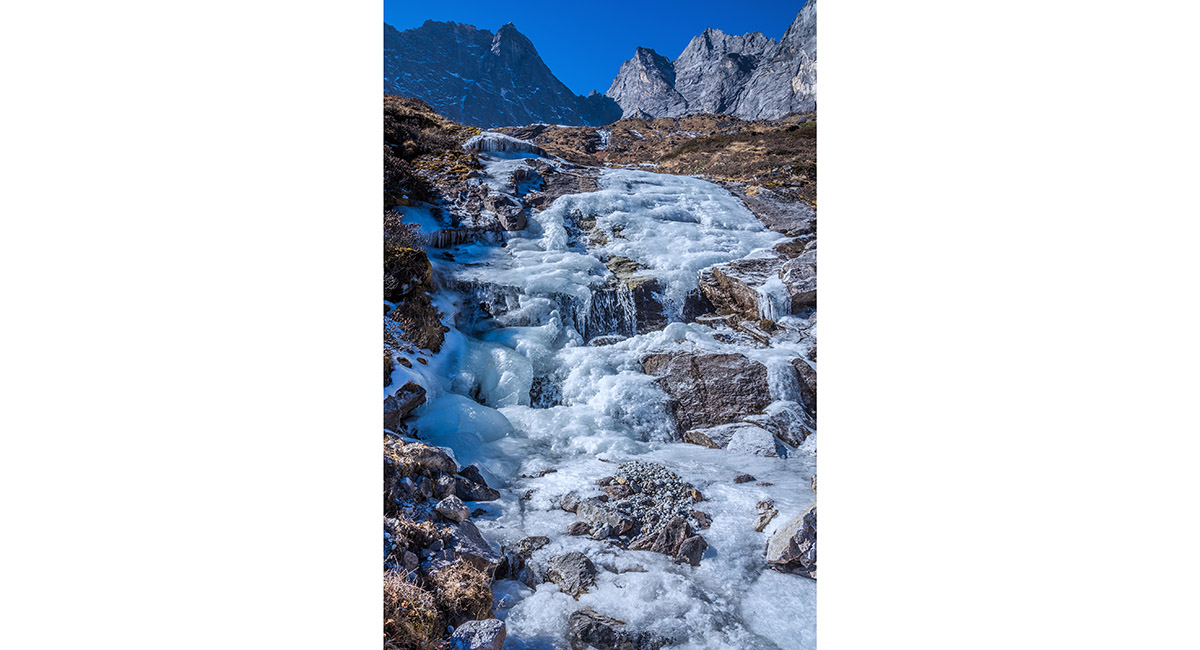
One of many frozen streams and waterfalls on the Mong La - Dole high route


Approaching Lusa (4,360m)

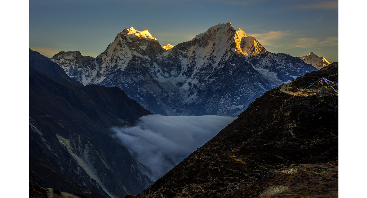
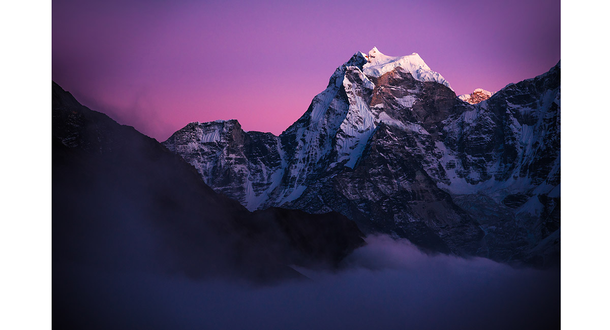
Kangtega (left - 6,779m) and Tamserku (6,608m), viewed from Lusa (4,360m) at sunset


To order a print or web resolution file of any image you see in this slide show, just right click the image, click “Copy Image URL” and paste in to the “Your message” box of our Contact Us form. Please also note, for each image, if you want a print or web resolution file. We will get back to you as soon as possible to confirm price and payment details.
Open Contact Us in a new window to paste Image URL(s) easily