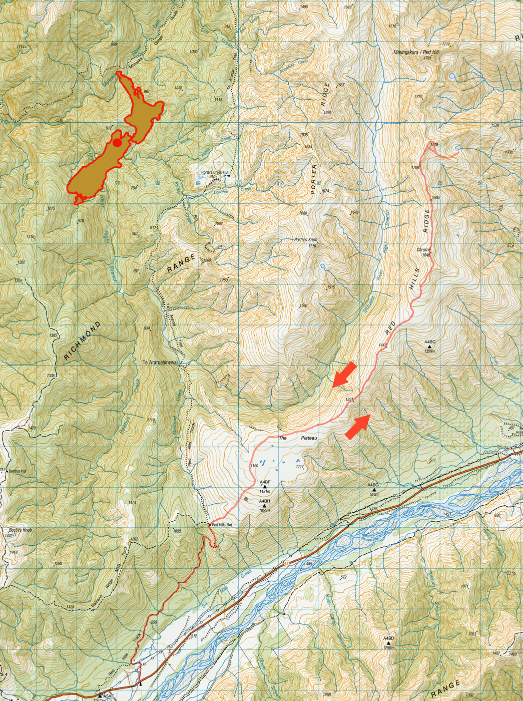
Red Hills, February 2024
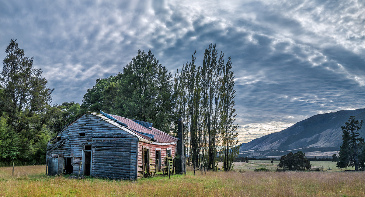
A derelict farm house at 640m on the Red Hills Track

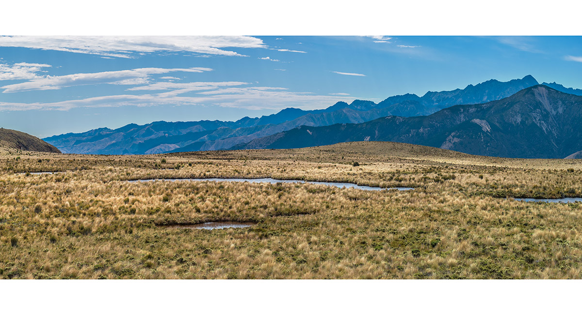
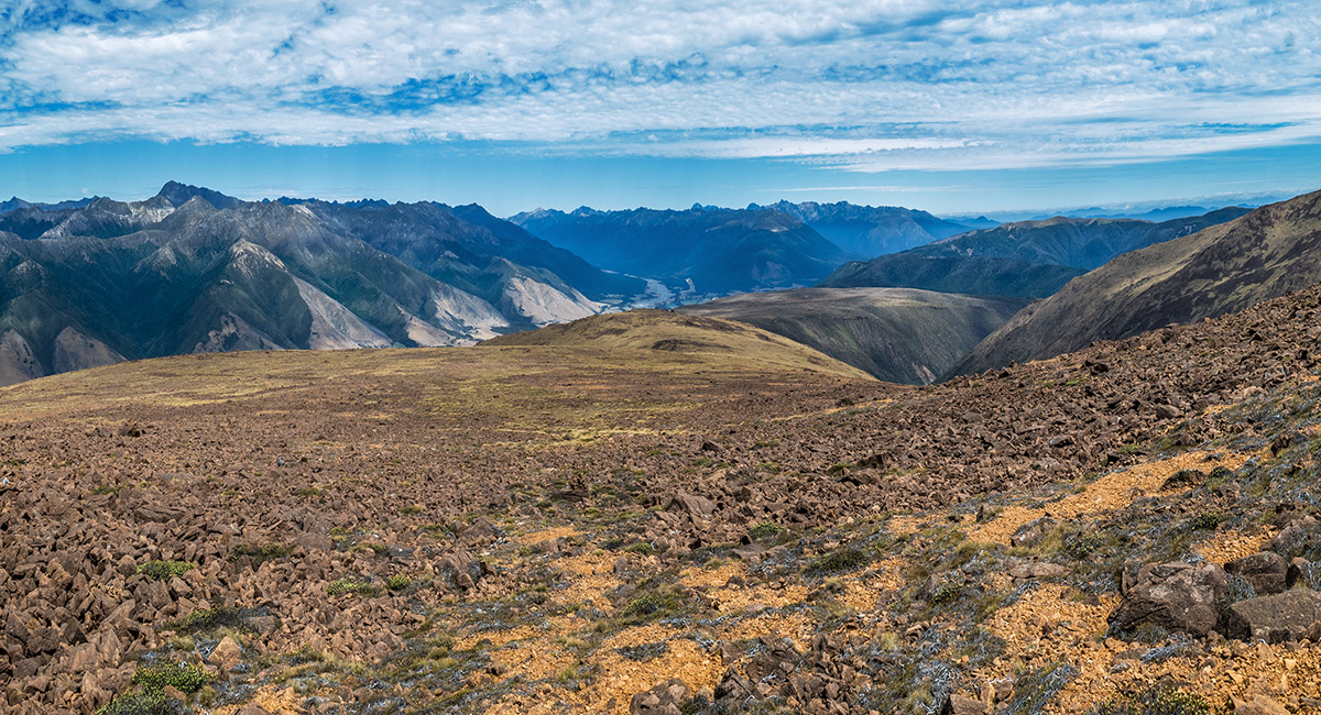
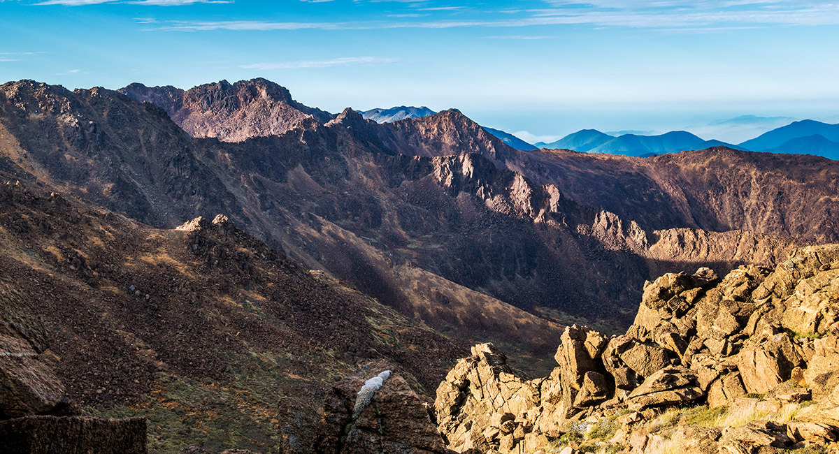
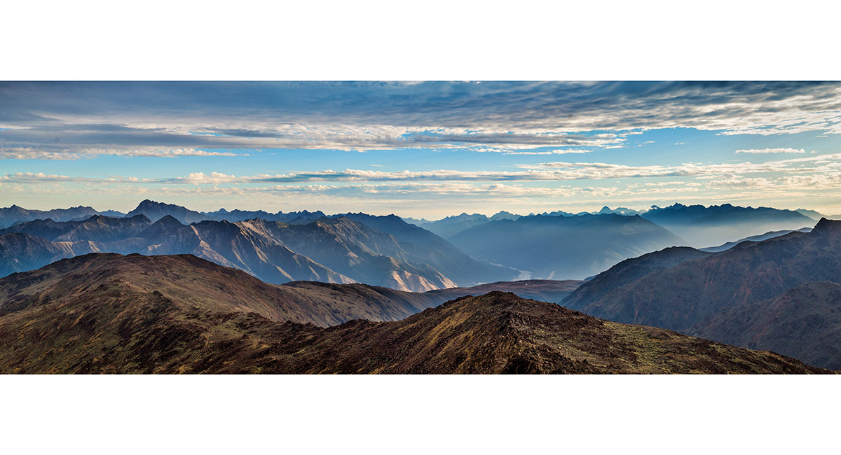
A view south across The Plateau (1,100m) to the Raglan Range and beyond

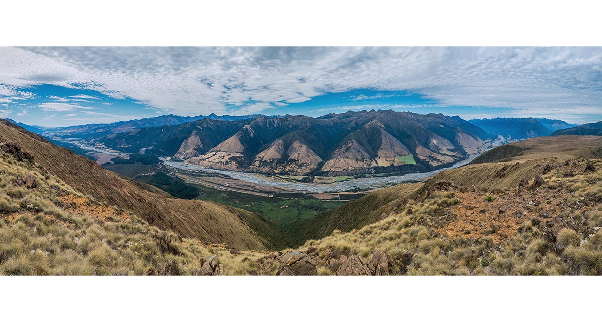
A view north of Point 1291, looking southeast to the Wairau Valley

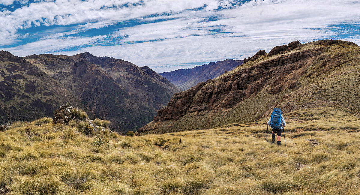
Heading north towards Point 1418


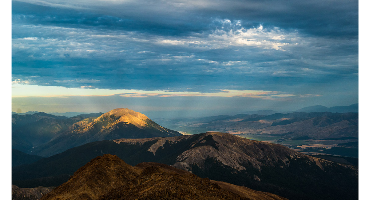
Beyond Point 1418, looking to Chrome (1,646m) with the head of Motueka River Right Branch centre

A view south, back down to The Plateau and beyond to the upper Wairau River


Now well into the rock garden that the Red Hills mostly is, heading towards Chrome

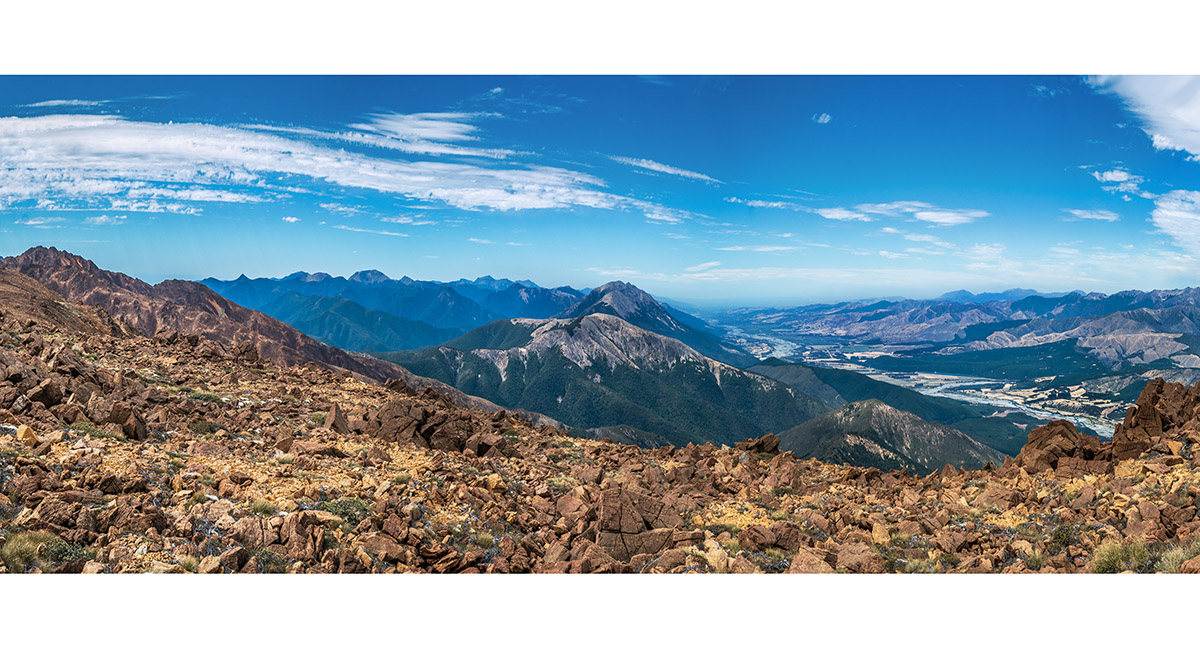
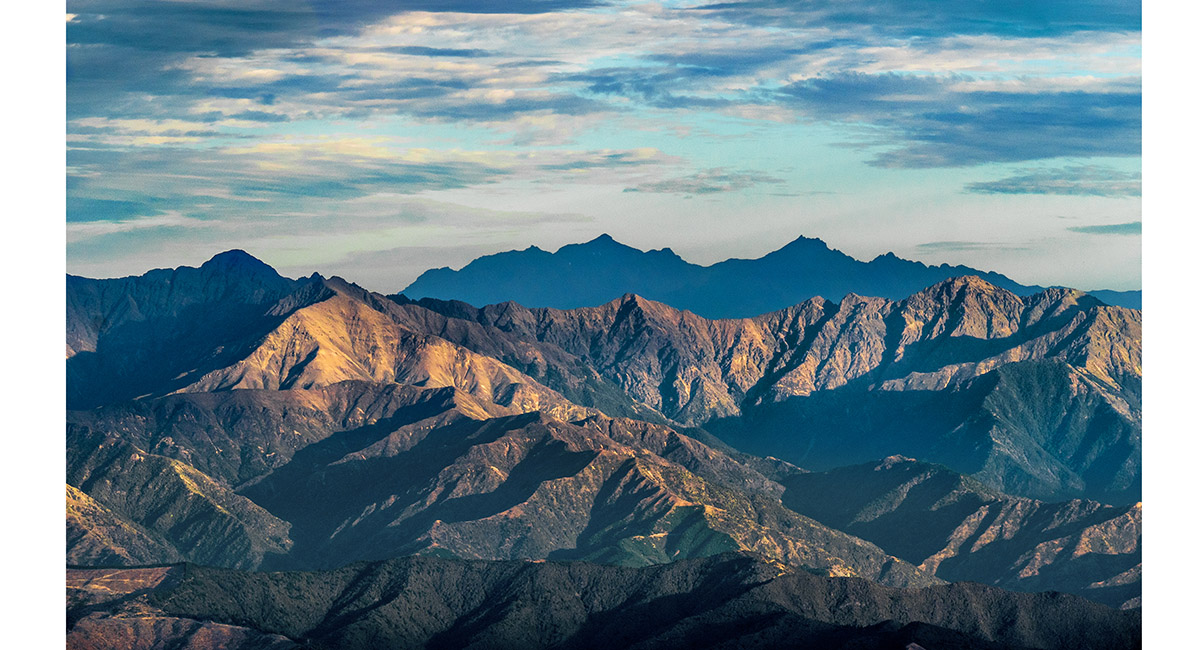
A view east from near Chrome, to the Wairau Valley and Mt Patriarch (1,656m)

Dropping off Point 1666, on the approach to Point 1706, with my camp spot beyond that on Point 1749 (the highest point on the left skyline here)

In the flatest spot on the rocky ridge at Point 1749, looking south, back down my route of the day - 22km from the Red Hills Track carpark


A view north to Maungakura/Red Hill (centre left skyline) from my tent spot on Point 1749

A view north along the ridge leading to Maungakura/Red Hill (left)


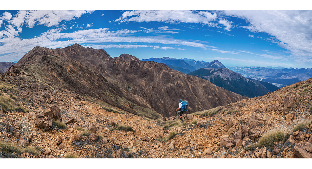
The southern approach (bottom right) to Maungakura/Red Hill (1,791m) - still another 2kms of broken ridge rock away


A view west across the Gordon Range

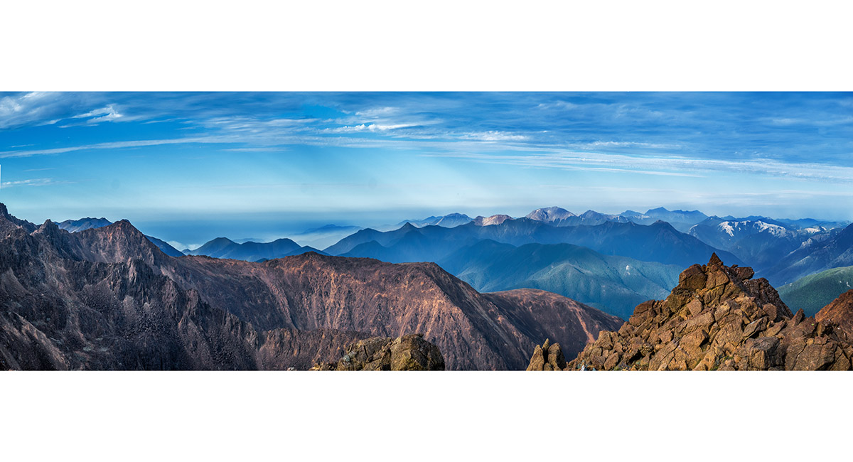
Looking east from Point 1749 to the Kaikouras

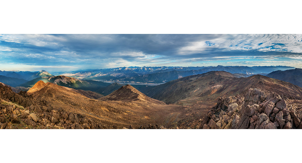
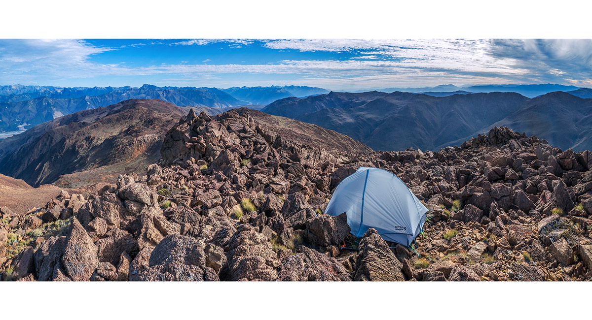
The big view from Point 1749, taking in the ridge back to The Plateau (right), Wairau Valley and the Kaikouras (centre) and, in the foreground, the basin giving access to a tarn at 1,500m I had to descend to next morning to replenish my water supply

Looking east from Point 1749 to the Kaikouras

A view south down the Red Hills from my tent spot on Point 1749

A view east to Mt Patriarch (1,656m) at sunset

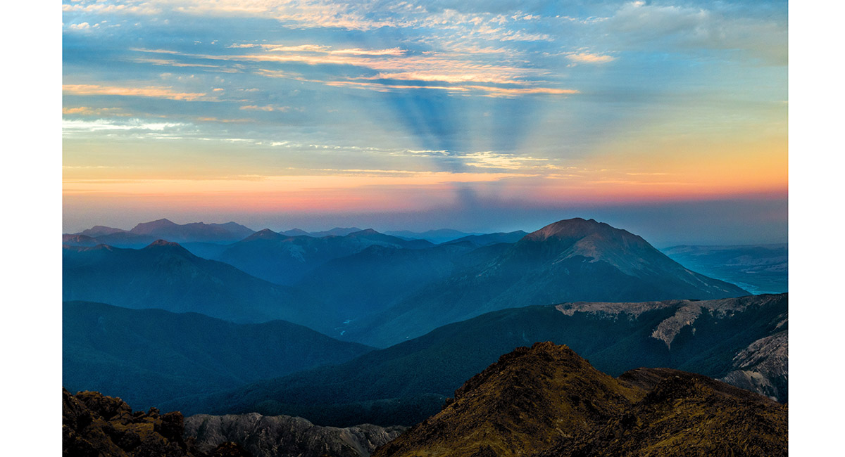
A view east to Mt Patriarch (1,656m) at sunset


Sunset view west from Point 1749. I should have realised that rough weather was coming from this beautiful cloud ceiling. Gail-force winds collapsed my tent around me at 4.45am the following morning - type 2.5 fun

Above the 1,500m tarn on the east side beneath Point 1749. I sourced water from a creek in this gut that had come to life with the unanticipated storm rain

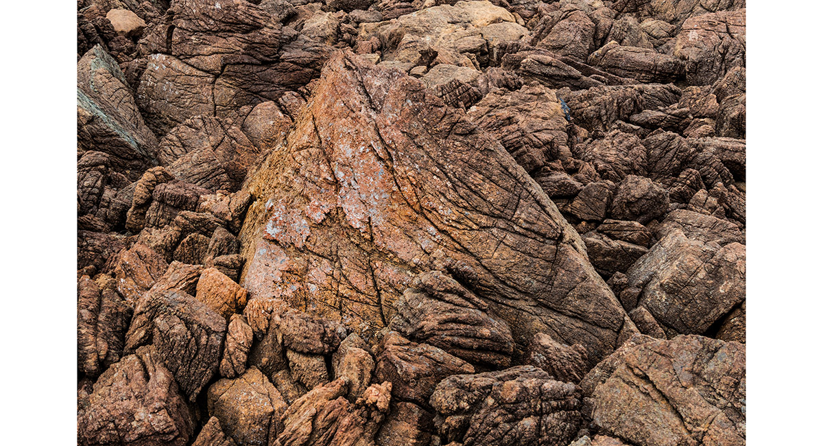
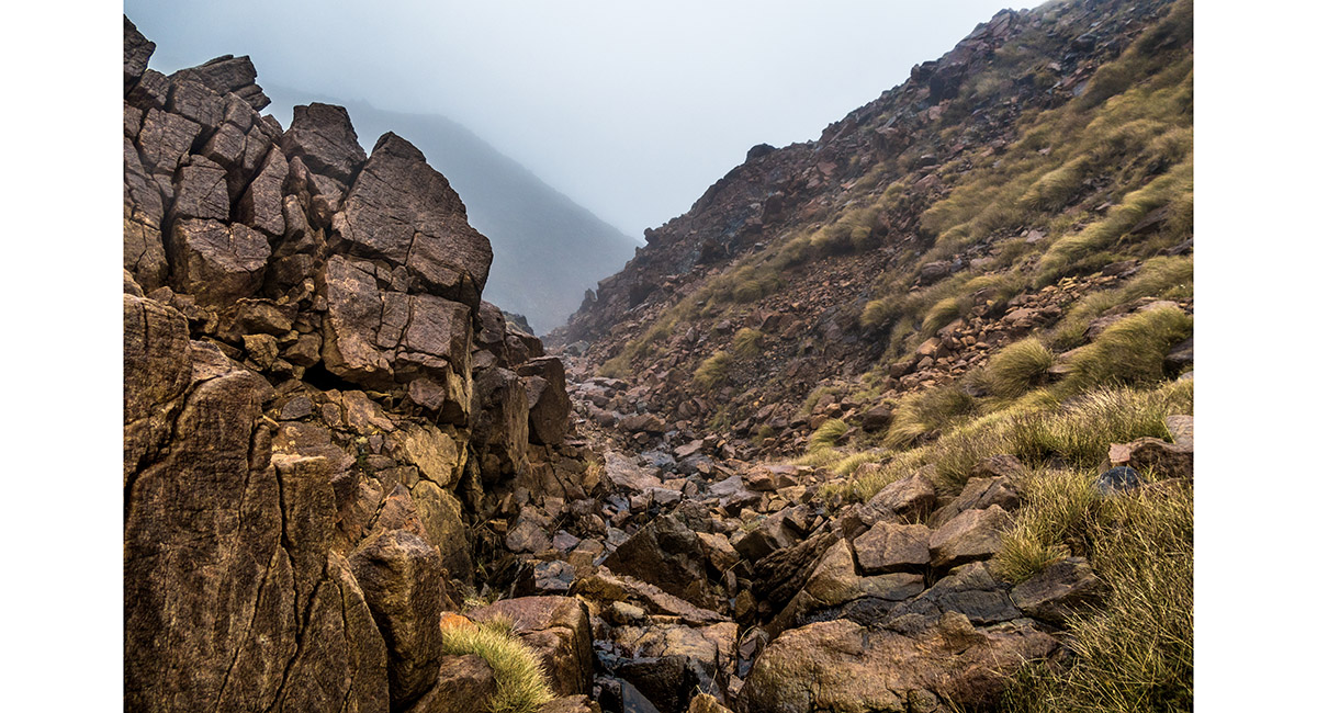
A fitting final image for a Red Hills trip - abrasive red rock!

Read about it Captivating Photography Oct/Nov 2024
To order a print or web resolution file of any image you see in this slide show, just right click the image, click “Copy Image URL” and paste in to the “Your message” box of our Contact Us form. Please also note, for each image, if you want a print or web resolution file. We will get back to you as soon as possible to confirm price and payment details.
Open Contact Us in a new window to paste Image URL(s) easily