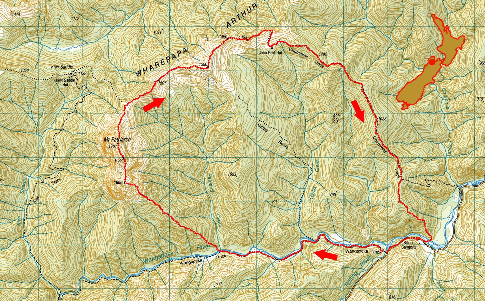
Mt Patriarch traverse, August 2025
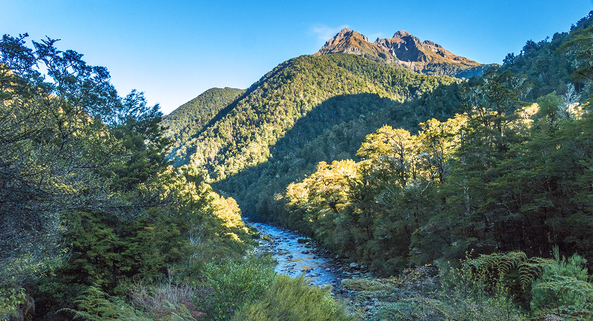
Looking west up Wangapeka River, with Mt Patriarch's three peaks top right. The spur leading to them from just west of the confluence of Patriarch Creek and Wangapeka River stretches up right, from left of centre

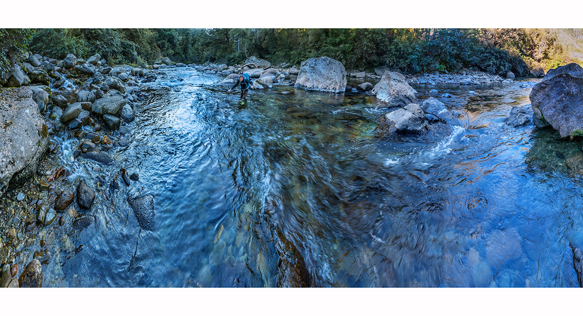
Crossing Wangapeka River at Patriarch Creek, at about 340m

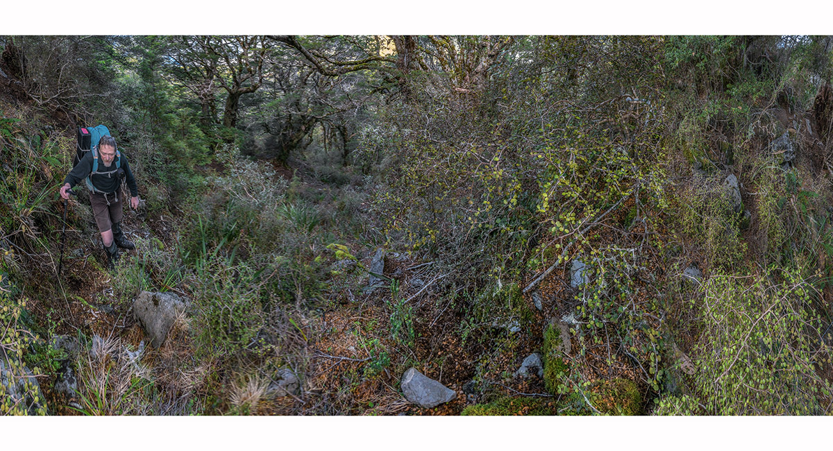
Climbing steep untracked bush above Wangapeka River. This continued for about 900 vertical metres

Here at the bushline even steeper dense scrub took over for 250 metres

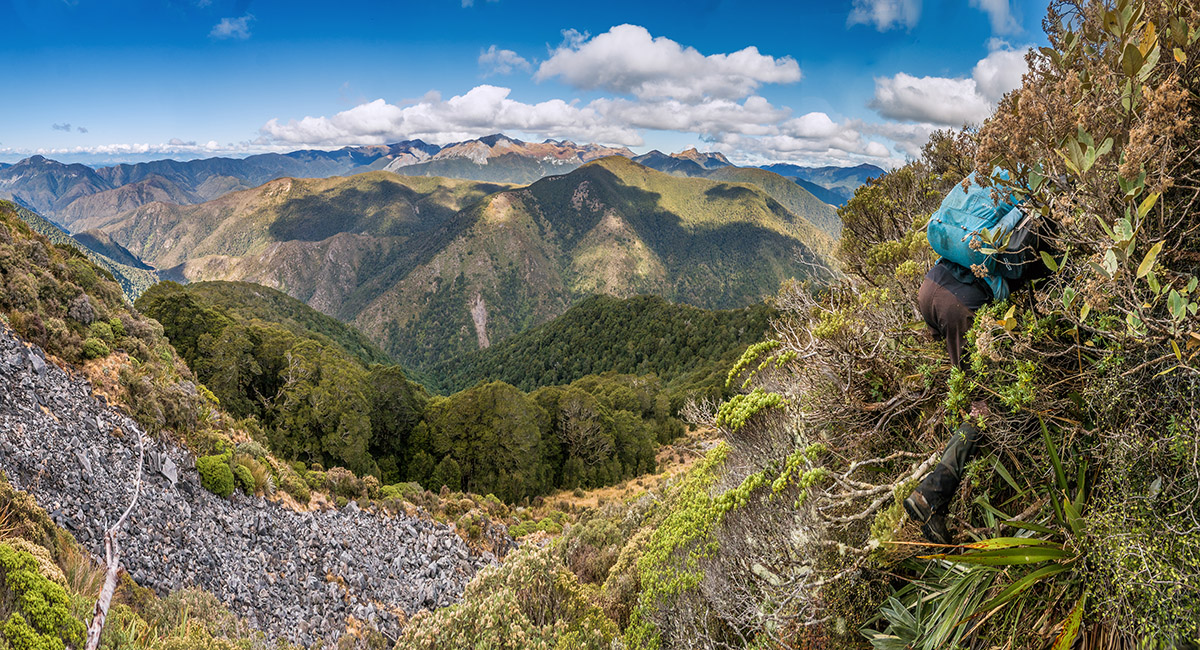
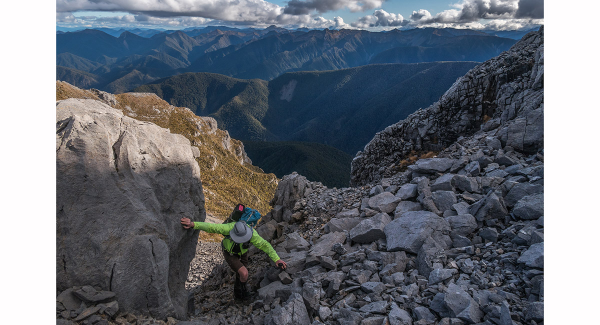
Bruce plunges into the steep scrub

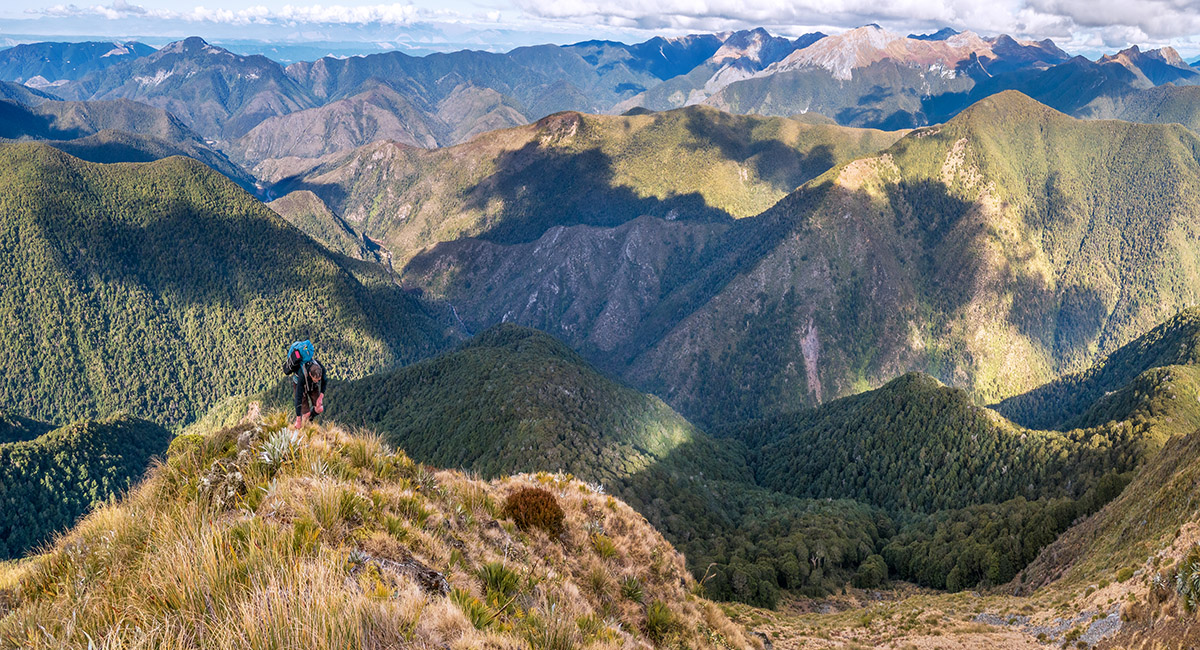
On the spur at about 1,350m, with Wangapeka River 1,050m below

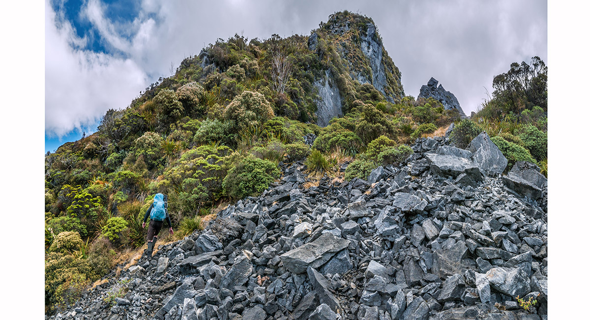
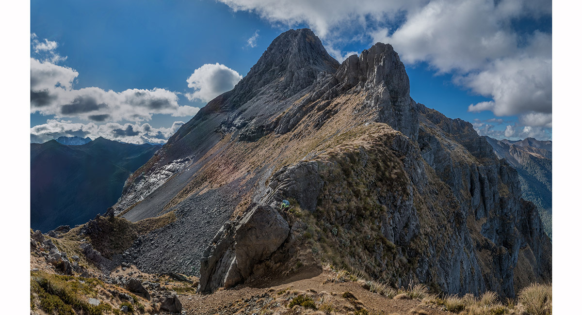
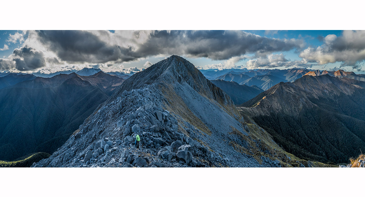
The final 100m of climb was up exposed tussock and karst to reach the first summit at 1,600m. The middle summit is at centre

About to leave the scrub beneath the 1,600m high point

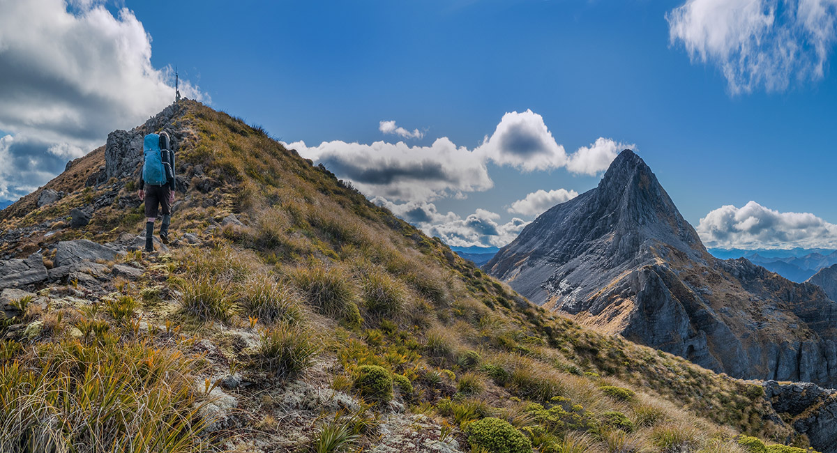
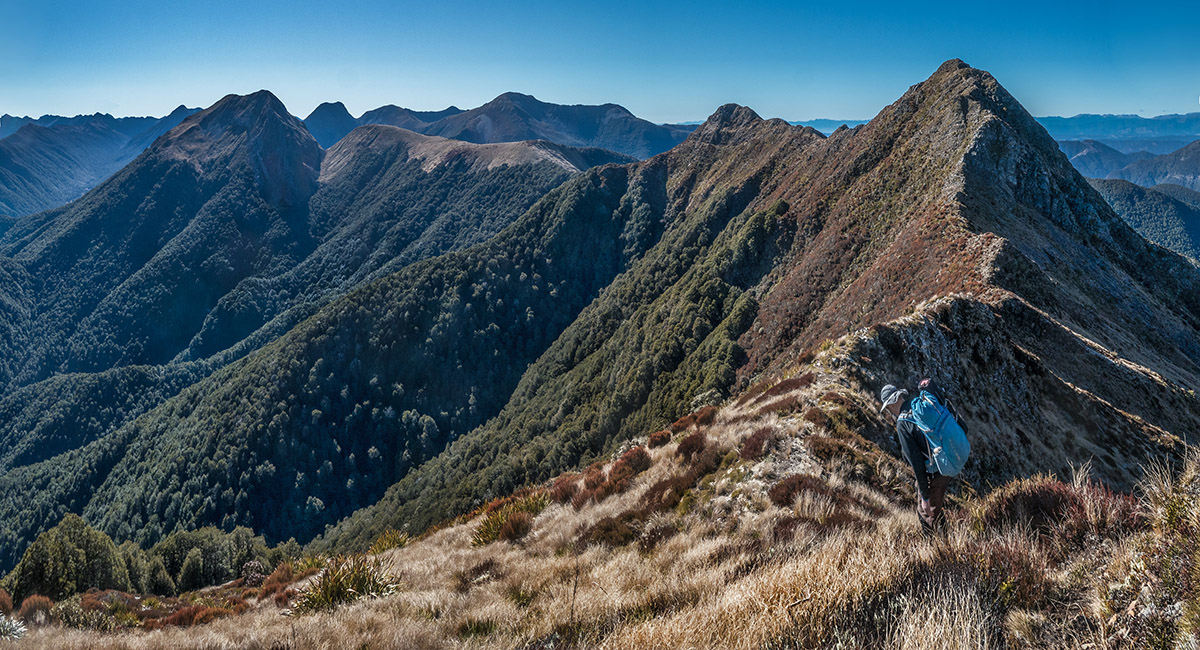
Approaching the 1,600m high point, with the middle 1,692m summit at right

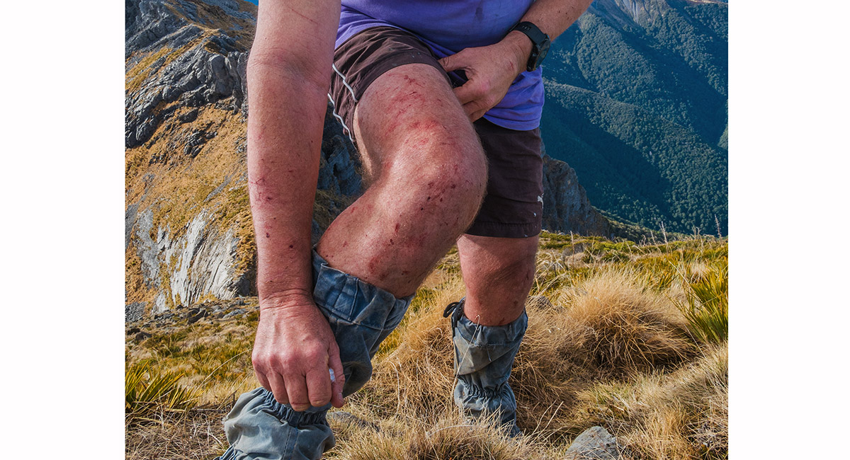
Evidence of untracked 'Tiger country'

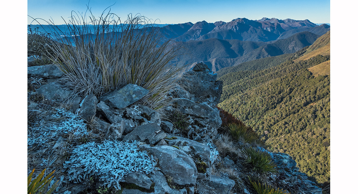
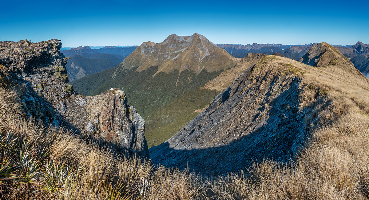
A view south to Mt Owen from the 1,600m high point

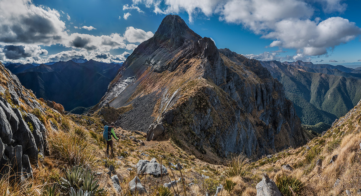
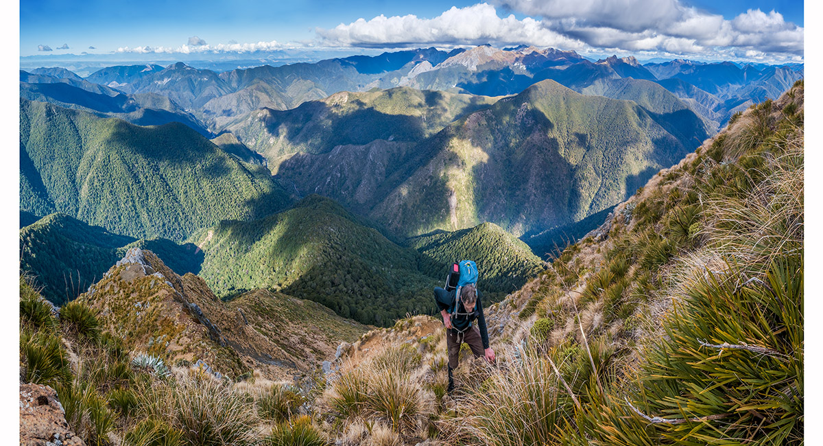
Bruce descending about 50m before beginning a 150m climb to the middle summit

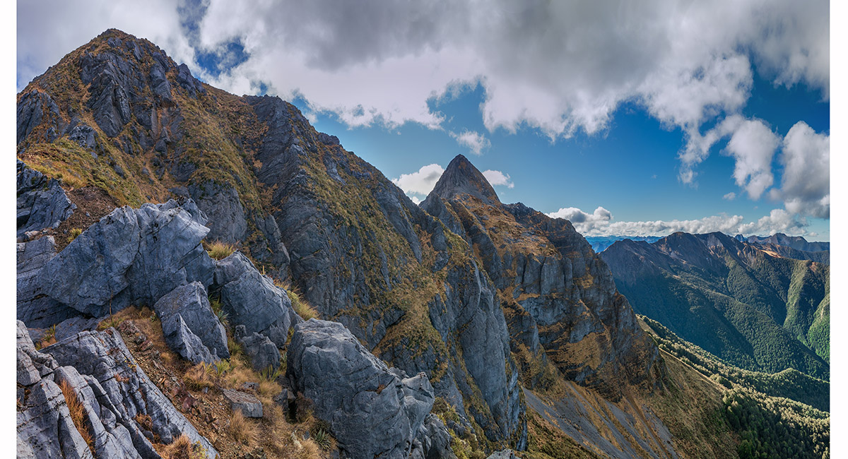
The route first goes left/west across the tussock to directly beneath the middle summit. A chute then gives access to the rocky saddle just right of centre. The climb then continues diagonally up towards the right/east skyline near the summit

Climbing the chute to reach the rocky saddle


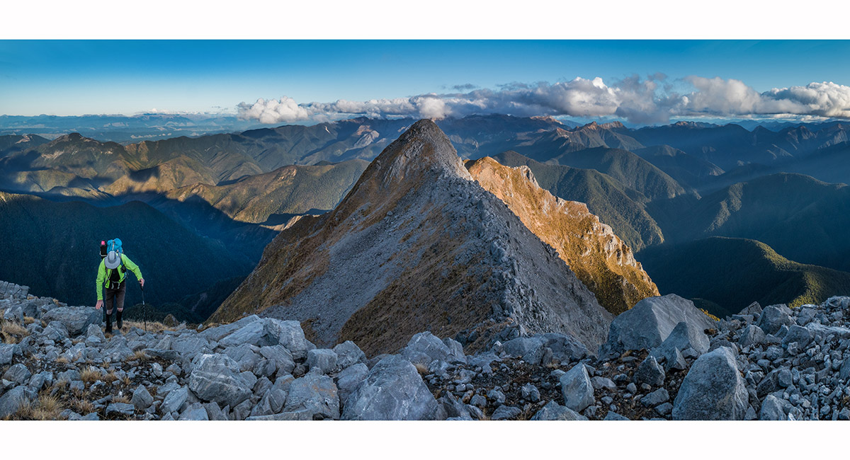
Approaching the middle summit, with the 1,600m high point below top right

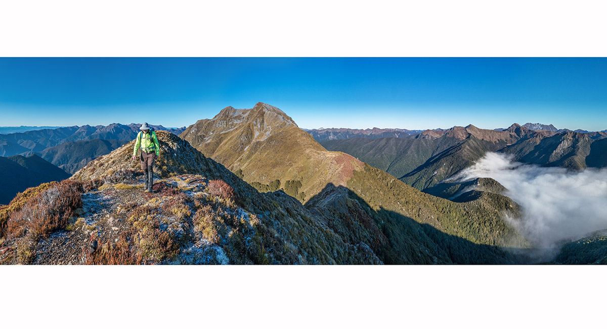
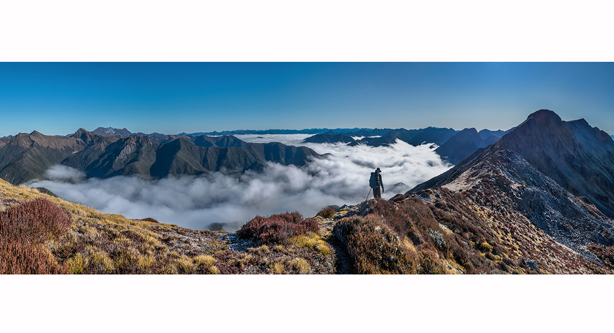
A view north from the middle summit (1,692m) to the main summit (1,701m)

A view north east from the middle summit along Wharepapa/Arthur Range. At centre is Mt Soddom and right Mt Gomorrah. The Twins and Mt Arthur are distant left in cloud

Bruce reorganising, now down on the broken karst boulder ridge between Pt1692 and the 1,701m summit

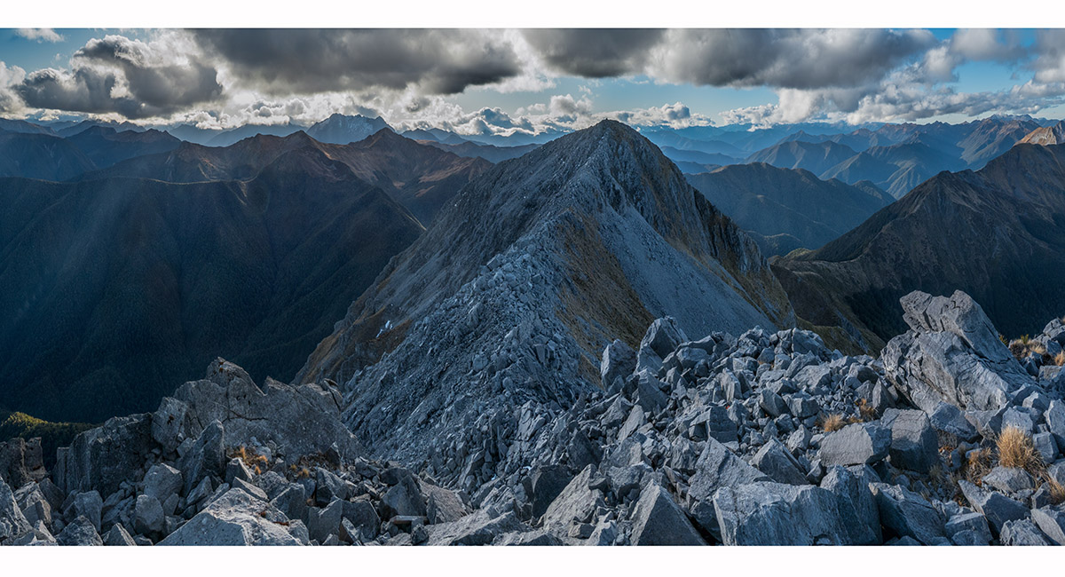
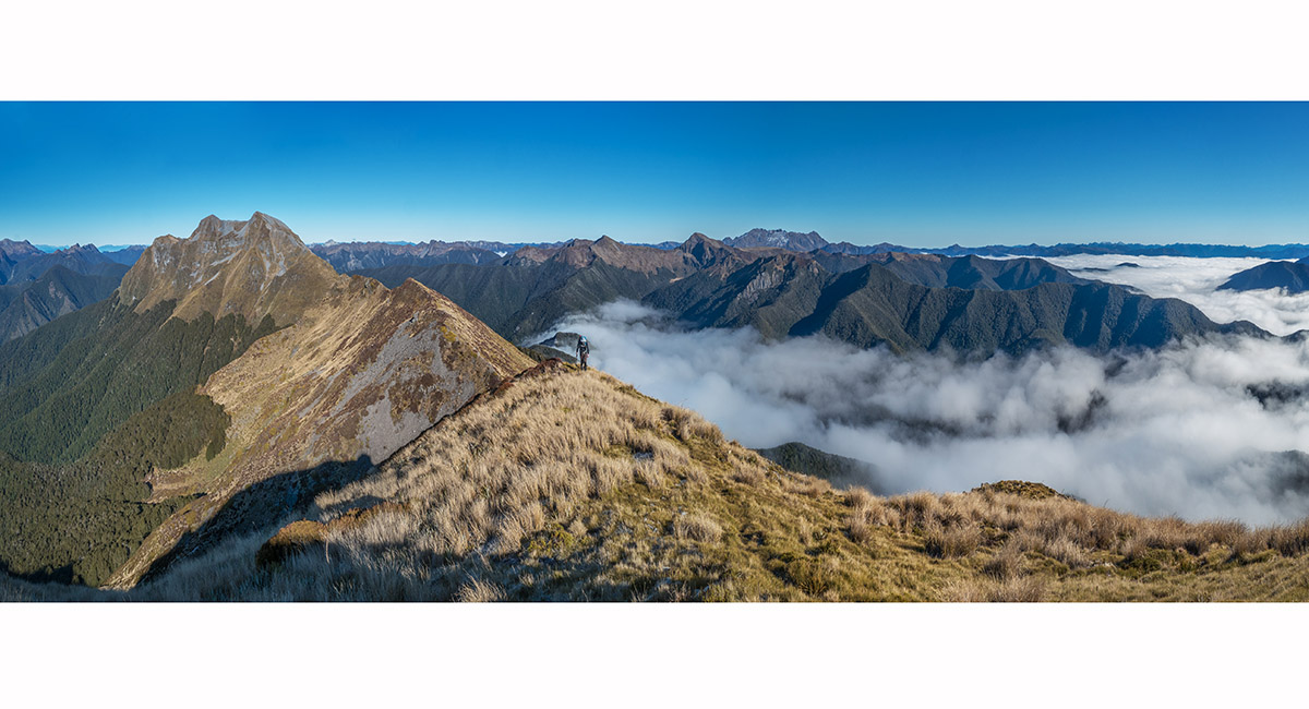
Nearing the 1,701m summit, with Pt 1692 at centre and the 1,600m high point sunlit behind, right of centre

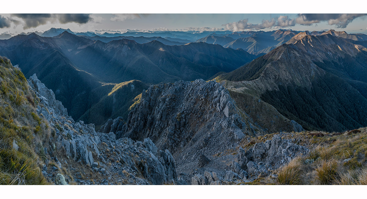
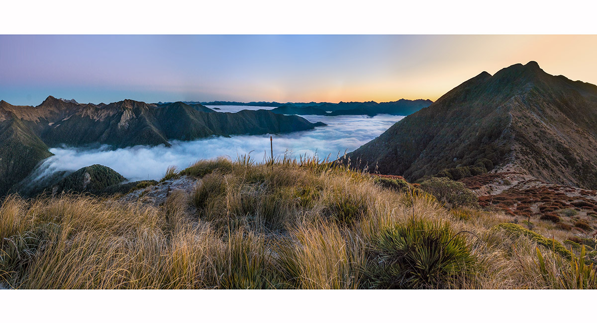
A view north from the main summit. 1,030m Kiwi Saddle is spot lit left of centre, with Mt Luna and more distant Mt Kendall on the left skyline. Wharepapa/Arthur Range stretches northwards at right, leading to Mts Soddom and Gomorrah on the right skyline. Our 1,400m bivvy spot is hidden by Mt Patriarch's karst north ridge

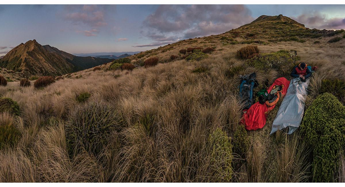
At our 1,400m bivvy spot, with the northern flanks of Mt Patriarch at right and Pt1507 on Wharepapa/Arthur Range at left

Dawn view north from near our bivvy spot, where the Kiwi Saddle track drops west. Pt1507 at right

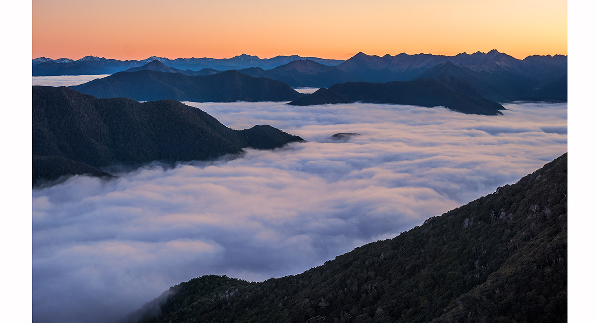
Dawn view north

Dawn view west to Pt1578 and Mt Luna (1,630m)

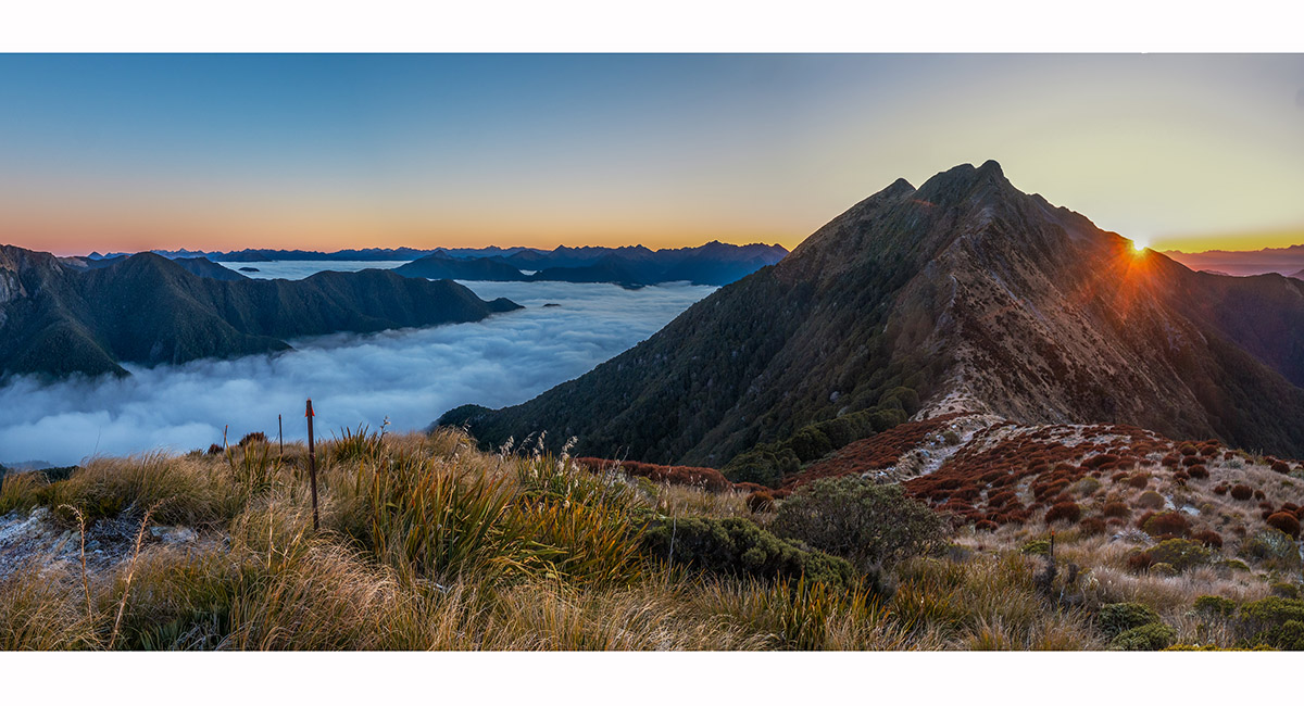
The rising sun breaches the east side of Pt1507

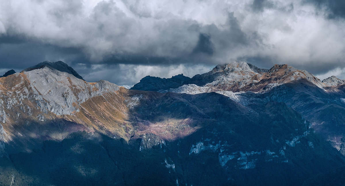
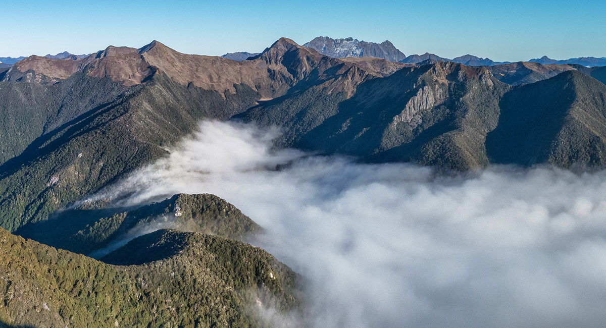
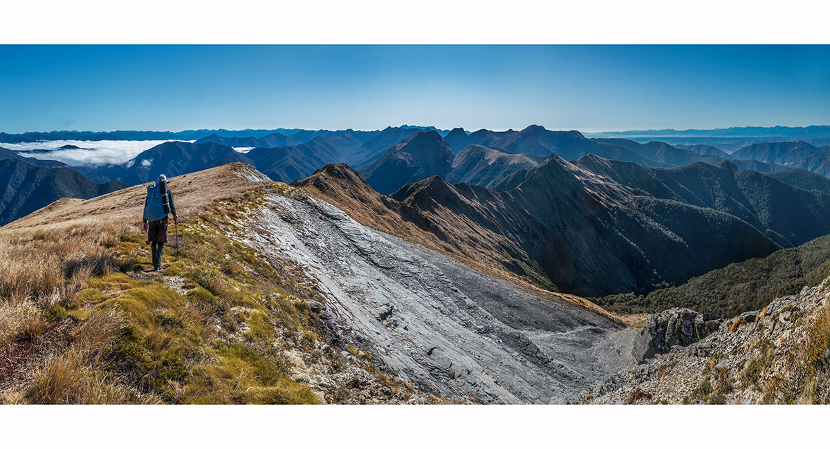
A morning view back to the Mt Owen group (right skyline) from about 1,450m on Wharepapa/Arthur Range's main ridge

Heading north, past Pt1507, with Mt Patriarch left of centre and Pt1578, Mt Luna and Mt Kendall (1,762m) on the right skyline

A view west over Kiwi Saddle to Pt1578 (left), Mt Luna (centre) and right of centre Mt Kendall's three high points - Pt1771, 1762m main summit and Pt1746

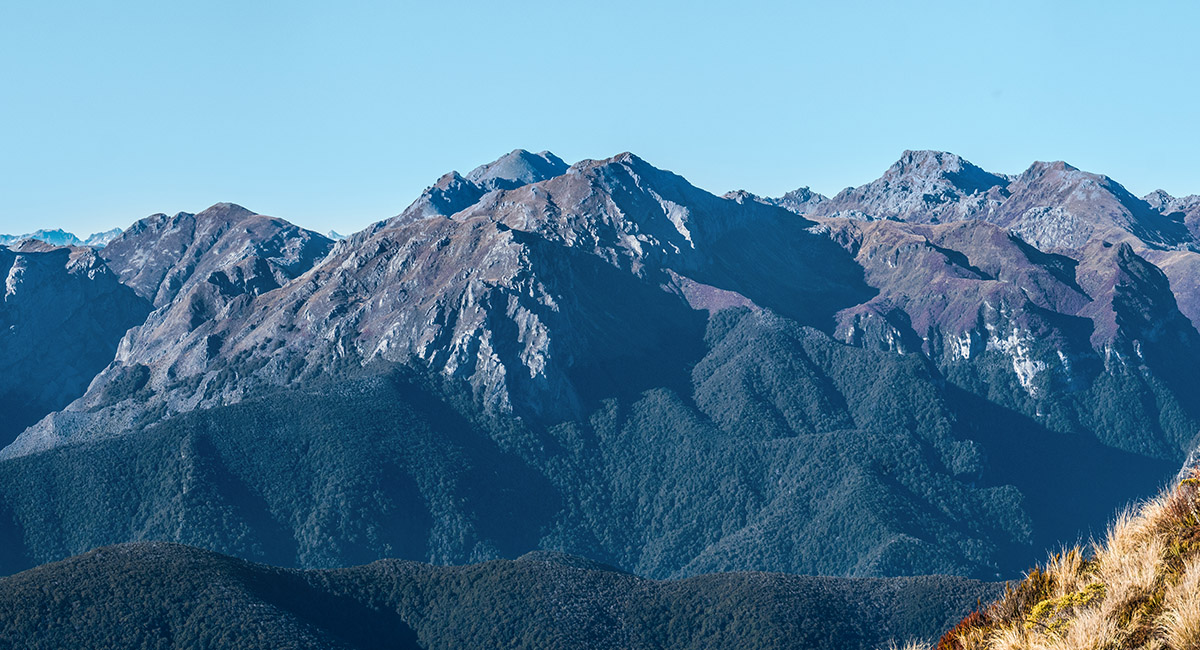
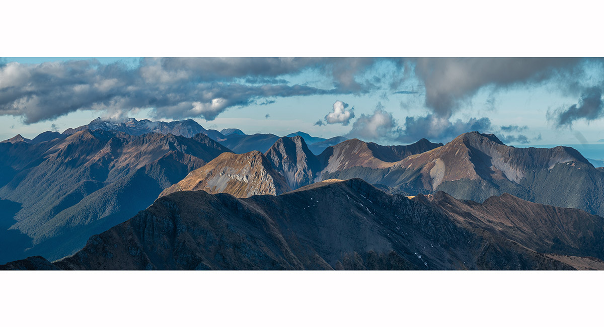
A closer look south to Billies Knob (1648m), Pt1764 and Mt Bell (1,857m) centre, and Mt Owen (1,875m) and Replica Hill (1,822m) right

A view north on the approach to Pt1566

A view south and west from near Pt1566, with Mt Patriarch at left and Mt Luna/Mt Kendall centre skyline

A view south from Pt1566 to Mt Patriarch

Heading north over Pt1566 with Mt Sodom centre

Looking north to Pt1460 (far right) and more distant Pt1463, beyond which the trail drops east to John Reid Hut. Mt Gomorrah is centre

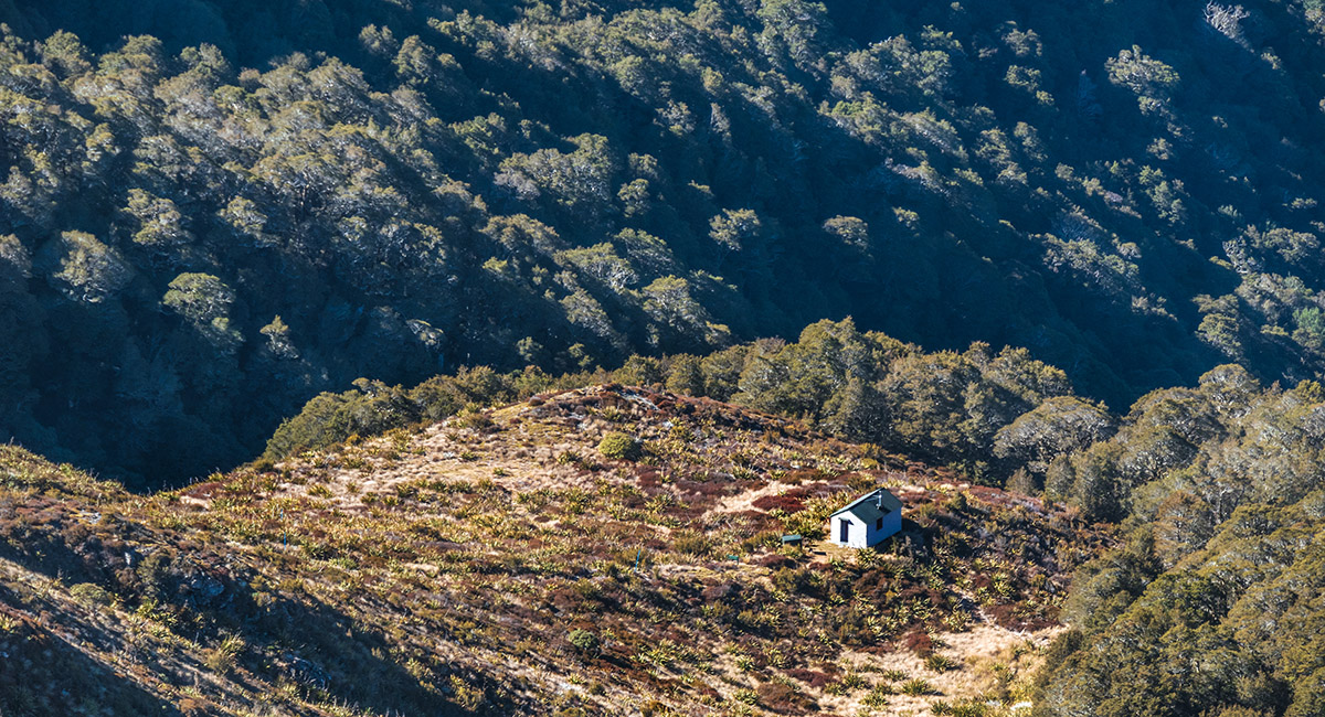
A view from Pt1460 to John Reid Hut (1,240m)

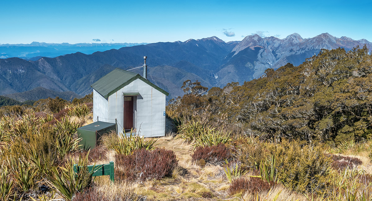
John Reid Hut, with the Mt Owen group top right

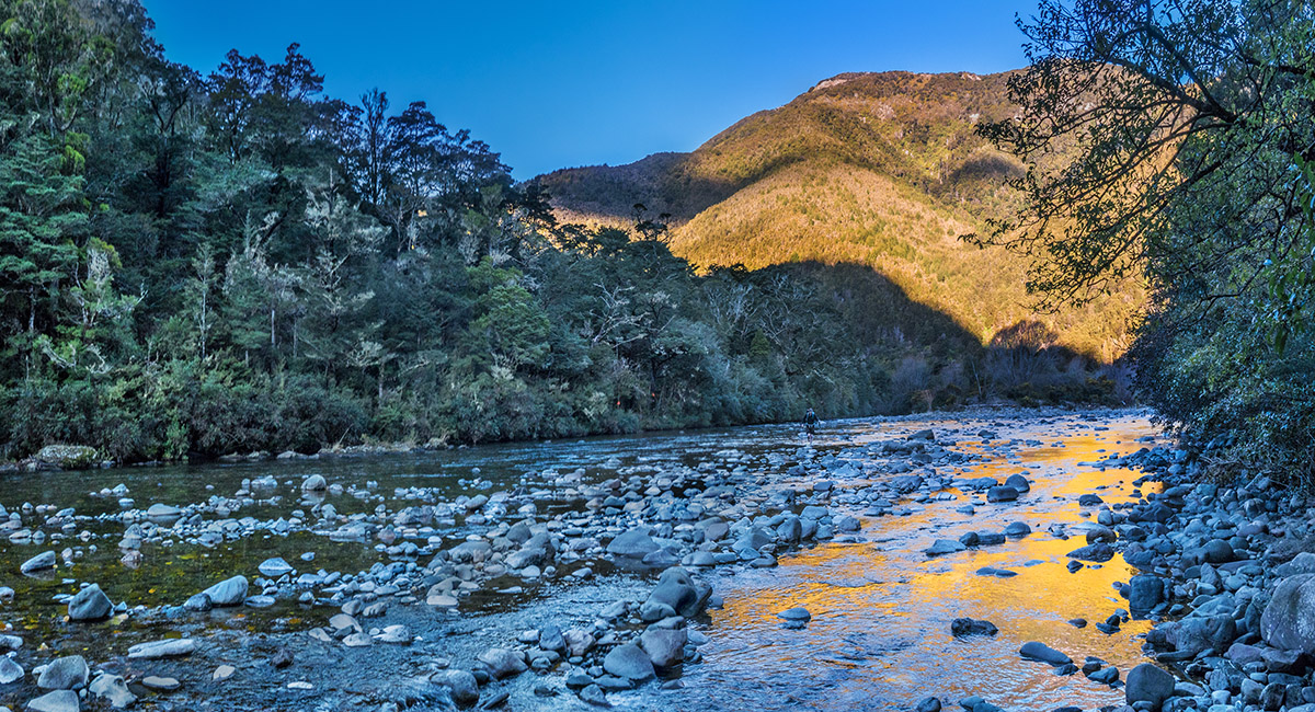
Crossing Wangapeka River at about 250m, at the base of the new section of Chummies Track

To order a print or web resolution file of any image you see in this slide show, just right click the image, click “Copy Image URL” and paste in to the “Your message” box of our Contact Us form. Please also note, for each image, if you want a print or web resolution file. We will get back to you as soon as possible to confirm price and payment details.
Open Contact Us in a new window to paste Image URL(s) easily