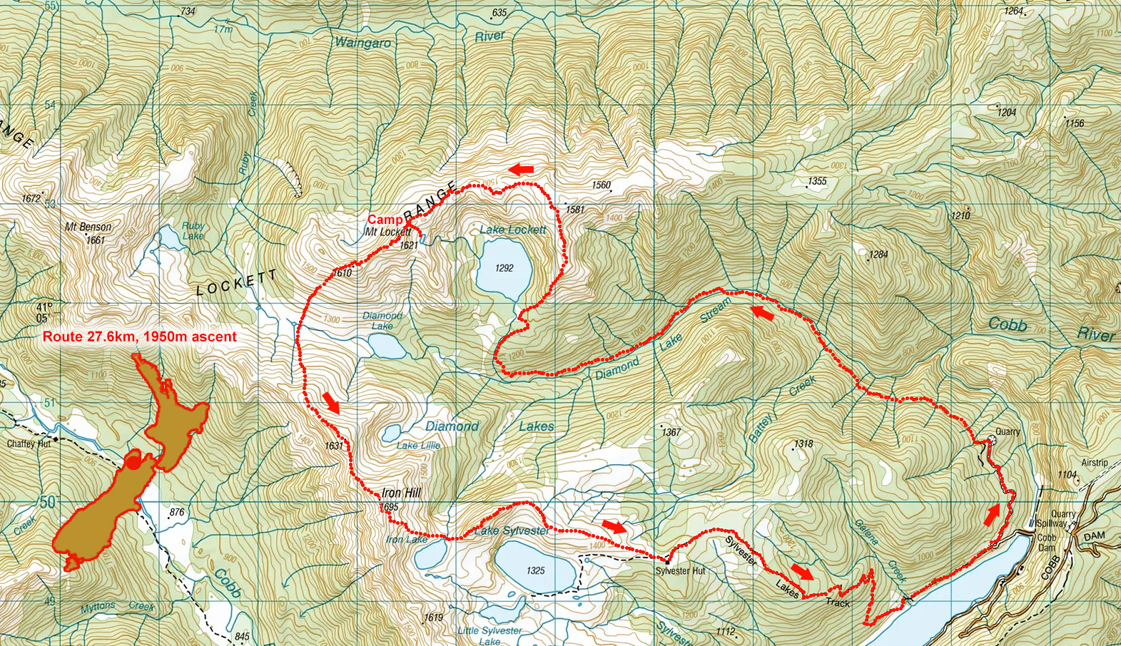
Mt Lockett circuit, April 2026
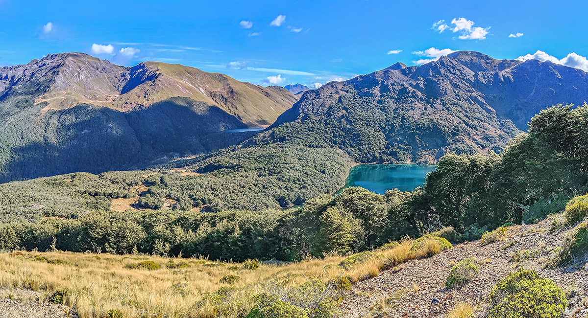
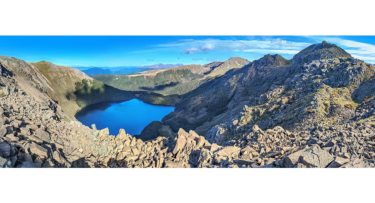
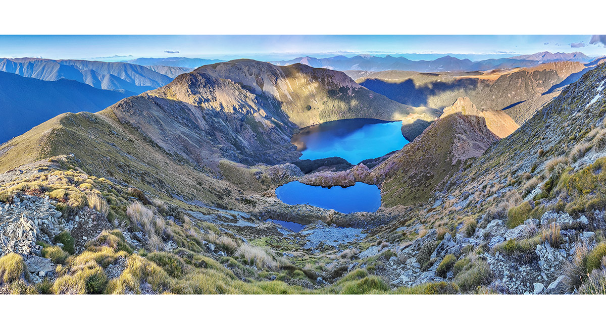
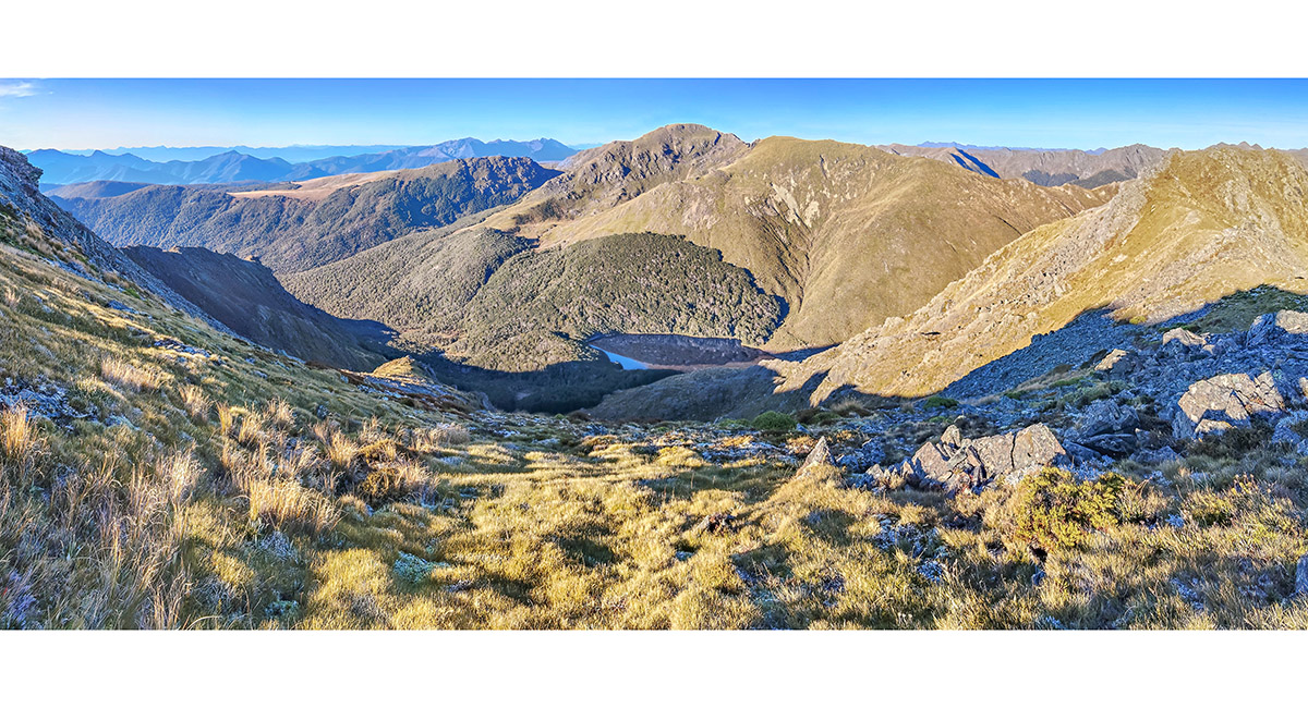
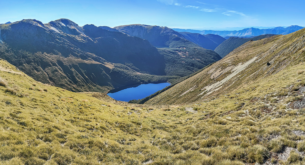
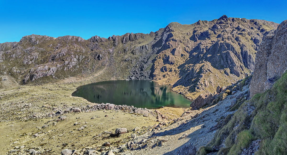
At 1,300m on the bushline, on the spur giving access to the Lockett Range, looking west to Lake Lockett (1,292m) and Mt Lockett (1,621m, right), Diamond Lake (1,240m, centre) and Iron Hill (1,695m, top left)

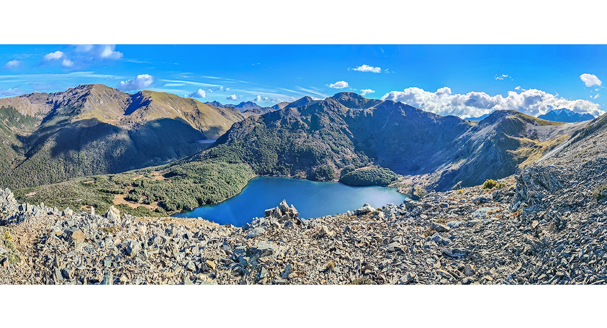
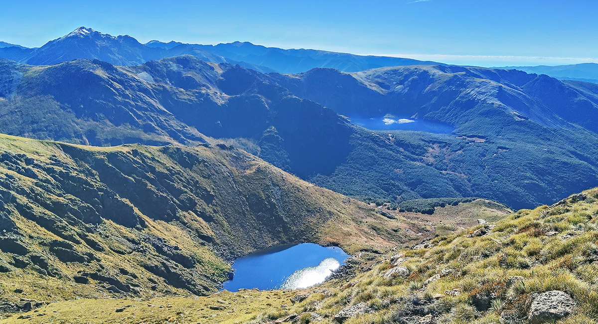
At 1,500m on the spur, beneath Pt1581, looking across Lake Lockett to Mt Lockett and Iron Hill left. Two tarns directly beneath Mt Lockett at 1,550m sit in the dip seen here below Mt Lockett

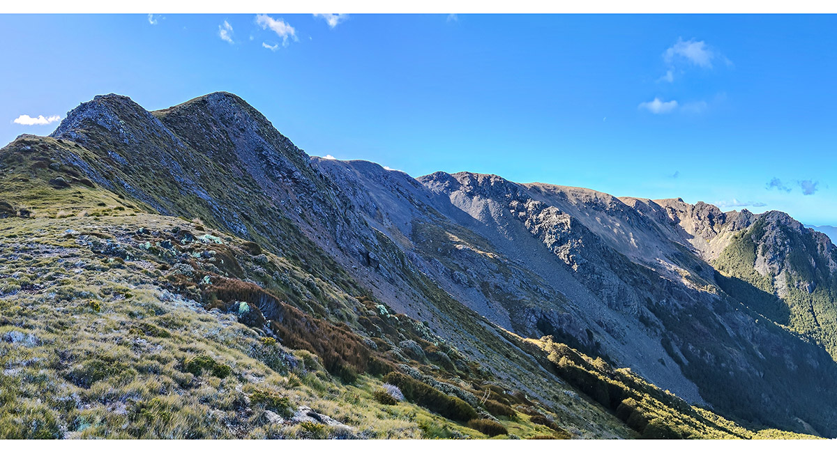
View north to Pt1581

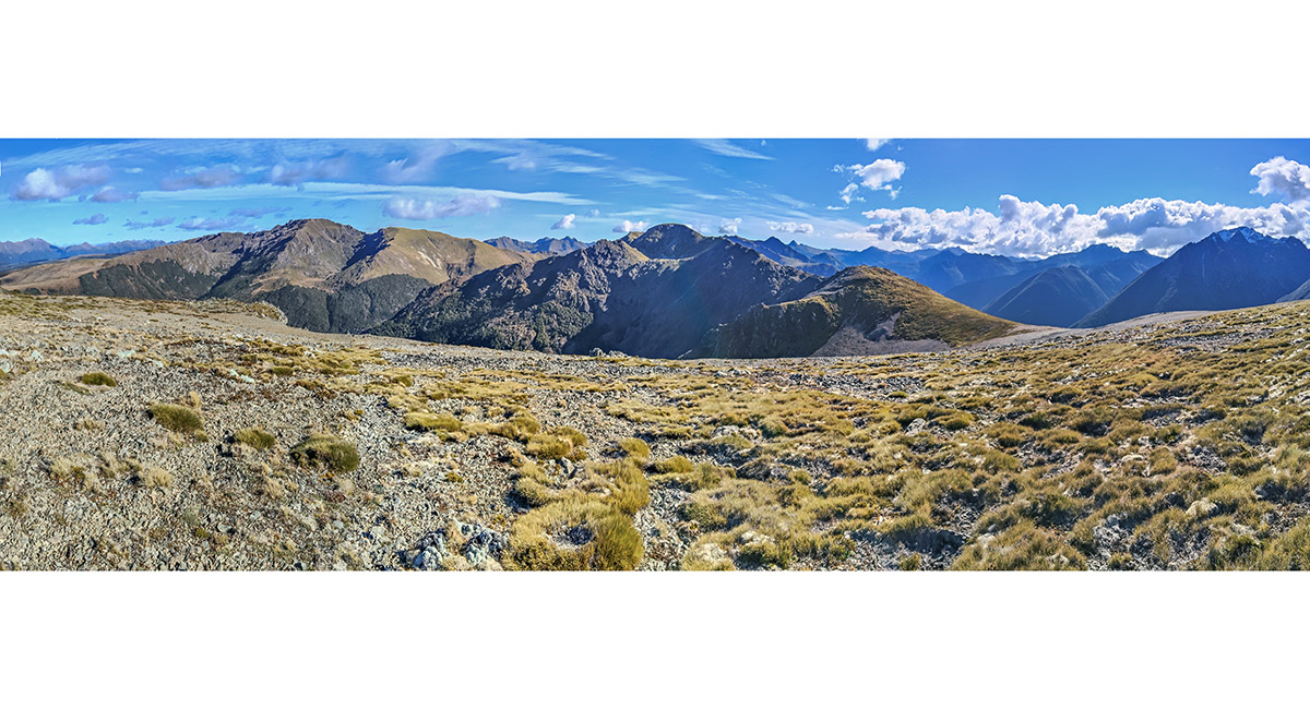
On the broad ridgetop west of Pt1581, looking west to Mt Lockett at centre. Mt Snowdon (1,859m) is far right

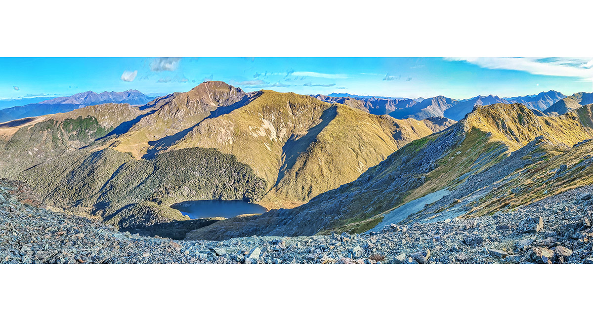
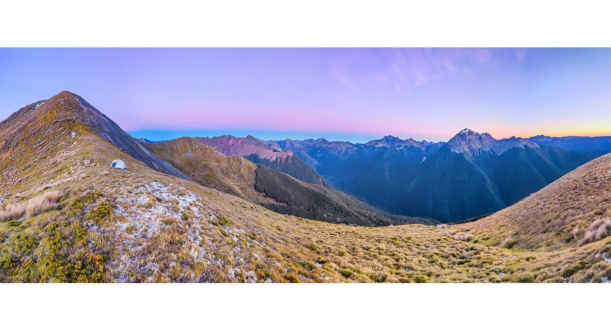
At about 1,500m on the ridgetop, with Mt Lockett far right and Lake Lockett below

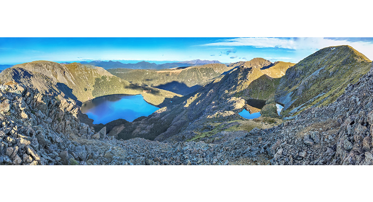
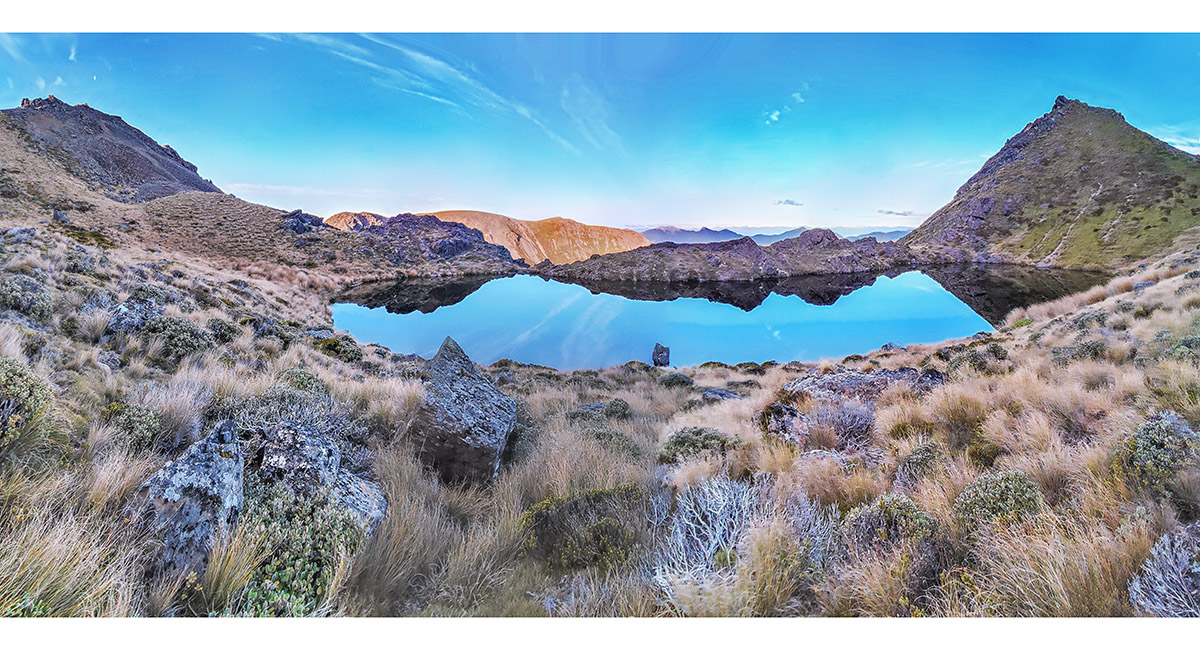
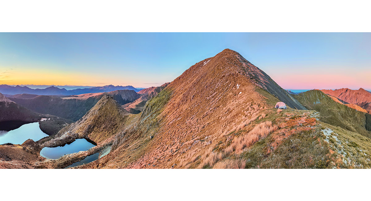
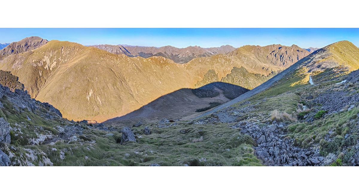
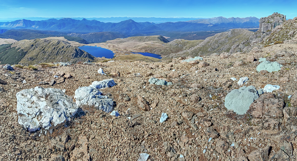
At 1,570m, where the two high tarns come into view, with Lake Lockett at left. My camp spot is far right where the final 30m slope to Mt Lockett's summit begins. The high tarns are an easy scramble down 70m for water, but offer less expansive views than at the camp spot

A summit view west from Mt Lockett (1,621m) over Diamond Lake to Iron Hill. Mt Arthur and The Twins are at left. My descent route southwest next morning is in the dip far right, just beyond Pt1610

A summit view north from Mt Lockett to Mt Snowdon (mid right), with Kakapo Peak (1,783m) distant centre

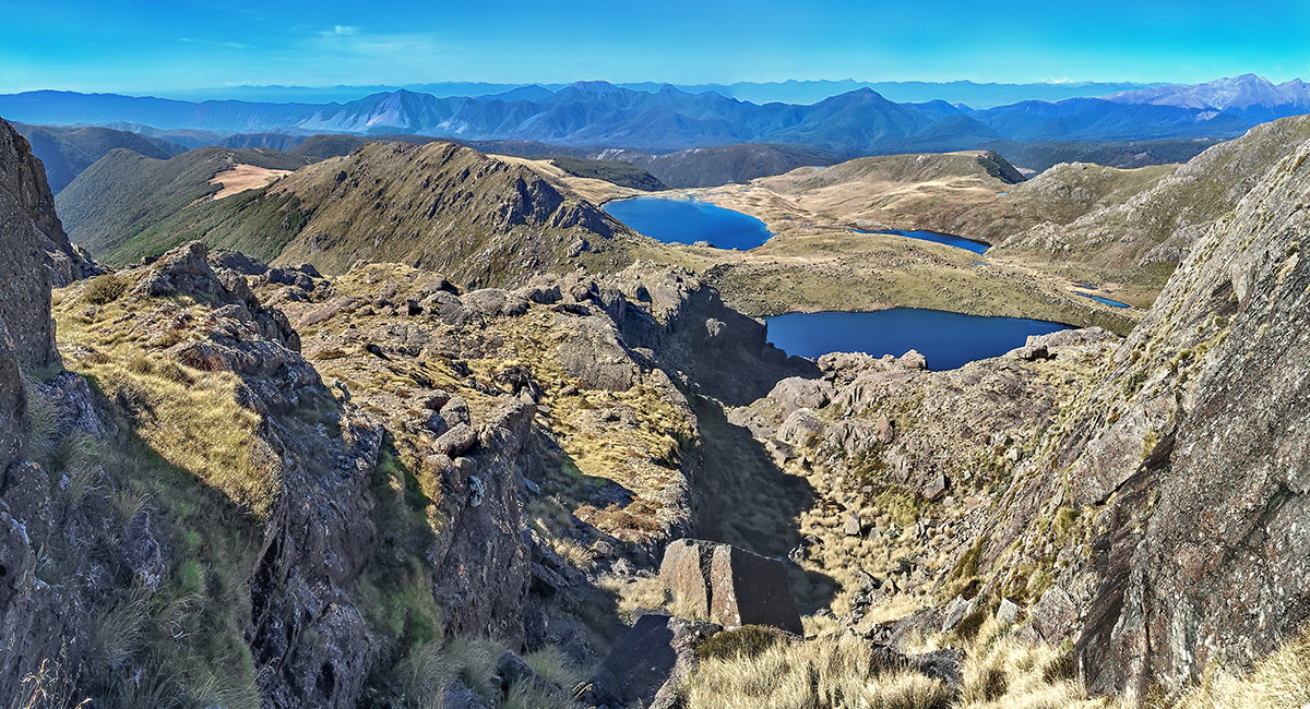
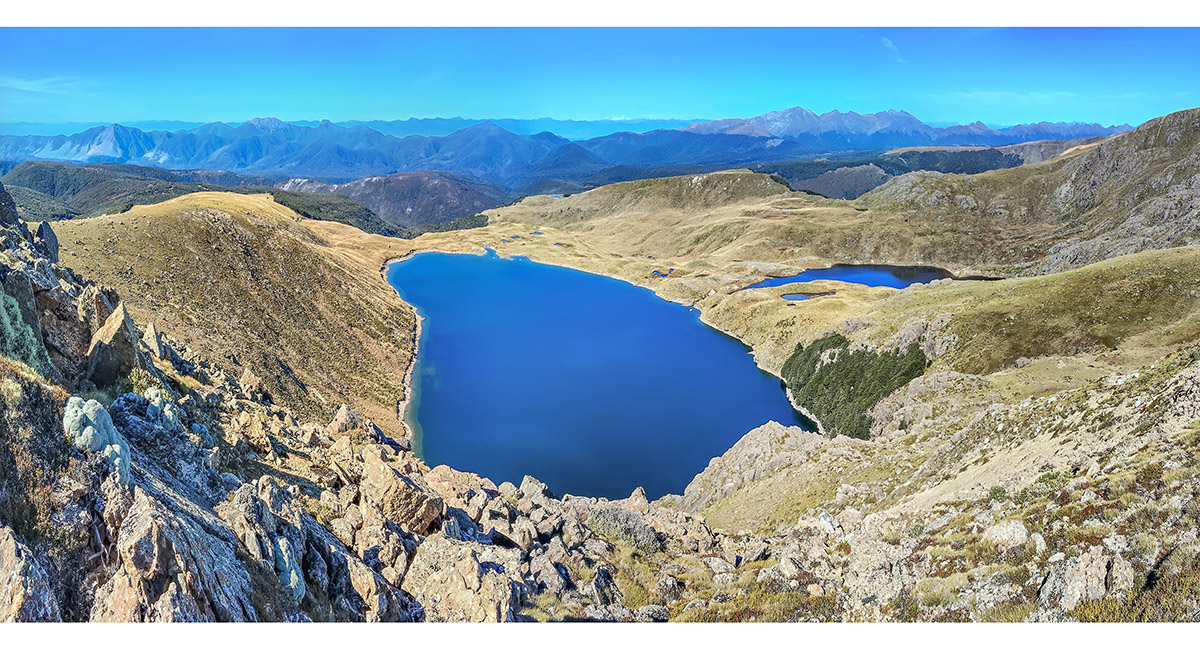
A summit view east from Mt Lockett to the high tarns, Lake Lockett and my ridgetop route of the afternoon

A view southeast across the larger high tarn to Wharepapa/Arthur Range. Hoary Head, Crusader, McMahon and Lodestone are in view

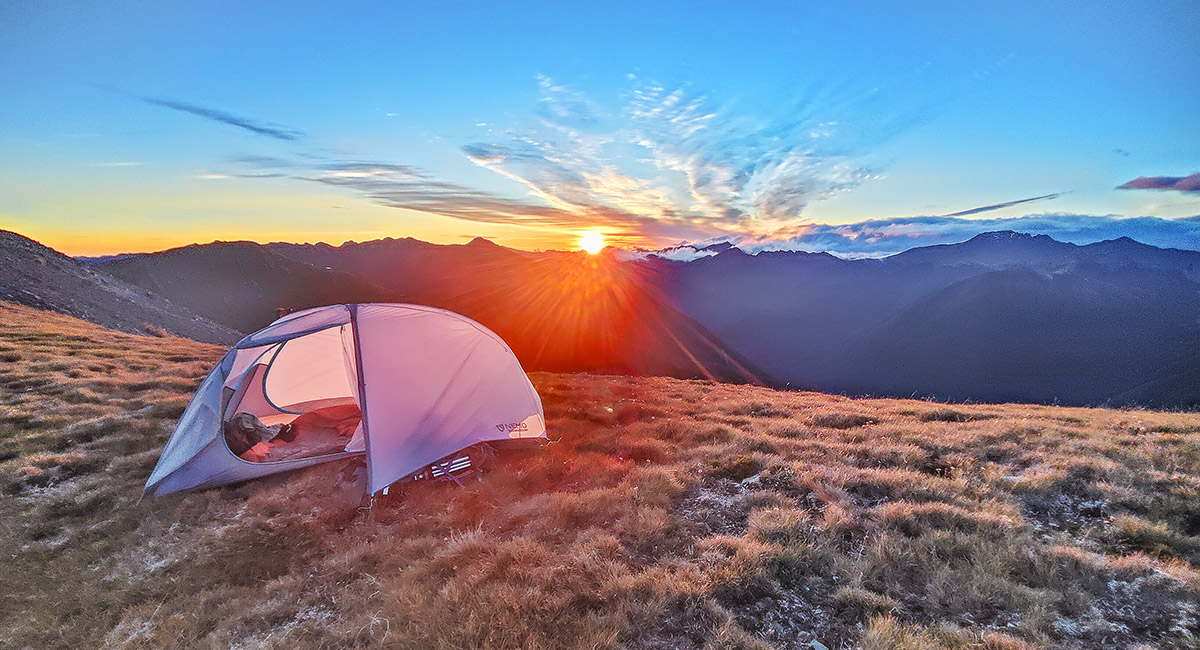
Sunset from my camp spot at 1,570m

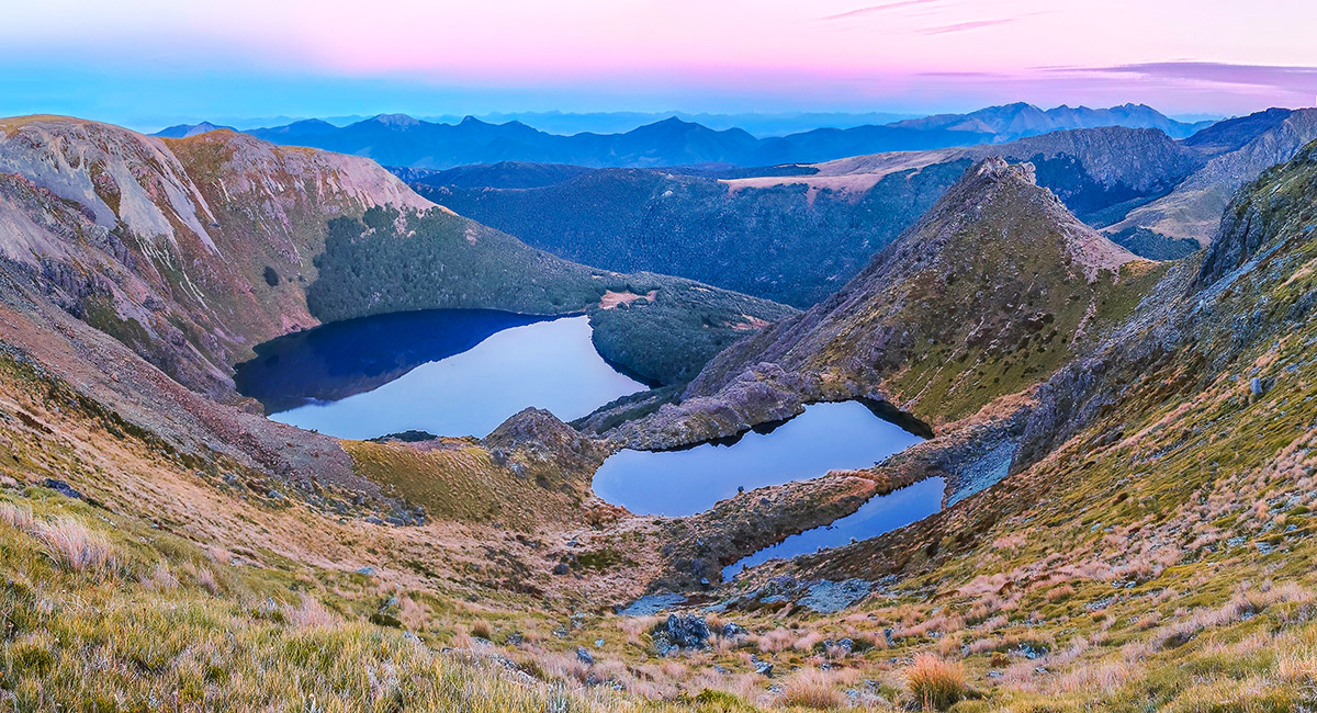
Dawn view of the high tarns and Lake Lockett, with Wharepapa/Arthur Range behind stretching from Mt Campbell to The Twins

Dawn view to Mt Snowdon (right) and Mt Lockett's summit (left)

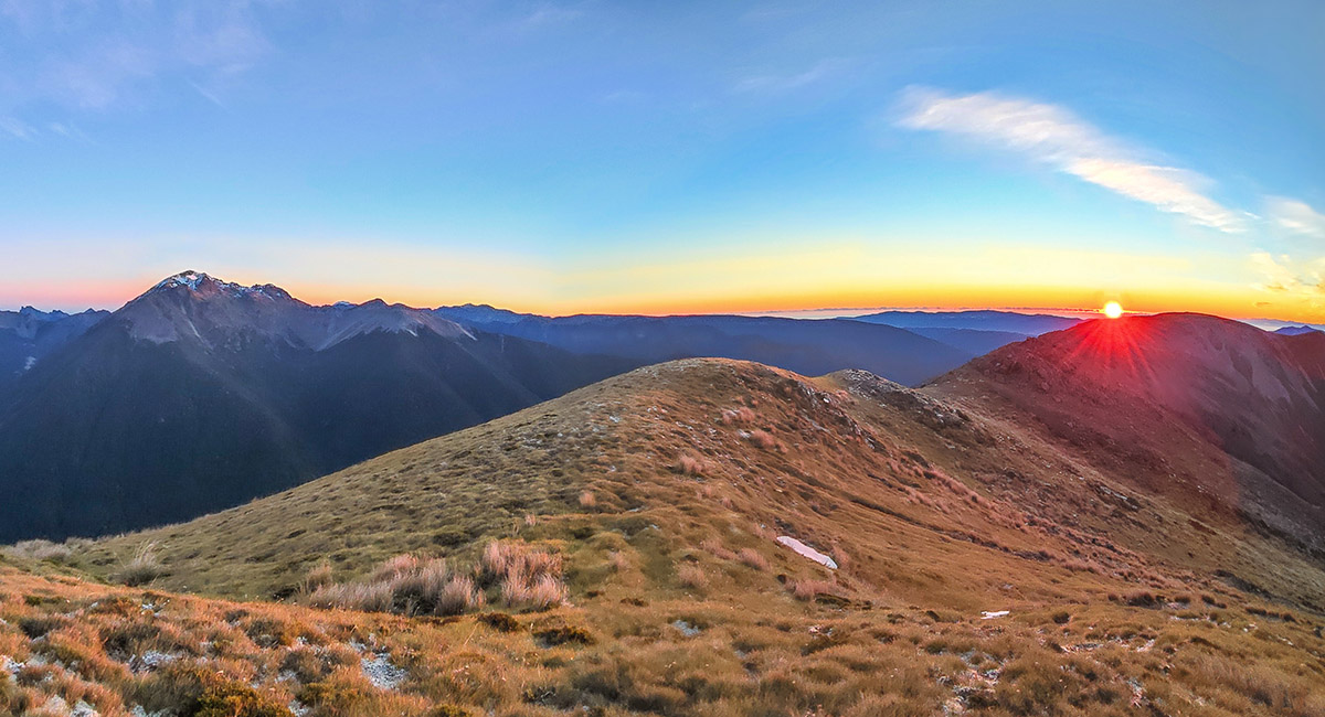
Sunrise, with Mt Snowdon left

Dawn view to Mt Lockett's summit, centre

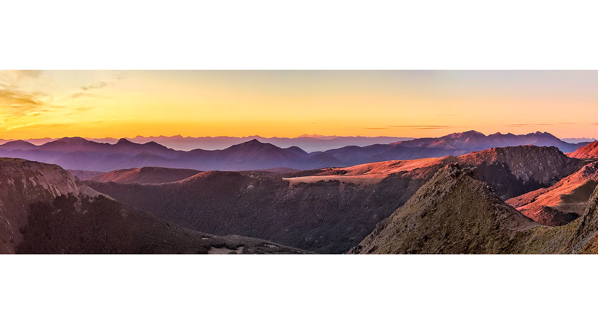
Dawn view southeast to Wharepapa/Arthur Range. From left, Mt Campbell, Hoary Head, Crusader, McMahon, Lodestone, Mt Arthur and The Twins. Mt Peel sits in front of Mt Arthur and The Twins

Just west of Mt Lockett's summit, with Pt1610 far right, Diamond Lake centre and Iron Hill above. Mt Peel, Mt Arthur and The Twins distant left of centre

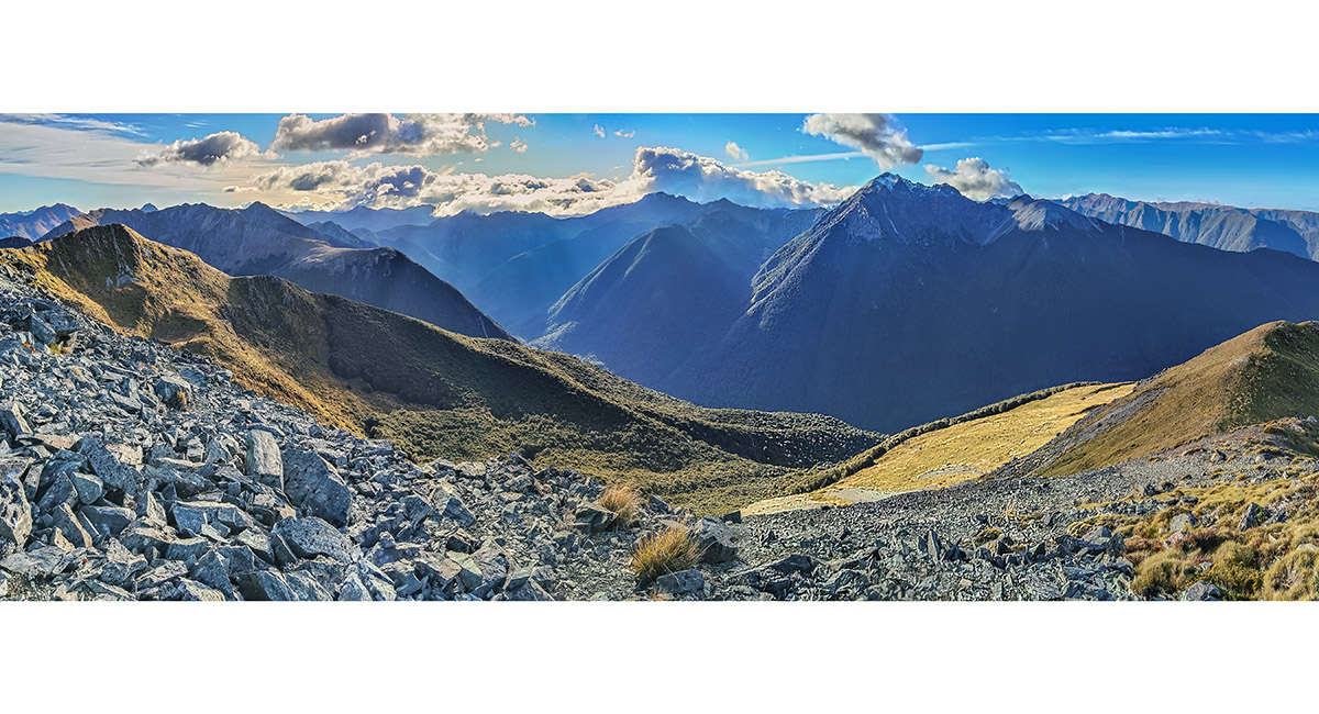
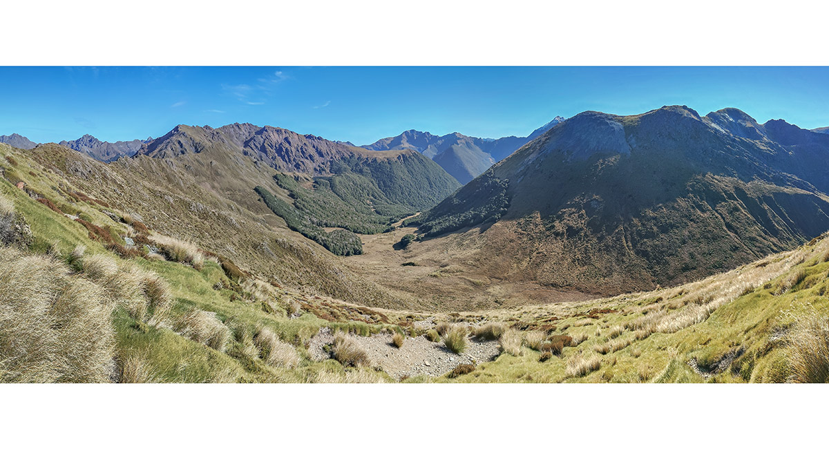
In the small dip just west of Pt1610, looking down my descent route and up the far side to access the ridge leading south to Iron Hill

My water source west of Diamond Lake, before beginning my climb back up to the tops, looking northwest to Mt Benson

Back on the ridge at about 1,500m, looking back to Pt1610 and Mt Lockett (right). Waingaro Peak (1,604m) is centre and Mt Benson (1,661m) mid left

At about 1,600m, looking over Lake Lillie to Lake Lockett (partially in view), with Mt Lockett and Pt1610 left

A view near Iron Hill over Lake Lillie to Lake Lockett. Mt Snowdon far left, with Pt1610 and Mt Lockett in front

On Iron Hill (1,695m), looking southeast to Lake Sylvester (1,325m) and Little Sylvester Lake. Wharepapa/Arthur Range behind

On the descent from Iron Hill, with Iron Lake in front of the Sylvester Lakes. To enjoy some more views I went over the rocky fin (1,560m) at left to reach Sylvester Hut

A view back to Iron Lake on the climb of the rocky fin. Iron Hill top right

A view south from the rocky fin to the Sylvester Lakes and Wharepapa/Arthur Range. Sylvester Hut is the tiny dot just before the distant bushline, beneath Hoary Head

Read about it Captivating Photography Jun/Jul 26
To order a print or web resolution file of any image you see in this slide show, just right click the image, click “Copy Image URL” and paste in to the “Your message” box of our Contact Us form. Please also note, for each image, if you want a print or web resolution file. We will get back to you as soon as possible to confirm price and payment details.
Open Contact Us in a new window to paste Image URL(s) easily