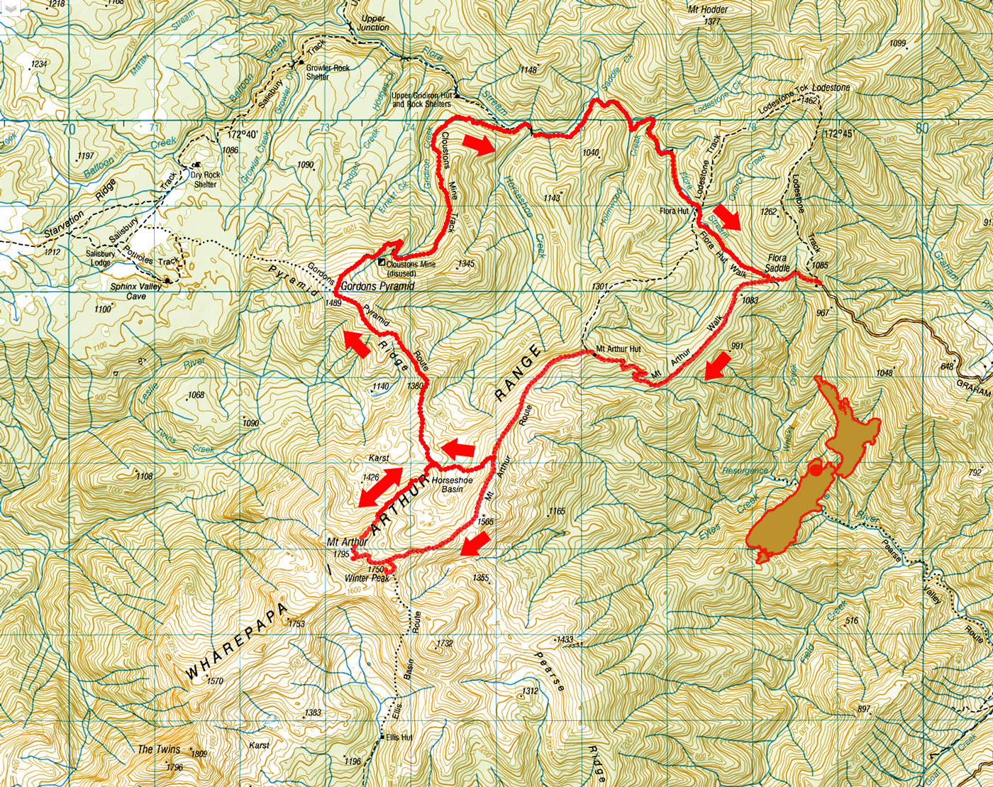
Mt Arthur bivvy and Gordons Pyramid, February 2023
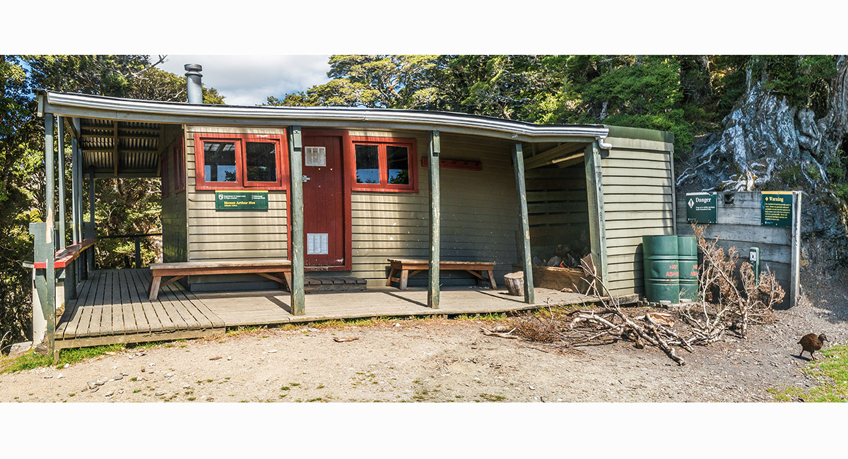
Mt Arthur Hut (1,300m)

A view at 1,350m, along the Mt Arthur Route (left) to Mt Arthur and Winter Peak, and Gordon's Pyramid right of centre

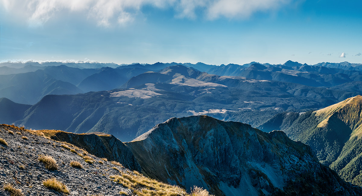
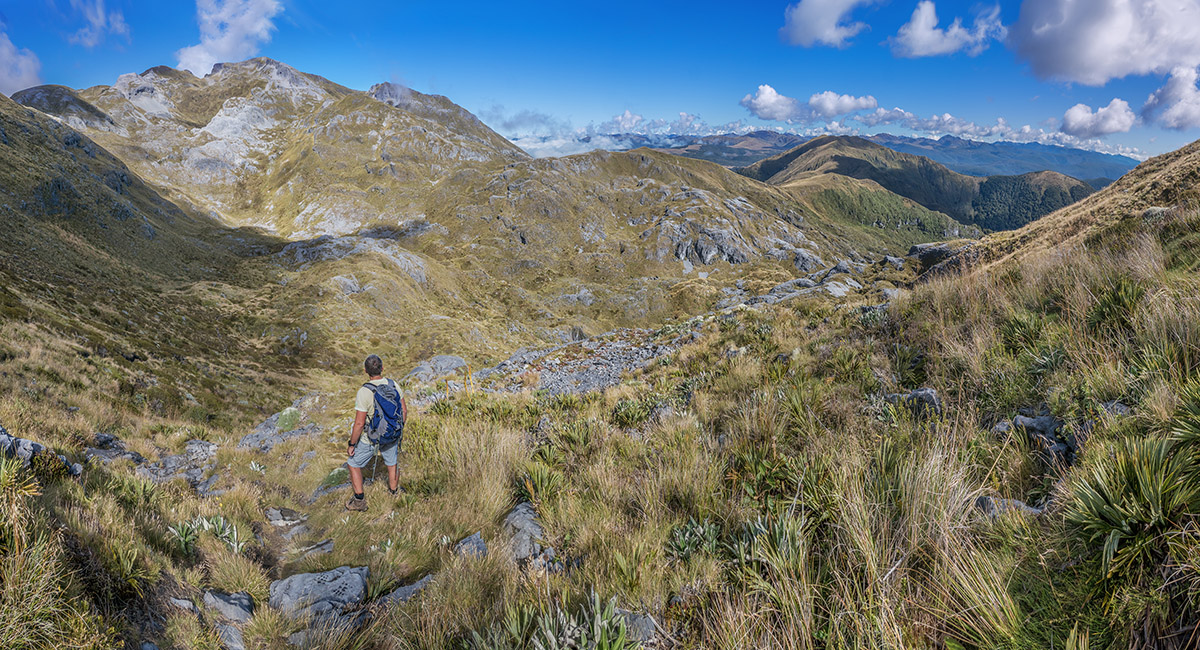
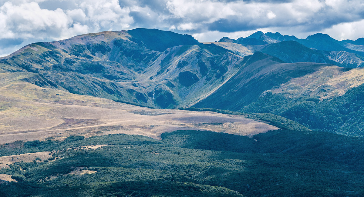
A view from 1,350m, above Mt Arthur Hut, to the Tablelands and distant mountains

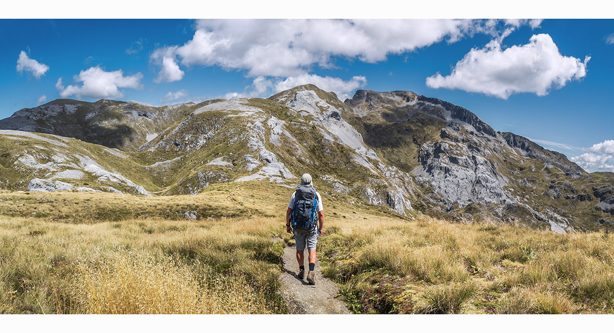
Heading up the Mt Arthur Route, Mt Arthur right of centre

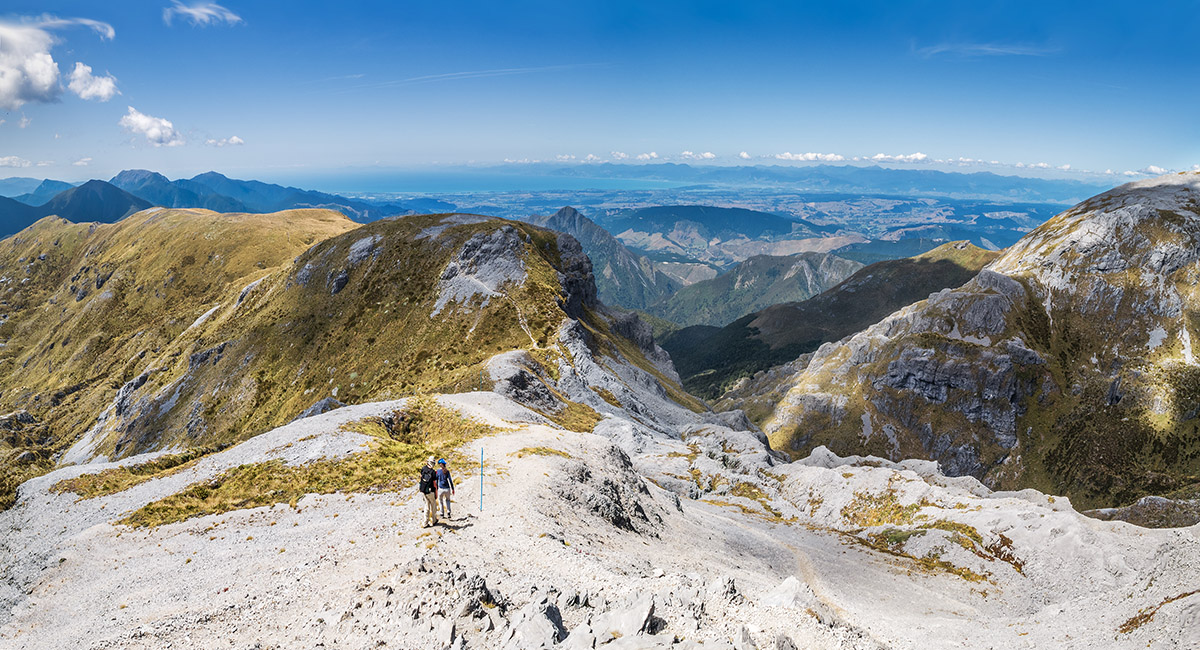
A view northeast, back along the Mt Arthur Route, from about 1,600m

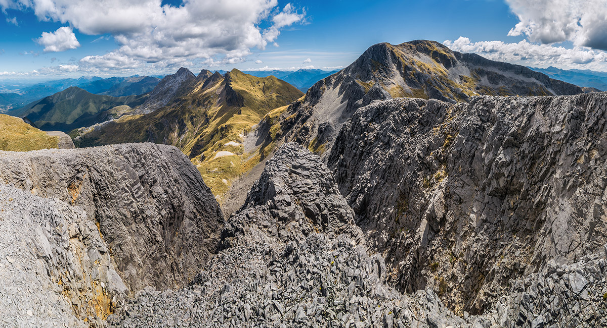
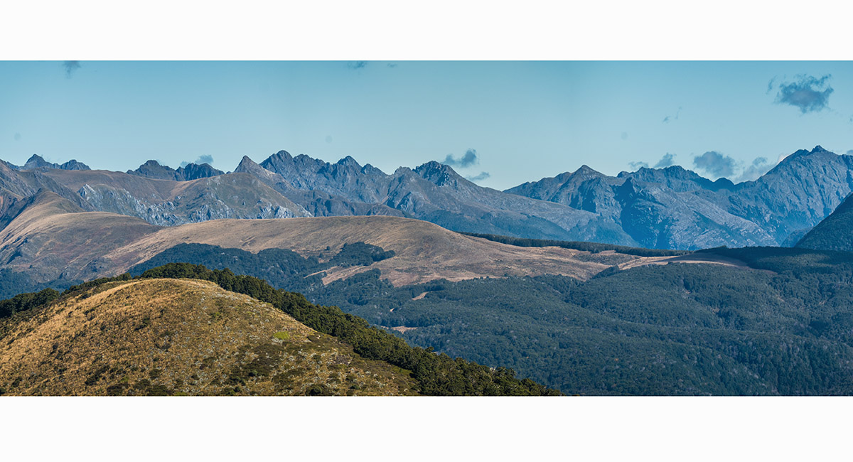
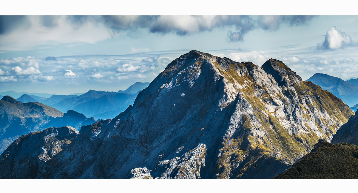
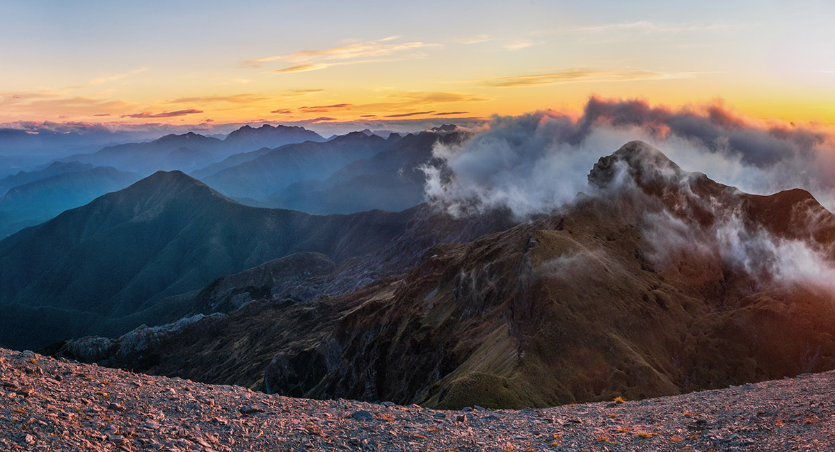
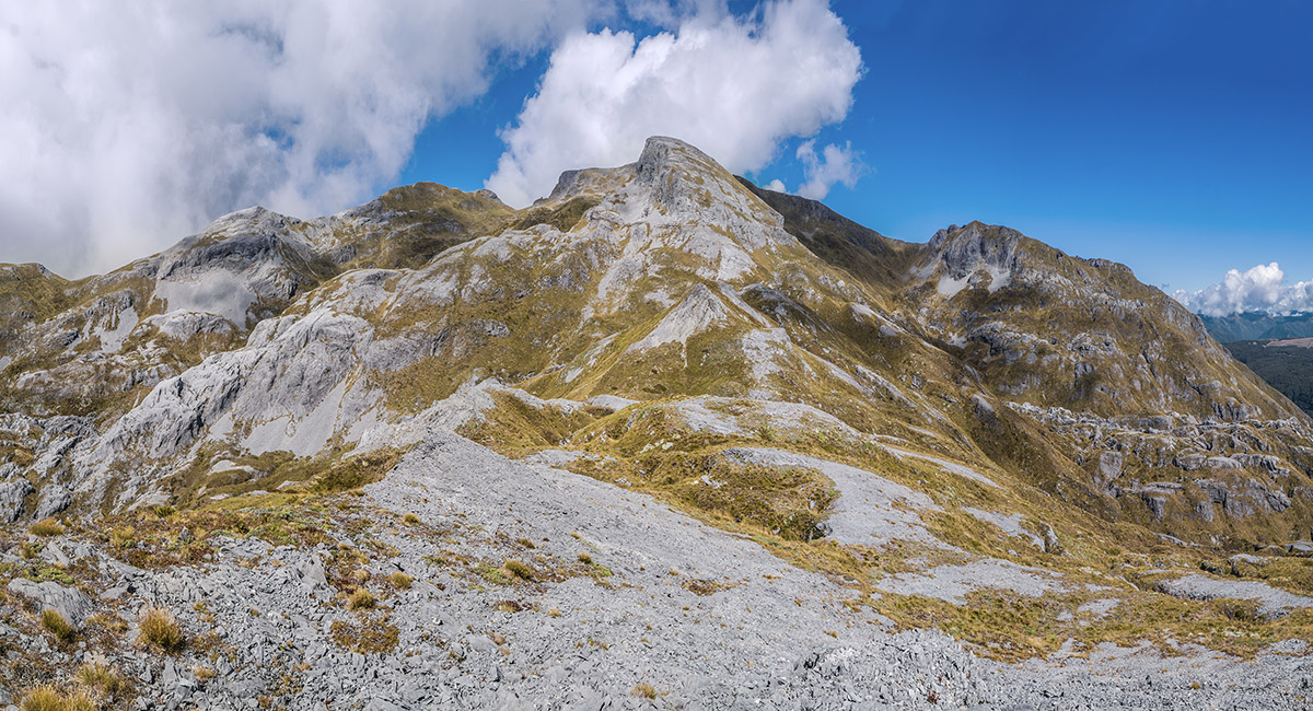
A view from Winter Peak (1,750m), northwest to Mt Arthur (1,795m, right) and southwest along the Arthur Range to the Twins (left)

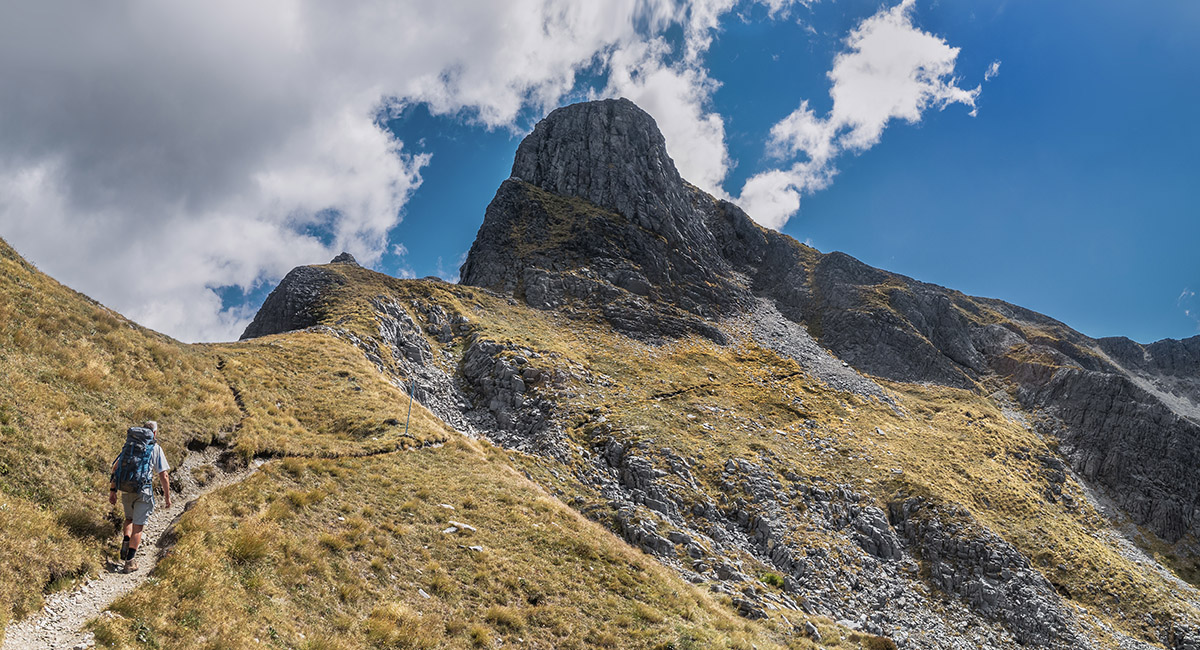
Back on the Mt Arthur Route at 1,700m, bound for the summit

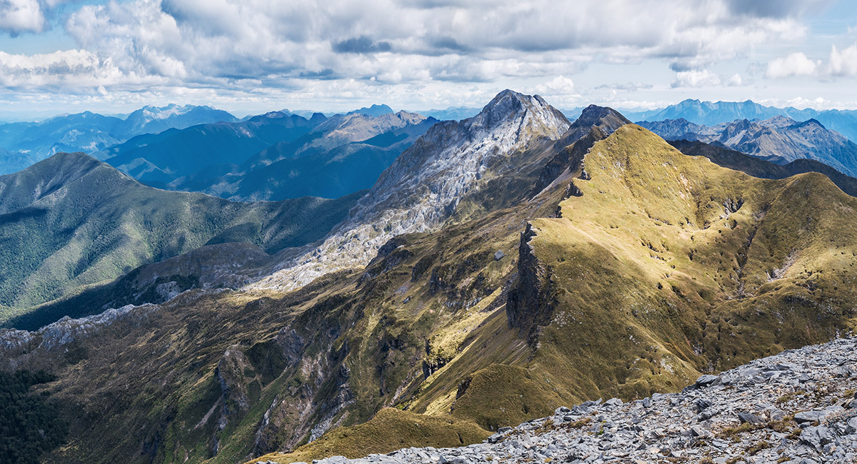
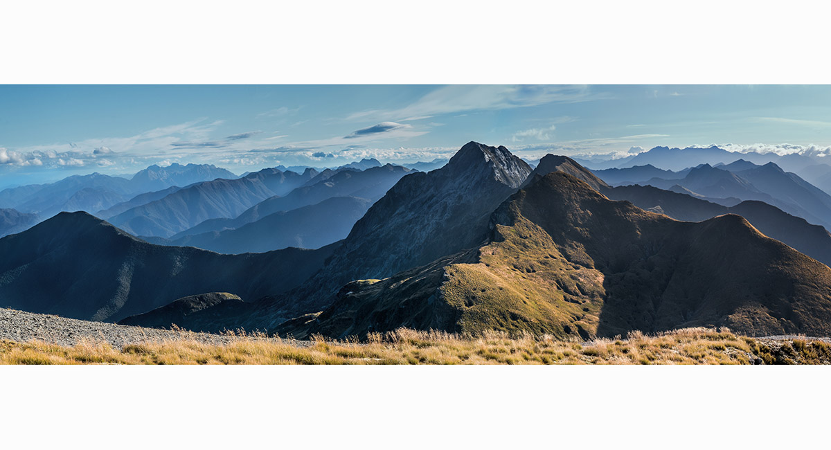
A Mt Arthur summit view southwest to the Twins (right of centre) and Mt Owen (distant left)

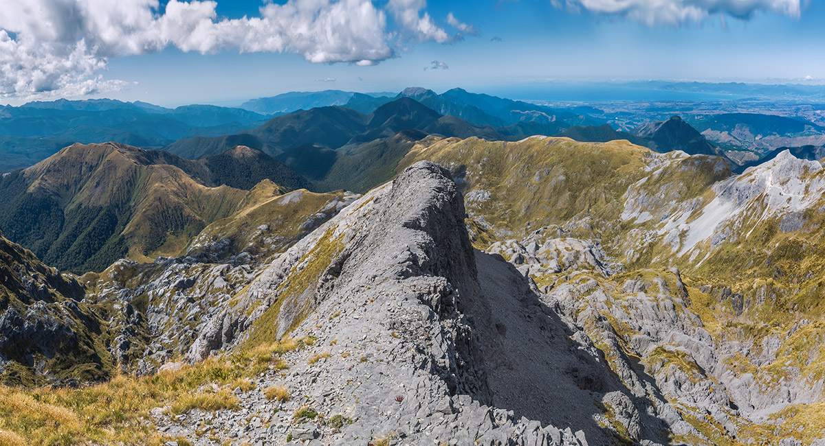
A Mt Arthur summit view northeast along the northeast ridge. Gordon's Pyramid is mid-left and the Mt Arthur Route mid-right

A Mt Arthur summit view north to Gordon's Pyramid (1,489m, left of centre)

A Mt Arthur summit view southwest to North Twin (1,809m, centre) and South Twin (1,796m, right)


A Mt Arthur summit view south to Mt Owen (1,875m)

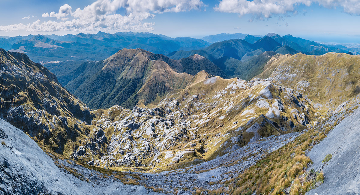
A Mt Arthur summit view south into the Ellis Basin. Ellis Hut is in the bush where the valley tussock reaches a point dead centre. Winter Peak is far left and the Twins right

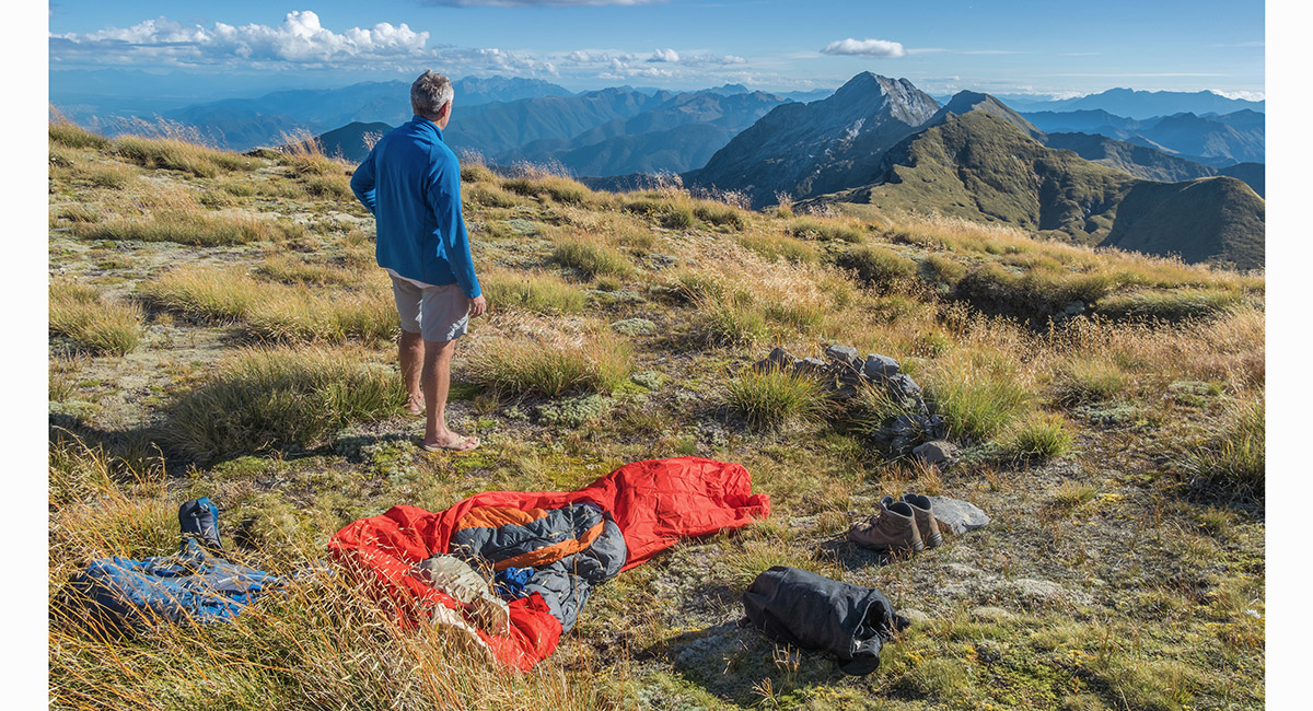
My bivvy spot on Mt Arthur, looking southwest to the Twins

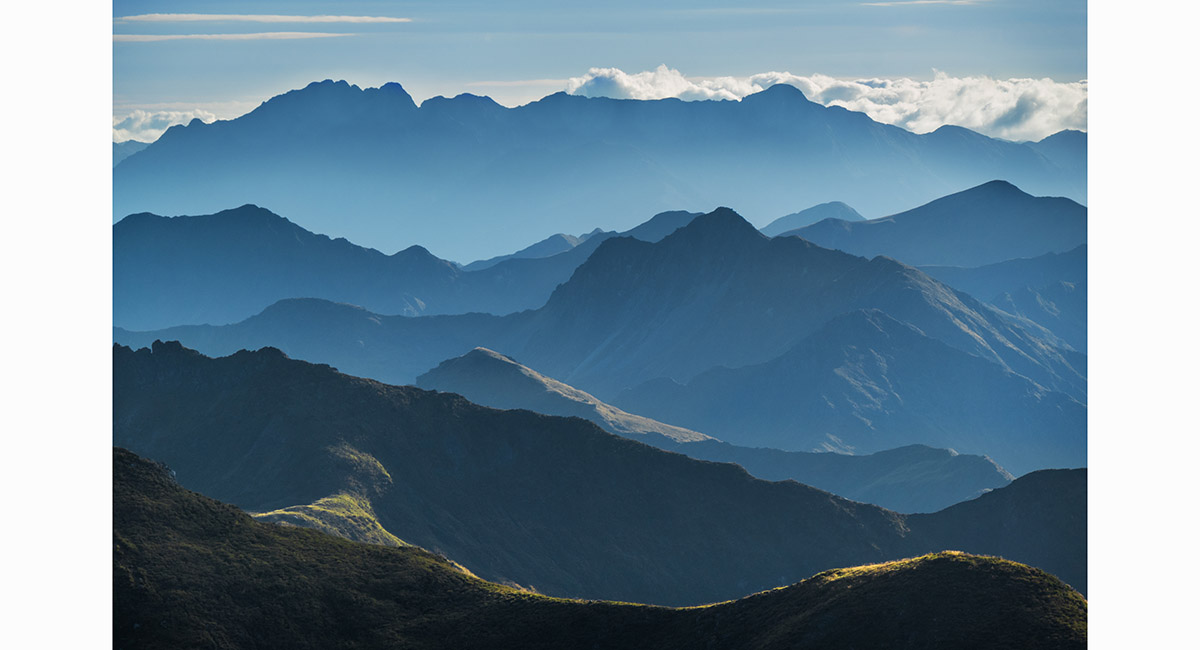
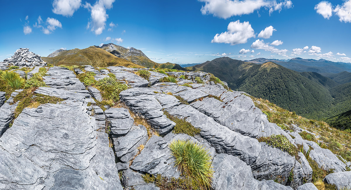
Ridges layered to the west

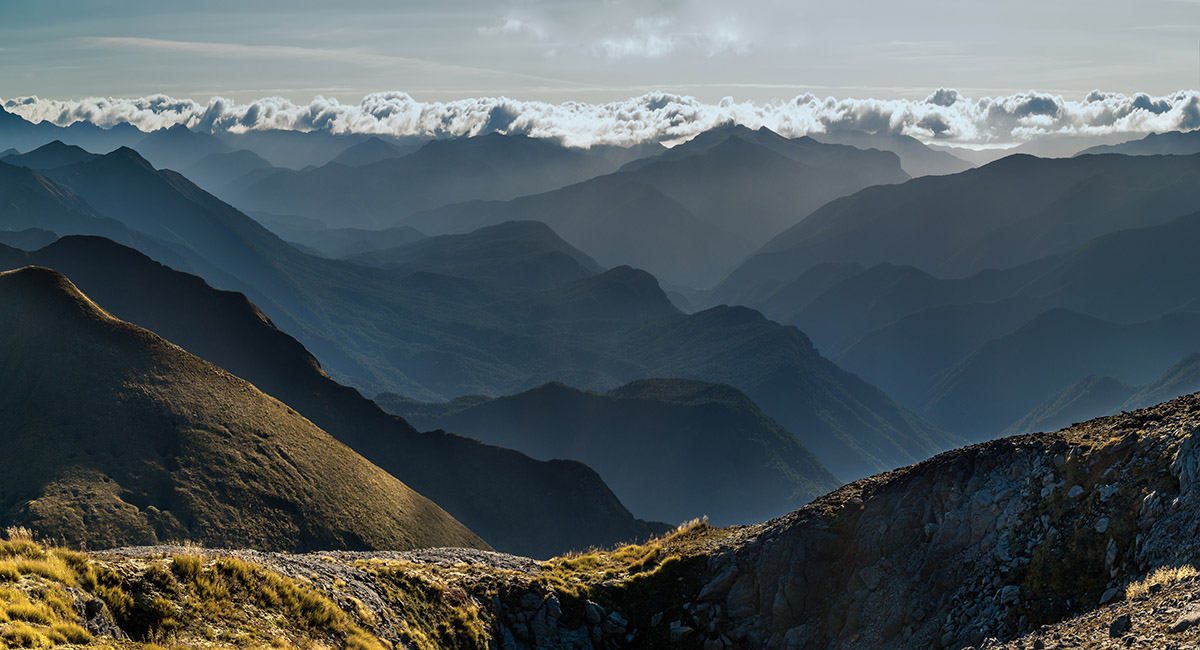
Ridges layered to the west. The weather was changing for the worse

A Mt Arthur summit view southwest to the Twins (right of centre)

A Mt Arthur summit view northwest to the Tablelands

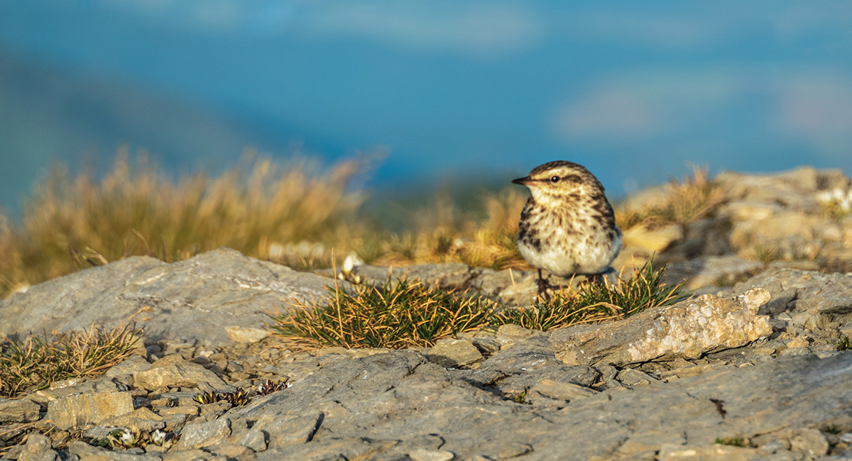
A dusk visitor

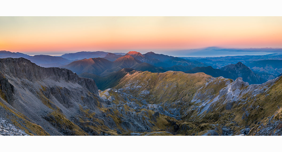
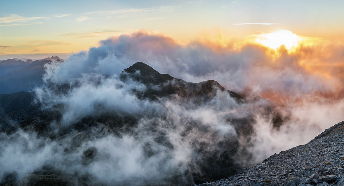
A Mt Arthur summit view at sunset northeast over the Mt Arthur Route to Tasman Bay (right). Lodestone (1,462m) glows orange centre

A Mt Arthur summit view at sunset northeast over the Mt Arthur Route (sunlit) to Tasman Bay (right)

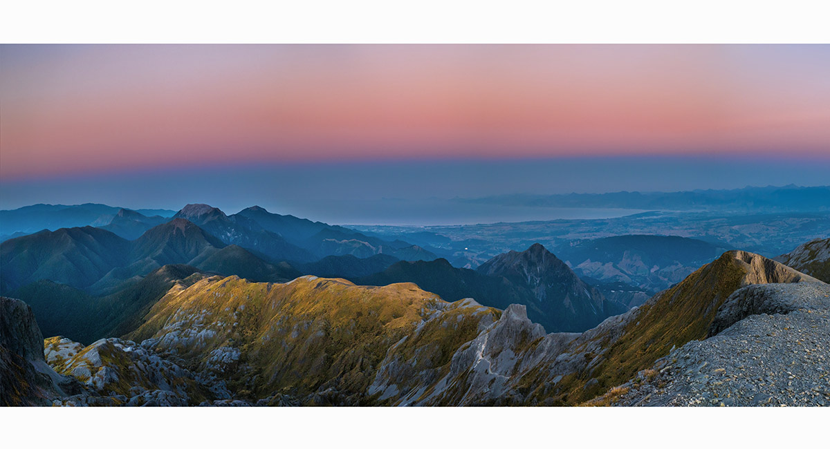
A Mt Arthur summit view at sunset southwest to the Twins in cloud

A Mt Arthur summit view at sunset southwest to the Twins in cloud at right

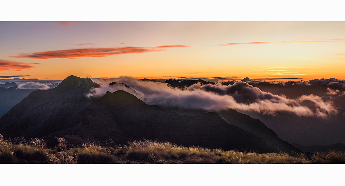
A Mt Arthur summit view at sunset west, with the Twins at left

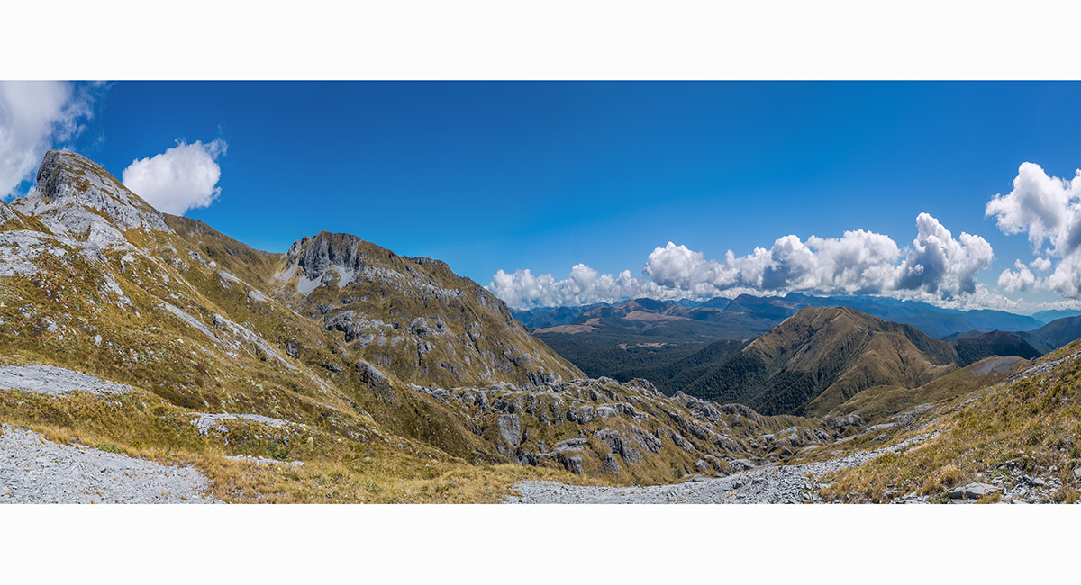
Dropping off the Mt Arthur Route into the basin leading to Gordon's Pyramid (right). Mt Arthur is top left


A sink hole in the basin beneath Mt Arthur

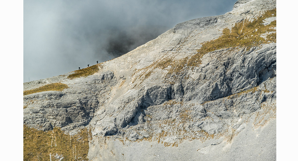
Trampers ascending the Mt Arthur Route

Looking directly up the northeast ridge of Mt Arthur, from about 1,400m on the Gordon's Pyramid Route

The northeast ridge of Mt Arthur is at left, from about 1,400m on the Gordon's Pyramid Route. Gordon's Pyramid is mid-right


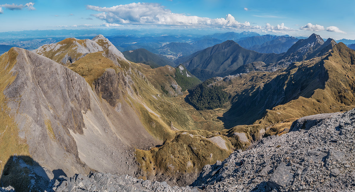
A view from Gordon's Pyramid, south to Mt Arthur (left) and west to the Tablelands and Mt Peel (right)

A view from Gordon's Pyramid west to Mt Peel (1,654m)

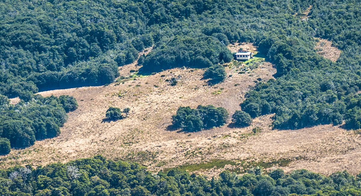
Salisbury Lodge (1,120m), viewed from Gordon's Pyramid (1,489m)

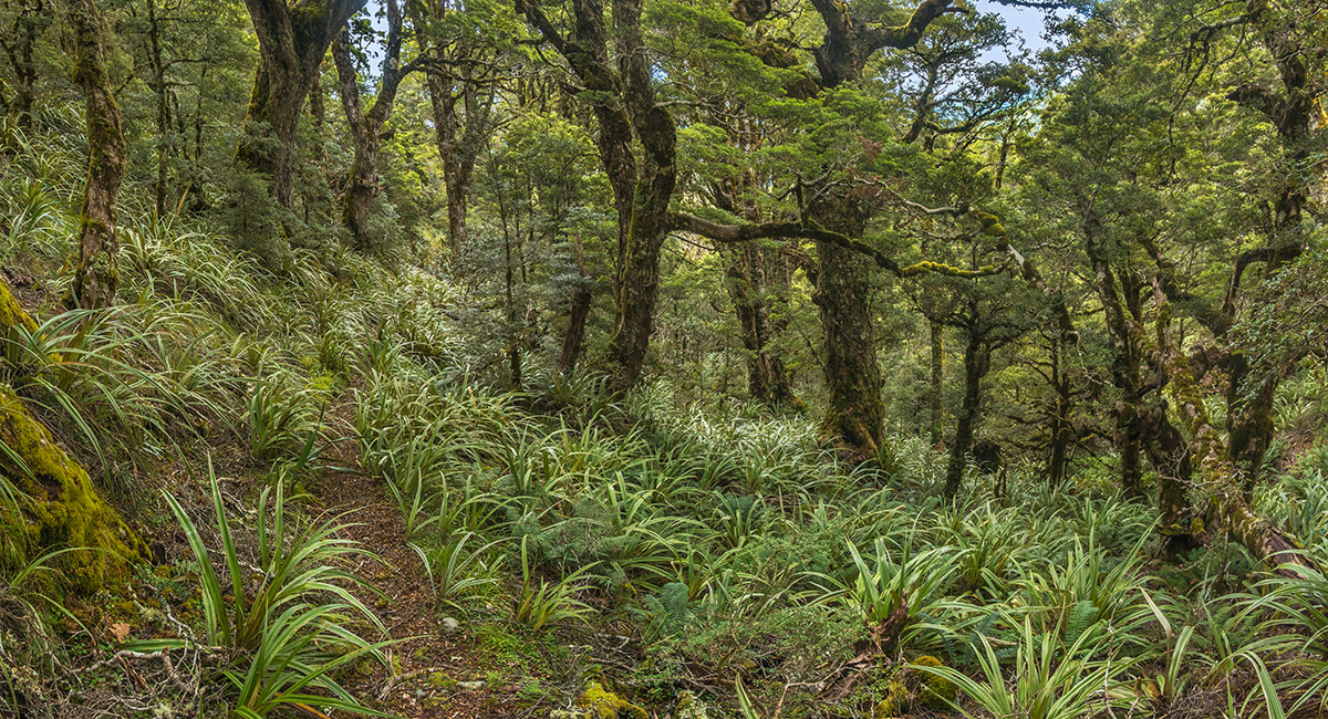
In the bush on the descent from Gordon's Pyramid, via the Cloustons Mine Track

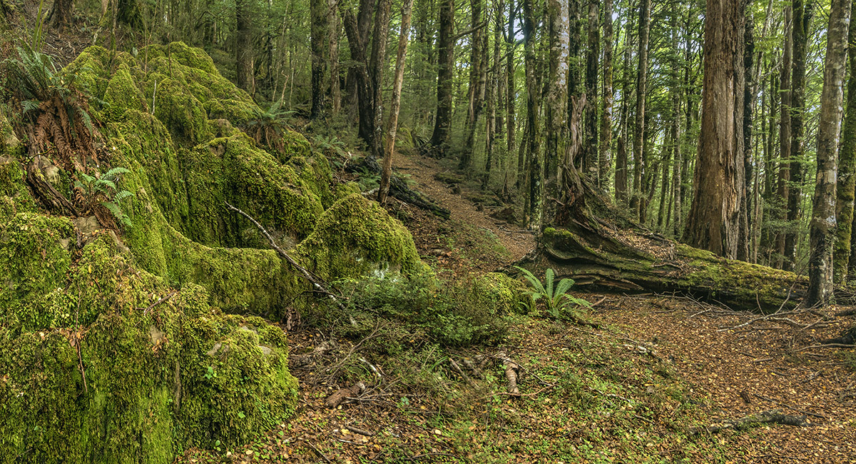
Moss-covered karst in the bush, on the descent from Gordon's Pyramid, via the Cloustons Mine Track

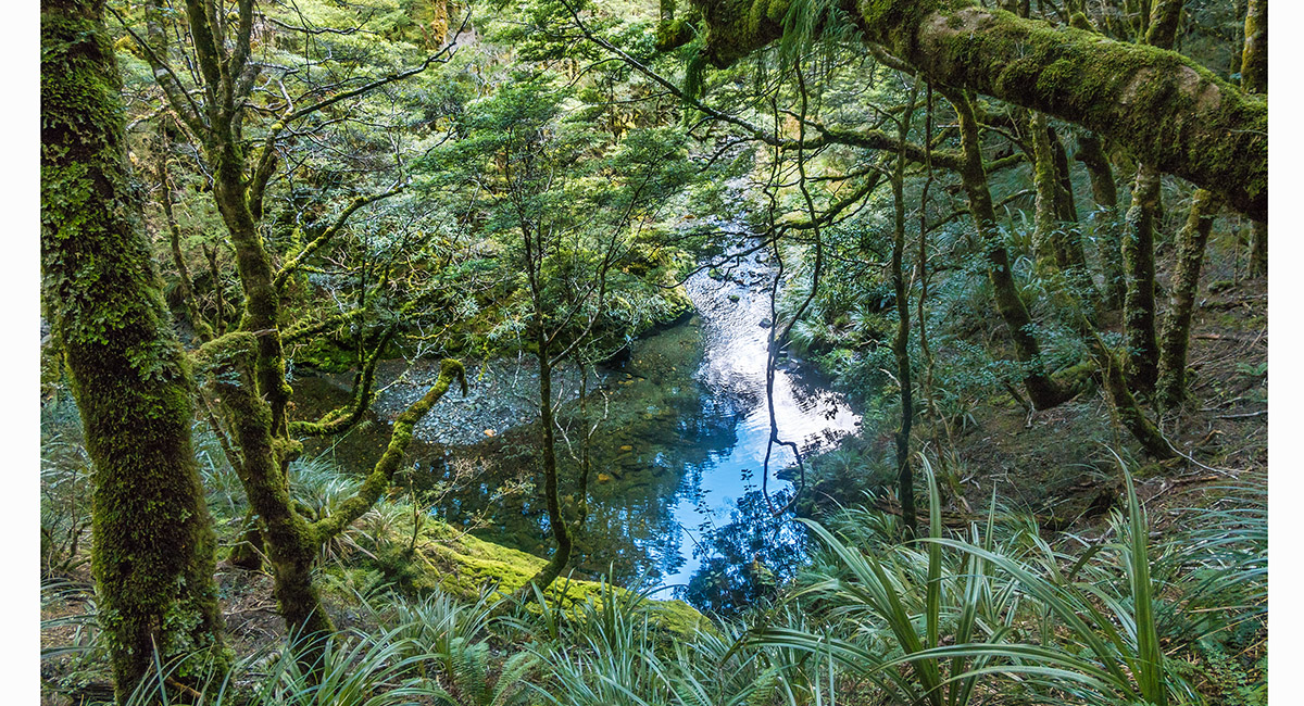
A view through trees to Flora Stream, near Flora Hut


Flora Hut (900m)

Read about it Captivating Photography July August 2023
To order a print or web resolution file of any image you see in this slide show, just right click the image, click “Copy Image URL” and paste in to the “Your message” box of our Contact Us form. Please also note, for each image, if you want a print or web resolution file. We will get back to you as soon as possible to confirm price and payment details.
Open Contact Us in a new window to paste Image URL(s) easily