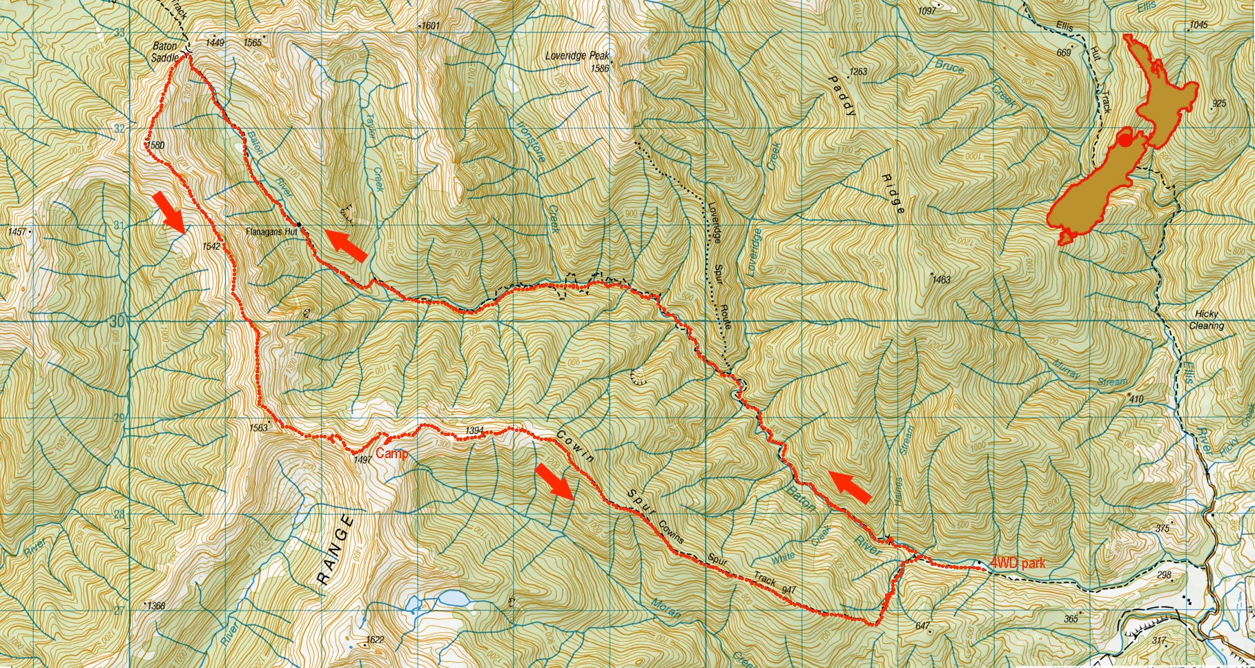
Baton Saddle Cowin Spur circuit, May 2025
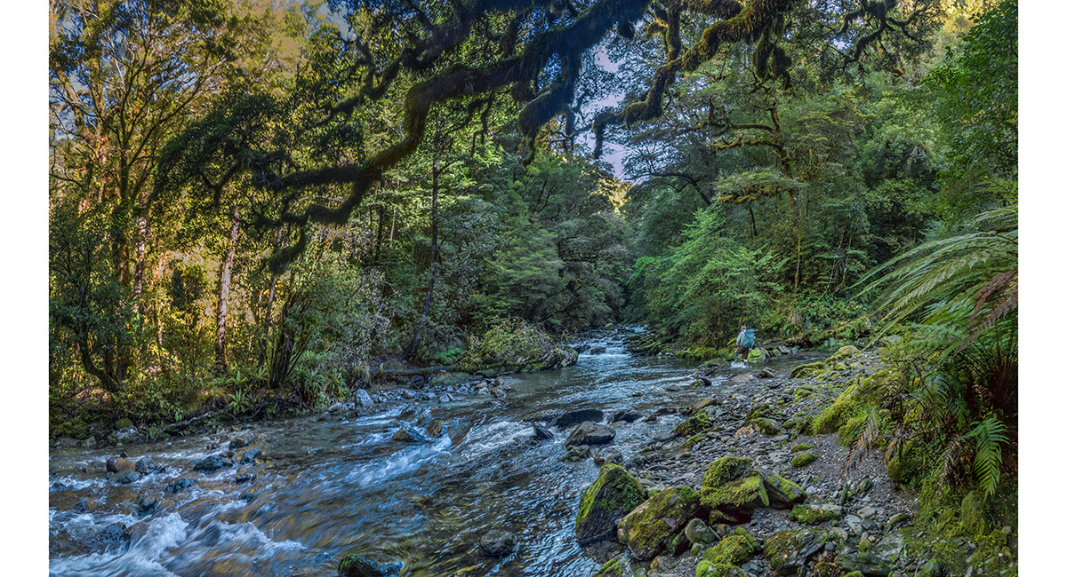
Above the swing bridge, on the lower section of Baton River

On the lower section of Baton River

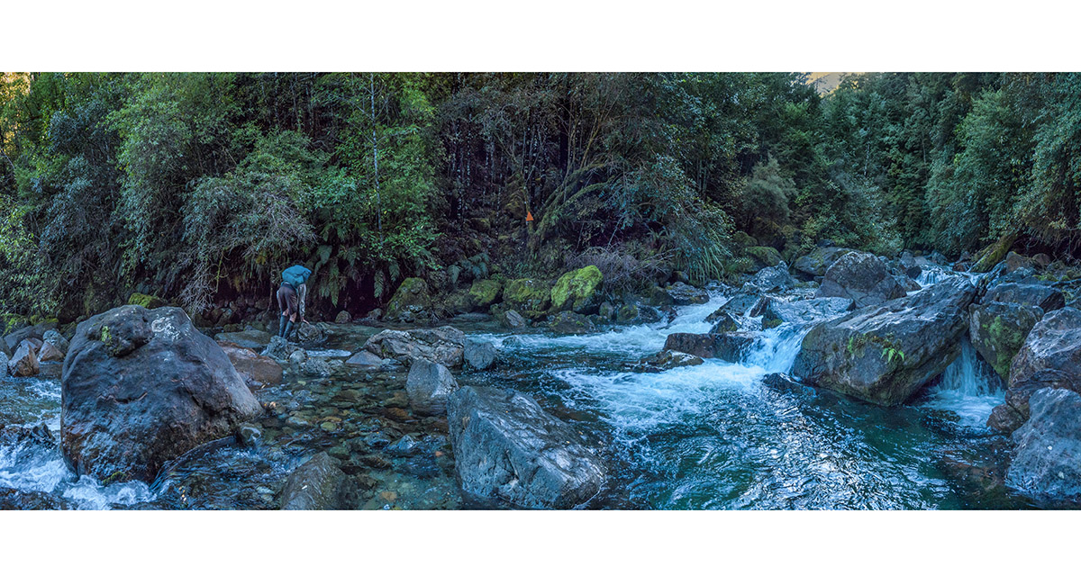
Beside the Baton River track close to Flanagan's Hut

Beside the Baton River track close to Flanagan's Hut

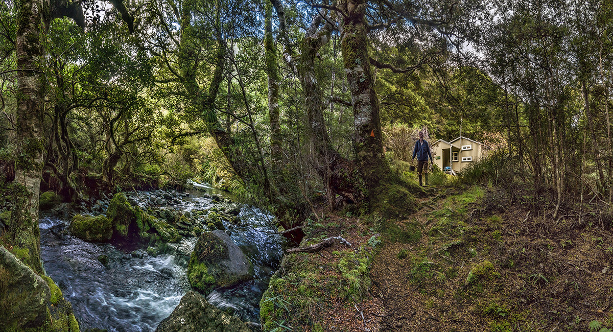
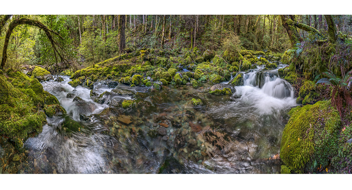
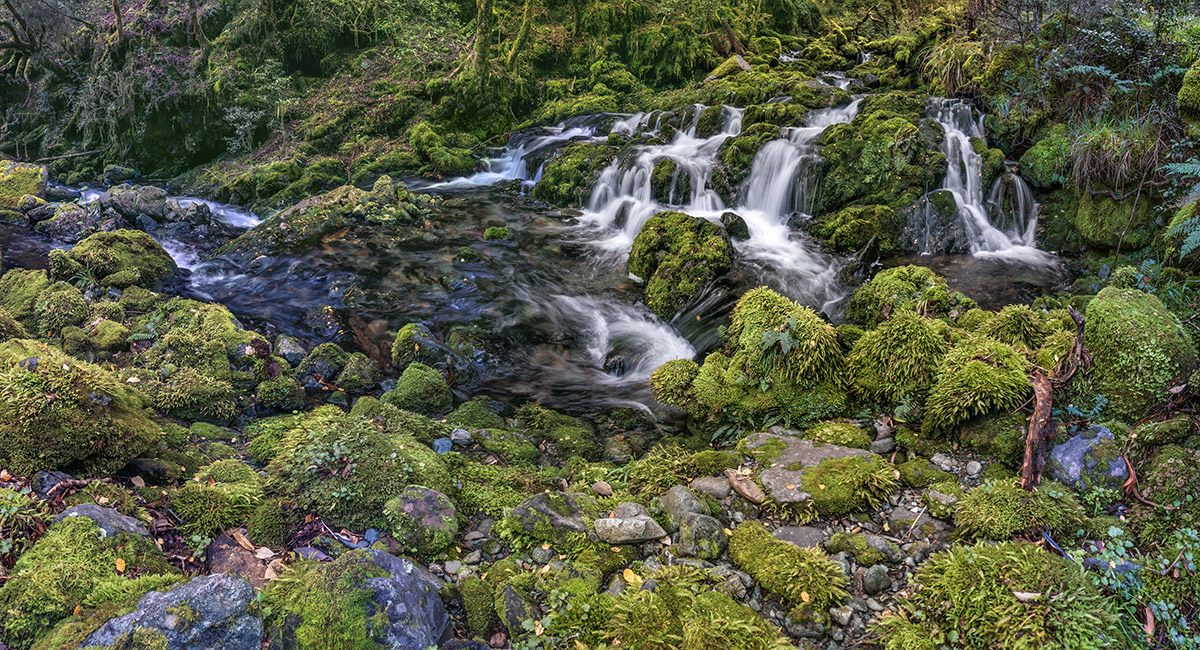
Upper Baton River, beside Flanagan's Hut

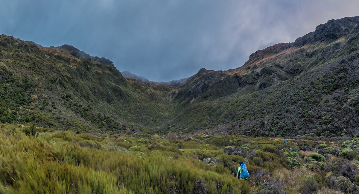
Above Flanagan's Hut, looking north to Baton Saddle

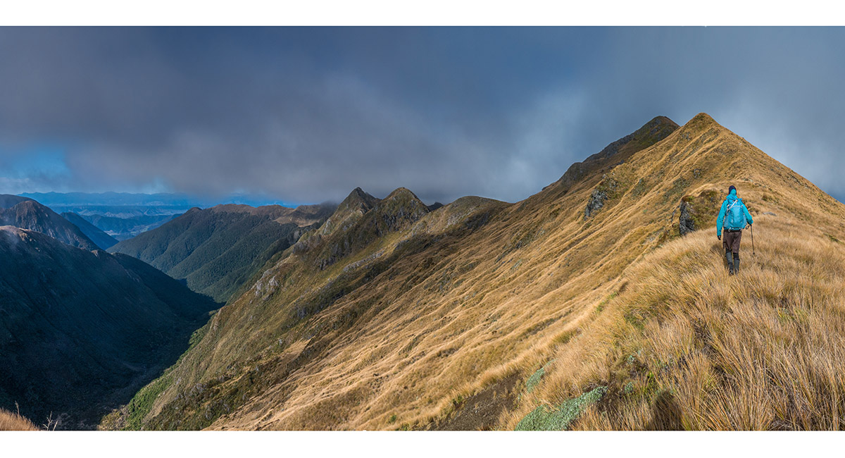
About 40 metres below Baton Saddle, looking south down Baton River valley

The view north from Baton Saddle


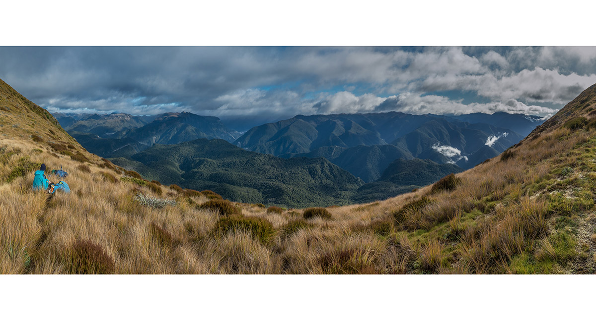
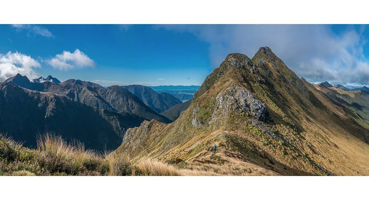
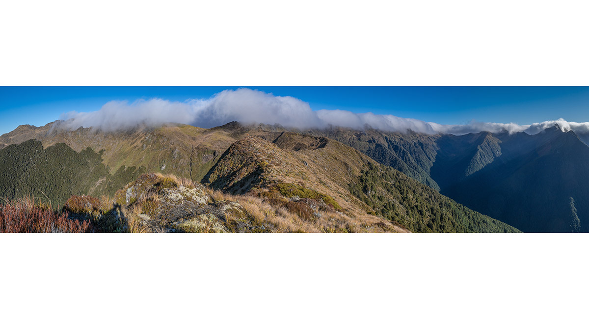
A view from 1,380m on Baton Saddle, looking south along Wharepapa/Arthur Range (right) - our route for the day

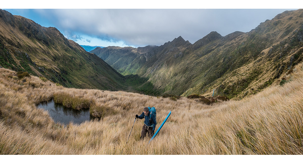
Heading south towards Pt1580

A view south to an unmarked 1525m point

A view south to an unmarked 1525m point

Looking south to Pt1542

Approaching Pt1542

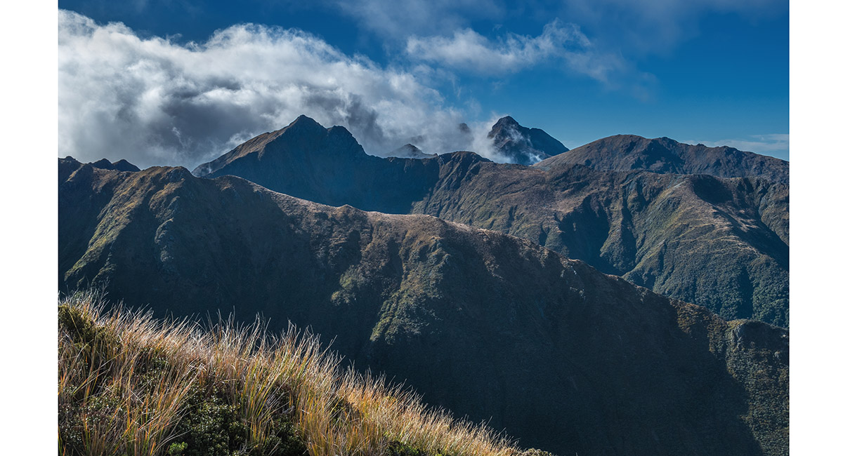
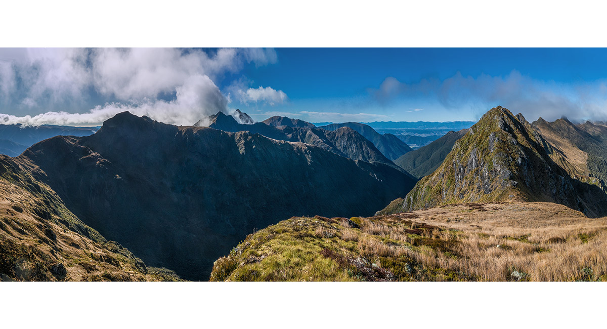
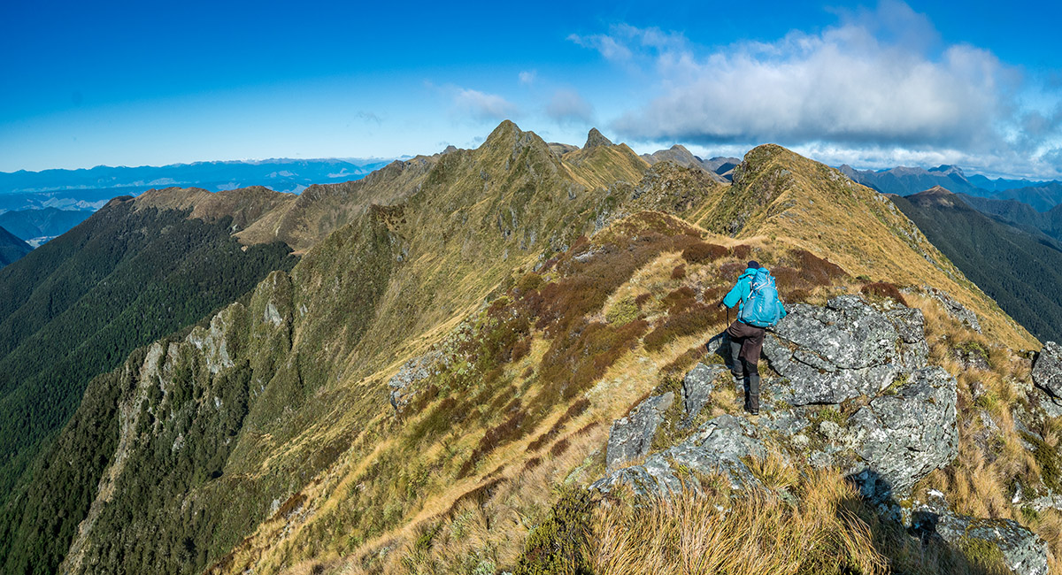
A view northeast from Pt1542 to Wharepapa/Arthur Range and The Twins

A view north from Pt1542, back to Pt1580 (left), Baton Saddle (centre) and The Twins (right)

A view north from Pt1542, back to Pt1580 (centre) and Baton Saddle (right)

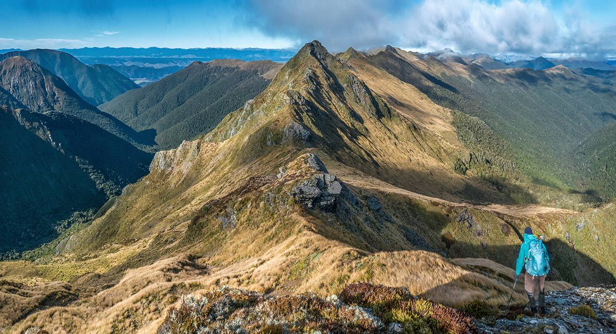
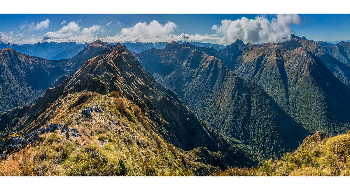
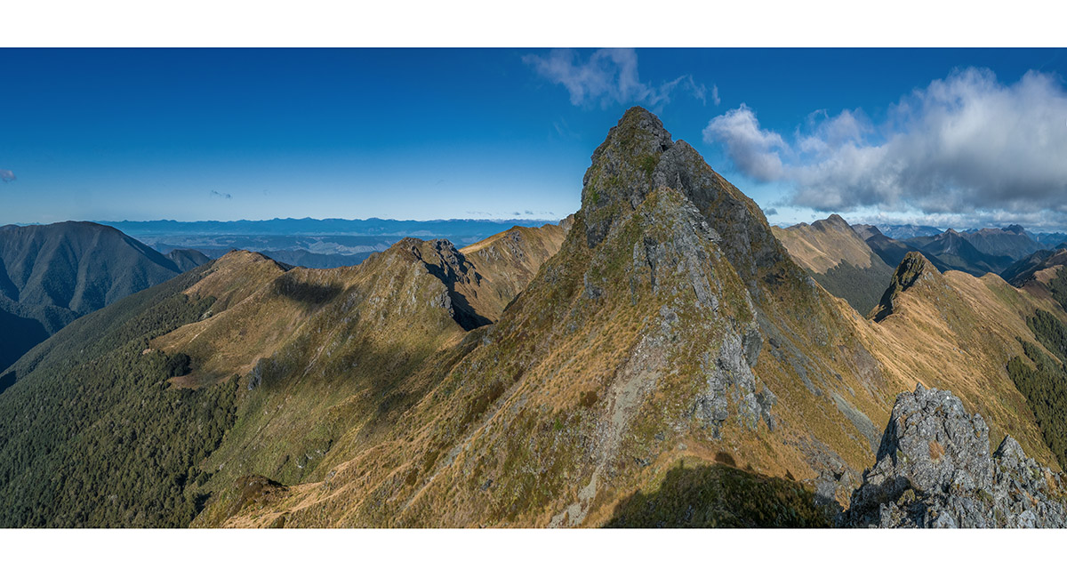
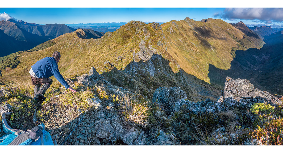
From Pt 1542 the ridge becomes more jagged and undulating. Pt1563 is the very steep peak right of centre on the skyline

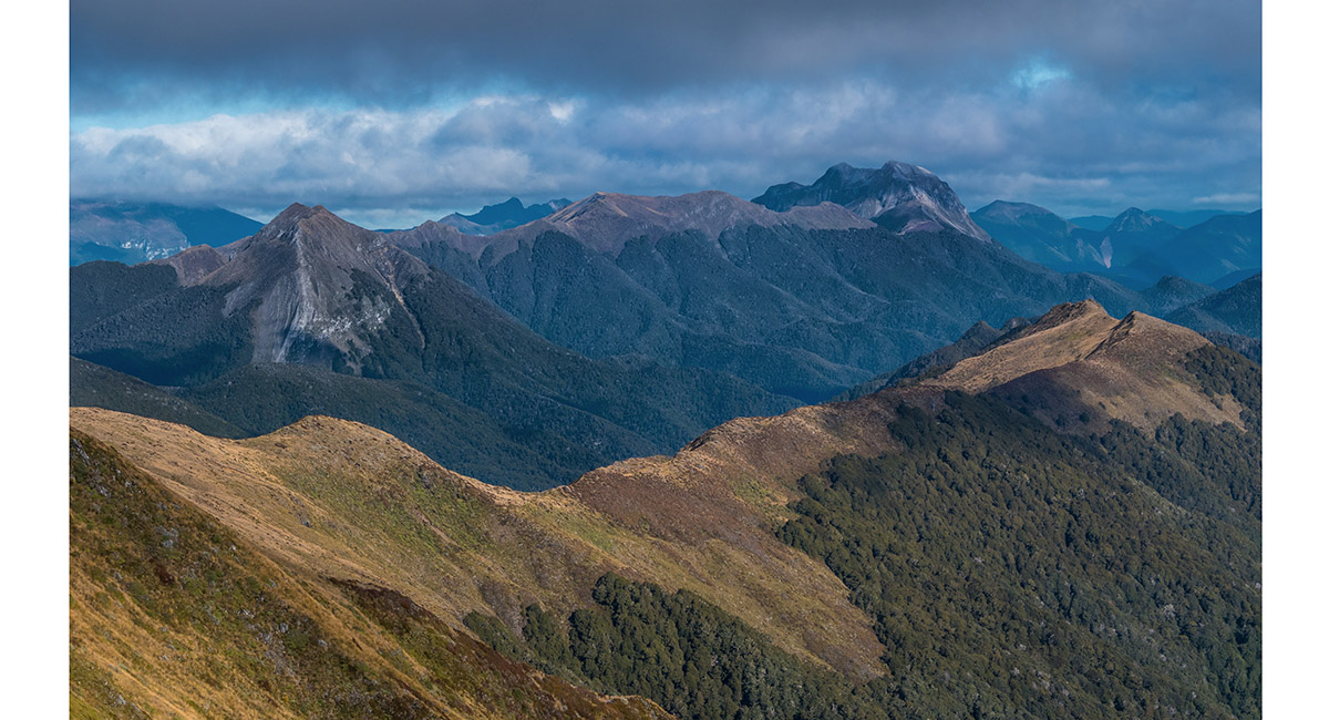
A view southwest to distant Mt Patriarch (1,701m - right) and Mt Baldy (1,542m - left)

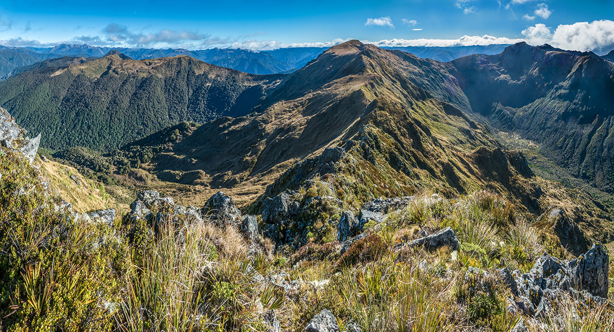
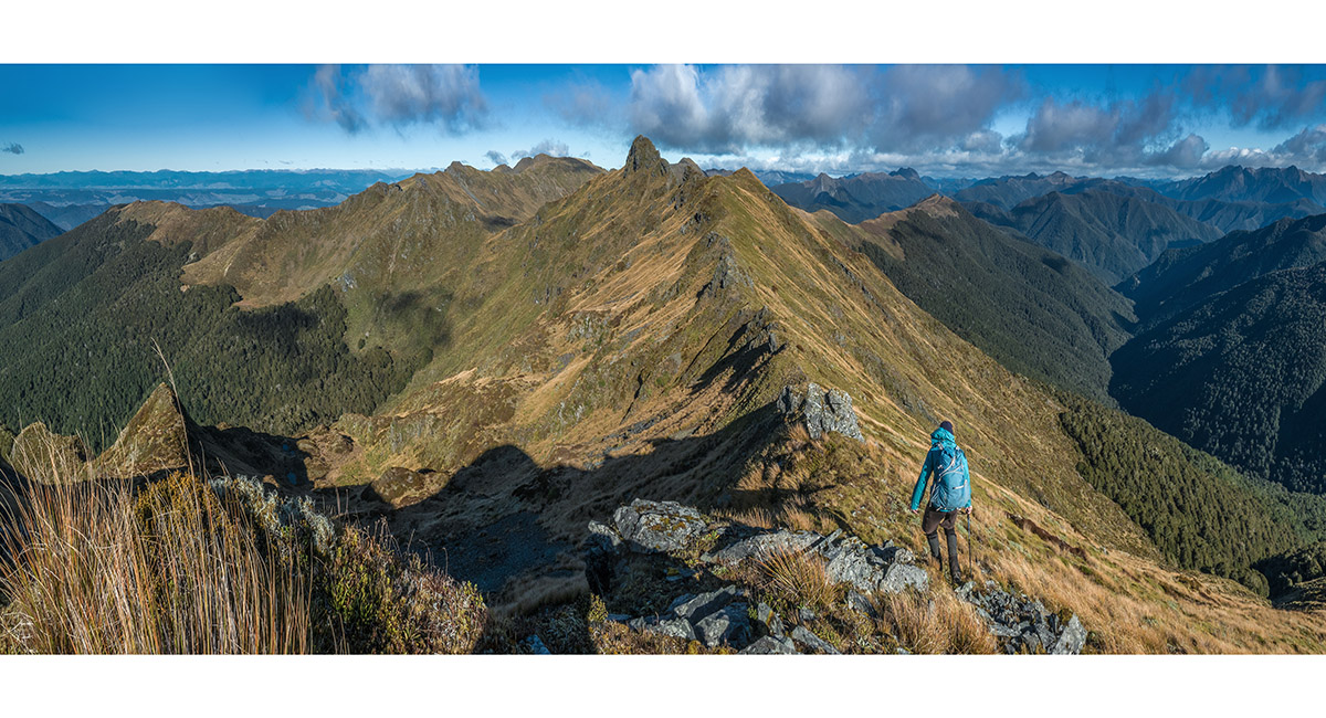
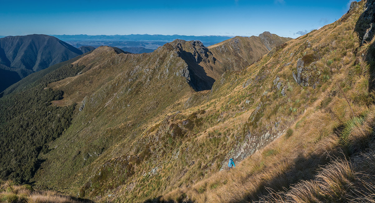
Another view north, back along the ridge to Pt1542 and Pt 1580 (left), with Wharepapa/Arthur Range stretching right to The Twins

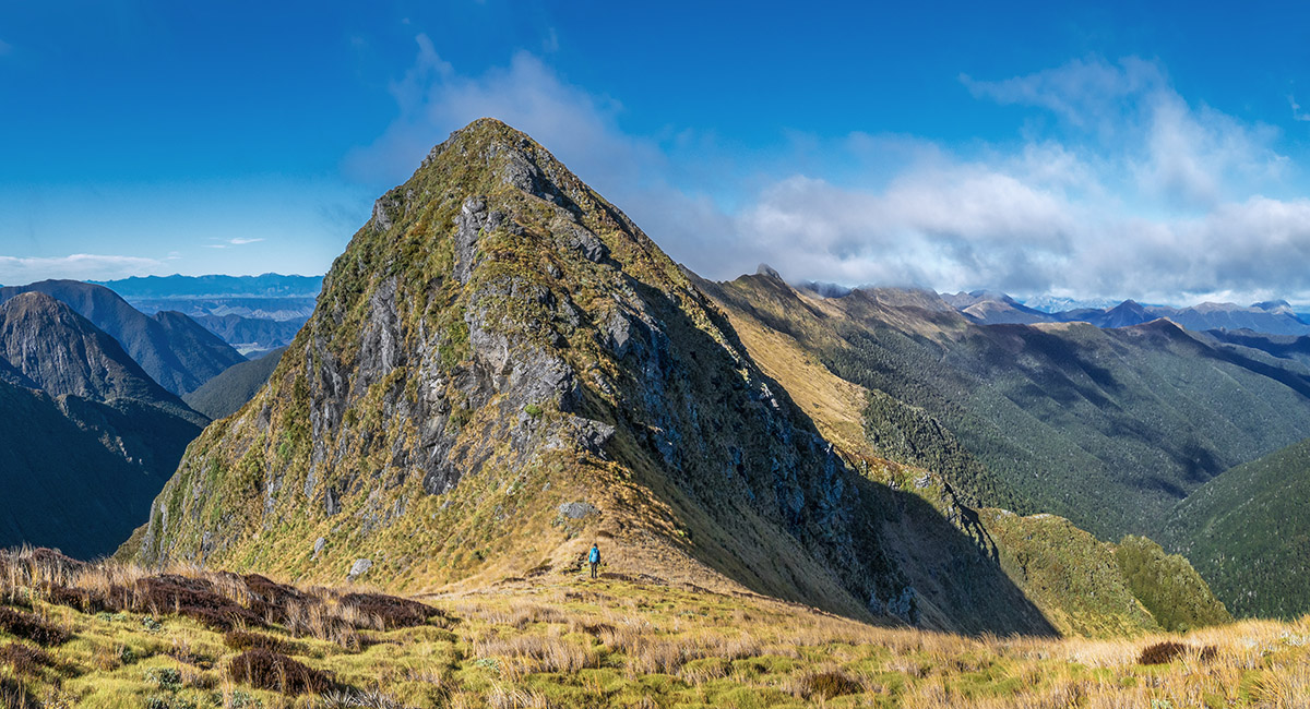
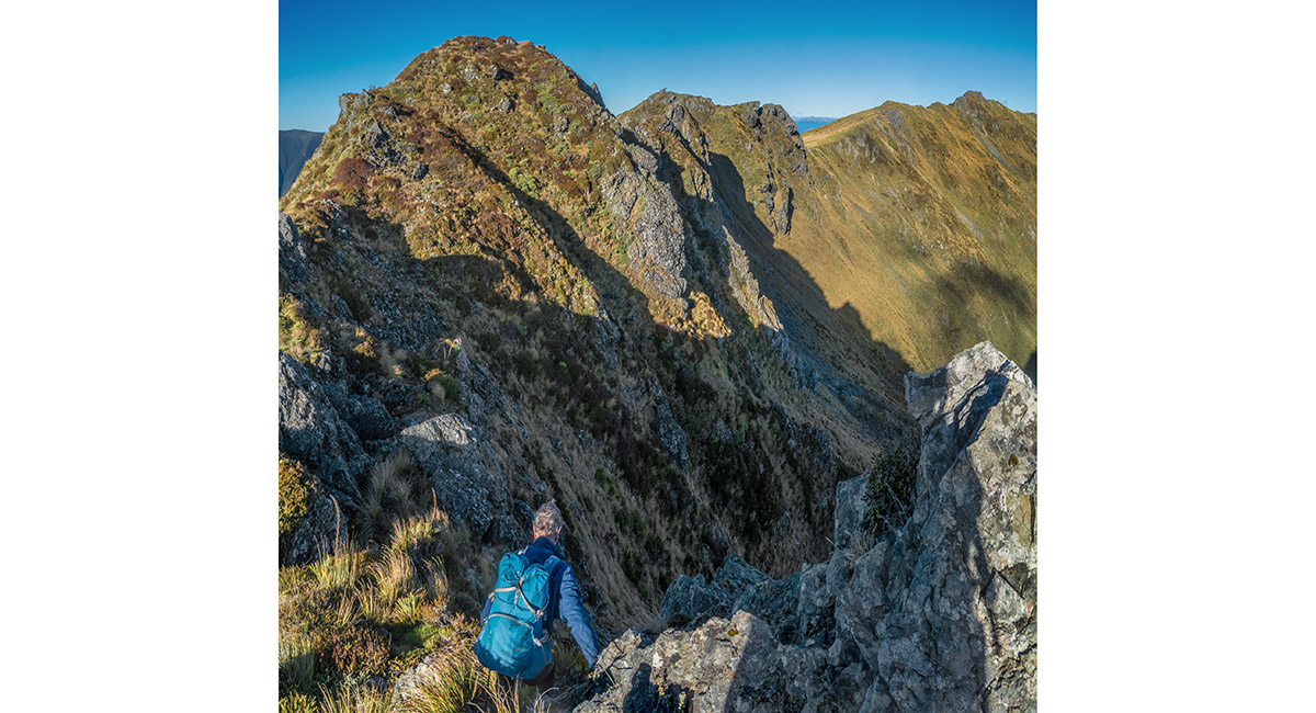
Nearing the intimidating looking Pt1563

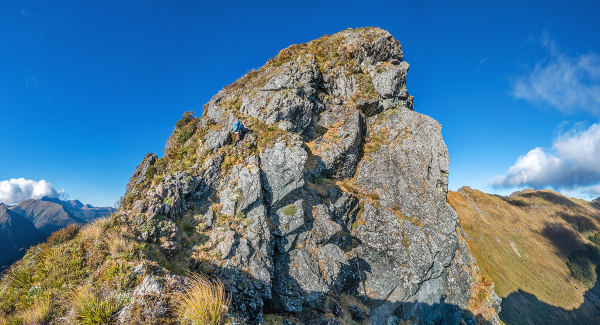
Pt1563, with a hint of the sidle route beneath its left flanks. The top of Cowin Spur extends south at left

On the sidle beneath Pt1563

Now ascending another lower but nearly as challenging section south of Pt1563

To begin with the route is manageable, topping out just below 1,500m

It undulates, not revealing what comes next until you're right on it

Bruce tentatively explores a way ahead, which was not appealing. This is where we retraced our steps a little, back to a dip where a chute dropped to mellower slopes on the left/west side

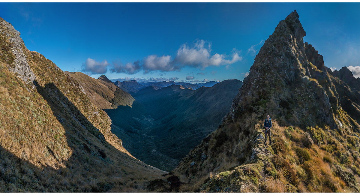
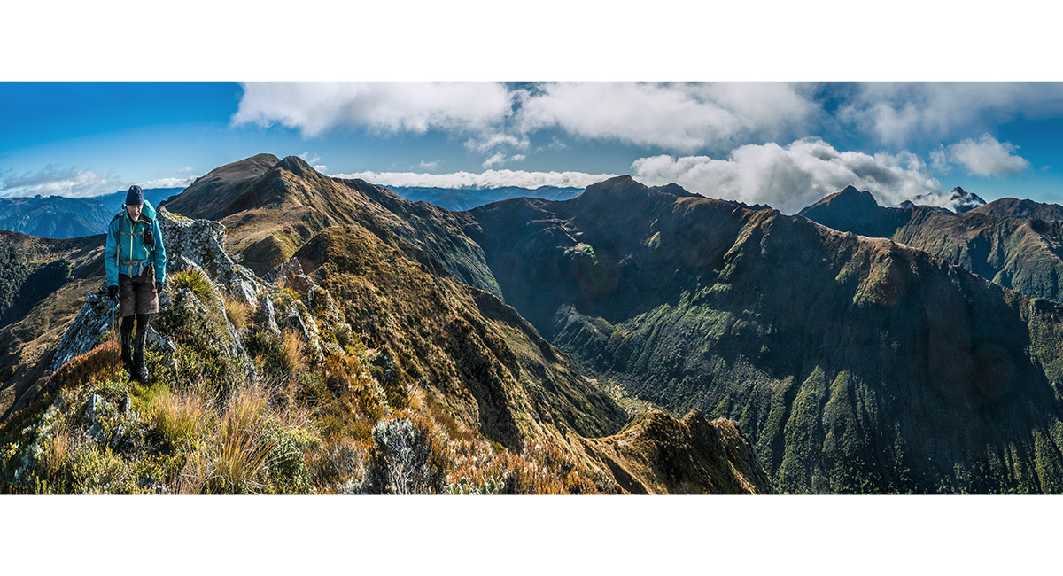
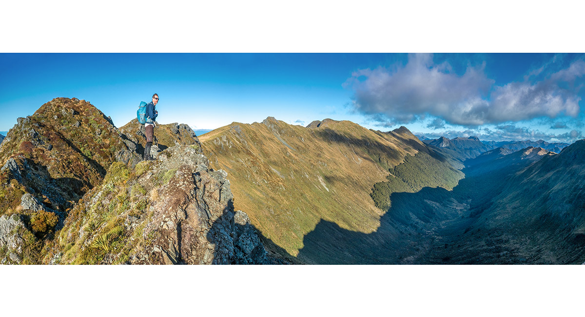
At the south end of the very steep and jagged section, having sidled up from the right to regain the ridge here

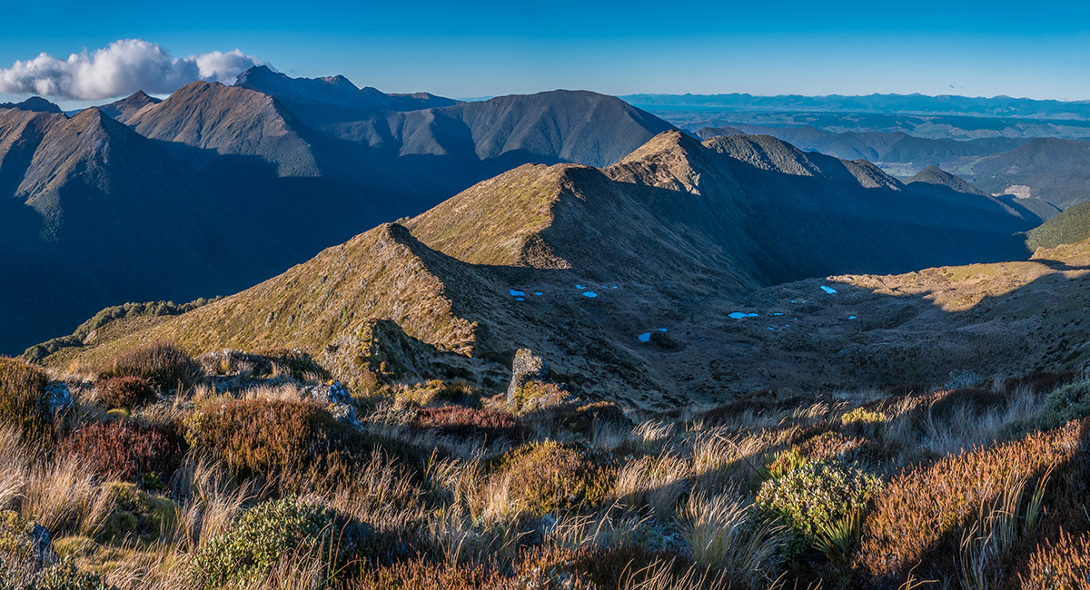
A view south from Pt1497, looking over our campsite and down Cowin Spur. The Twins are distant top left

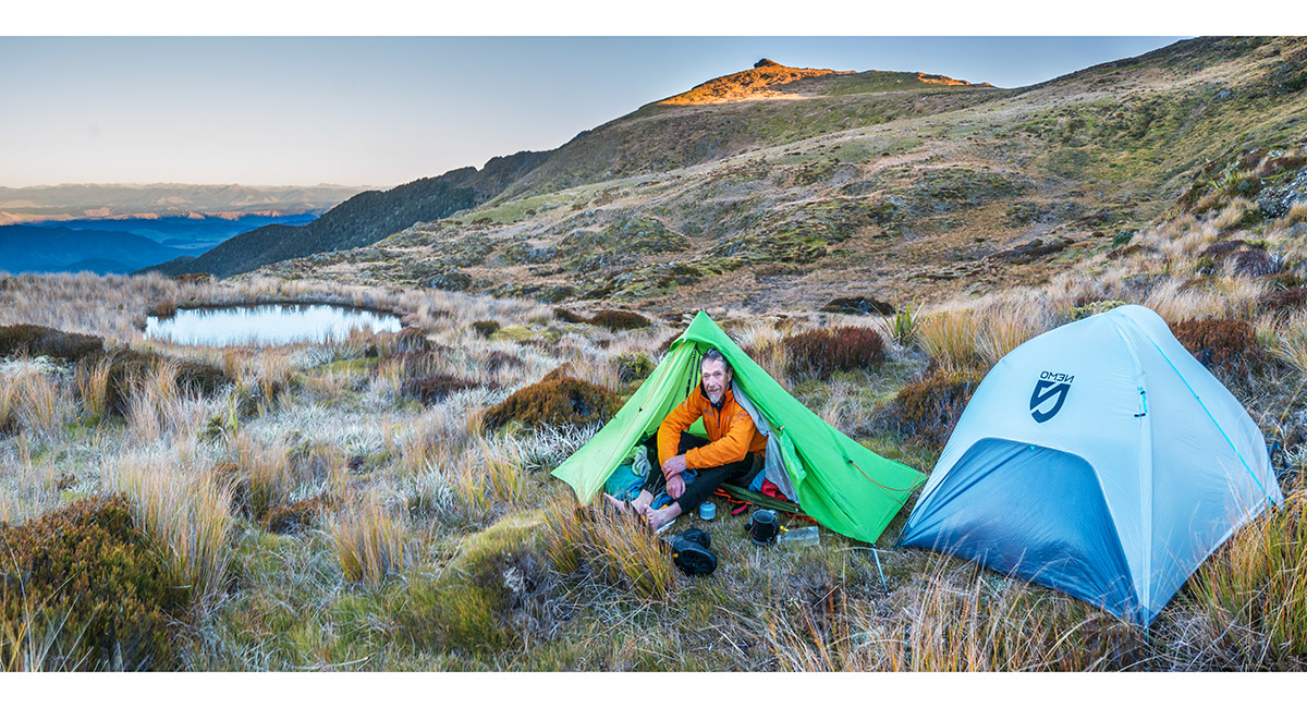
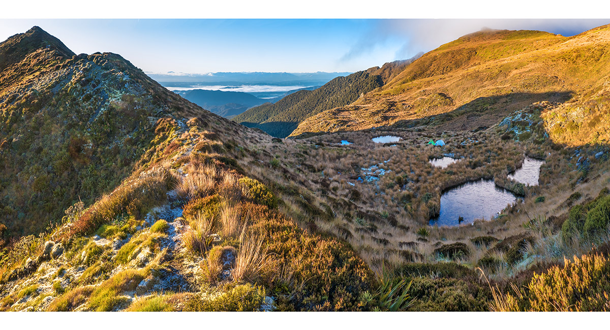
Plenty of flat spongy ground and plenty of tarn water at 1,380m, just south of Cowin Spur

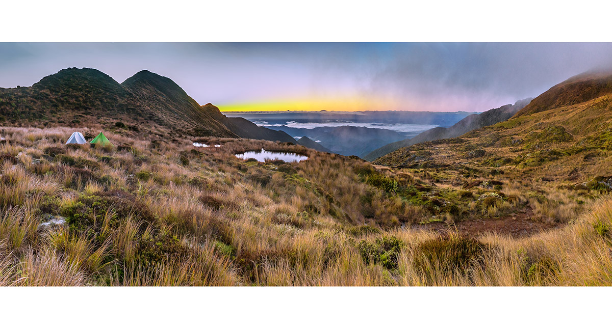
A dawn view south

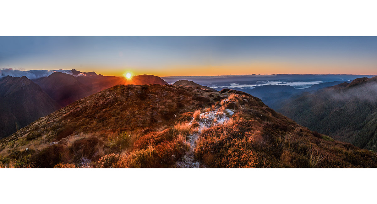
Sunrise, viewed from a 1,400m prominence east of the campsite

Dawn view southeast to the distant Kaikouras

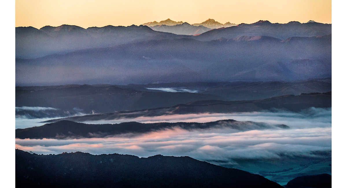
Sunlit, from left, Crows Nest, Tapuae-o-Uenuku, Alarm and Mitre

A view west, back from the prominence, across the campsite to Pt1497

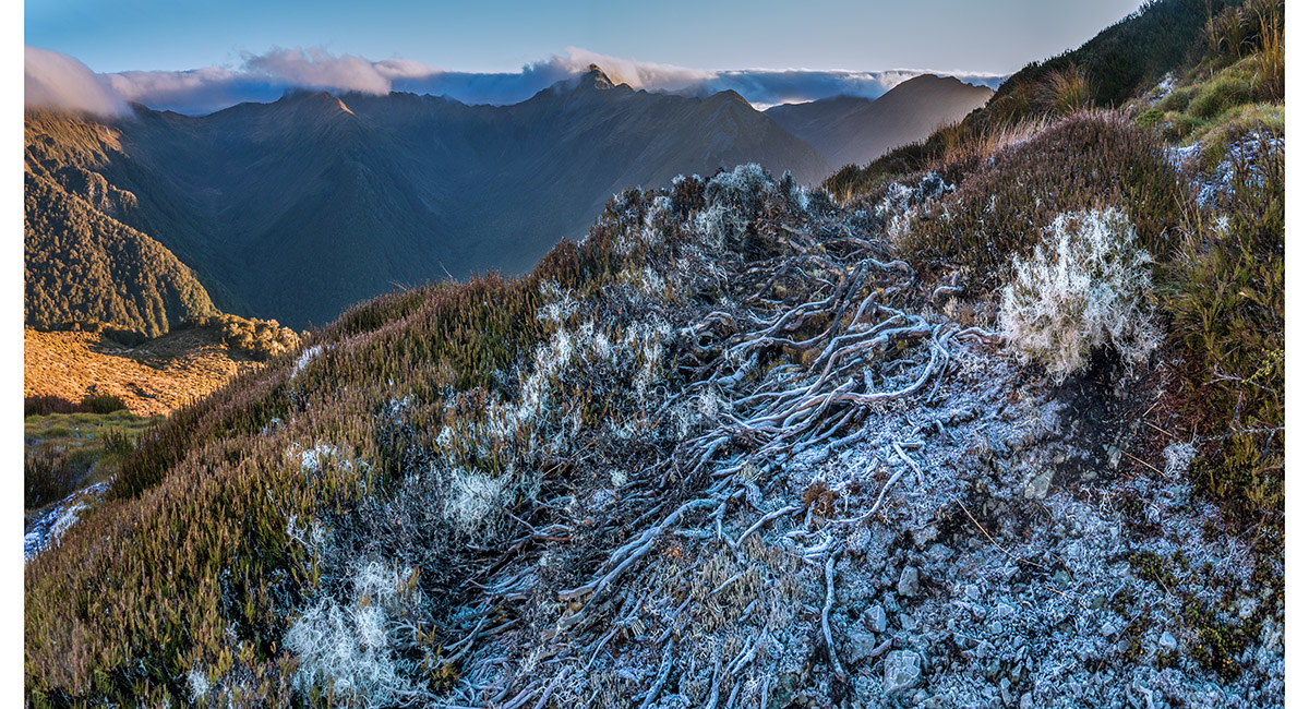
Frost-coated leatherwood roots

Our campsite and the 1,400m prominence top left

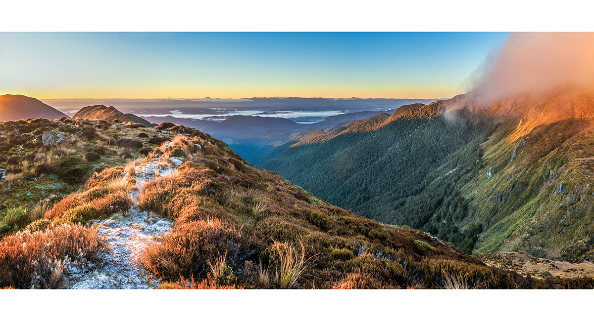
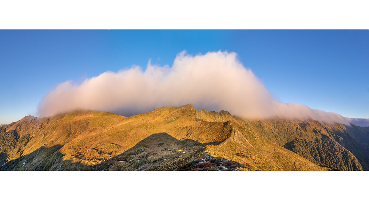
A view west, back up Cowin Spur from near Pt1394. Baton Saddle is just clear of cloud mid right

To order a print or web resolution file of any image you see in this slide show, just right click the image, click “Copy Image URL” and paste in to the “Your message” box of our Contact Us form. Please also note, for each image, if you want a print or web resolution file. We will get back to you as soon as possible to confirm price and payment details.
Open Contact Us in a new window to paste Image URL(s) easily