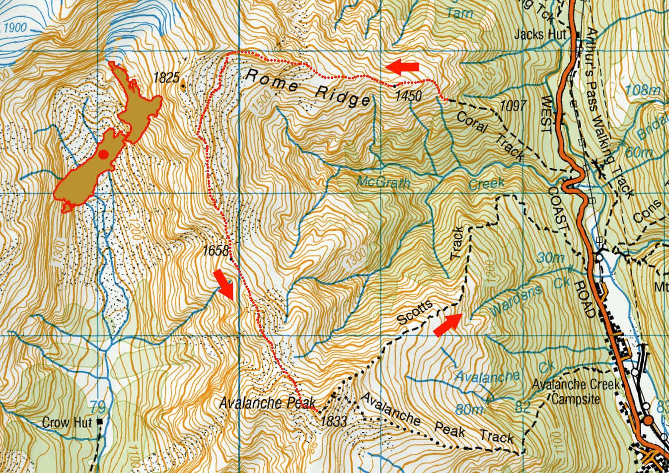
Rome Ridge to Avalanche Peak, June 2022

Dawn view south down SH 73 from the Coral Track


At about 1,100m on the Coral Track, looking south to Avalanche Peak and part of the route we planned to travel to reach it


Above the Coral Track at 1,300m at the base of Rome Ridge, looking south


Above the Coral Track at 1,300m at the base of Rome Ridge, looking south


At 1,450m on Rome Ridge, looking south. Avalanche Peak is right and Phipps Peak far left


Near 1,500m on Rome Ridge, with our entire route before us - Rolleston low peak (2,212m) right, Avalanche Peak (1,833m) left


Near 1,500m on Rome Ridge, looking south


At about 1,600m on Rome Ridge. This is where the biggest challenge came due to steep terrain and thin snow and ice for about 120 vertical metres


Climbing steep frozen snow and ice at about 1,650m, looking south back down Rome Ridge


Climbing steep frozen snow and ice at about 1,650m


Our route dropped off Rome Ridge to the south at 1,700m, just before the next steep section. Rolleston low peak is now in cloud as the weather starts to close in on us


Dropping off Rome Ridge into the basin above McGrath Creek. Avalanche Peak is in the centre, with our ridge route stretching back to us


At about 1,600m, in the basin above McGrath Creek. Avalanche Peak is right


At about 1,600m, in the basin above McGrath Creek. Avalanche Peak is right or centre


Heading out of the basin, back up to join the ridge at about 1,750m


A view north, back to Rome Ridge


Ridge view south to Avalanche Peak, with Crow Valley to the right


Looking north to the Crow Glacier, top left, soon to engulfed in cloud


Ridge view south on the climb of Point 1658, before Avalanche Peak


Looking south, with one more high point to pass before the climb to Avalanche Peak


Looking south, with one more high point to pass before the climb to Avalanche Peak


Another short spell of front pointing to get down frozen snow-covered rocks


Heading to the last high point before Avalanche Peak, hoping for the clouds and sleet to hold off a bit longer


Approaching 1,720m


A glance back to Mt Rolleston confirmed that we didn't have much time before the sleet hit us


Here comes the rain, 12.15pm right on queue - credit to MetService!

Read about it An alpine adventure at Arthur’s Pass Wilderness Magazine June 2024
To order a print or web resolution file of any image you see in this slide show, just right click the image, click “Copy Image URL” and paste in to the “Your message” box of our Contact Us form. Please also note, for each image, if you want a print or web resolution file. We will get back to you as soon as possible to confirm price and payment details.
Open Contact Us in a new window to paste Image URL(s) easily