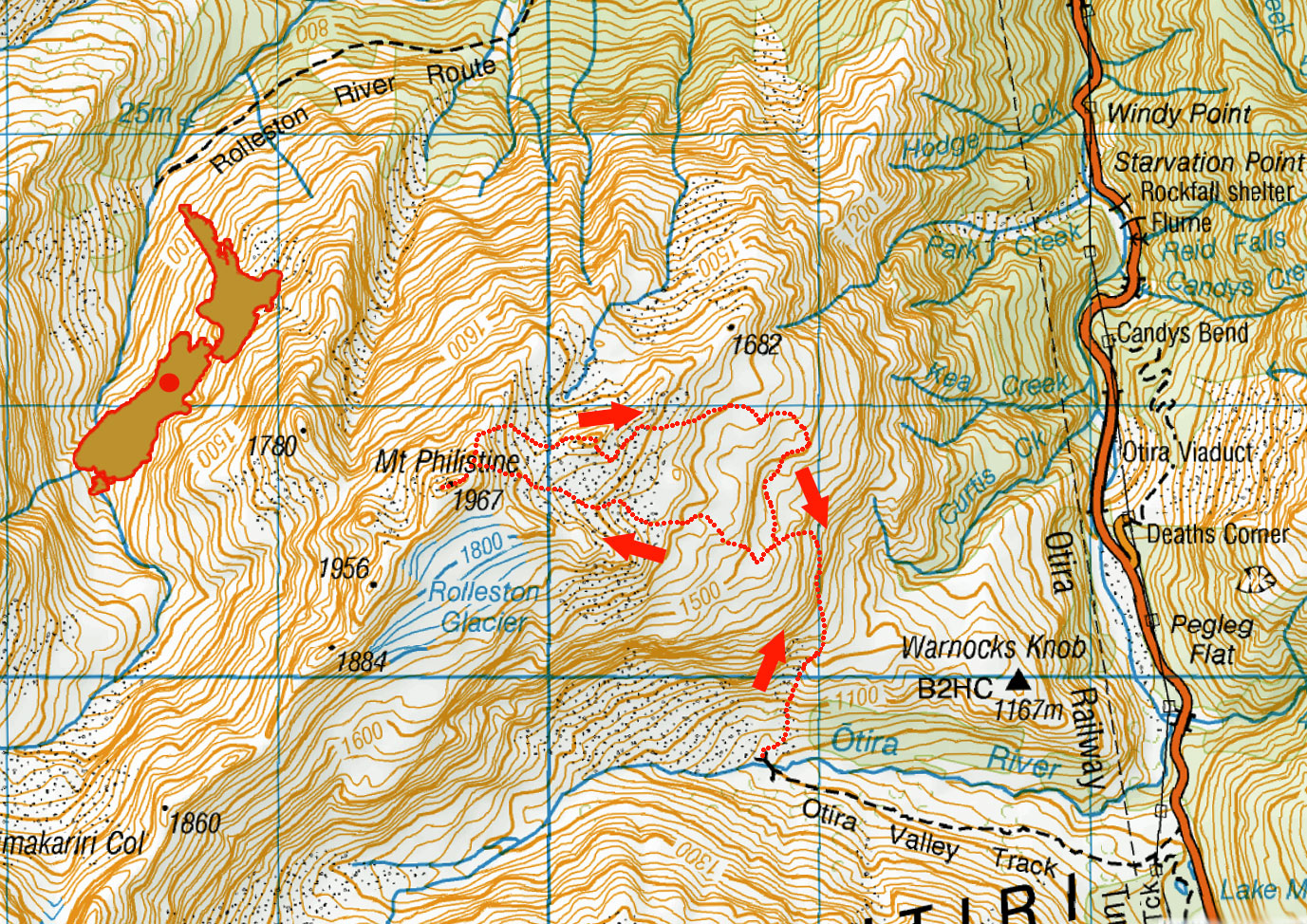
Mt Philistine, June 2022

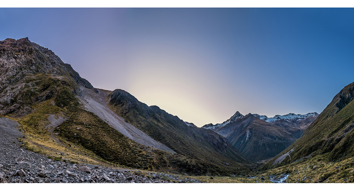
At dawn below the Otira river bridge, looking to the initial scree climb on the right towards Warnock's Knob

The view back down Otira River to Phipps Peak (1,965m). The climb to Warnock's Knob is to the left beneath the bluffs


Above Warnock's Knob, at about 1,200m, looking across SH 73 to Phipps Peak

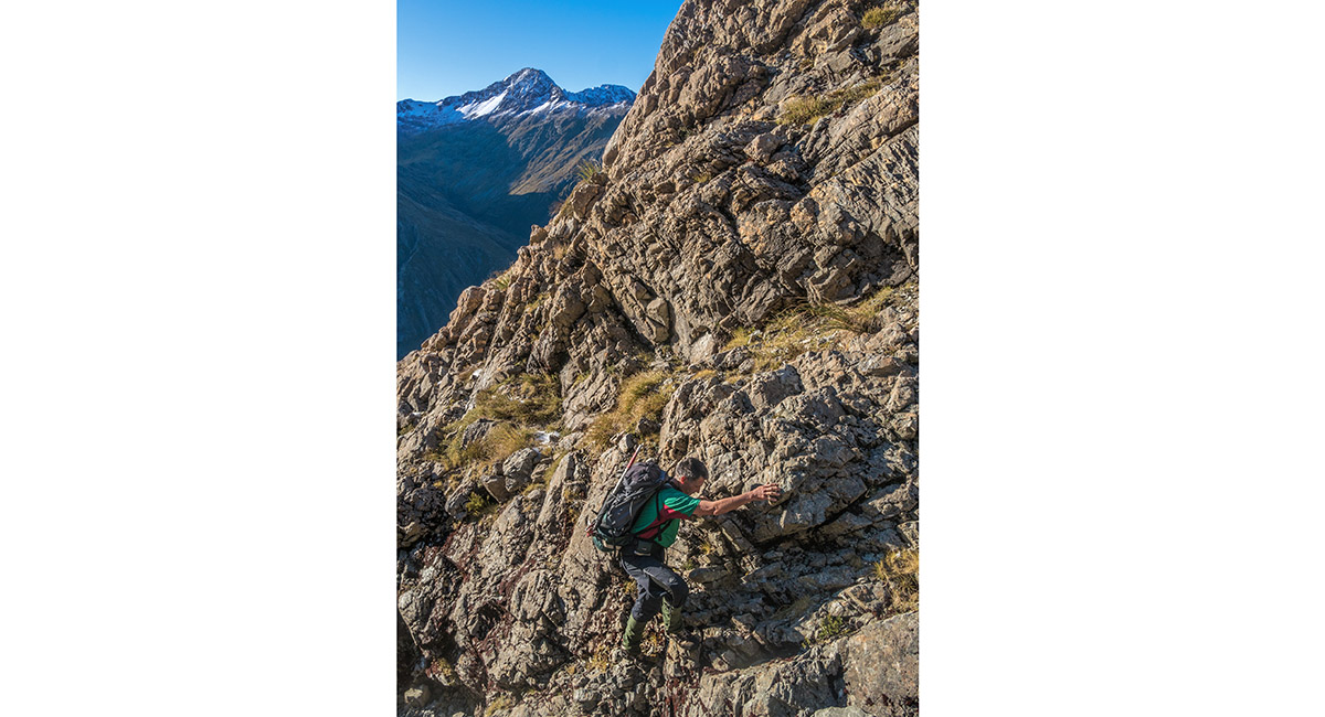
Climbing the steep section above Warnock's Knob, Phipps Peak behind

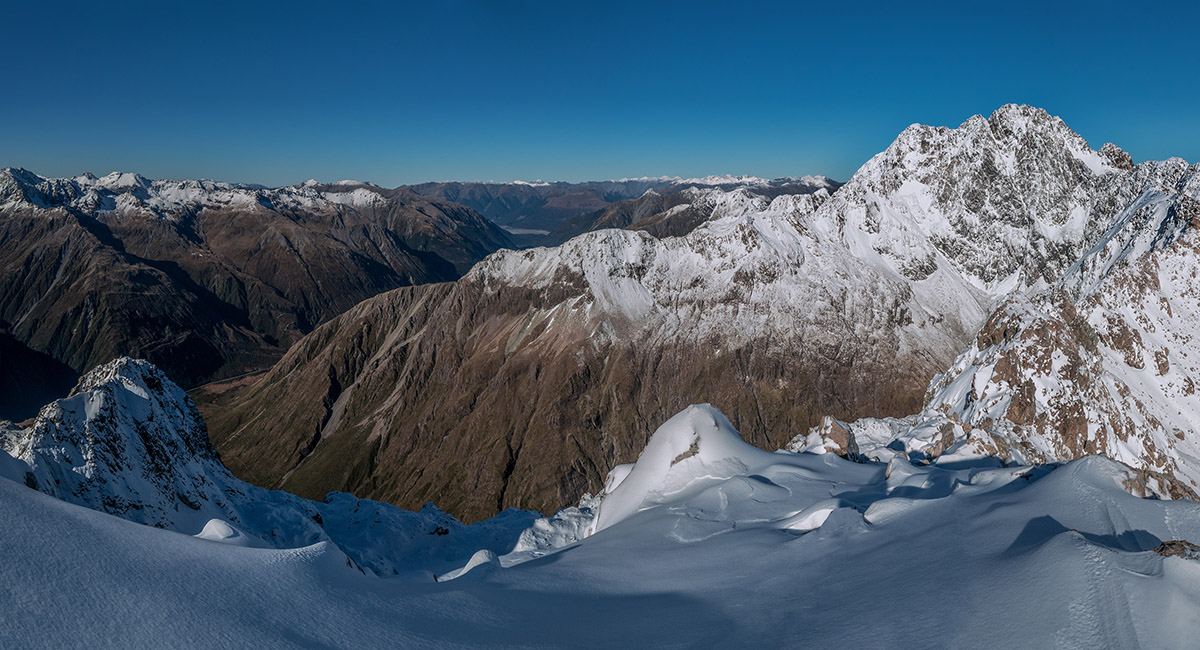
At 1,500m, looking west to Mt Philistine's east ridge (right) and south to Mt Rolleston (centre)


At 1,500m, looking south to Mt Rolleston (centre)


At 1,500m, looking east to Phipps Peak (left of centre)


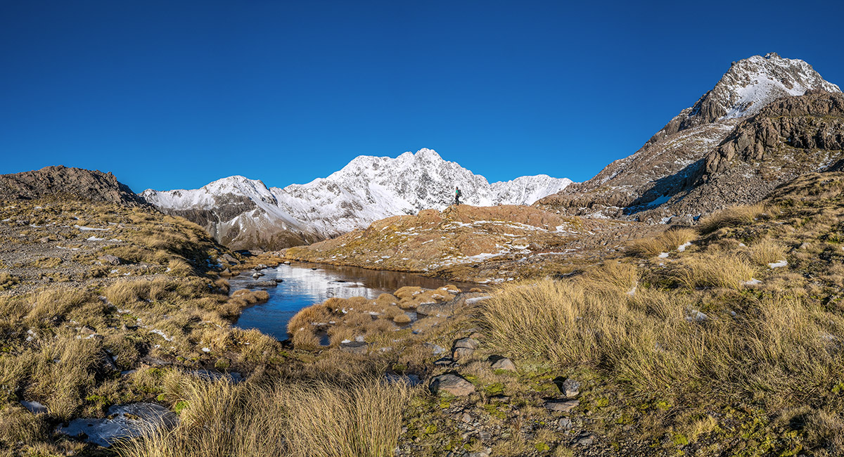
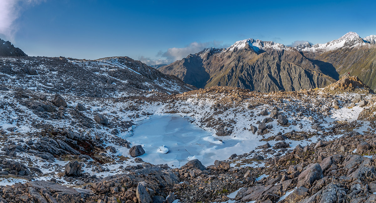
A section of the frozen tarn at 1,500m


At 1,500m, looking west to Mt Philistine's east ridge and summit (centre) and south to Mt Rolleston (left)

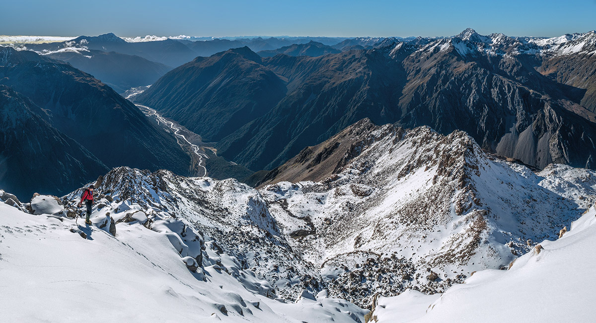
At about 1,600m, looking south


At about 1,650m, looking south and east


At about 1,650m, looking west to the summit of Mt Philistine, plus the rocky 1,800m high point (right) we would climb on our descent


At about 1,650m, looking south and east


Now at 1,700m at the base of the summit cone of Philistine. The 1,800m high point is left. Mt Franklin is now also in view left of centre


At 1,850m beneath the steepest section of the climb to Philistine's summit

At 1,900m, where the terrain relents just below the summit. View north down SH 73 with Mt Alexander (1,958m) left and Mt Franklin (2,145m) right


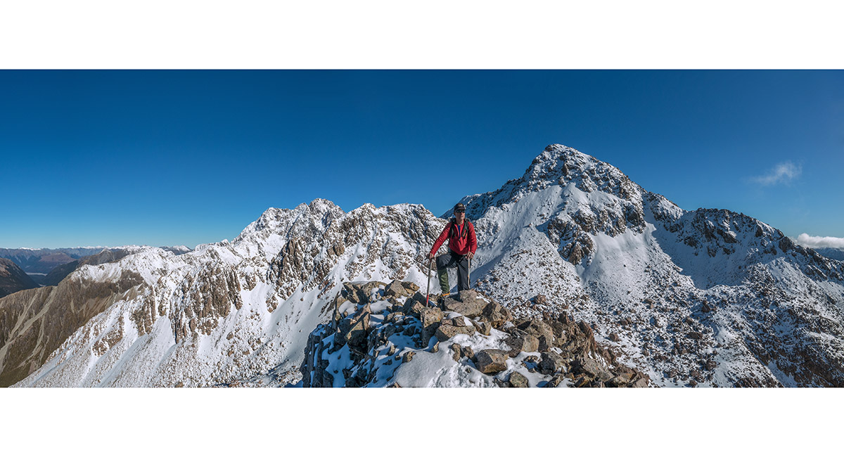
Mt Philistine (1,967m) summit view south to Mt Rolleston (2,275m). Mt Lancelot (2,112m) is right


Mt Philistine (1,967m) summit view south to Mt Rolleston (2,275m) and Mt Lancelot (2,112m). With Rolleston River gorge to the west and Mt Alexander far right


Mt Philistine (1,967m) summit view south to Mt Rolleston (2,275m), giving a view of the traverse route between the two peaks

Mt Philistine (1,967m) summit view south to Mt Rolleston (2,275m) and Goldney Ridge

Commencing our descent from Philistine


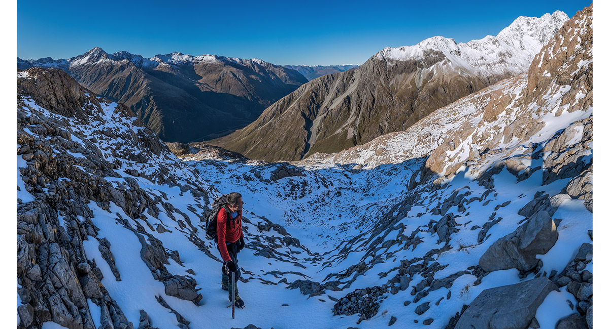
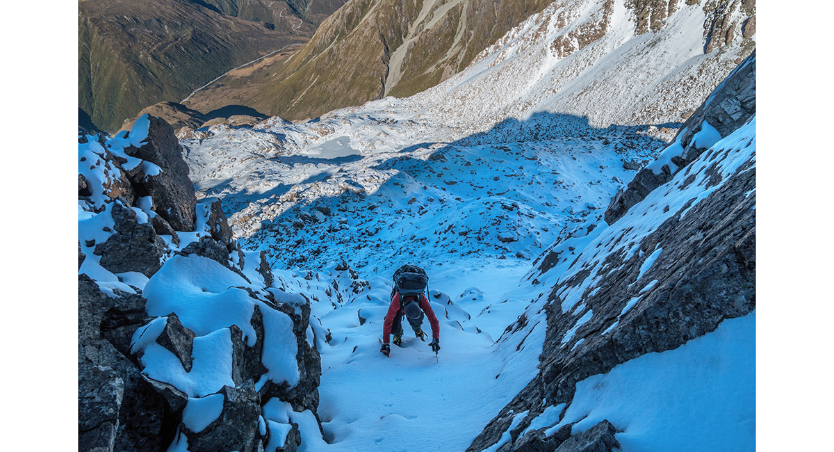
Descending the steep 60m couloir off Philistine's north ridge


Descending the steep 60m couloir off Philistine's north ridge

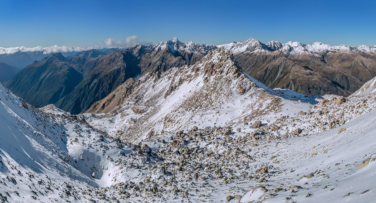
The 1,800m high point dead ahead, with Mt Russel (1,868m) left of centre and Mt Franklin (2,145m) right of centre


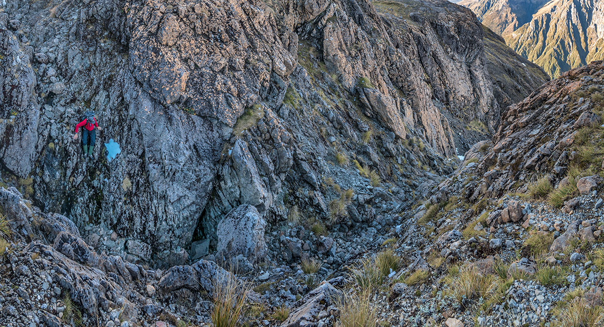
Climbing the 1,800m high point with Mt Philistine behind. Our descent couloir is in shadow on the right dropping from the notch. Our ascent route traversed diagonally up from the left to the snowy shoulder right of the summit


1,800m view north to south

1,800m view west to Philistine and south

Our descent from the 1,800m point dropped down another steep chute for 40 or so metres


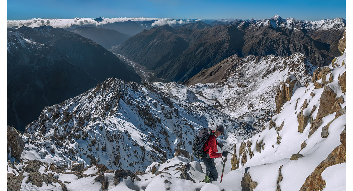
At about 1,700m, beginning a slow westward plod across slippery rocks

At about 1,600m


At about 1,540m, heading south towards Warnock's Knob, aiming to skirt beneath the bluffs at right


Icicles at a frozen waterfall at 1,500m

Now back on the ascent trail at about 1,400m

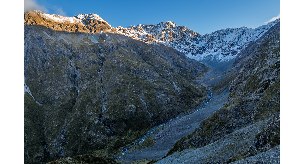
Sunset approaches as we drop back down the scree below Warnocks Knob, looking up Otira Valley


Dusk view of Phipps Peak, beyond Otira Valley

To order a print or web resolution file of any image you see in this slide show, just right click the image, click “Copy Image URL” and paste in to the “Your message” box of our Contact Us form. Please also note, for each image, if you want a print or web resolution file. We will get back to you as soon as possible to confirm price and payment details.
Open Contact Us in a new window to paste Image URL(s) easily