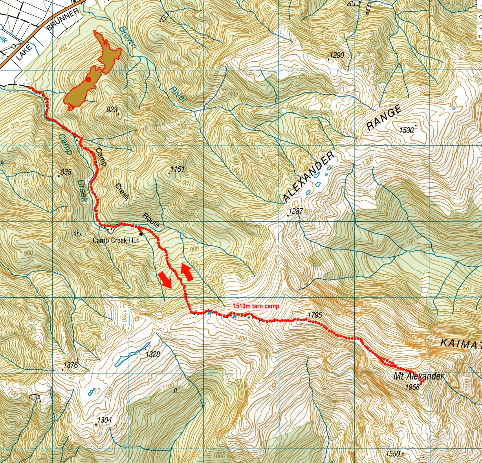
Mt Alexander, February 2026
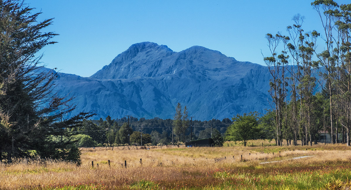
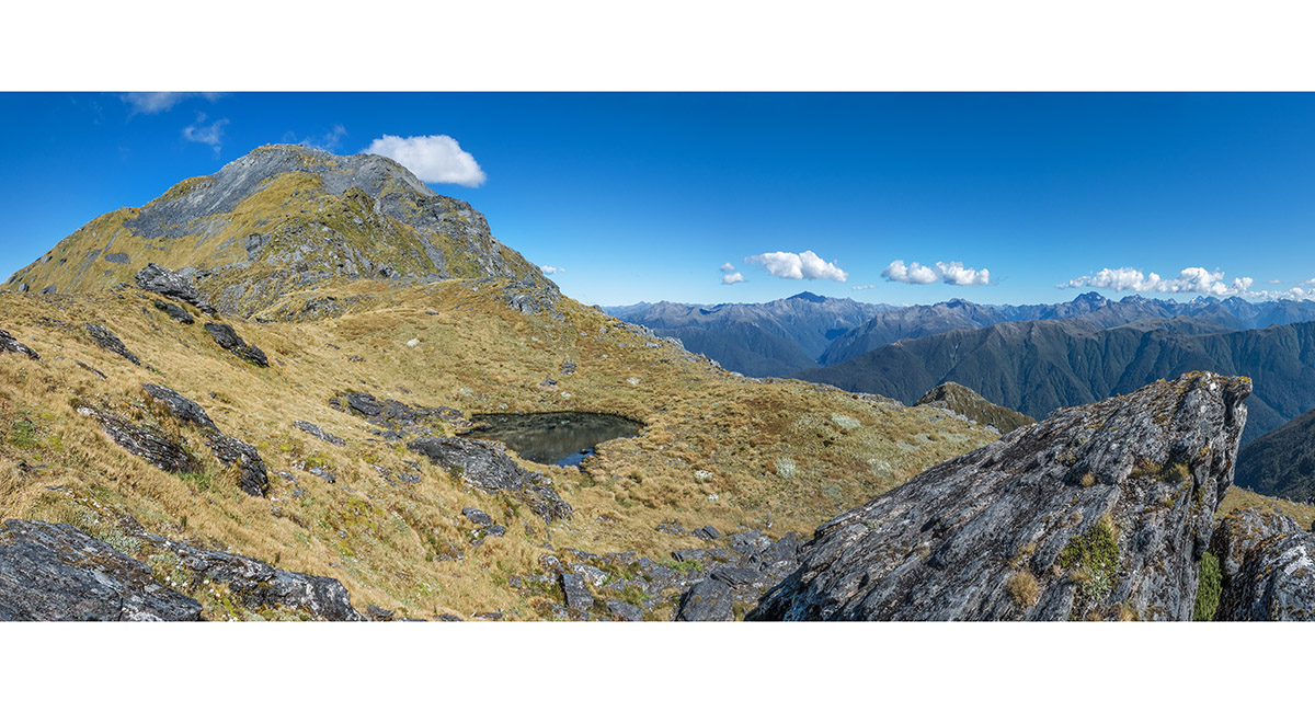
A view from the northwest of Mt Alexander (1,958m - left) and Pt1795

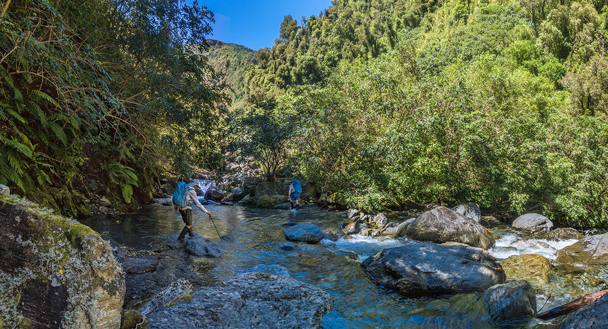
Some boulder hopping in Camp Creek in the lower valley

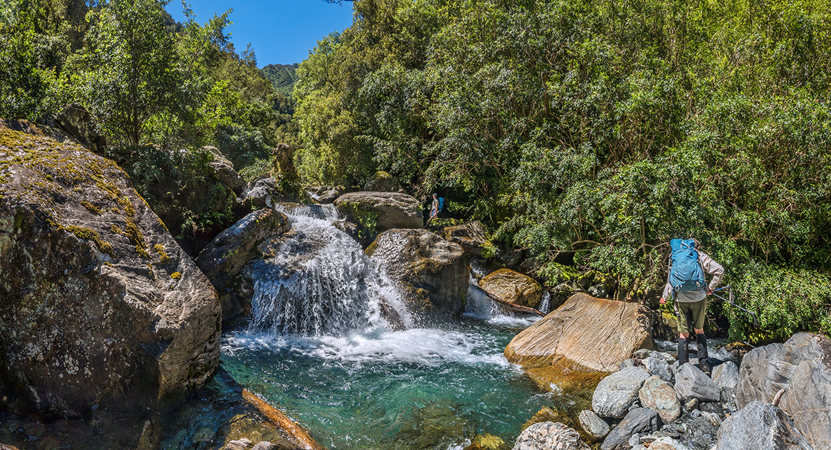
Some boulder hopping in Camp Creek in the lower valley

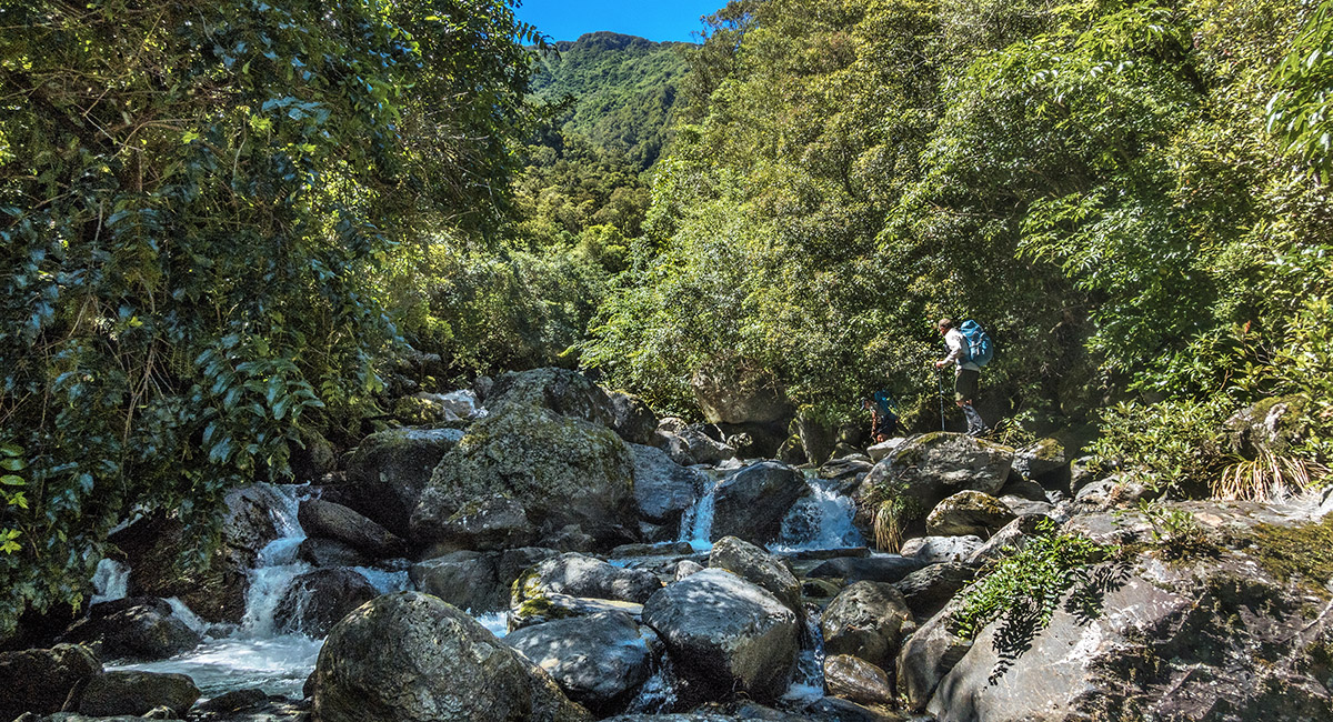
Some boulder hopping in Camp Creek in the lower valley

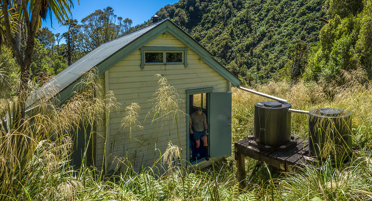
Camp Creek Hut (750m)


Inside Camp Creek Hut

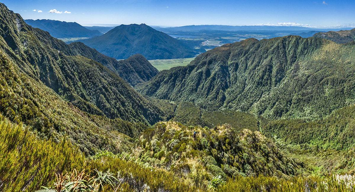
A view from about 1,350m on the steep spur giving access to the ridge, looking north down Camp Creek

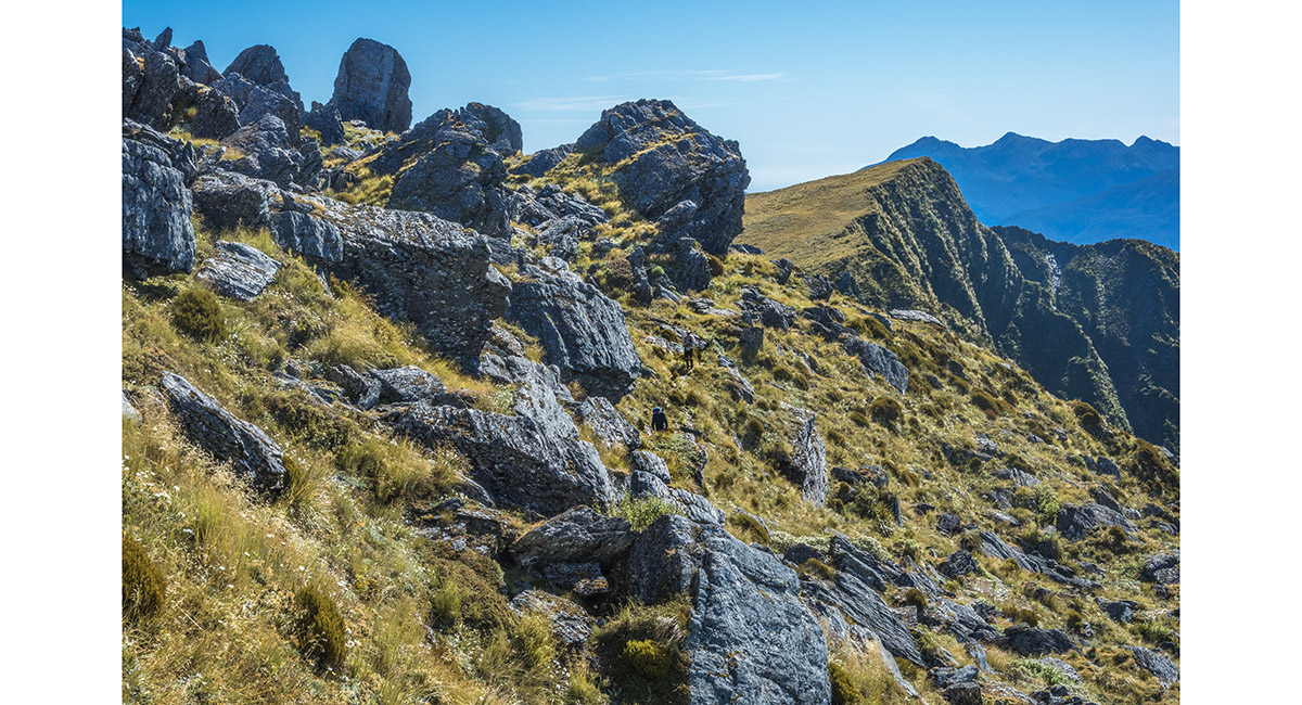
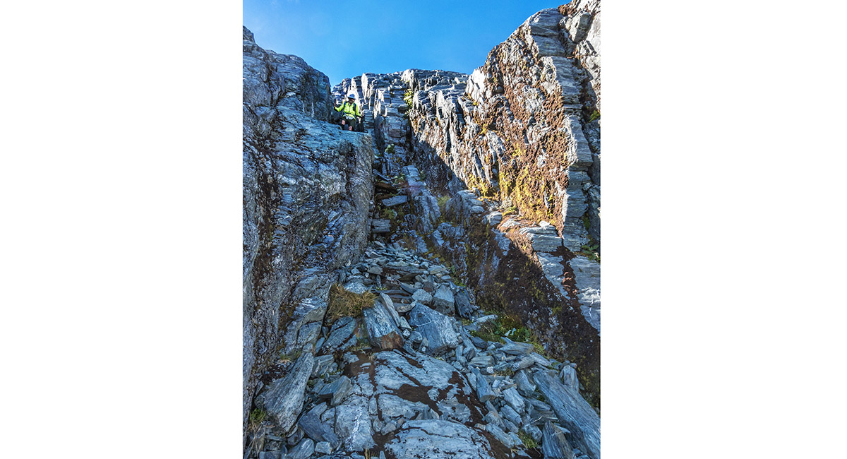
Sidling a bouldery trail to reach the ridge top at 1,400m

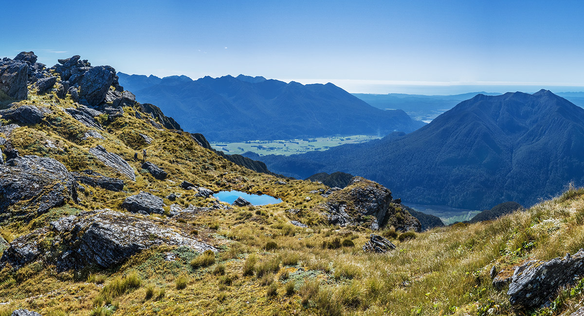
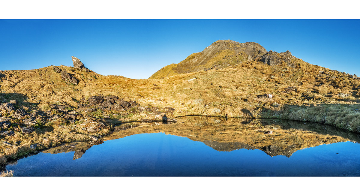
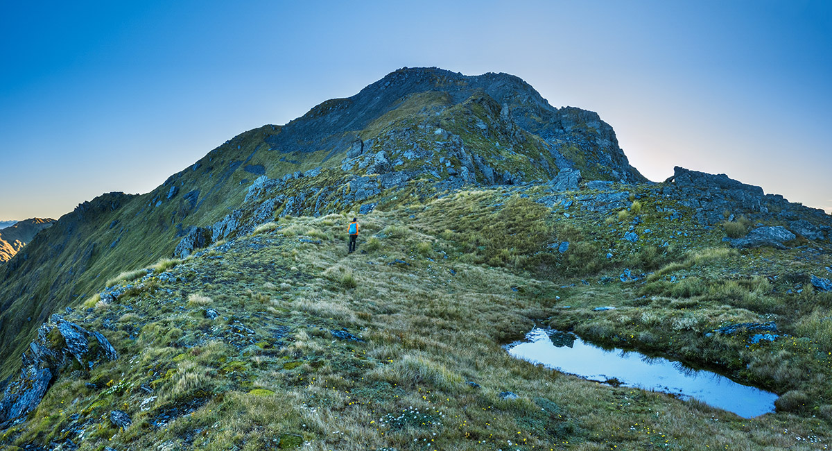
A tarn at 1,400m right at the point where the ridge route begins

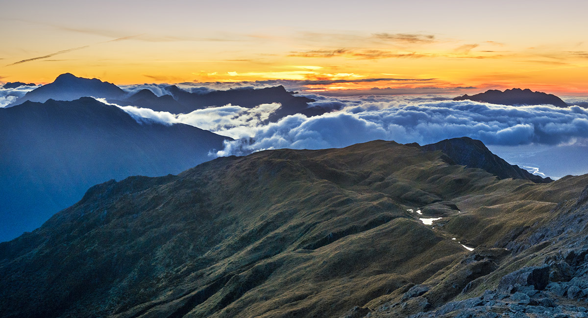
Another 100 metres of ascent up the ridge leads to this lovely tarn where we camped. Pt1795 is top left

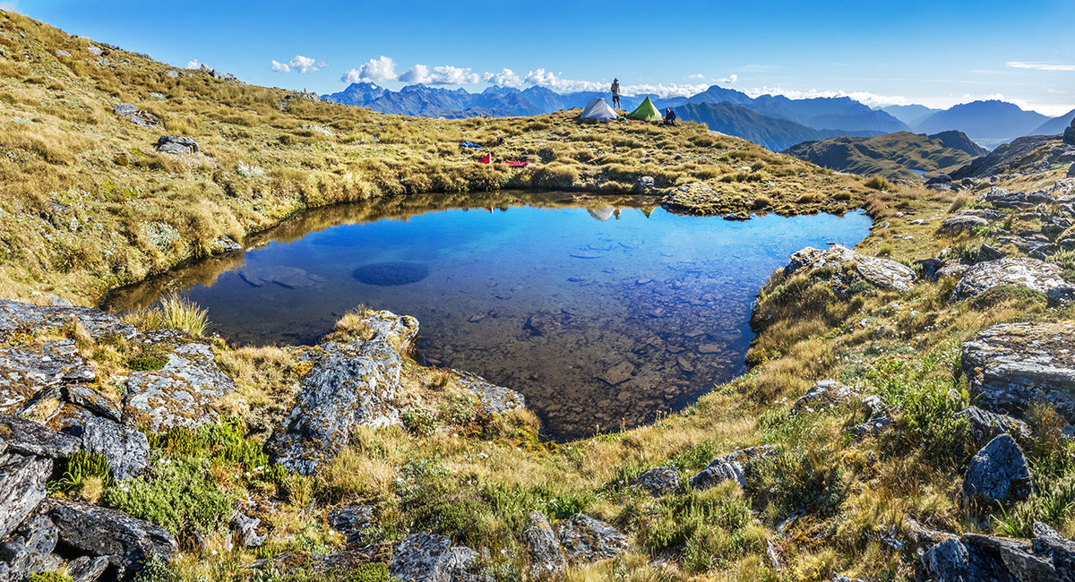
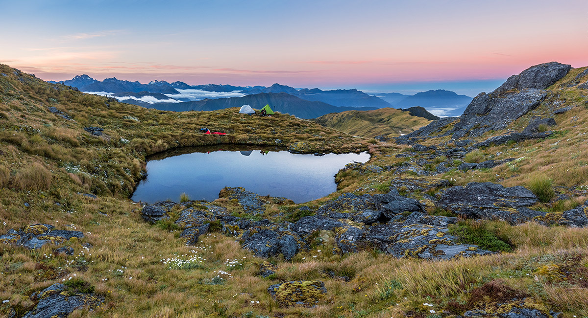
Our tarn camp site at 1,510m

Our tarn camp site at 1,510m

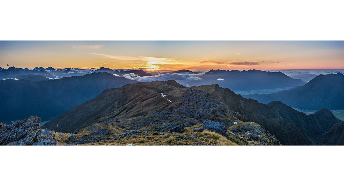
Our tarn camp site at 1,510m - sunset

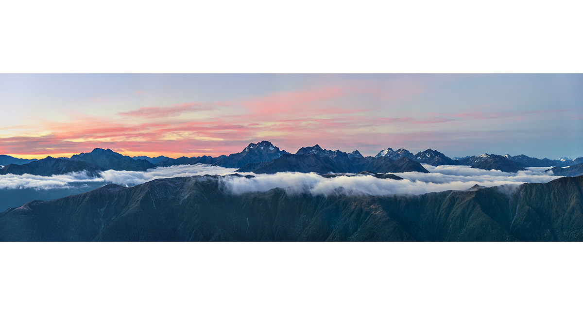
A dusk view just above camp, here looking southwest to a bouldery spur with several larger tarns at 1,320m. Mt Rolleston and other peaks are at left

A dusk view just above camp, here looking north with the Alexander Range at right

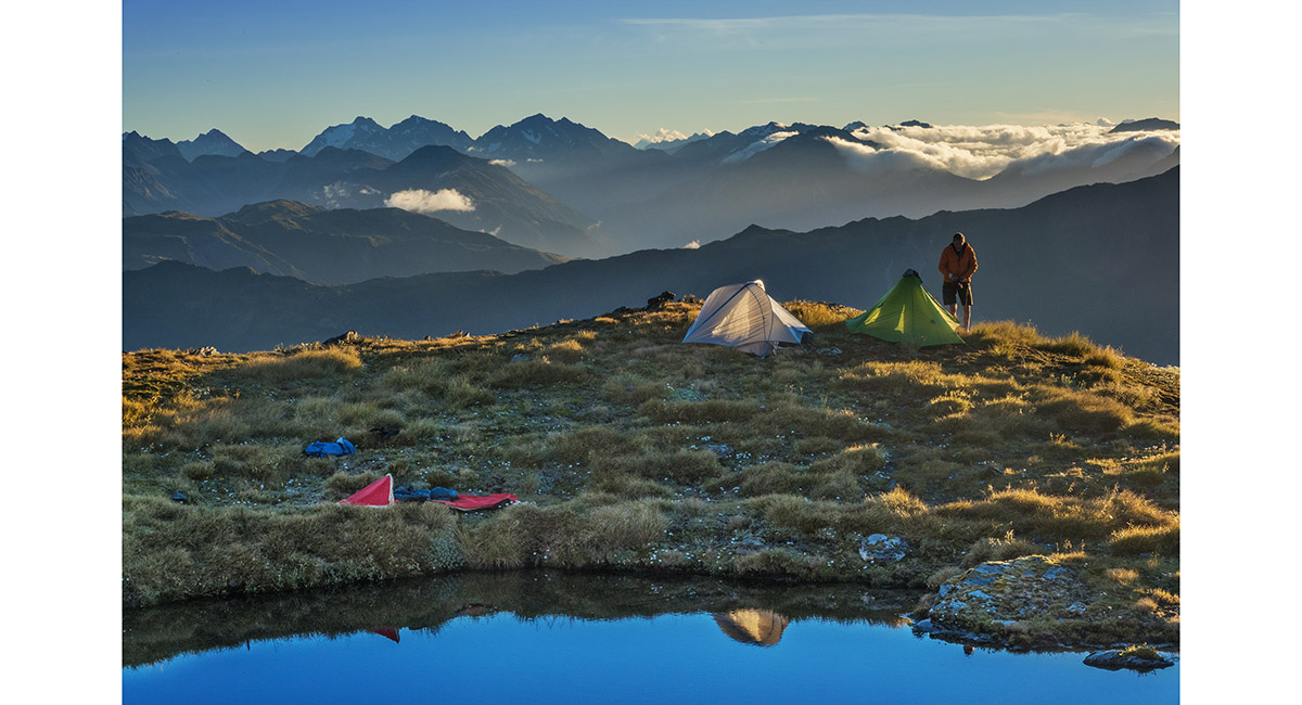
Sunset at camp

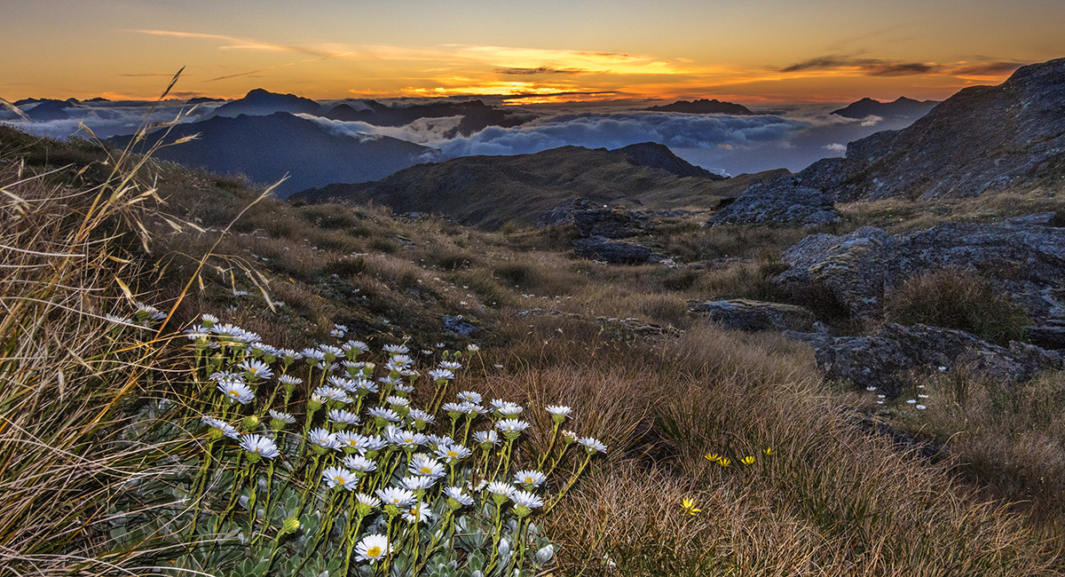
A closer look at the tarns at 1,320m, sunset

Dawn view south, with Mt Rolleston just left of centre, then looking right, Mt Greenlaw and Mt Murchison

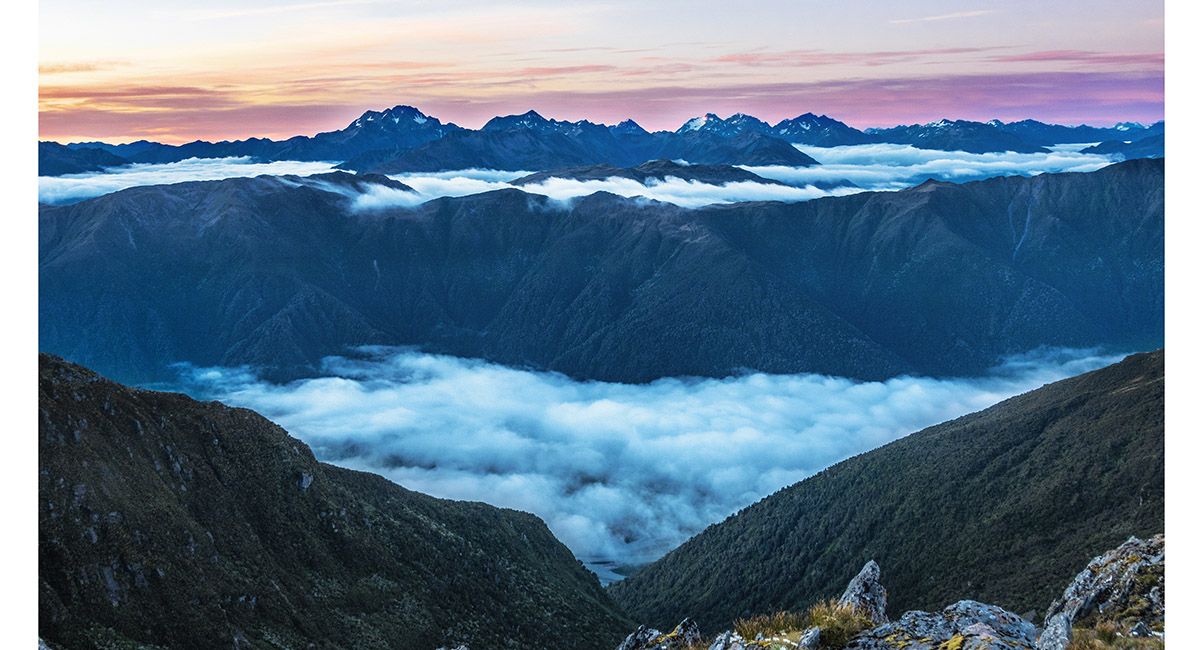
Dawn view south, with Mt Rolleston left, then looking right, Mt Greenlaw and Mt Murchison (with the snow face)

Dawn at camp

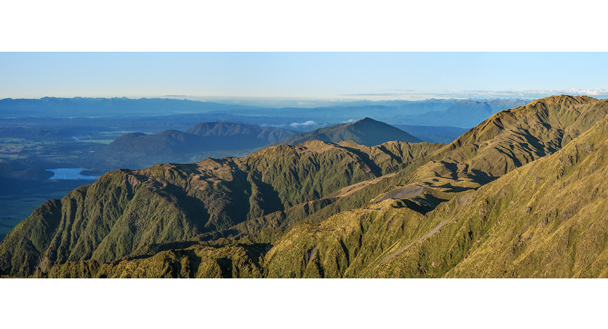
Dawn view over the spur with the 1,320m tarns. Mt Turiwhate centre and Mts Treacey and Bruce Murray right

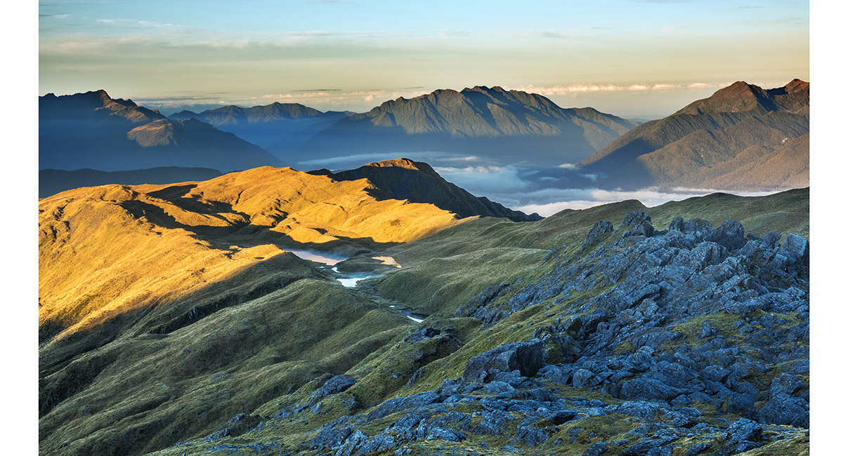
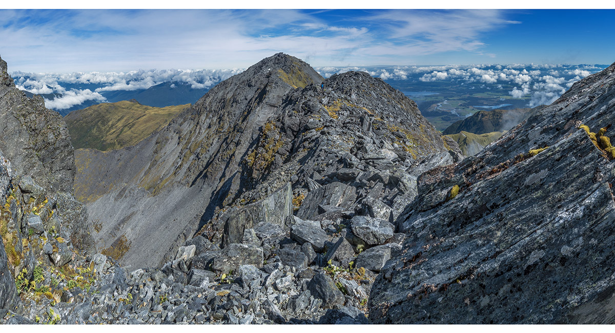
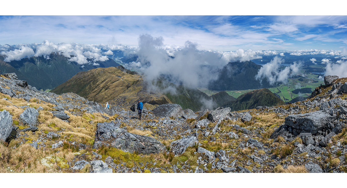
Looking east from 1530m, up to Pt1795


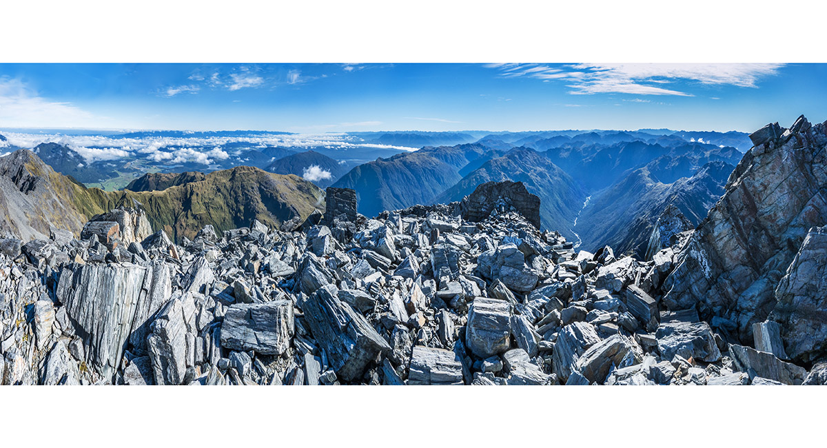
A view southeast from Pt1795 to Mt Alexander (1,958m)

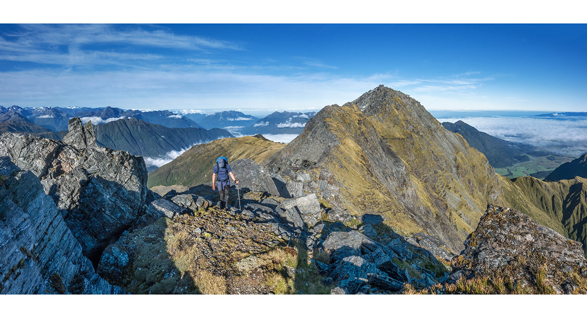
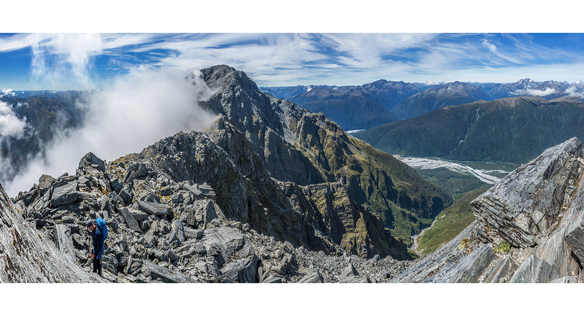
Looking back to Pt1795 from about halfway along the rocky ridge leading to Alexander's summit

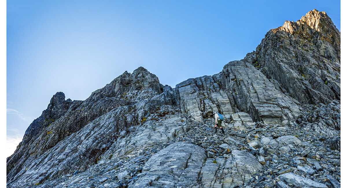
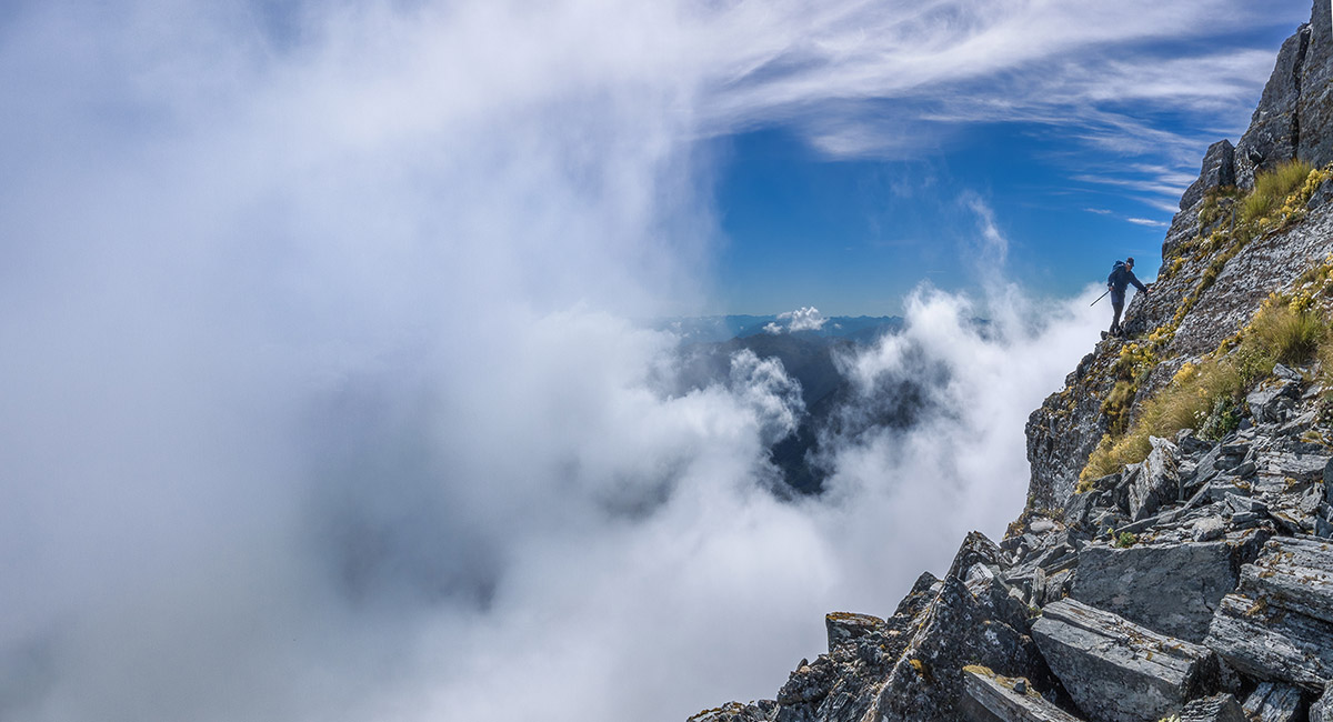
Nearing the end of the steep sidle across scree and slabs beneath the ridge on the north side, here at about 1,900m. Access to easier ground before the summit was up the chute to the left of Bruce

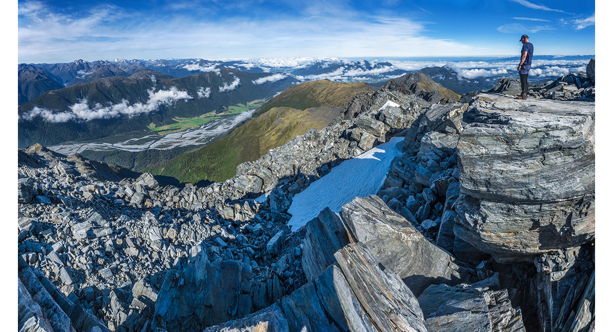
A view southwest from Alexander's summit, looking across Taramakau River and SH73

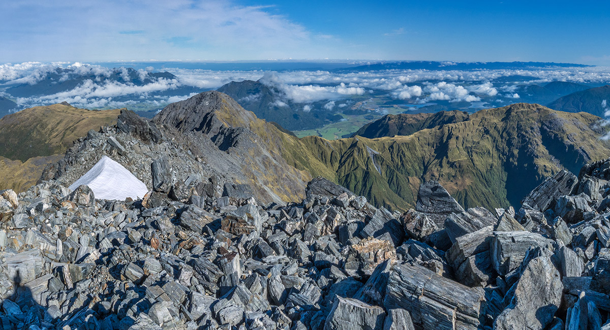
A view northwest from Alexander's summit, looking back to Pt1795 and the Alexander Range stretching right

A view east from Alexander's summit, looking up Crooked River

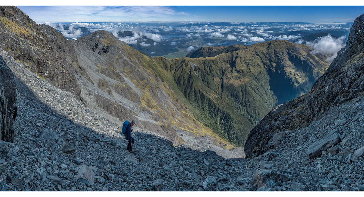
Here at about 1,900m, on the descent, retracing our sidle on the north side, with Pt1795 top left

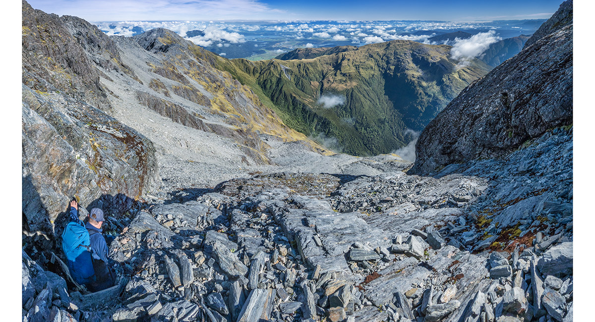
About to descend the chute we used to access the easier scree beneath the summit

Bruce descending the chute

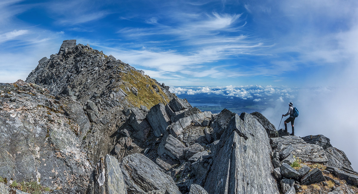
Back on the ridge at about 1,800m, looking along to Pt1795


Ridge travel on our way back to Pt1795


Ridge travel on our way back to Pt1795, here looking back to Mt Alexander. The north-side sidle to reach the summit is in clear view

Ridge travel on our way back to Pt1795. Sometimes short sidles are required

Looking back to Pt1795 from the rocky ridge leading to Alexander's summit

A view from a high point on the ridge east of Pt1795, looking to Mt Alexander

Now descending the easier west side of Pt1795 - now a poled route


Approaching the 1,400m tarn, before beginning the boulder sidle and steep spur descent to Camp Creek

Read about it Captivating Photography Apr/May 26
To order a print or web resolution file of any image you see in this slide show, just right click the image, click “Copy Image URL” and paste in to the “Your message” box of our Contact Us form. Please also note, for each image, if you want a print or web resolution file. We will get back to you as soon as possible to confirm price and payment details.
Open Contact Us in a new window to paste Image URL(s) easily