Northern Crossing, December 2020

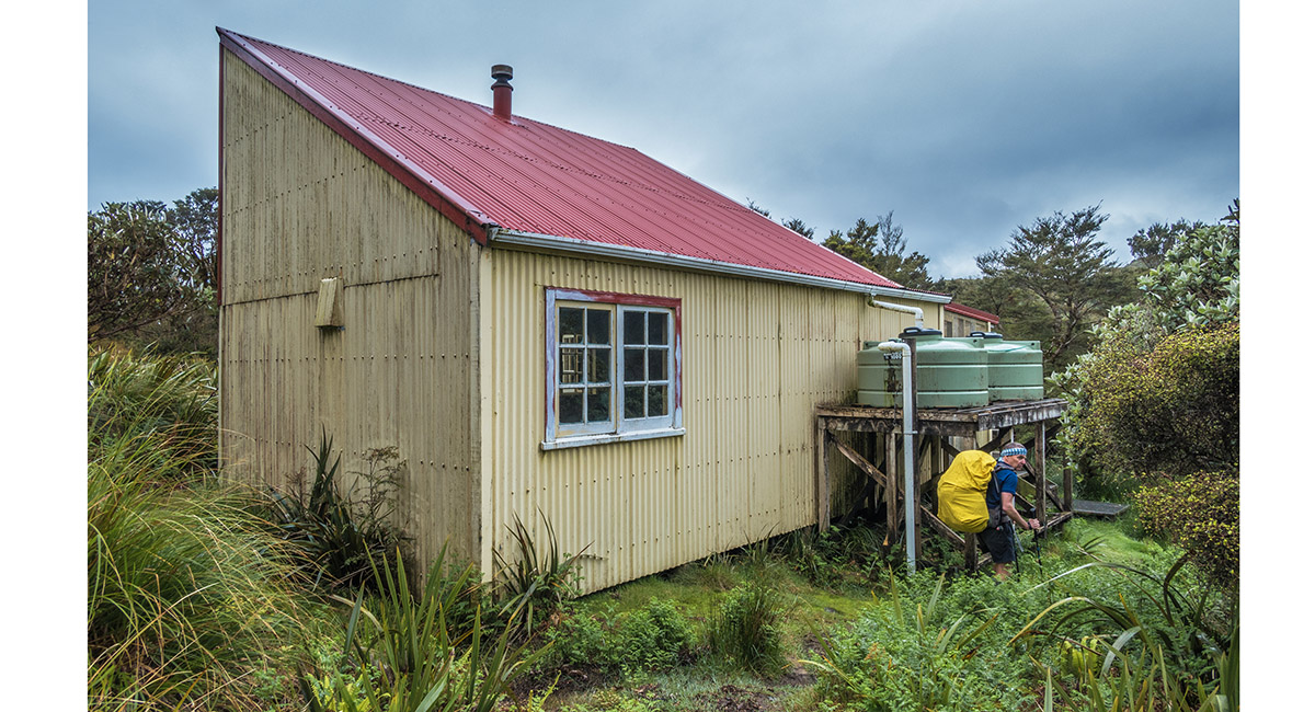
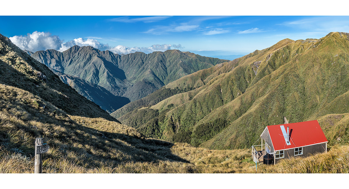
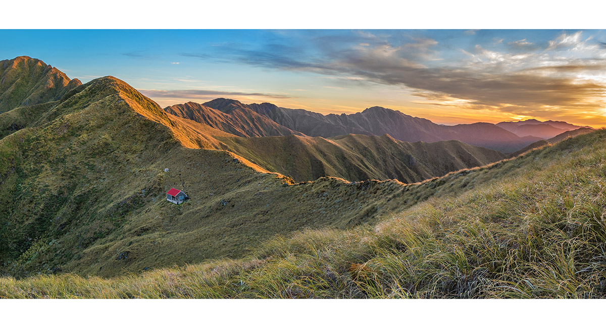
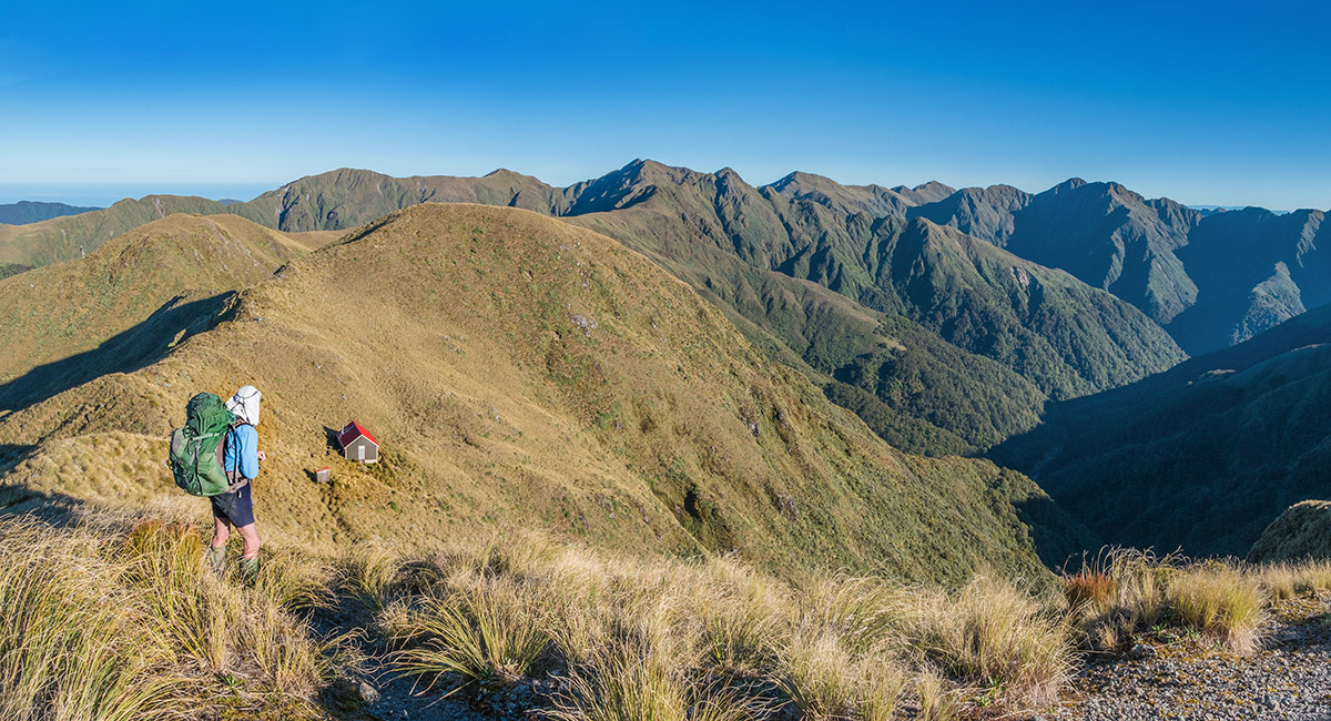
Waiopehu Hut (950m), viewed from about 800 metres on Gable End Ridge


TA mud-fest, at about 900 metres, on Gable End Ridge


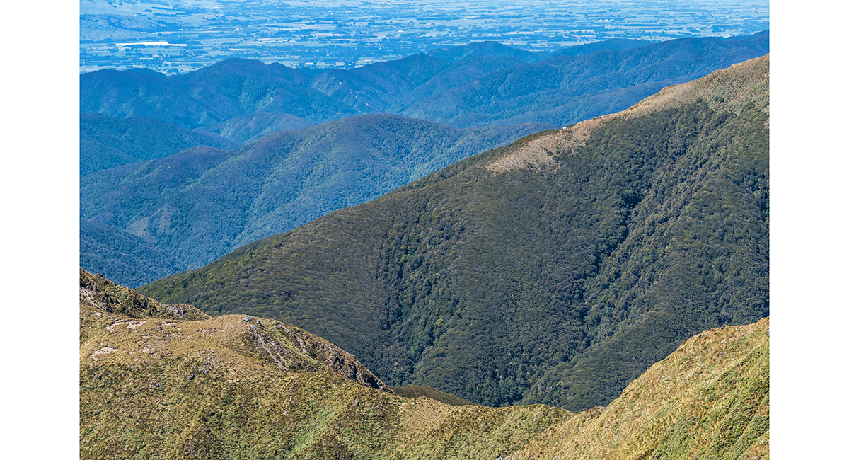
On Gable End Ridge, approaching Richards Knob (985m), with Butcher Saddle (690m) left of centre, below the cloud

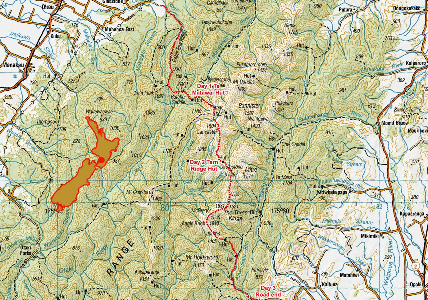
Te Matawai Hut (900m)

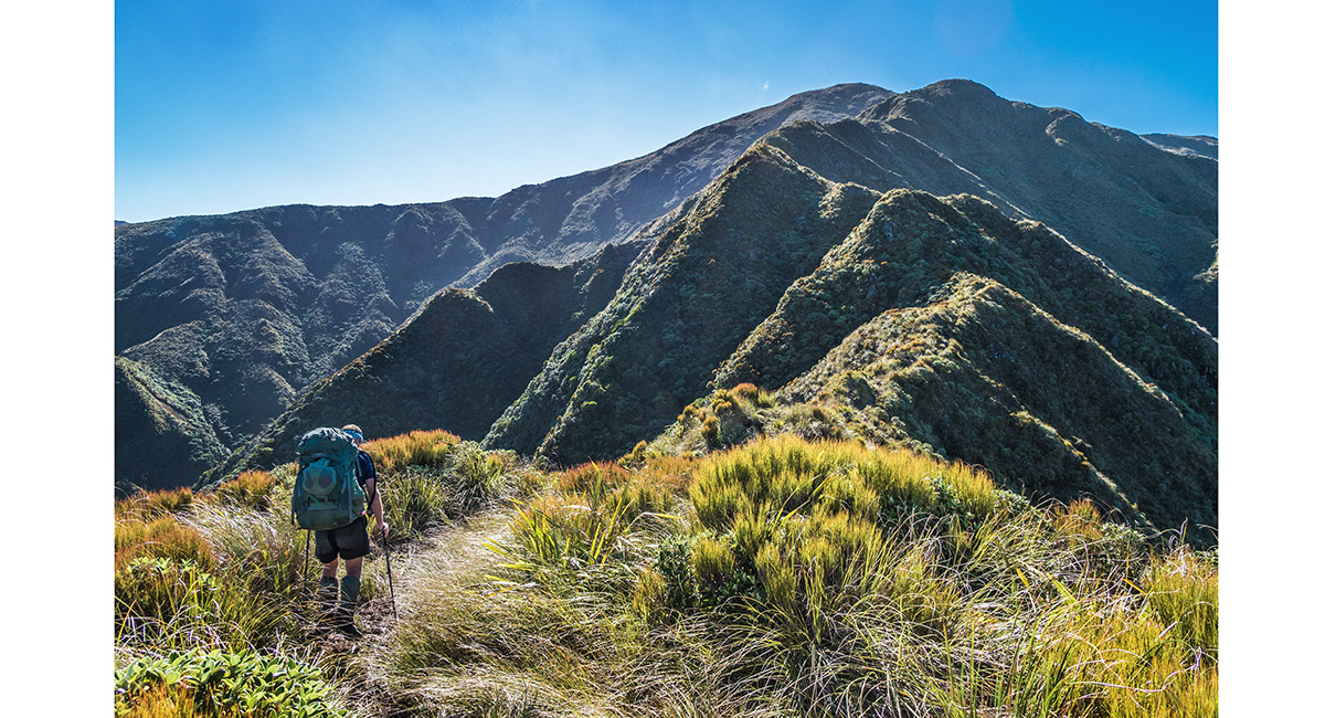
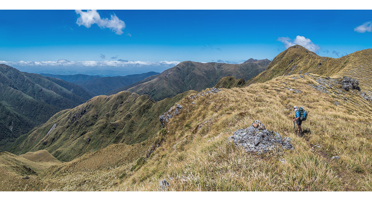
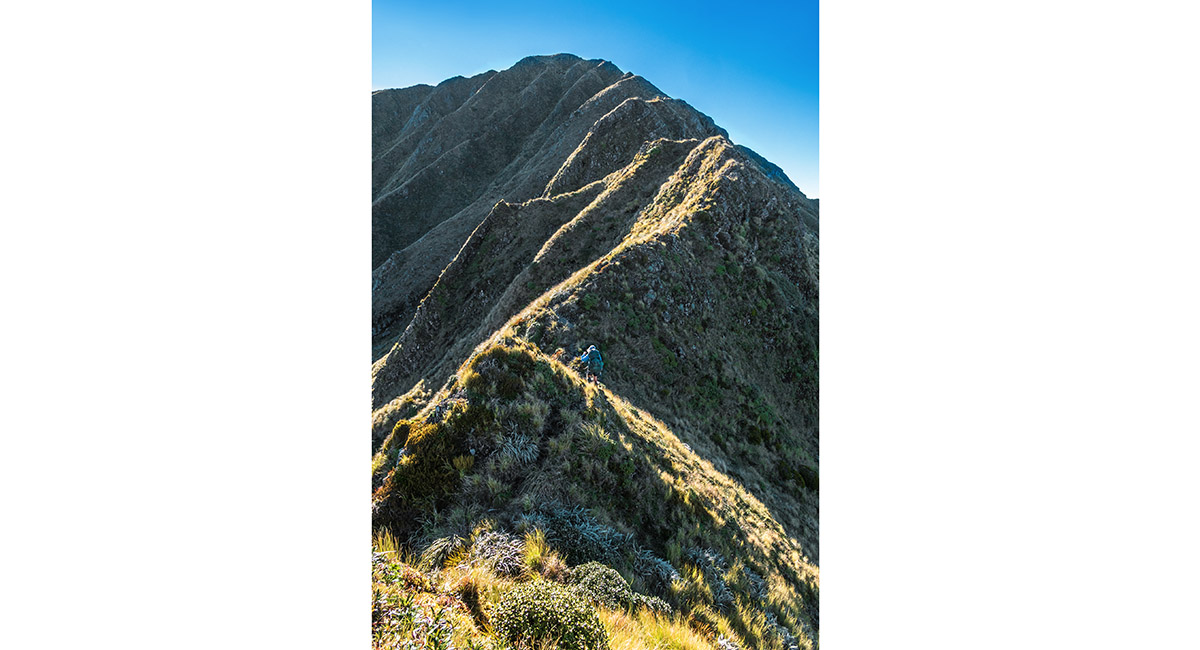
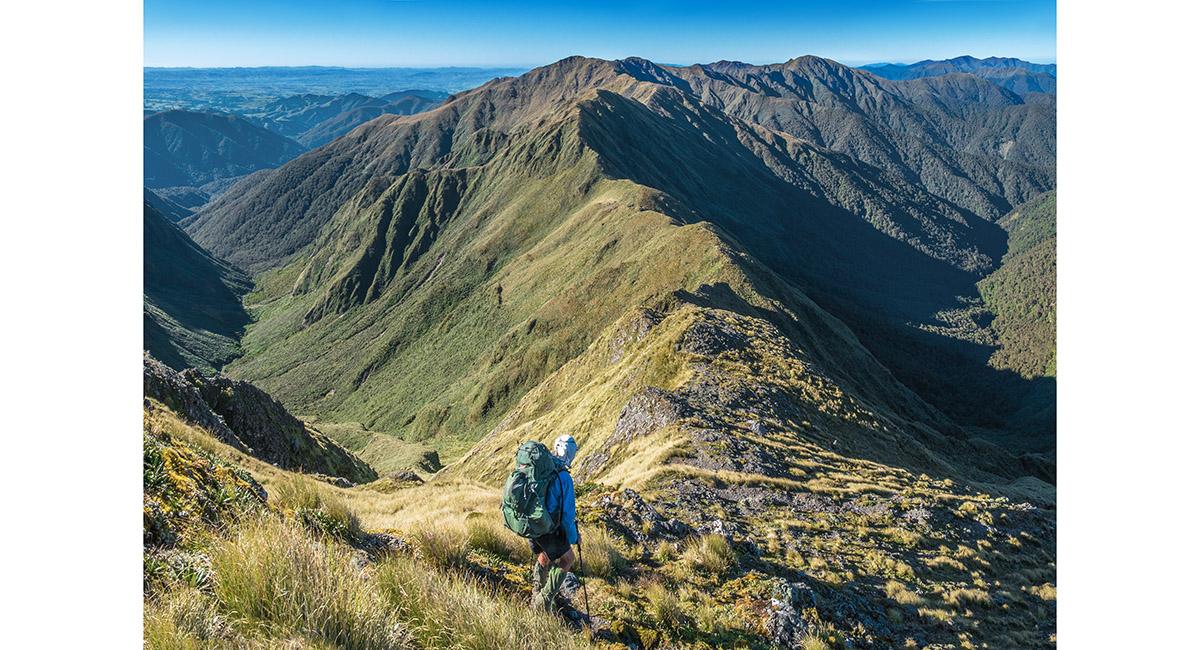
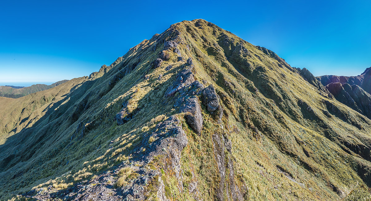
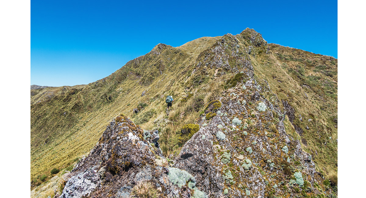
Climbing south-east to Pukematawai (1,432m)

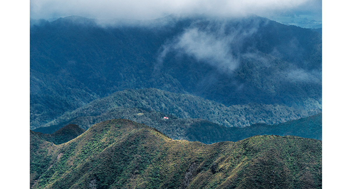
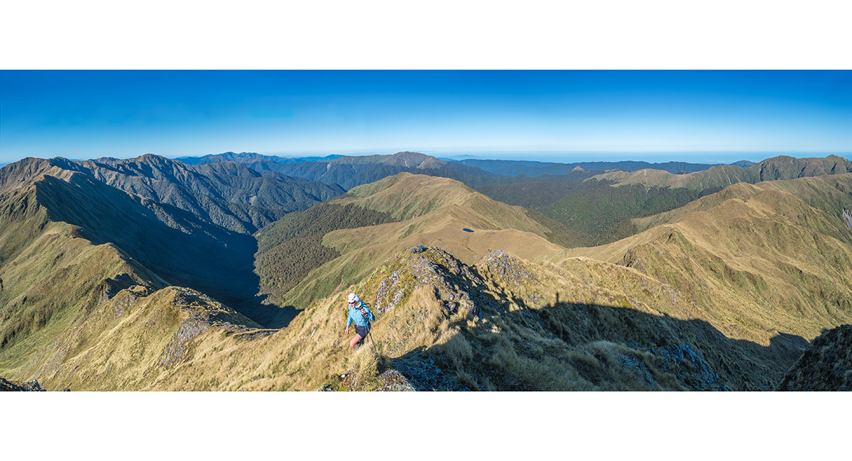
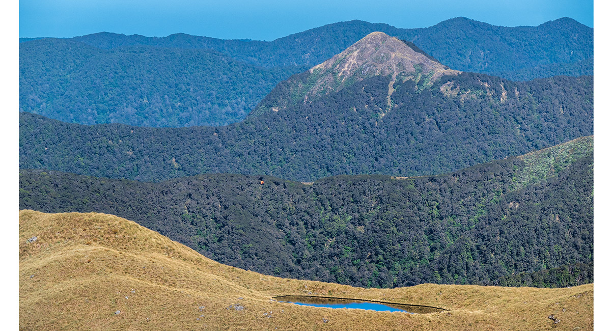
At the junction of Dora Track and Te Araroa Trail, just south of Pukematawai. Te Matawai Hut is the tiny red dot distant centre

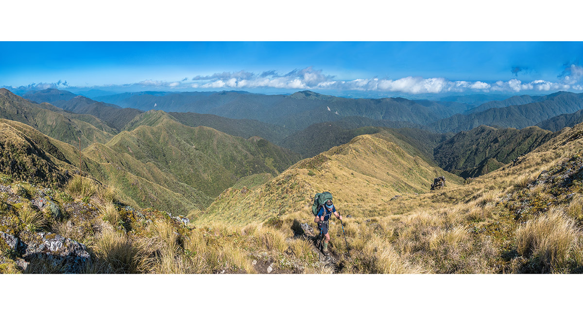
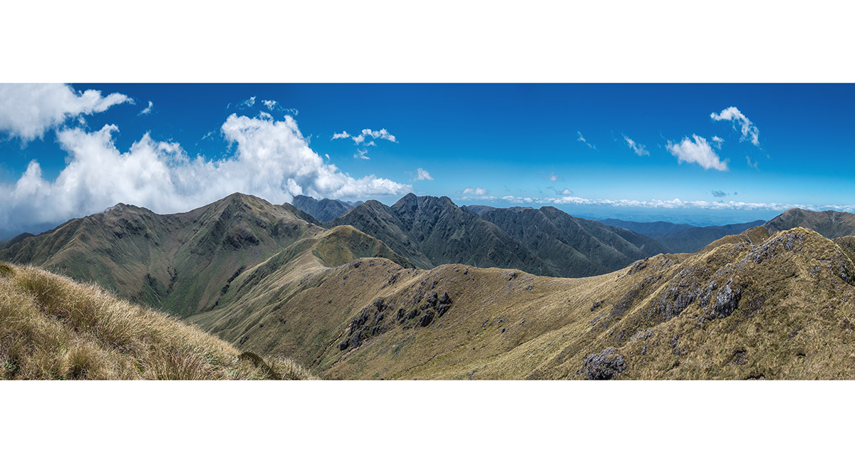
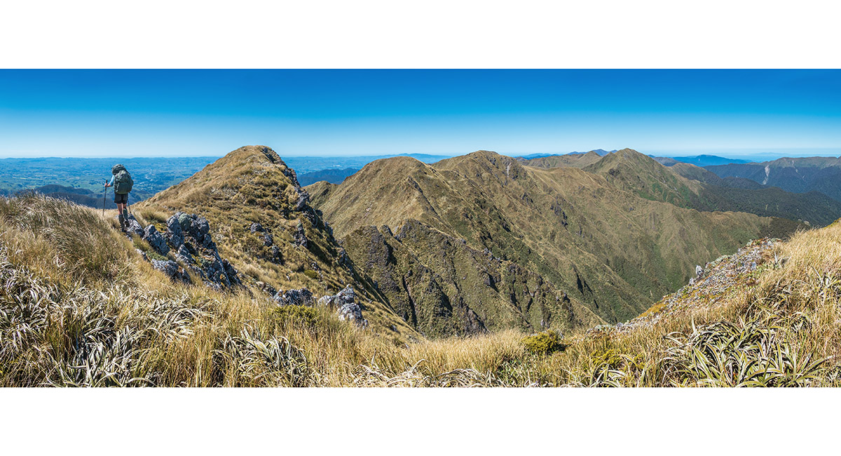
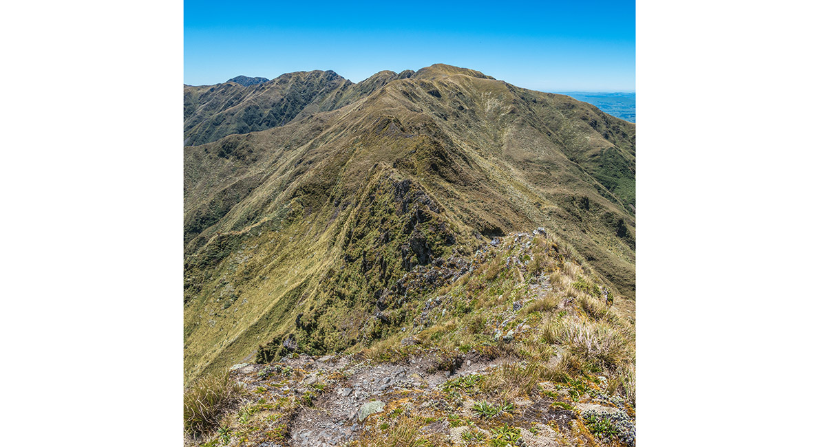
Descending the east side of Pukematawai, with Arete (1,505m) near right of centre. Dundas Ridge stretches across left


Arete Biv (1,360m), with Bannister far left (1,537m and 1,513m)


The view from Arete Biv of the Twins (left) and Bannister

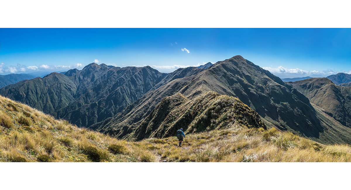
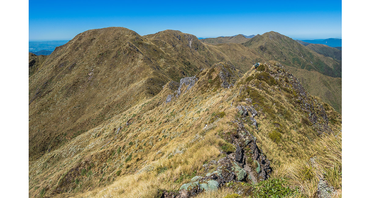
Heading south to Waiohine Pinnacle (1,470m - right), with Pinnacle ridge stretching down and left. The flat ridge mid-skyline is Table Ridge. Lancaster is out of picture far right

Summit view from Lancaster (1,504m), looking north to Pukematawai (left), Arete, the Twins, Bannister (centre)

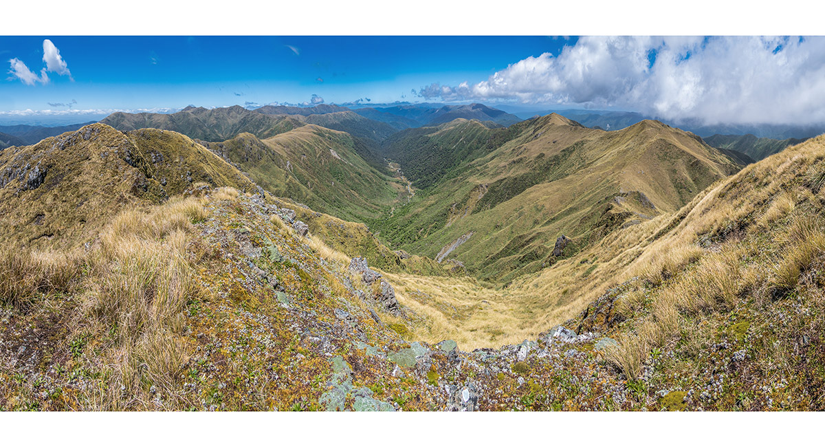
Looking south from Lancaster, down Tarn ridge (left), Waiohine headwaters (centre) and Carkeek Ridge (right)

Looking north-west to Te Matawai Hut, from Lancaster

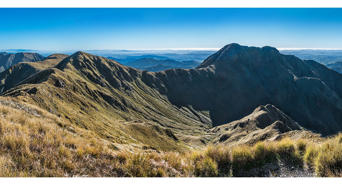
A view at the northern end of Waiohine Pinnacles, towards Tarn Ridge

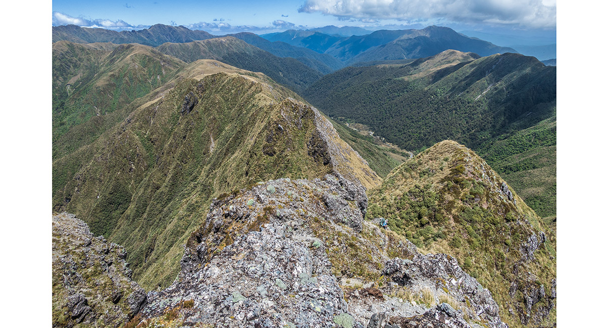
At the southern end of Waiohine Pinnacles - impressive country

Near the southern end of Waiohine Pinnacles, as the trail joins Tarn Ridge. Table Ridge is on the left skyline. Mitre, Brocket and Girdlestone are left of centre and the Broken Axe Pinnacles in the skyline dip, right of centre


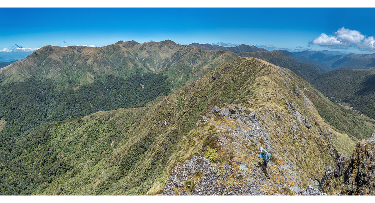
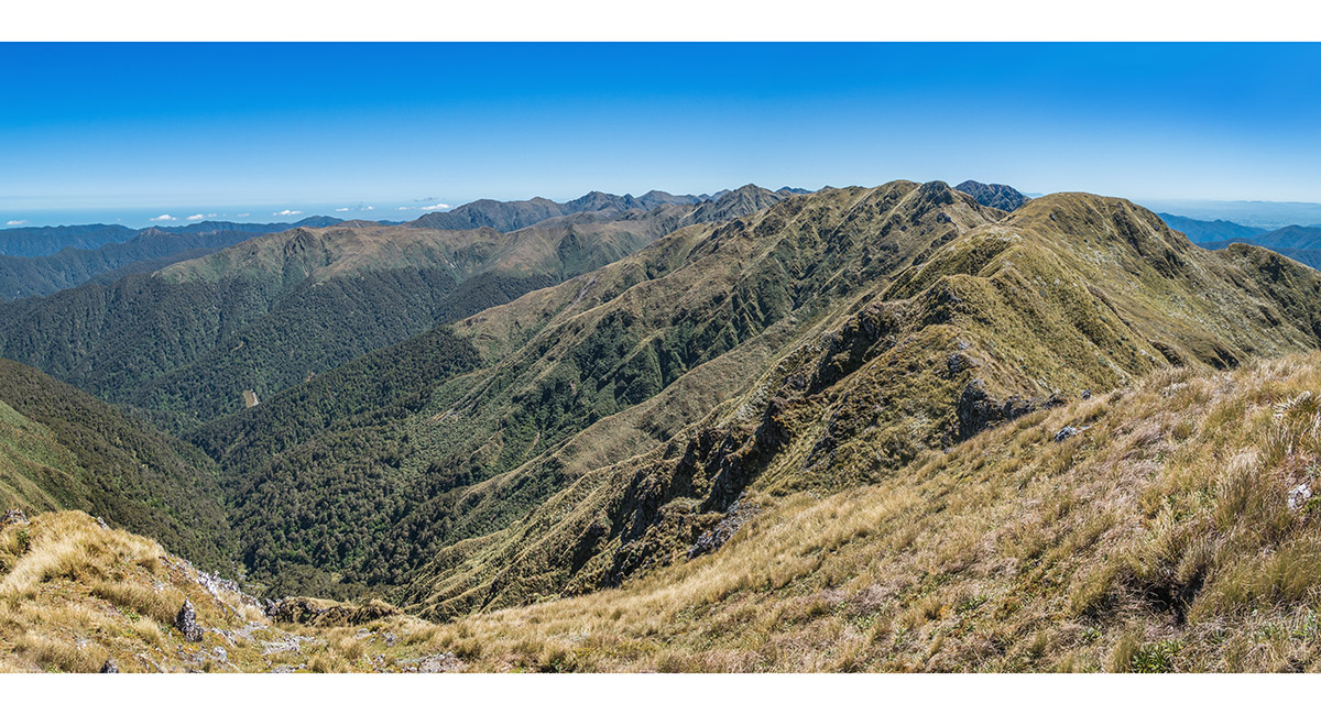
Looking north from the beginning of Tarn ridge - Lancaster left, Waiohine Pinnacles centre and Bannister distant right

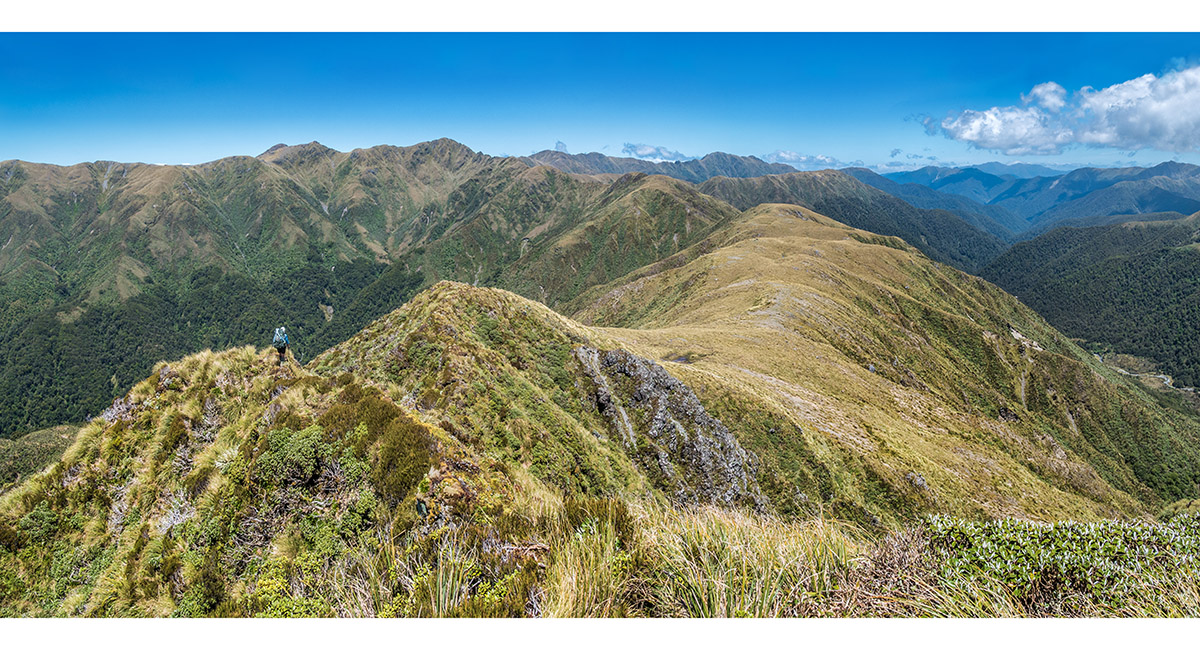
View south along Tarn Ridge

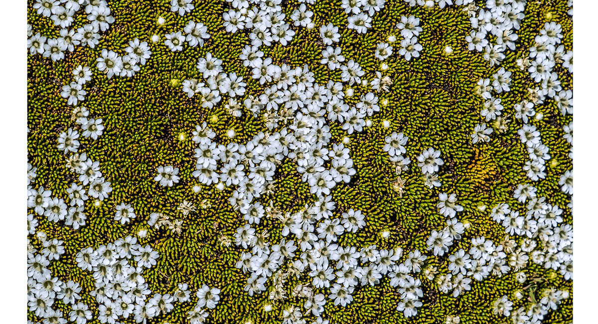
Micro view at my feet (Phyllachne?)

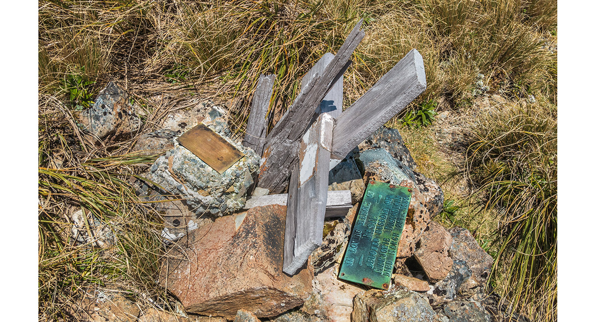
The grave of Basil Blatchford and memorial site at 1,320m, just north-west of Tarn Ridge Hut


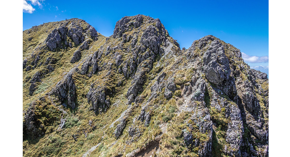
The Broken Axe Pinnacles, viewed from just above Tarn Ridge Hut. The crux is the left-hand incline of the most prominent fin, just left of centre

Tarn Ridge Hut (1,360m), with Bannister dominating the distant skyline

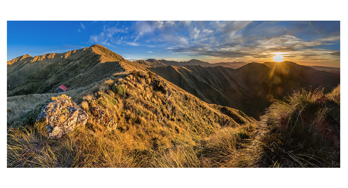
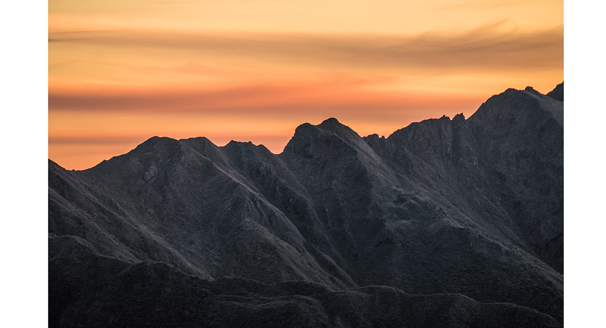
Sunset view above Tarn Ridge Hut, to Girdlestone (left) and Dorset Ridge stretching across right. Broken Axe Pinnacles and McGregor centre distant skyline

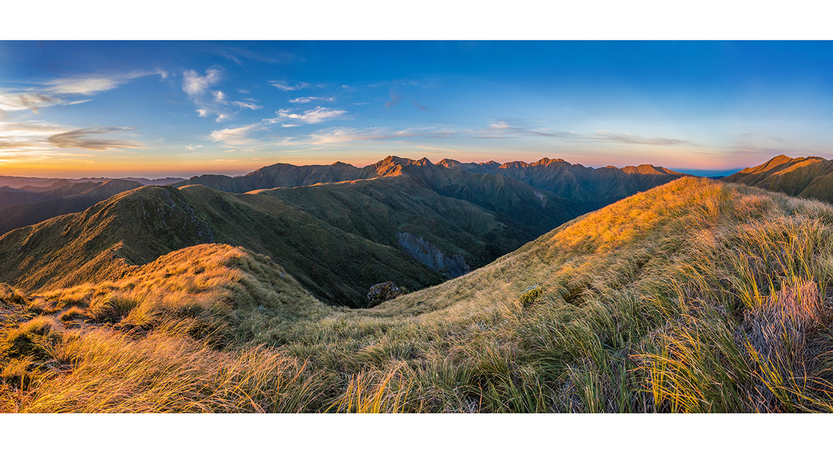
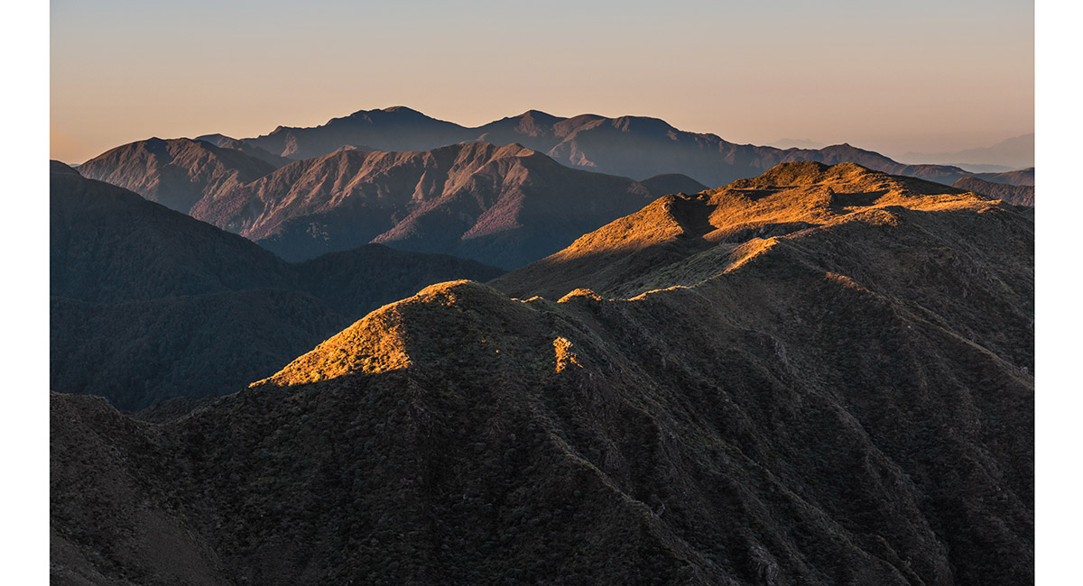
Sunset view north, above Tarn Ridge Hut, to Tarn Ridge sunlit, leading right to the Waiohine Pinnacles, centre

Sunset view south, to Girdlestone (far left), then Adkin, the Three Kings, Broken Axe Pinnacles, McGregor (our route for the following day), with Dorset Ridge middle foreground

Sunset view west to Kapiti Island (right skyline), with Dorset Ridge stretching in from the left middle-foreground, from above Tarn Ridge Hut

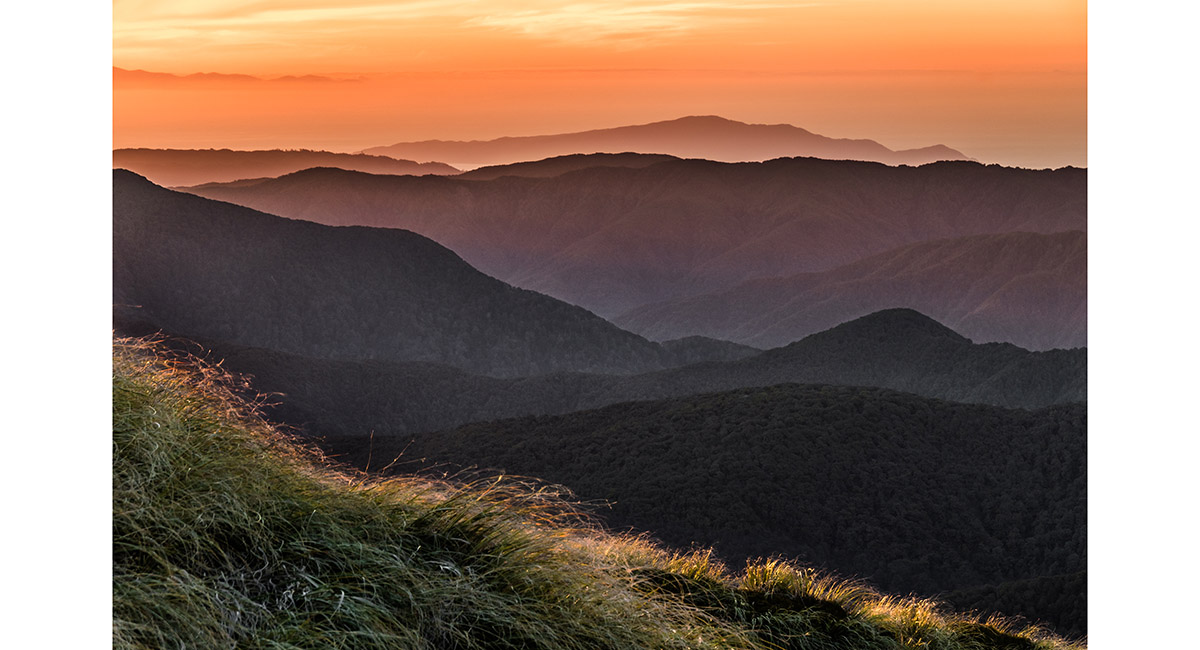
Sunset view west to Kapiti Island, from above Tarn Ridge Hut

Sunset view south to the Broken Axe Pinnacles (crux centre left), from above Tarn Ridge Hut

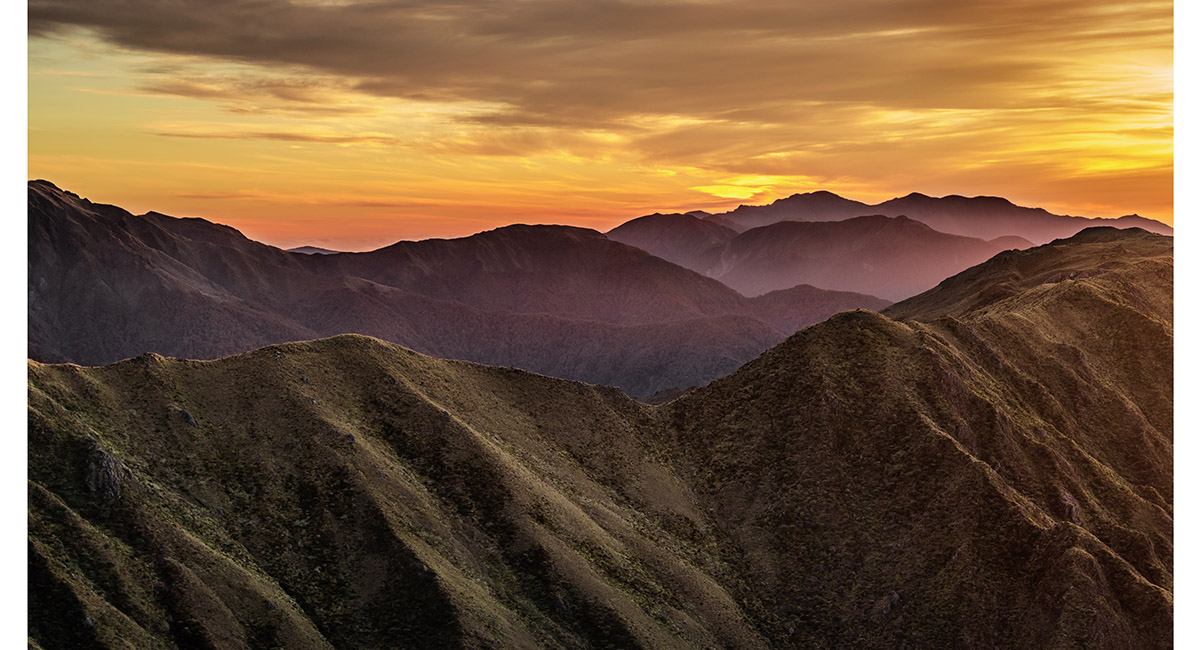
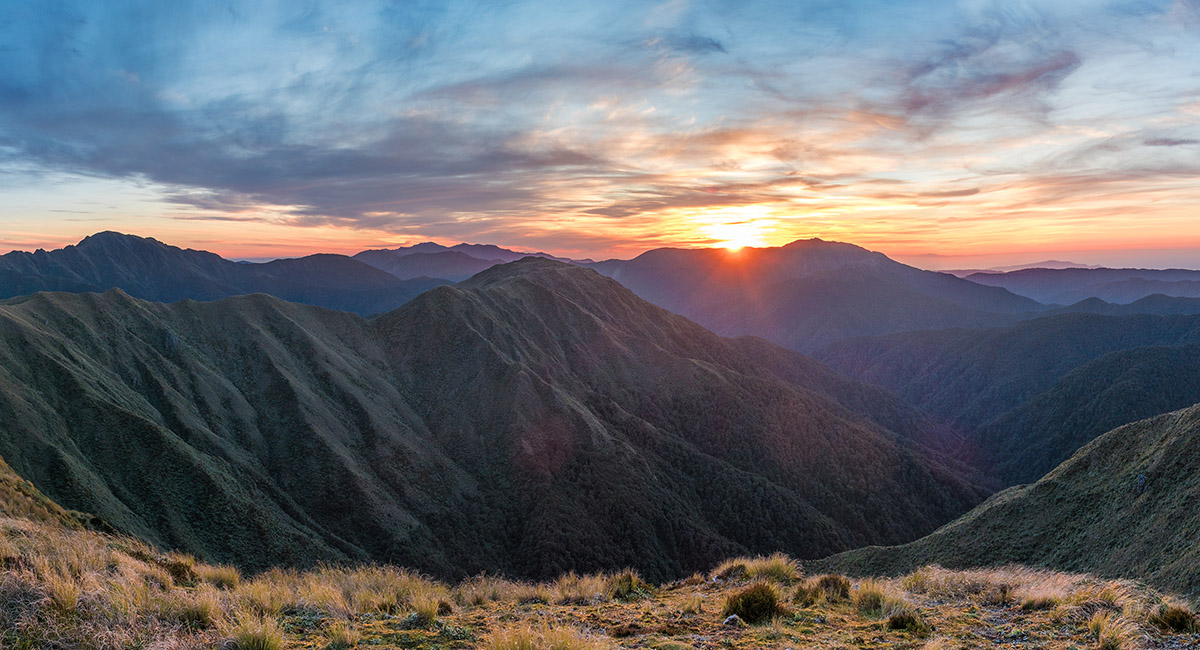
Sunset view south-west, to the higher western end of Dorset Ridge and peaks beyond

Dawn view south-west, to the higher western end of Dorset Ridge and peaks beyond

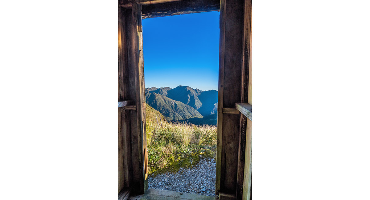
Tarn Ridge Hut loo-view of Bannister

View north above Tarn Ridge Hut, back to the Waiohine Pinnacles (left of centre) and Bannister (right). The steep Pinnacle Ridge plunges to Arete Forks Hut, hidden in shadow

A view of Dorset Ridge, looking west from beneath the summit of Girdlestone

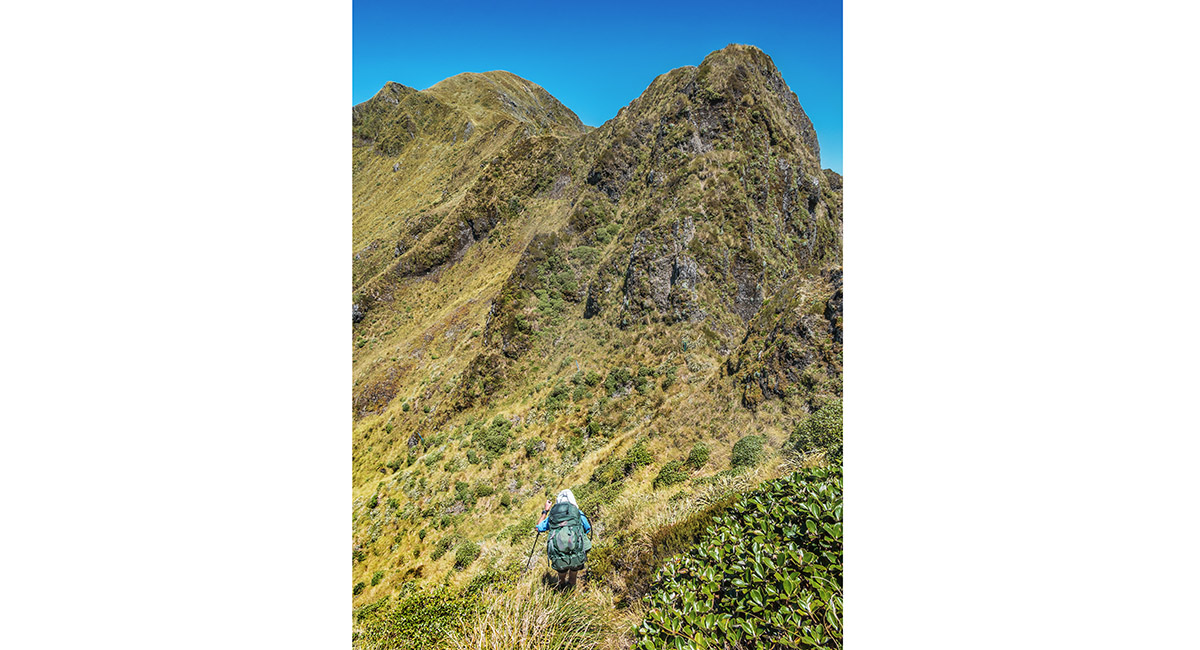
The south-eastward climb to Girdlestone

A summit view from Girdlestone (1,546m), looking south to Adkin, the Three Kings and McGregor (left), west along Dorset Ridge (centre) and north to Tarn Ridge (right)

A summit view from Girdlestone (1,546m), looking north-east to Brocket (1,538m) and east to Mitre (1,571m) and Peggy's Peak (1,545m)

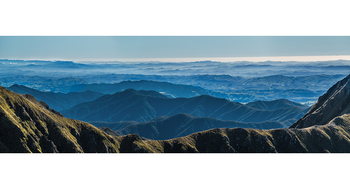
A summit view from Girdlestone (1,546m), looking east, over the ridge between Brocket and Mitre, to the Wairarapa

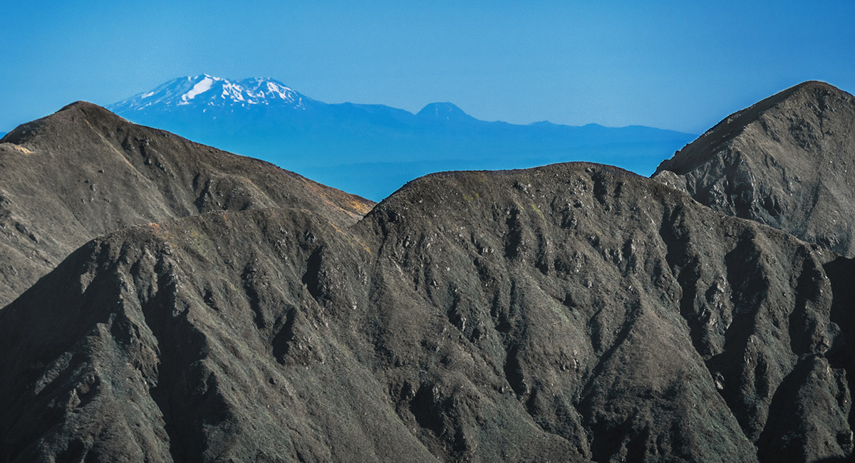
A summit view from Girdlestone, looking north to Mount Ruapehu and Ngauruhoe


A summit view from Girdlestone, looking west to Carkeek Hut (1,170m)

Descending the south side of Girdlestone, with Adkin (1,460m) ahead

Looking north, back up the south side of Girdlestone

Another view of Carkeek Hut (the red dot left of centre), across Dorset Ridge on the descent of Girdlestone

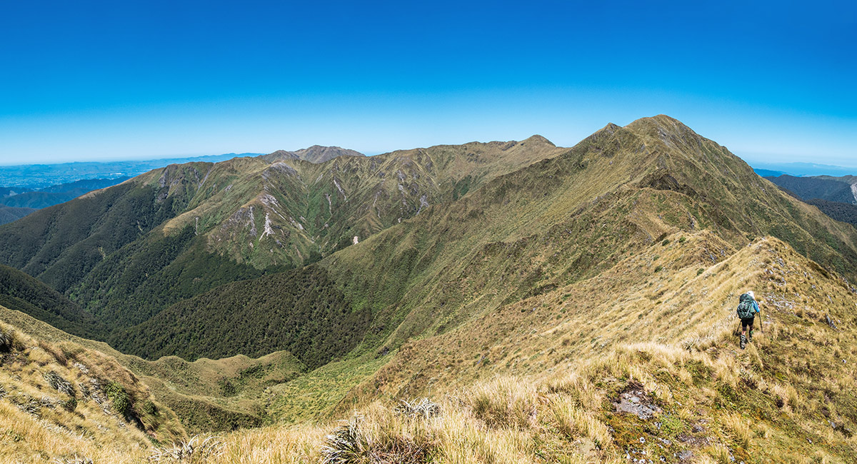
Approaching North King (1,535m), with the other two ahead to the south. McGregor and Angle Knob are distant right

On craggy terrain between North and Mid King (1,521m)

Jumbo Hut (1,230m), viewed from South King (1,531m)

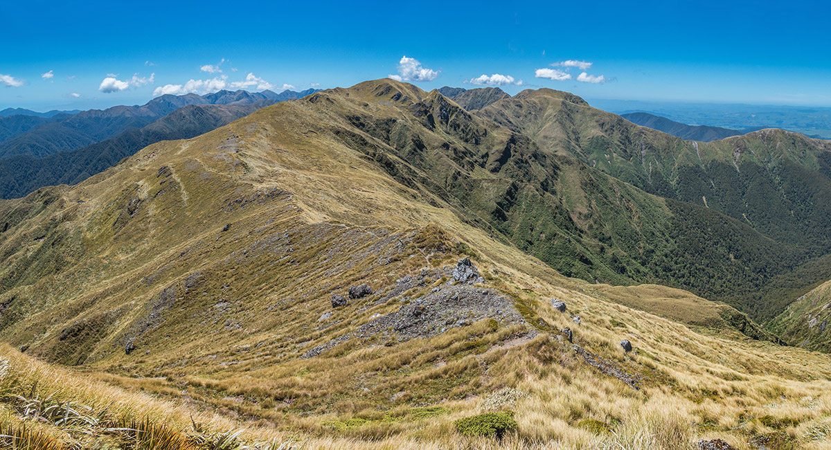
The view north from South King, back along our route

The view south-west, on the descent of South King towards the Broken Axe Pinnacles and McGregor. Jumbo Hut is a tiny white dot just on the treeline at left. Mt Holdsworth is left centre, distant skyline

A foreshortened view of the crux of the Broken Axe Pinnacles - right, with McGregor distant left. The DOC trail avoiding the crux leads around to the left

On the southern portion of the Broken Axe Pinnacles, heading for McGregor

Looking north, back along the Broken Axe Pinnacles, from beneath McGregor

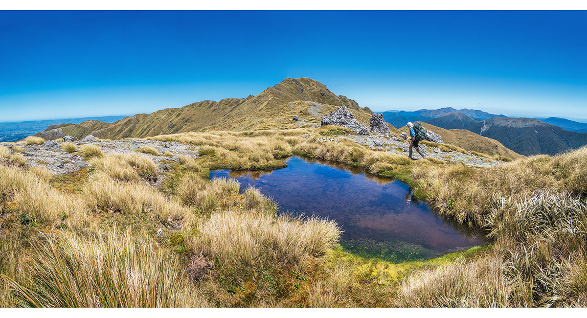
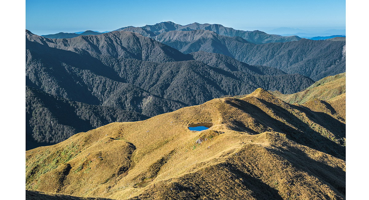
A tarn north of Angle Knob (1,510m)

The view north-east from Angle Knob, back to McGregor. Baldy Ridge leads out of picture to the right

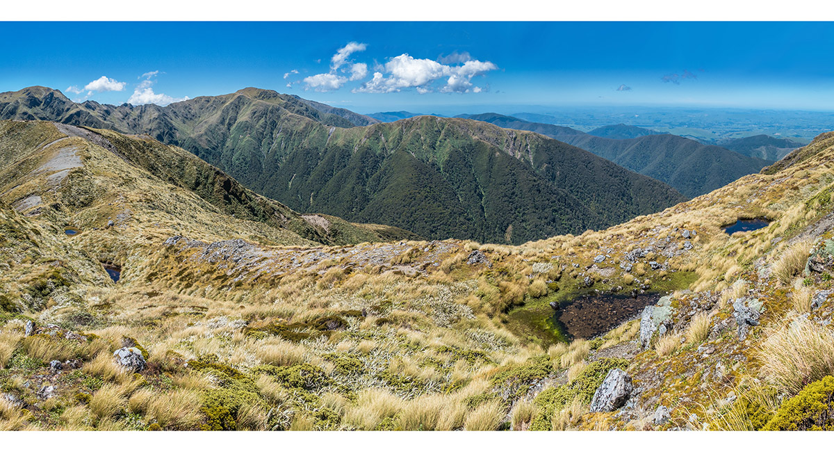
A series of small tarns on the north side of Jumbo (1,405m), with Baldy Ridge stretching across from the left and the Broken Axe Pinnacles further left skyline

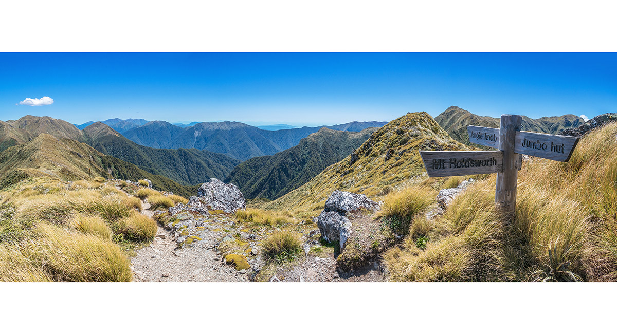
Back on the tourist route at the Jumbo junction - now it's all down hill, via Jumbo and Atiwhakatu Huts, to the carpark 4 hours away - an 11 hour day

Read about it Tararua tops feast Wilderness Magazine Mar 21
To order a print or web resolution file of any image you see in this slide show, just right click the image, click “Copy Image URL” and paste in to the “Your message” box of our Contact Us form. Please also note, for each image, if you want a print or web resolution file. We will get back to you as soon as possible to confirm price and payment details.
Open Contact Us in a new window to paste Image URL(s) easily