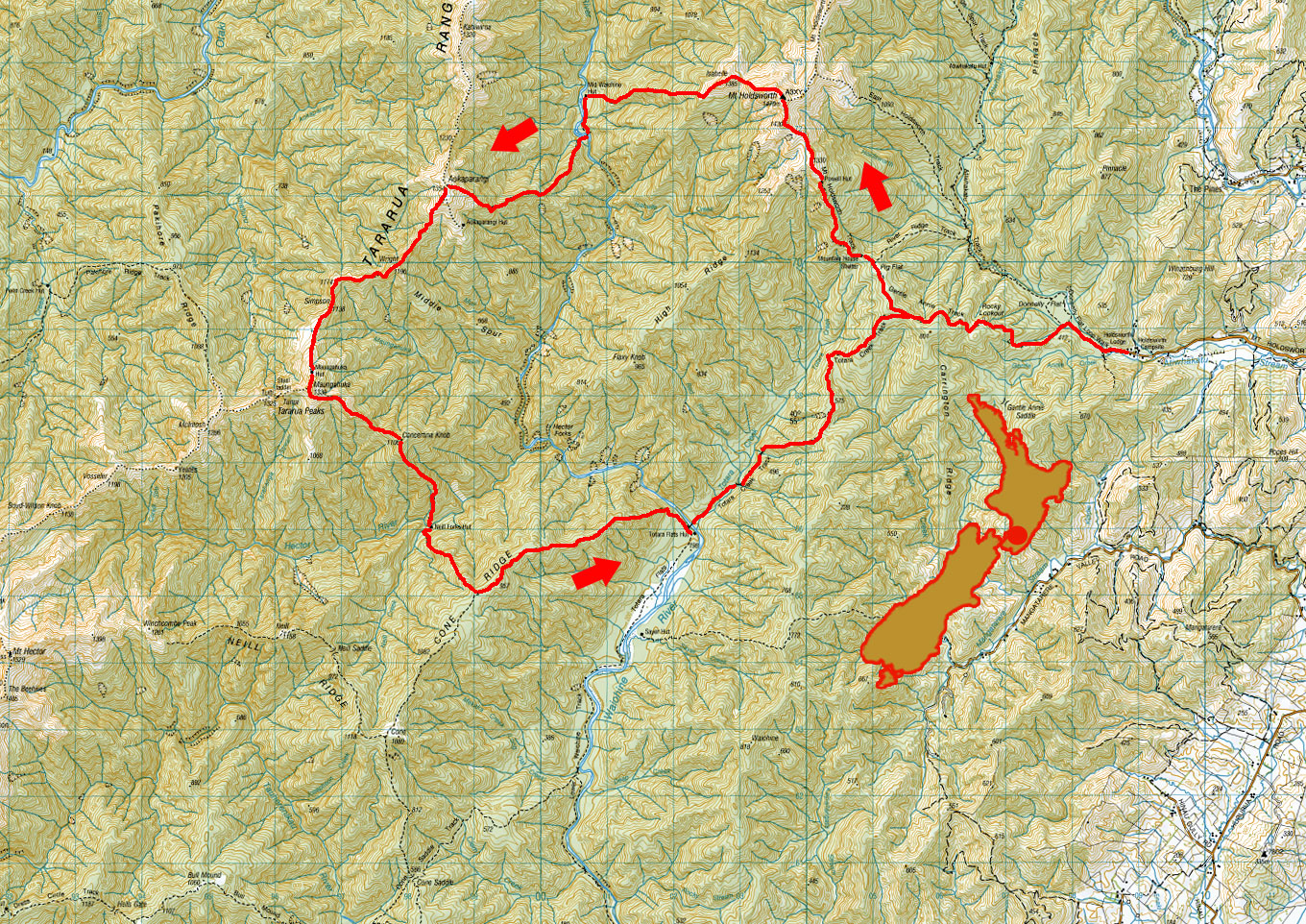
Holdsworth Aokaparangi Maungahuka Totatara Flat circuit, March 2019
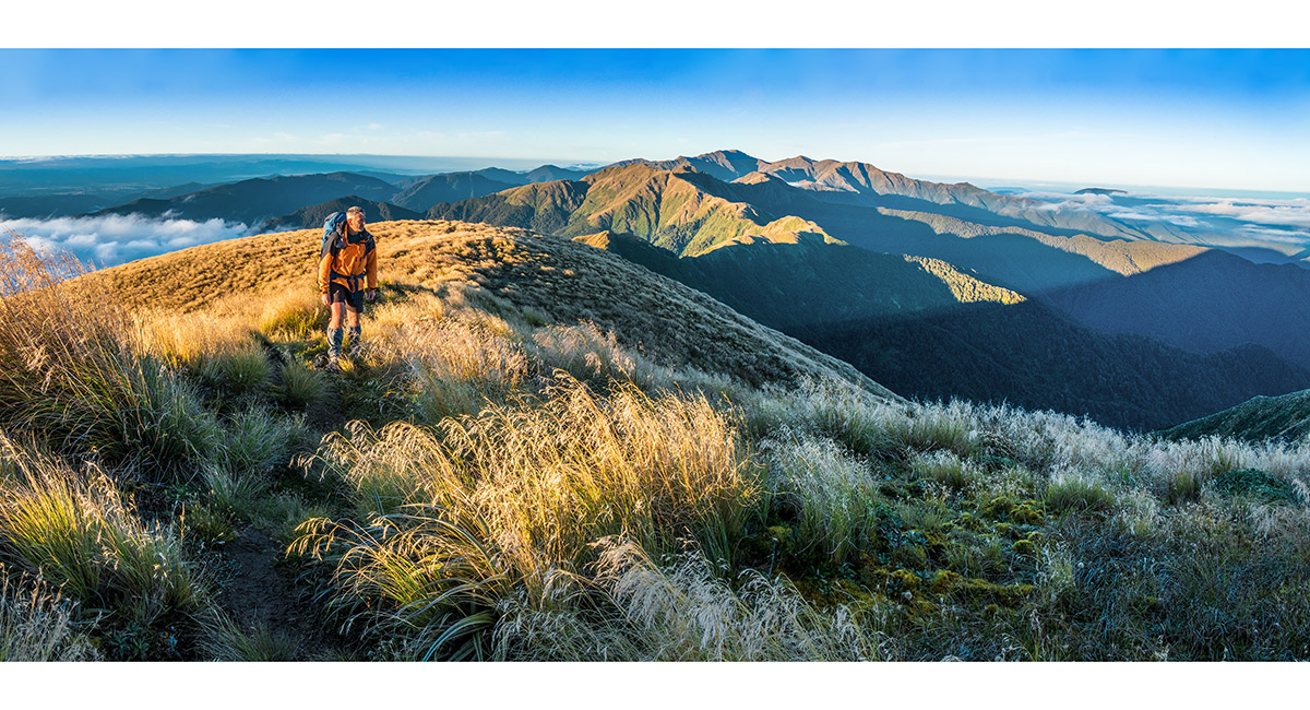
 A view from about 700m on the Gentle Annie Track, up to Powell Hut (1,200m) and Mt Holdsworth (1,470m - far right)
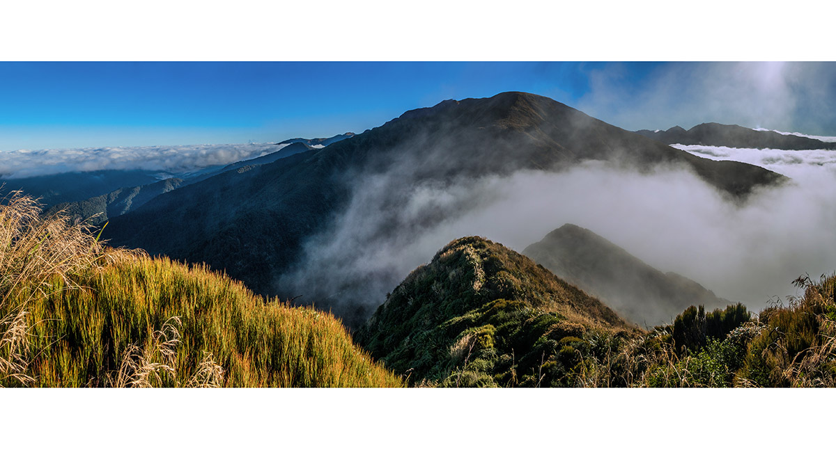
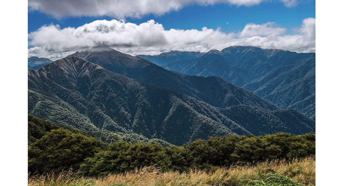
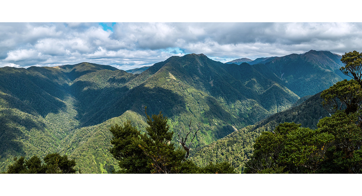
 A view south east from above Powell Hut
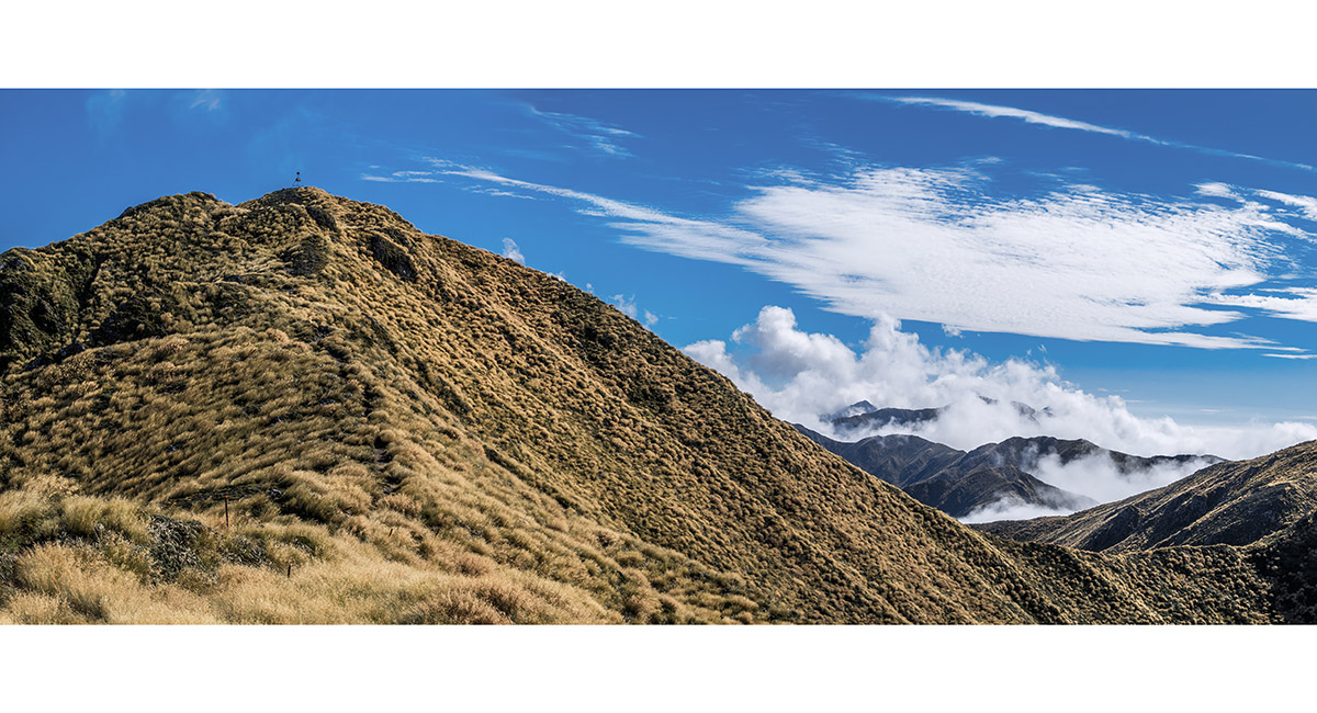
 Mt Holdsworth trig, left, with the route along to Jumbo, right
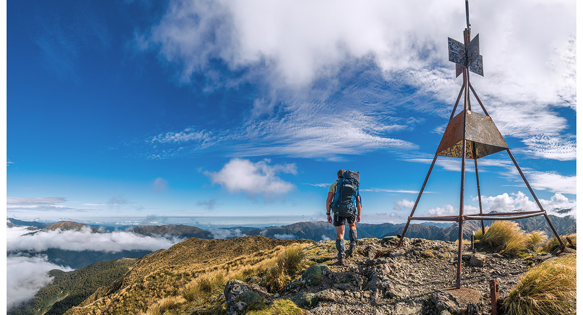
 Mt Holdsworth trig, looking west to Isabelle and the main range
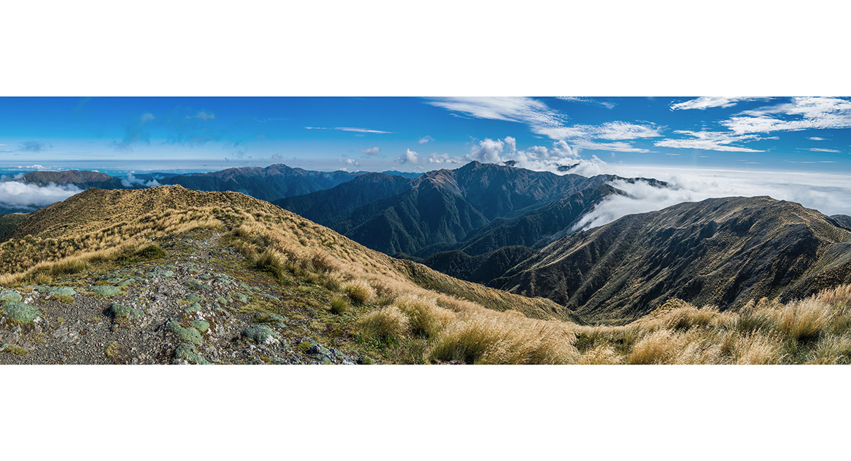
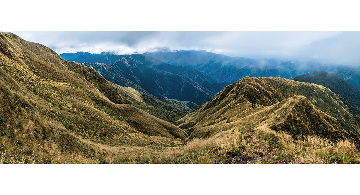
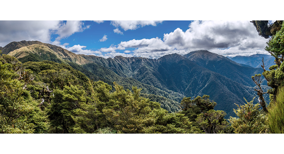
 A wide view from Mt Holdsworth, spanning the main range at left and the route along to Jumbo and beyond, right
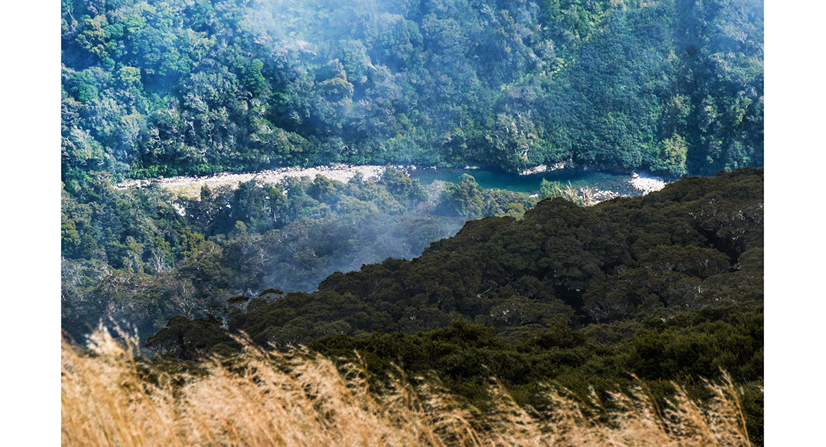
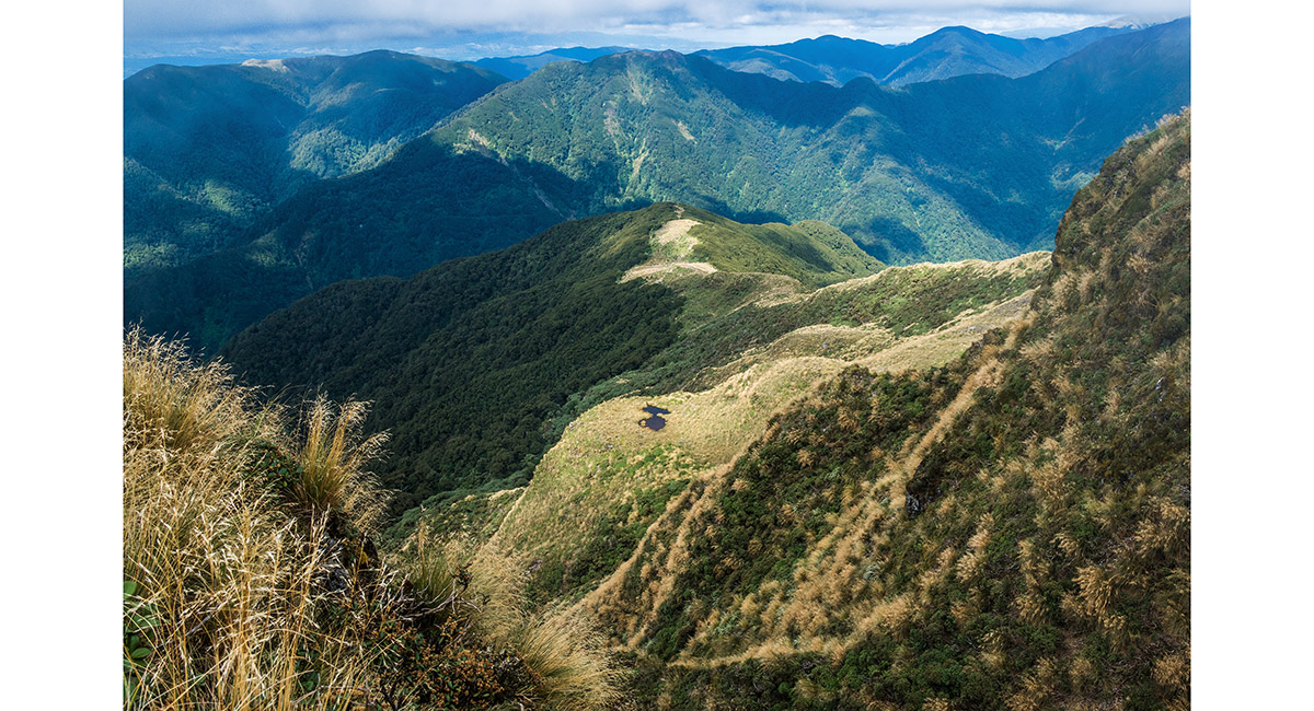
 From Isabelle (1,385m), looking down 1,000m to the Waiohine River, near Mid Waiohine Hut
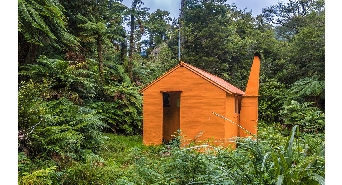
 Mid Waiohine Hut (380m)
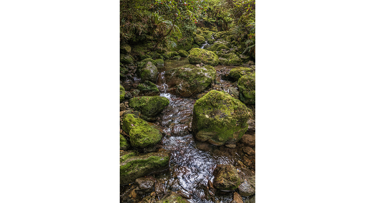
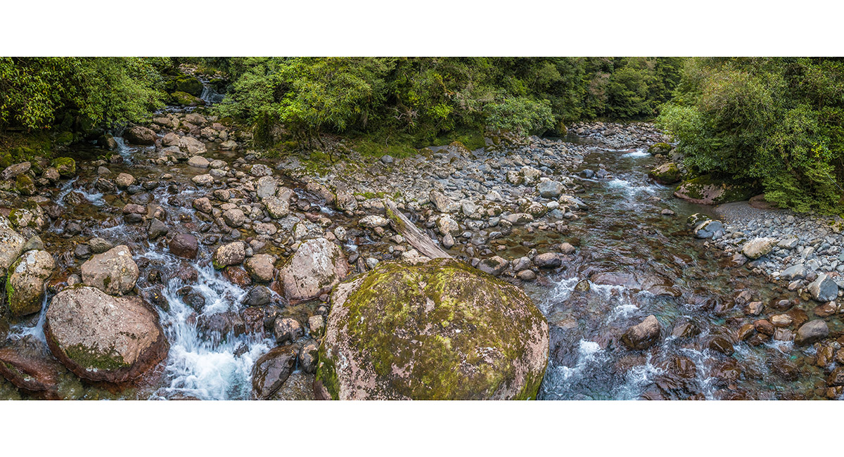
 A tributary stream on the true left of Waiohine River
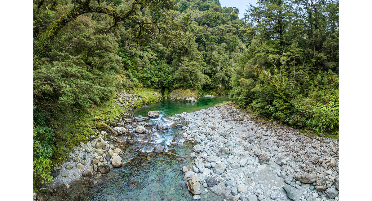
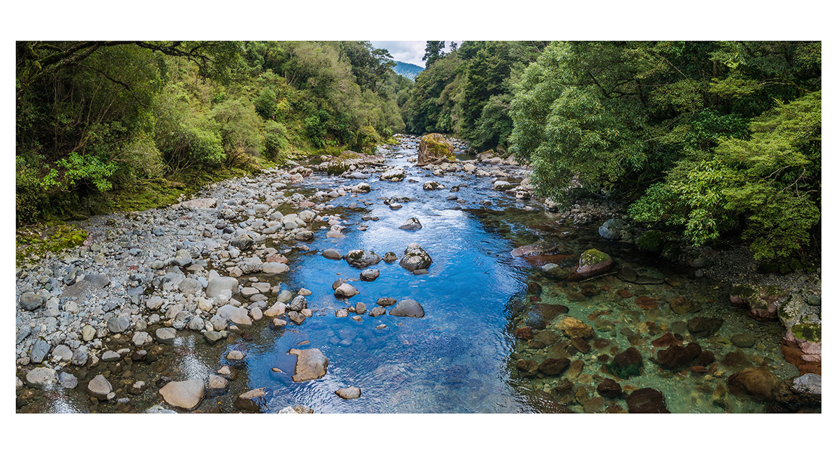
 Looking south, down river, from the swing bridge just south of Mid Waiohine Hut
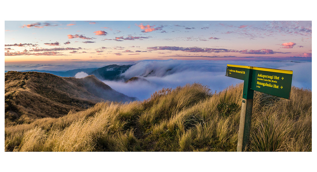
 At my bivvy site just below the summit of Aokaparangi (1,354m)
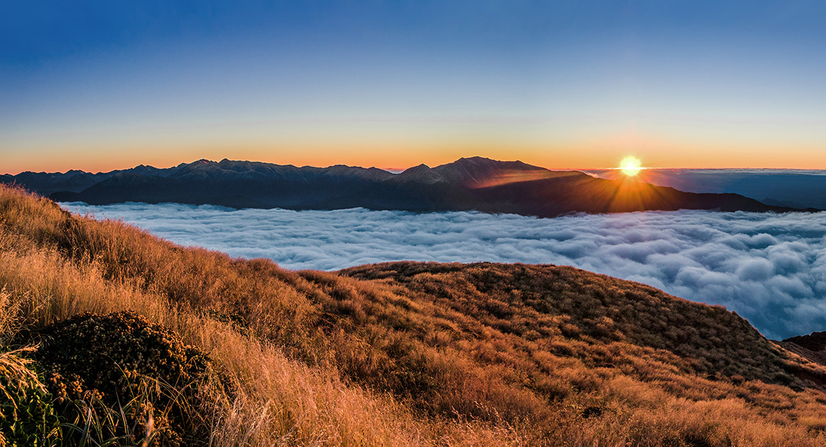
 At sunset, on top of Aokaparangi
 At sunset, on top of Aokaparangi, looking north
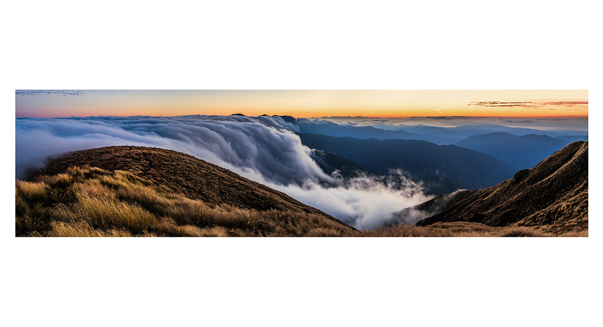
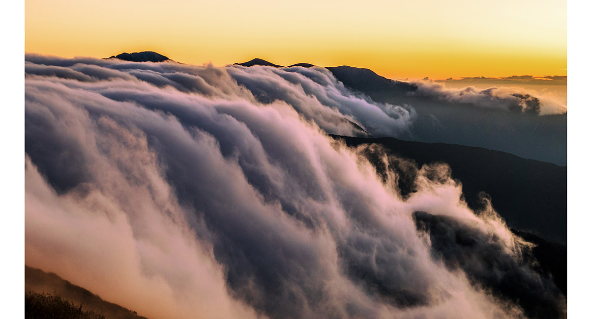
 At sunset, on top of Aokaparangi, looking south and west
 At sunset, on top of Aokaparangi, looking southwest
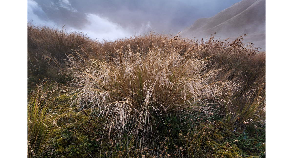
 Alpine grass on Aokaparangi
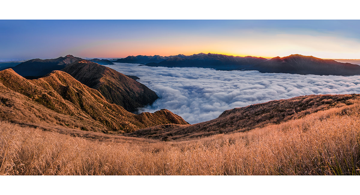
 At sunrise on Aokaparangi, looking north (left), over Kahiwiroa (1,320m) to Mt Crawford (1,462m) and east to Mt Holdsworth and Isabelle (far right). In between these two points lies a big chunk of Tararuas
 At sunrise on Aokaparangi, looking north to Carkeek Ridge (right)
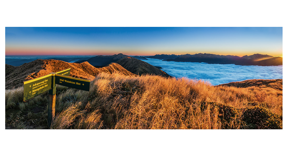
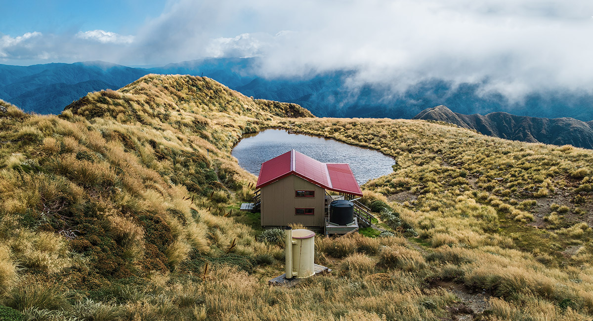
 At sunrise on Aokaparangi, looking south to Maungahuka Hut (1,280m) and the Tararua Peaks, with Winchcombe (1,261m) behind
 At sunrise on Aokaparangi, looking south and west. At left is the main range leading to Mt Hector. In the distant right is the Kapiti Coast
 At sunrise on Aokaparangi, looking east to Mt Holdsworth (left of centre)
 At sunrise on Aokaparangi, looking north and east to Mt Crawford (left of centre) and Mt Holdsworth (far right)
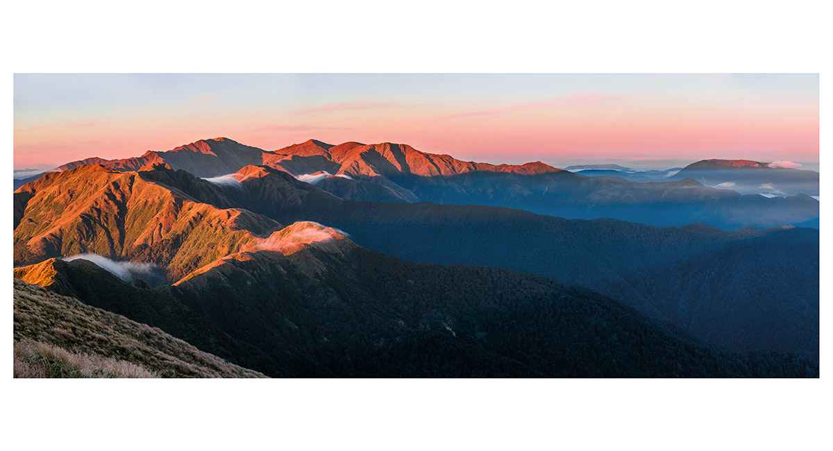
 At sunrise on Aokaparangi, looking south along the main range to Maungahuka (left), then on along over the Tararua Peaks towards Bridge Peak
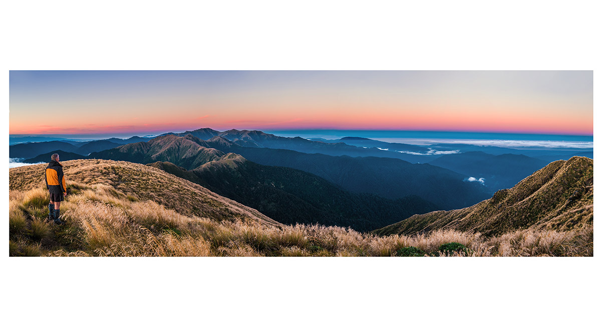
 At sunrise on Aokaparangi, looking south along the main range to Maungahuka (left), then on along over the Tararua Peaks to Bridge Peak and Mt Hector, plus the Kapiti Coast to the right
 About to depart Aokaparangi, looking south along the main range to Maungahuka (left), then on along over the Tararua Peaks to Bridge Peak and Mt Hector
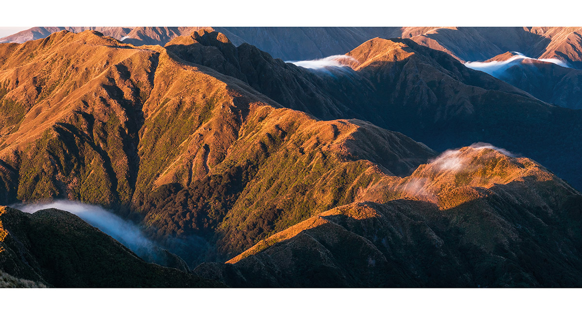
 Near Simpson (1,138m), looking northeast, back to Aokaparangi (1,354m)
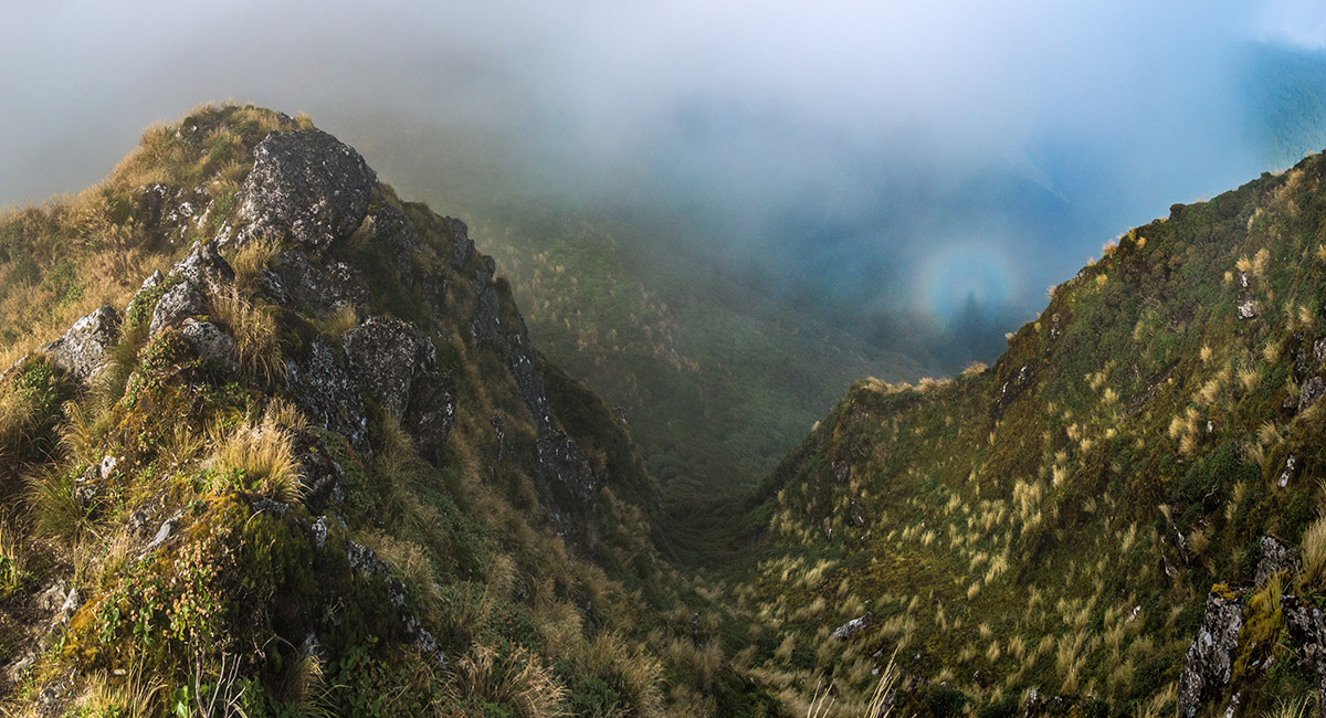
 A brocken spectre of my shadow, projected on steep craggy ground on the west side of the main range
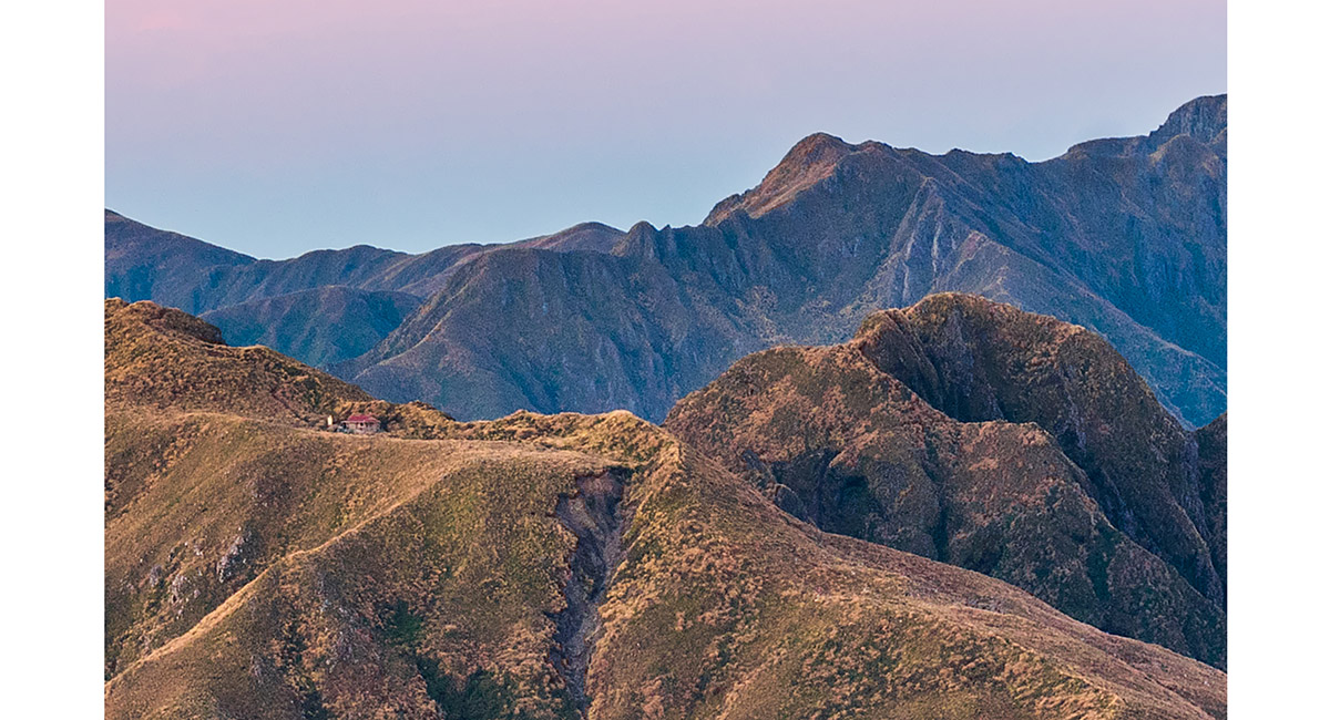
 Looking north, across Maungahuka Hut (1,280m)
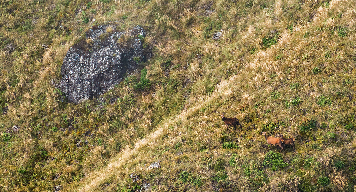
 Deer at about 1,100m, on the north side of the ridge dropping off Maungahuka to Neill Forks
 Looking west to the Tararua Peaks, just below the top of Maungahuka
 The view down the ridge between Maungahuka and Concertina Knob (1,106m - far left). Maungahuka Stream cuts a path down the centre
 Looking south to Neill (1,158m, top centre), from beneath Maungahuka
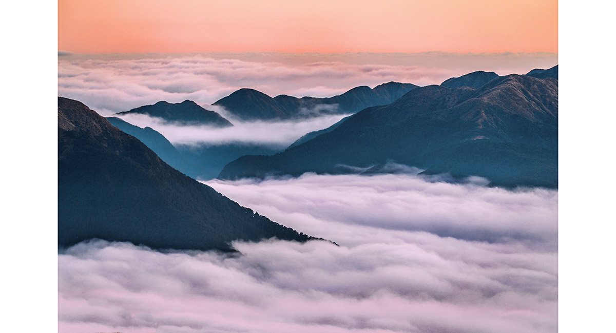
 The view north east, to Aokaparangi (in cloud - left) and Mt Holdsworth (right)
 Entering goblin forest on the west side of Concertina Knob (1,106m)
 A view from a peep hole in the goblin forest, west to Maungahuka (left) and north to Aokaparangi (right - in cloud)
 A view from the east side of Concertina Knob, south and west to Cone Ridge (left), Neill (centre) and Winchcombe (right)
 Looking northeast from the swing bridge beside Neill Forks Hut, down Hector River
 Looking southwest from the swing bridge beside Neill Forks Hut, to Neill Creek (left) and Hector River (right)
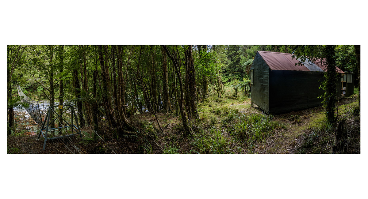
 Neill Forks Hut (350m) and the swing bridge
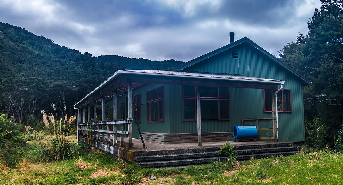
 Totara Flats Hut (200m)
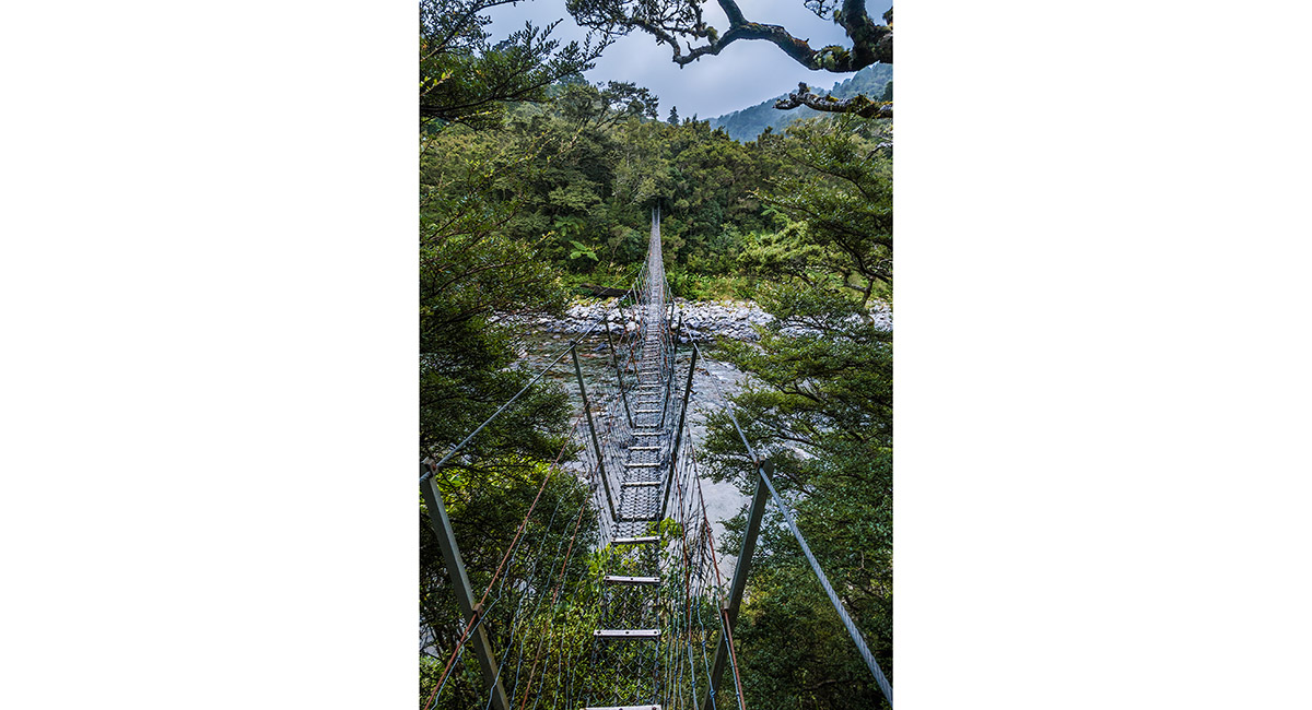
 The swing bridge spanning Waiohine River, just north of Totara flats Hut


A view from about 700m on the Gentle Annie Track, up to Powell Hut (1,200m) and Mt Holdsworth (1,470m - far right)

A view south east from above Powell Hut
Mt Holdsworth trig, left, with the route along to Jumbo, right
Mt Holdsworth trig, looking west to Isabelle and the main range
A wide view from Mt Holdsworth, spanning the main range at left and the route along to Jumbo and beyond, right
From Isabelle (1,385m), looking down 1,000m to the Waiohine River, near Mid Waiohine Hut
Mid Waiohine Hut (380m)
A tributary stream on the true left of Waiohine River
Looking south, down river, from the swing bridge just south of Mid Waiohine Hut

At my bivvy site just below the summit of Aokaparangi (1,354m)
At sunset, on top of Aokaparangi
At sunset, on top of Aokaparangi, looking north
At sunset, on top of Aokaparangi, looking south and west
At sunset, on top of Aokaparangi, looking southwest
Alpine grass on Aokaparangi
At sunrise on Aokaparangi, looking north (left), over Kahiwiroa (1,320m) to Mt Crawford (1,462m) and east to Mt Holdsworth and Isabelle (far right). In between these two points lies a big chunk of Tararuas
At sunrise on Aokaparangi, looking north to Carkeek Ridge (right)
At sunrise on Aokaparangi, looking south to Maungahuka Hut (1,280m) and the Tararua Peaks, with Winchcombe (1,261m) behind
At sunrise on Aokaparangi, looking south and west. At left is the main range leading to Mt Hector. In the distant right is the Kapiti Coast
At sunrise on Aokaparangi, looking east to Mt Holdsworth (left of centre)
At sunrise on Aokaparangi, looking north and east to Mt Crawford (left of centre) and Mt Holdsworth (far right)
At sunrise on Aokaparangi, looking south along the main range to Maungahuka (left), then on along over the Tararua Peaks towards Bridge Peak
At sunrise on Aokaparangi, looking south along the main range to Maungahuka (left), then on along over the Tararua Peaks to Bridge Peak and Mt Hector, plus the Kapiti Coast to the right
About to depart Aokaparangi, looking south along the main range to Maungahuka (left), then on along over the Tararua Peaks to Bridge Peak and Mt Hector
Near Simpson (1,138m), looking northeast, back to Aokaparangi (1,354m)
A brocken spectre of my shadow, projected on steep craggy ground on the west side of the main range
Looking north, across Maungahuka Hut (1,280m)
Deer at about 1,100m, on the north side of the ridge dropping off Maungahuka to Neill Forks

Looking west to the Tararua Peaks, just below the top of Maungahuka
The view down the ridge between Maungahuka and Concertina Knob (1,106m - far left). Maungahuka Stream cuts a path down the centre
Looking south to Neill (1,158m, top centre), from beneath Maungahuka
The view north east, to Aokaparangi (in cloud - left) and Mt Holdsworth (right)
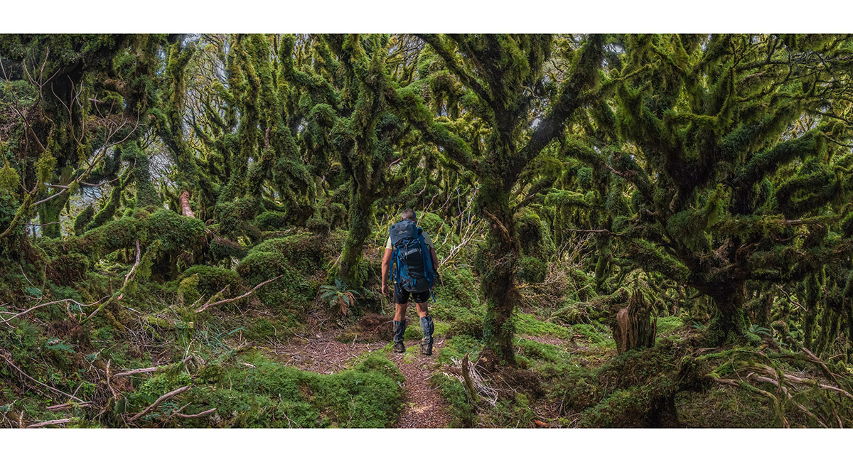
Entering goblin forest on the west side of Concertina Knob (1,106m)
A view from a peep hole in the goblin forest, west to Maungahuka (left) and north to Aokaparangi (right - in cloud)
A view from the east side of Concertina Knob, south and west to Cone Ridge (left), Neill (centre) and Winchcombe (right)
Looking northeast from the swing bridge beside Neill Forks Hut, down Hector River
Looking southwest from the swing bridge beside Neill Forks Hut, to Neill Creek (left) and Hector River (right)
Neill Forks Hut (350m) and the swing bridge
Totara Flats Hut (200m)
The swing bridge spanning Waiohine River, just north of Totara flats Hut
Read about it A trip beyond memory lane
To order a print or web resolution file of any image you see in this slide show, just right click the image, click “Copy Image URL” and paste in to the “Your message” box of our Contact Us form. Please also note, for each image, if you want a print or web resolution file. We will get back to you as soon as possible to confirm price and payment details.
Open Contact Us in a new window to paste Image URL(s) easily