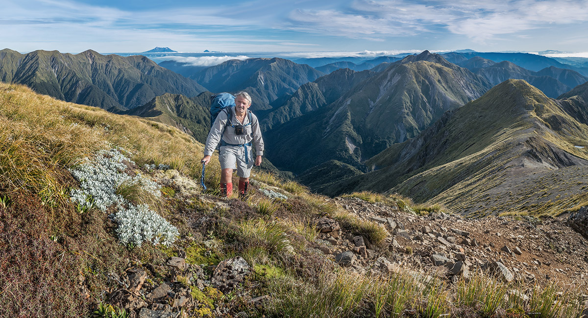
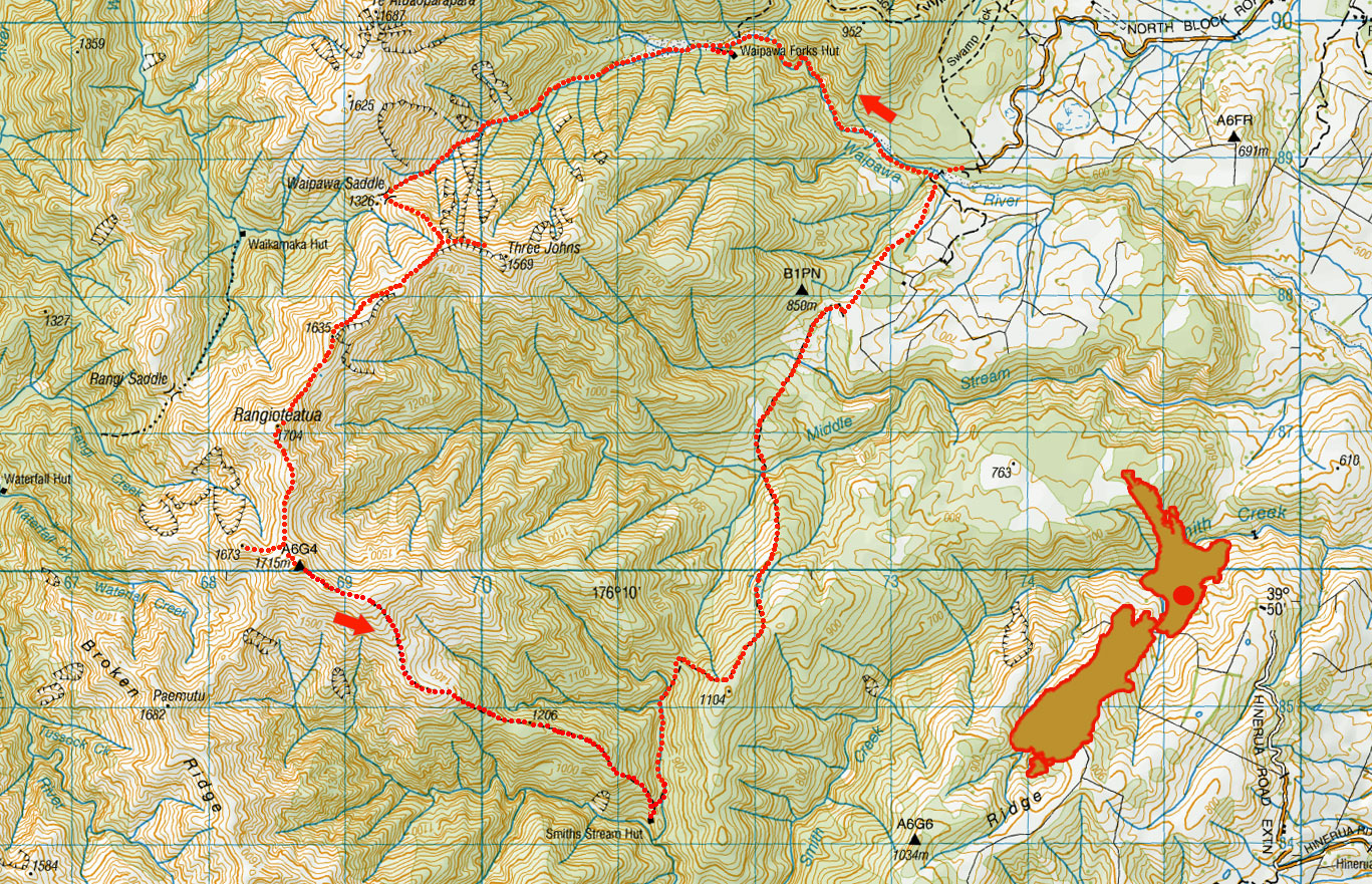
Rangioteatua circuit, April 2022
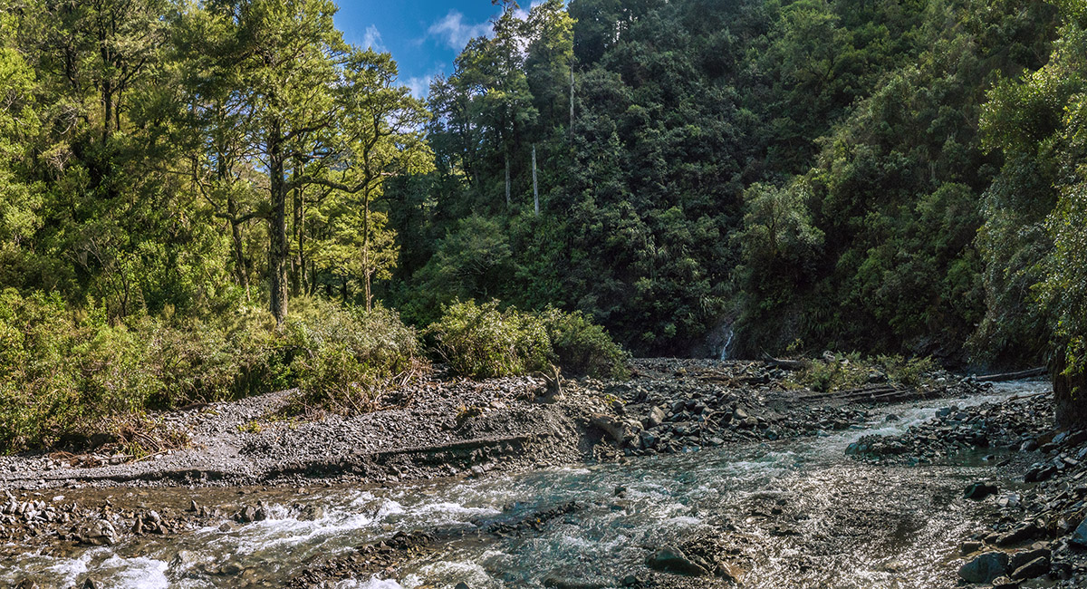
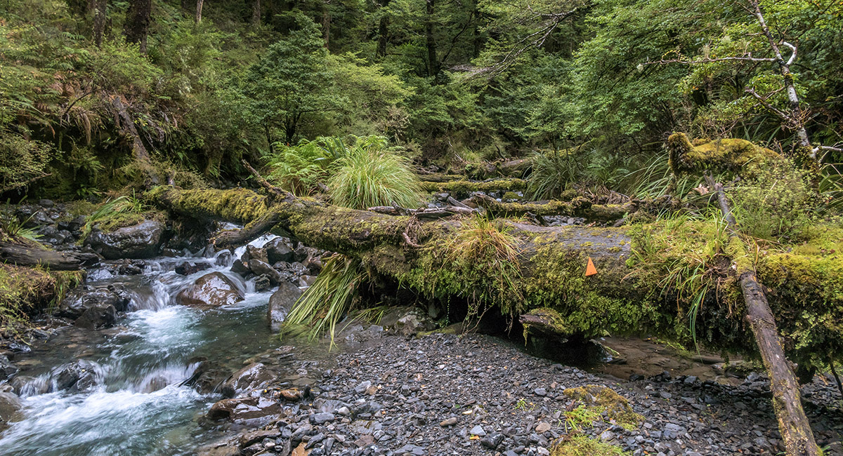
Waipawa River, not far after the trail head

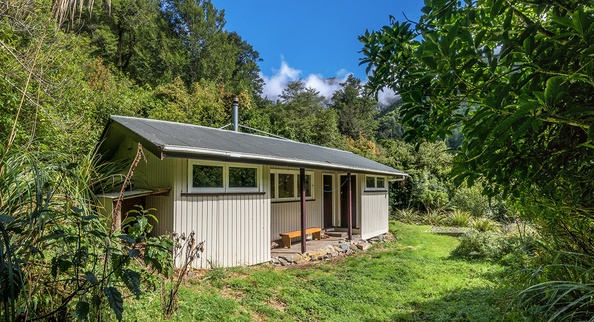
Waipawa Forks Hut (720m)

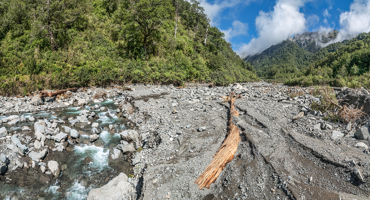
Looking west, up Waipawa River, beyond Waipawa Forks Hut

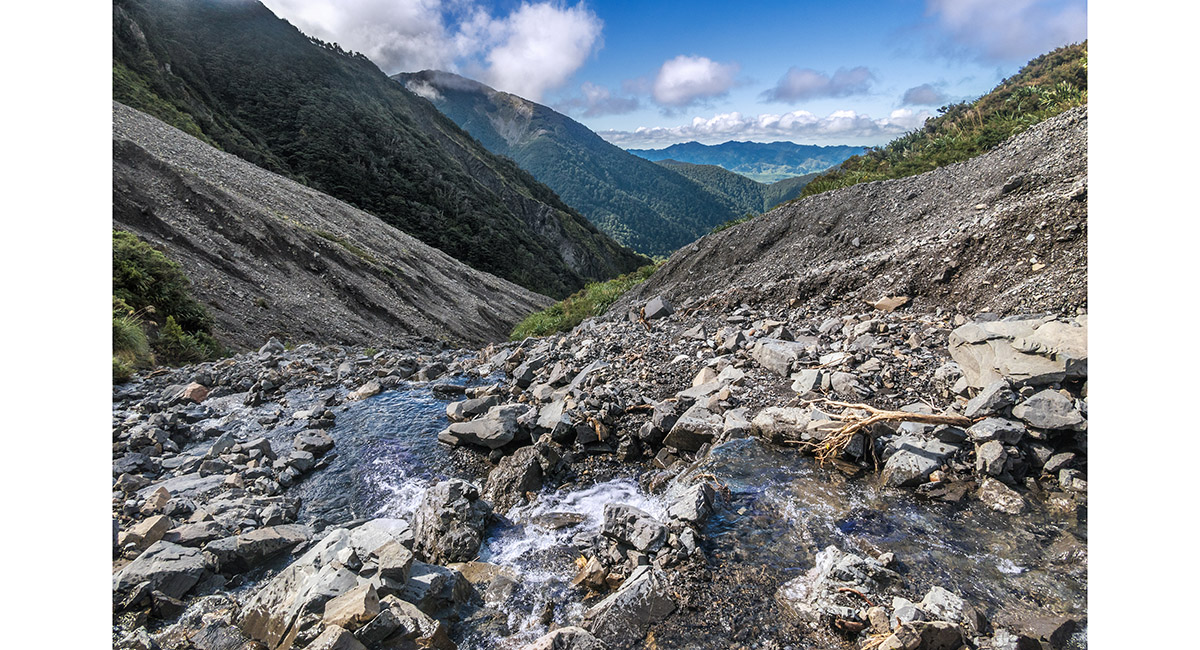
At about 1,050m, looking down Waipawa River

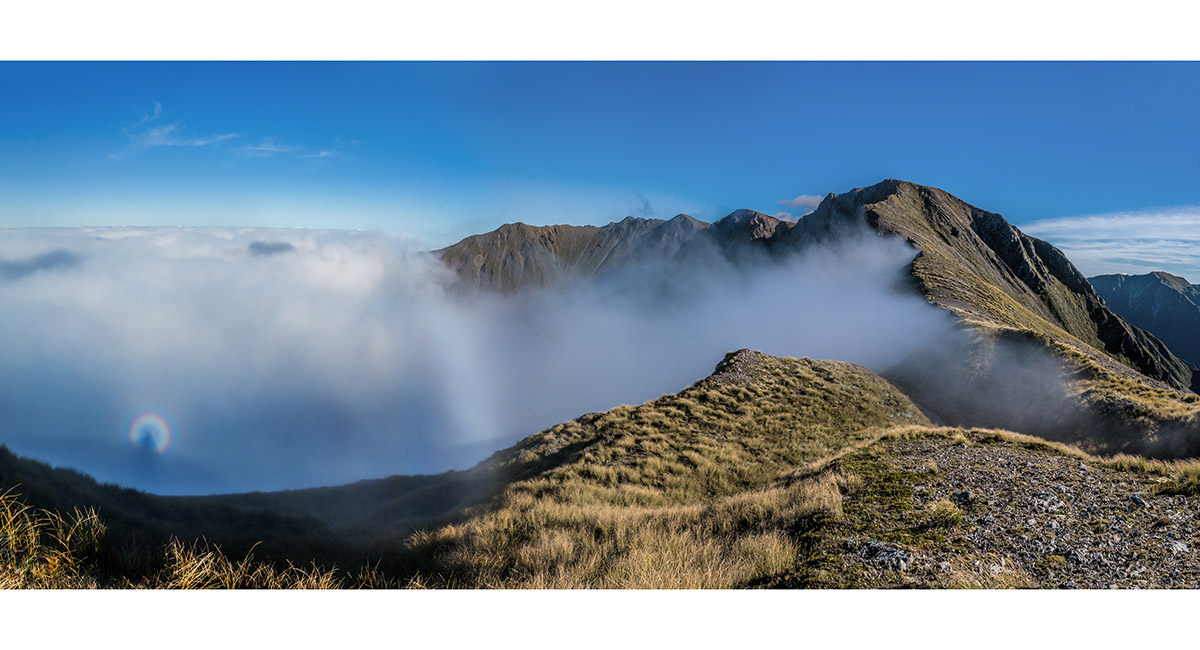
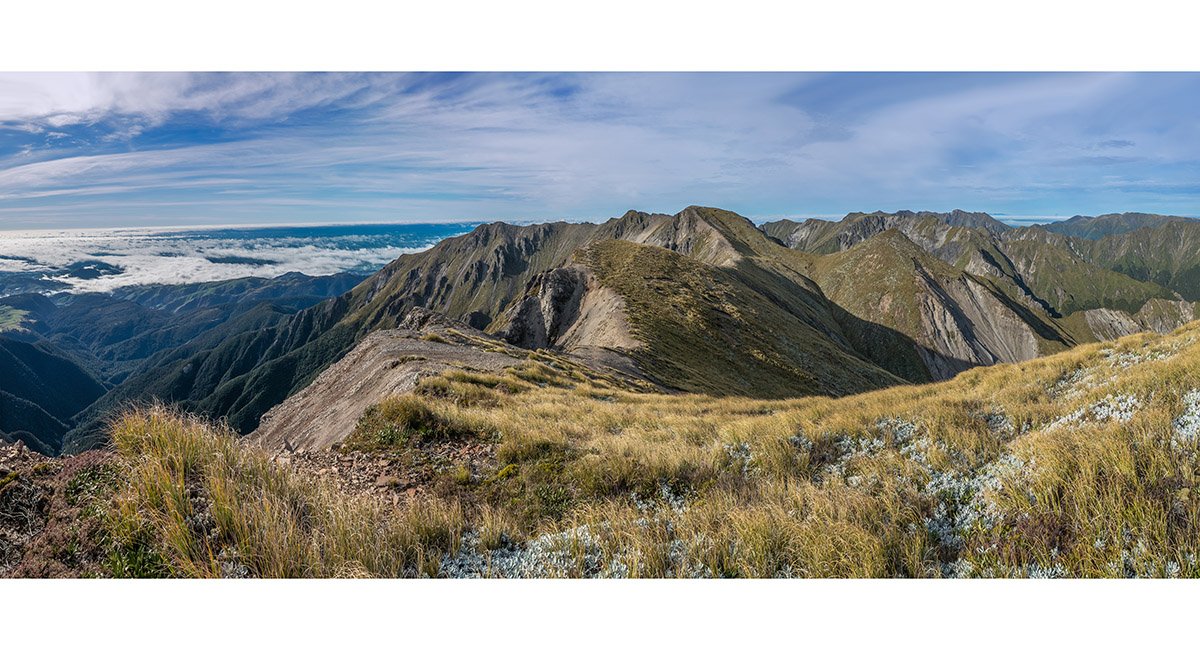
The view from Pt 1635m, southwest to Rangioteatua, with a brochen spectre far left

The view from my bivvy site, southwest to Rangioteatua, with Mangaweka and Hikurangi Range to the right

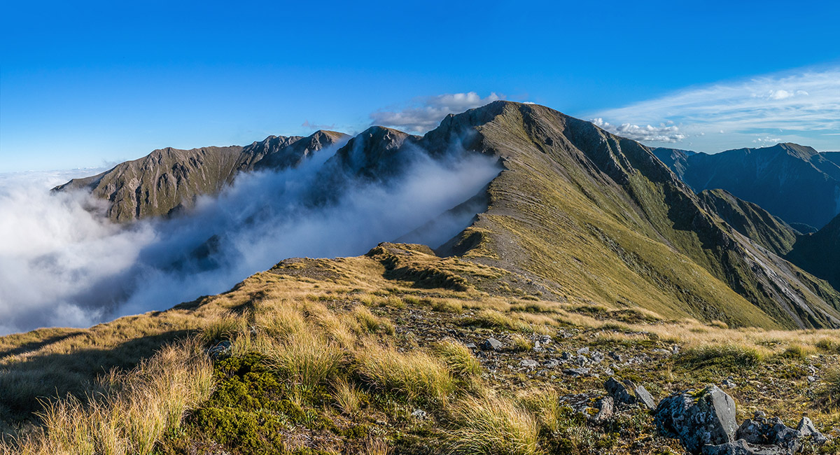
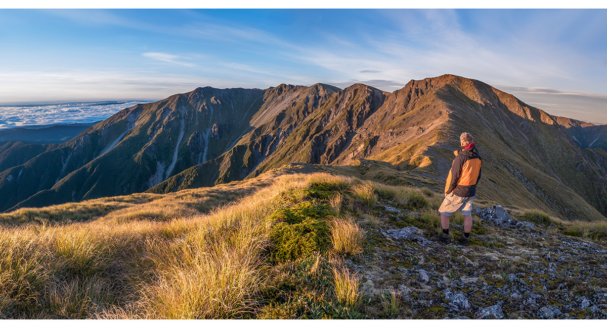
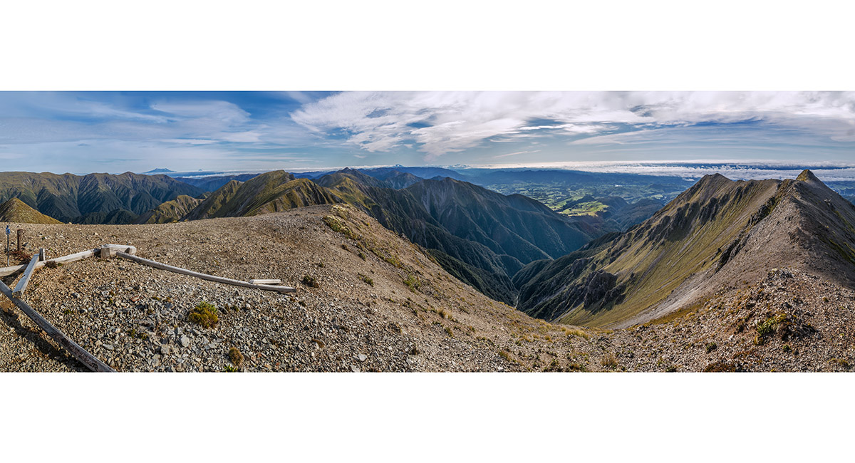
Te Atuaoparapara (1,687m, centre) and Three Johns (1,569m, far right), viewed from Pt 1635m


Three Johns (1,569m), viewed from Pt 1635m

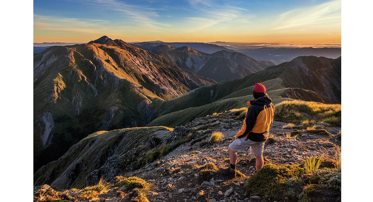
Te Atuaoparapara (1,687m), viewed from Pt 1635m

The view from Pt 1635m, southwest to Rangioteatua

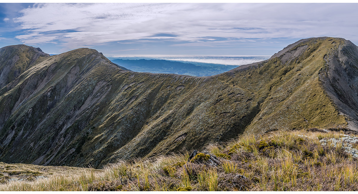
Waipawa Saddle (1,326m) and the route leading up to Te Atuaoparapara at left

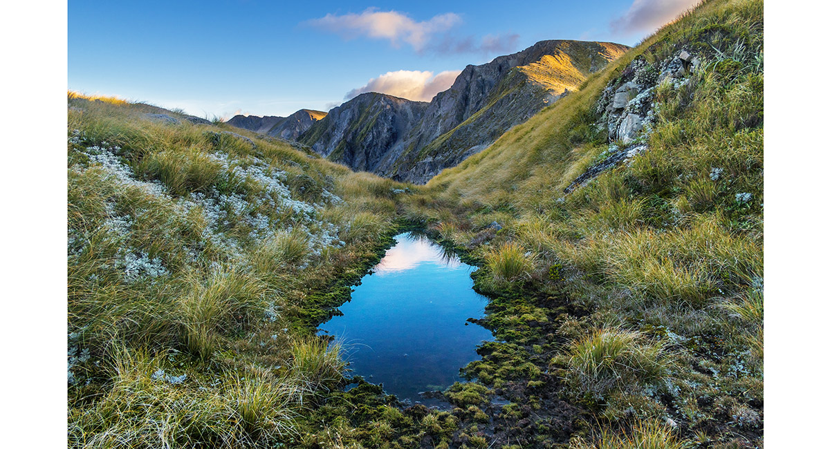
A small un-mapped tarn just beneath my bivvy site, with Rangioteatua behind

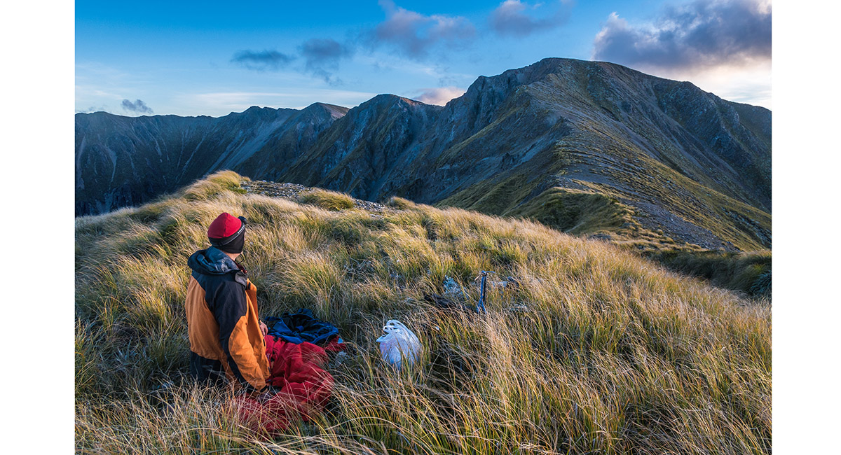
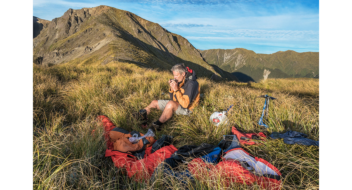
Setting up my bivvy site at 1,600m, looking southwest to Rangioteatua (1,704m)

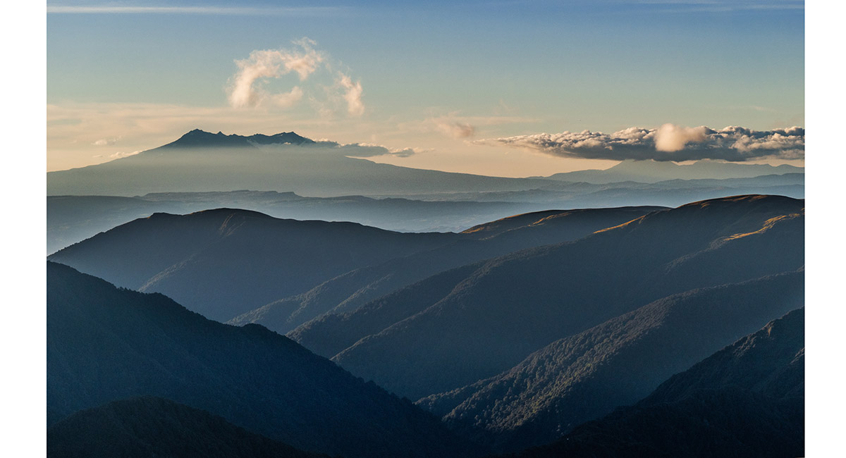
Dusk view from Pt 1635m, northwest to Ruapehu and Ngauruhoe

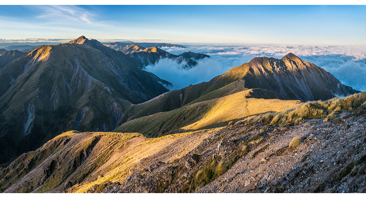
Te Atuaoparapara (1,687m, left) and Three Johns (1,569m, right) at dusk, from Pt 1635m

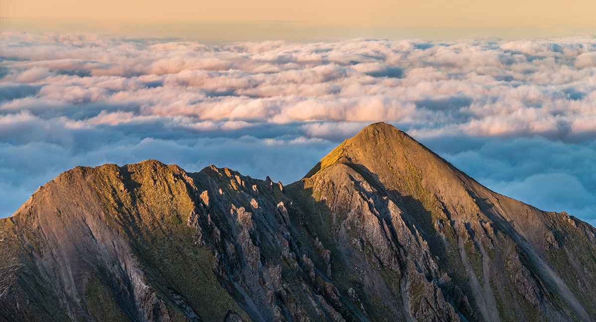
Three Johns (1,569m) at sunset, from Pt 1635m

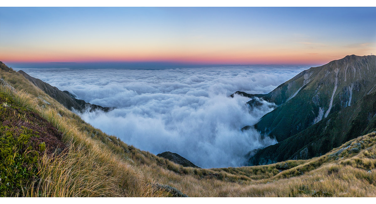
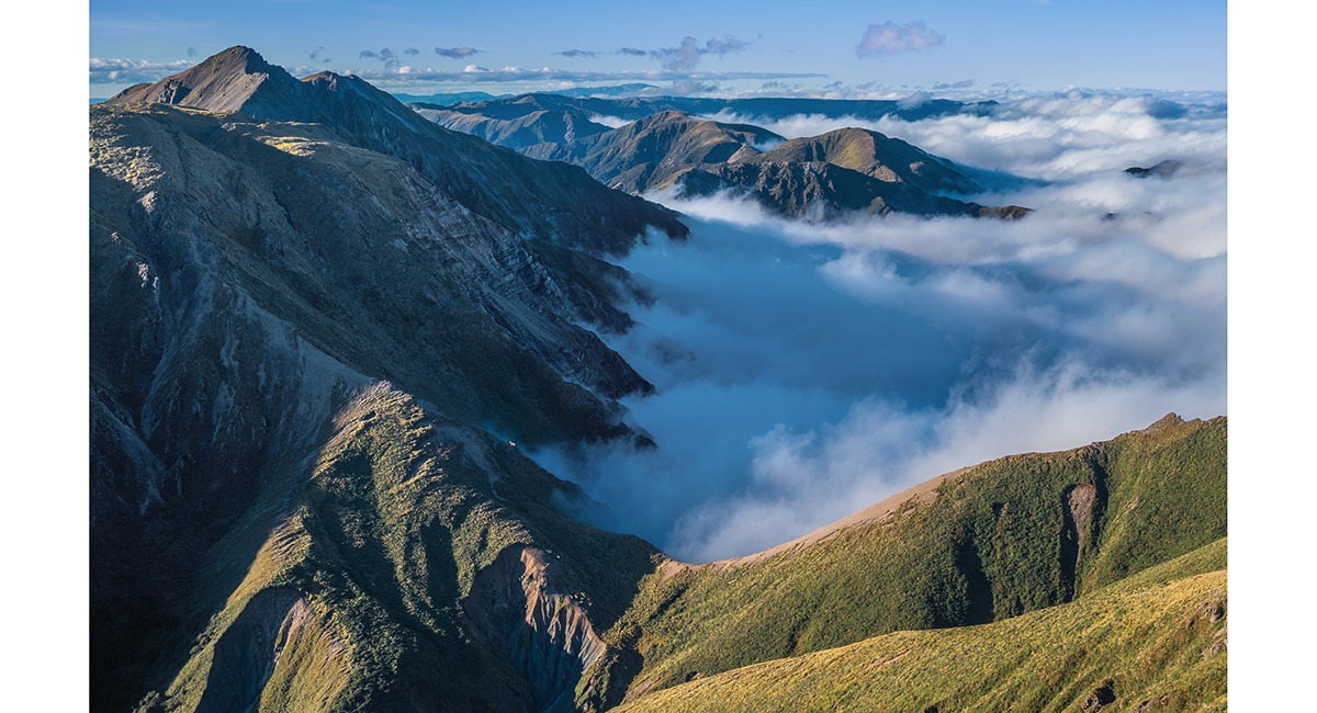
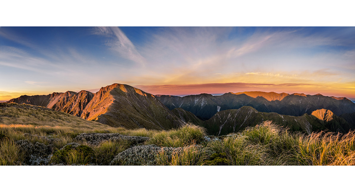
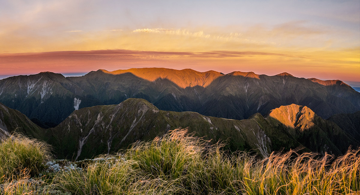
Evening cloud slowly retreats as the warmth of the day ebbs away. Here looking east

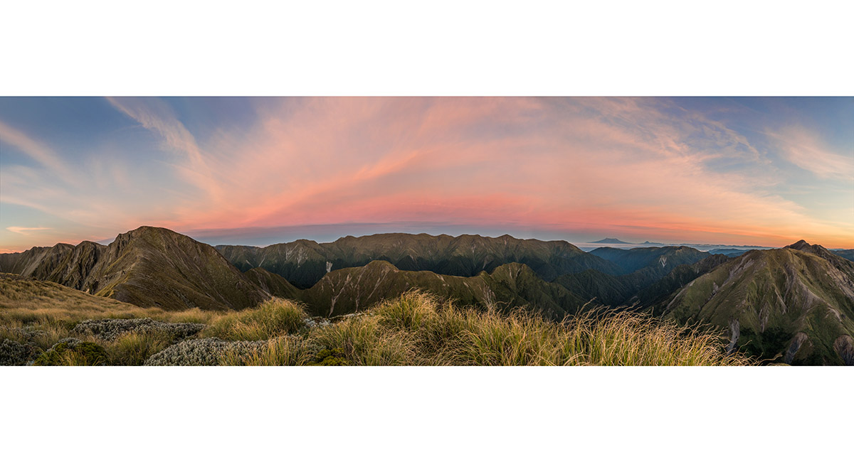
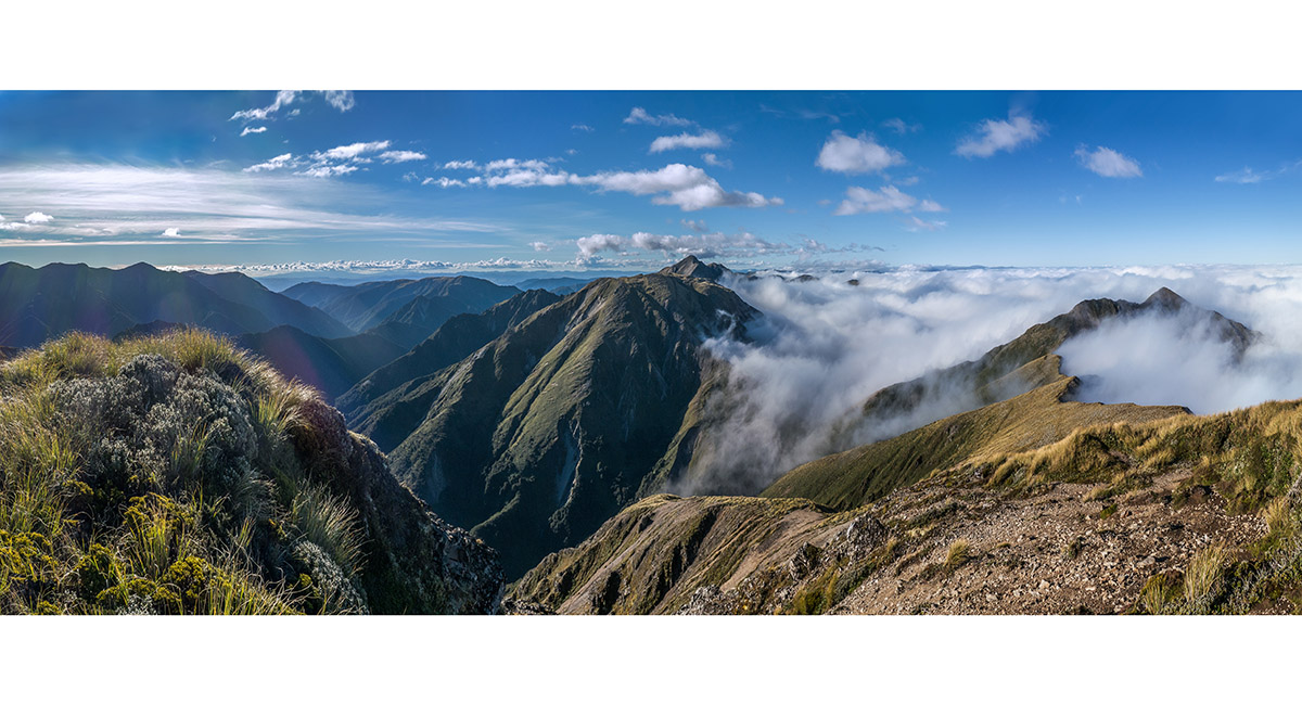
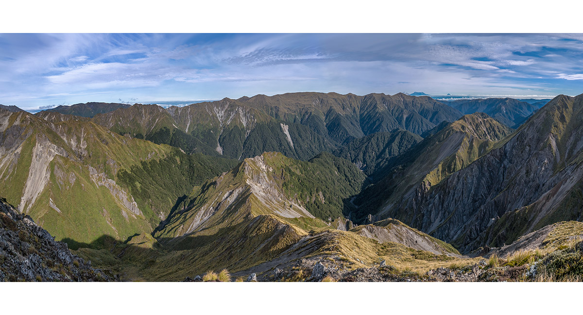
Dawn view from Pt 1635m, north to Te Atuaoparapara (far right), northwest to distant Ruapehu and Ngauruhoe, west to Mangaweka and south to Rangioteatua (left)

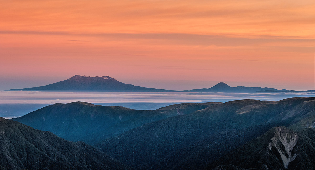
Dawn view from Pt 1635m, northwest to Ruapehu and Ngauruhoe

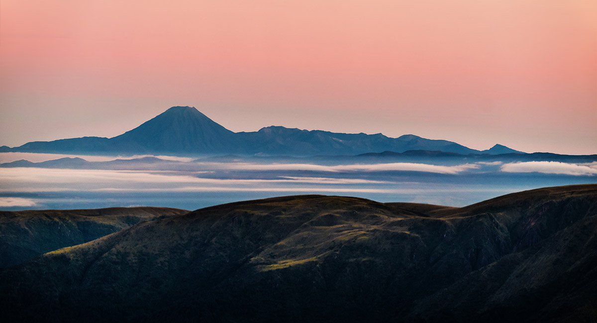
Dawn view from Pt 1635m, northwest to Ngauruhoe

Dawn view from Pt 1635m, west to Mangaweka (right) and south to Rangioteatua (left of centre)

Dawn view from Pt 1635m, west to Mangaweka

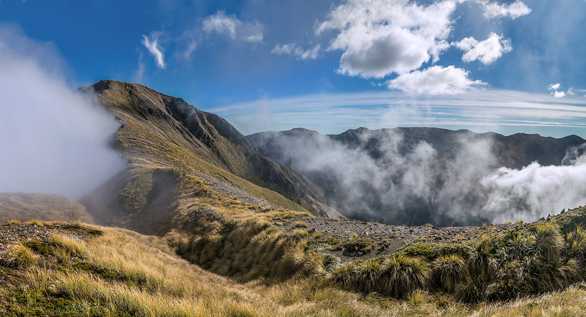
Dawn view from Pt 1635m, north to Waipawa Saddle in the dip and Te Atuaoparapara top left. The ridge leading to the high point of Three Johns is far right

Above my bivvy site on Pt 1635m, looking south to Rangioteatua, right. A6G4 (1,715m) is on the skyline centre, with the ridge leading to Smiths Stream Hut leading off it to the left

My bivvy site, with Rangioteatua top left

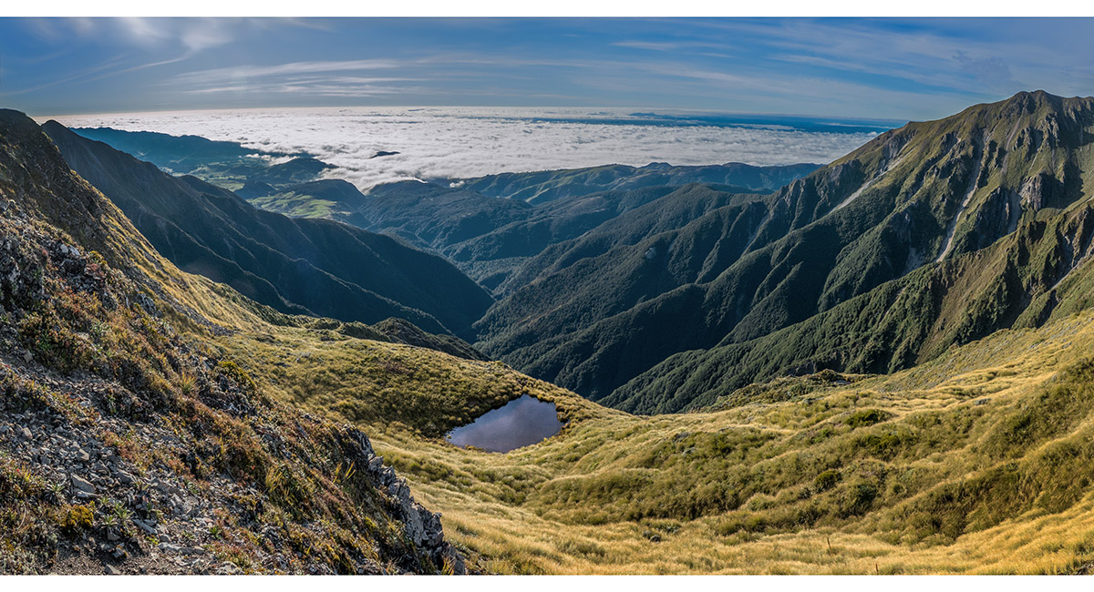
The tarn marked on the map beneath my bivvy site on the east side of the ridge

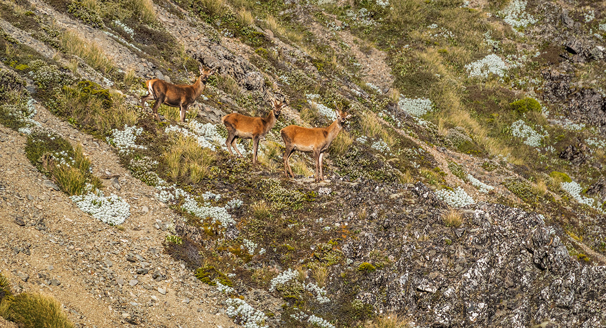
Just north of Rangioteatua these three deviated from their own climb, opting to plunge down scree slopes to the west

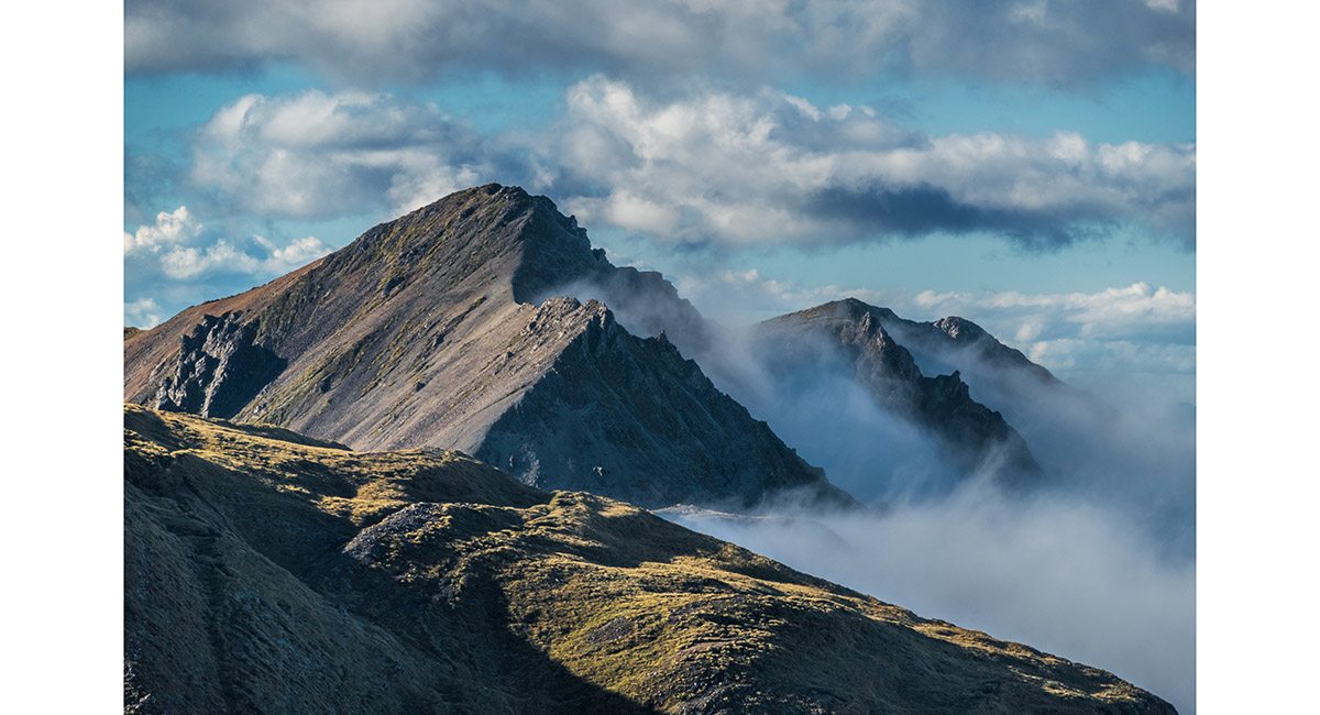
Just north of Rangioteatua. Te Atuaoparapara is the black pyramid right of centre skyline

The view south from Rangioteatua to A6G4 (1,715m). After the dip on the right is Pt 1673m

The view from A6G4 (1,715m), to Mangaweka, Hikurangi and distant Ruapehu (left). My bivvy site is left of centre, with Te Atuaoparapara on the skyline. Three Johns is centre. On the right is the ridge leading out of picture far right to Smiths Stream Hut


The view south from A6G4 (1,715m), over Broken Ridge to Ohuinga (1,686m)

The view east from Pt 1673m, back to A6G4 (1,715m), and north to Rangioteatua (1,704m, far left)

The view west from Pt 1673m, to Mangaweka and Hikurangi Range


At about 1600m, looking south east down the route to Smiths Stream Hut

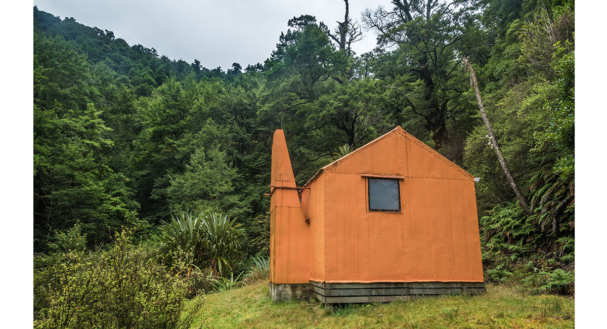
Smiths Stream Hut (800m)

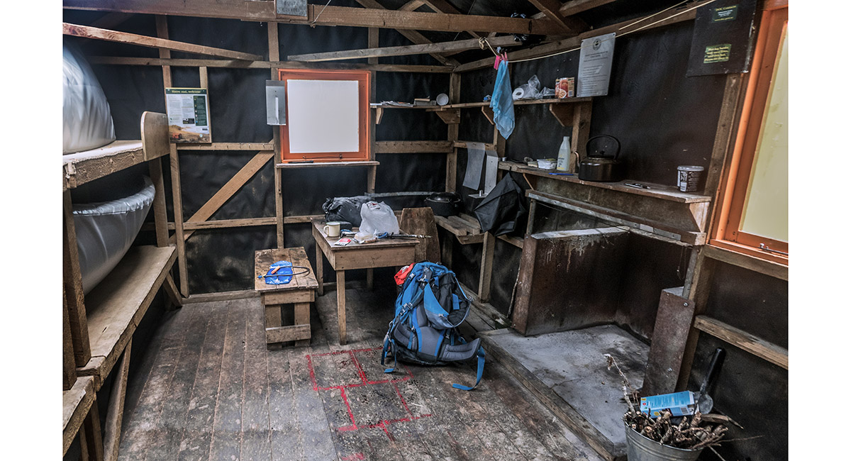
Inside Smiths Stream Hut

Looking north, up Smith Creek

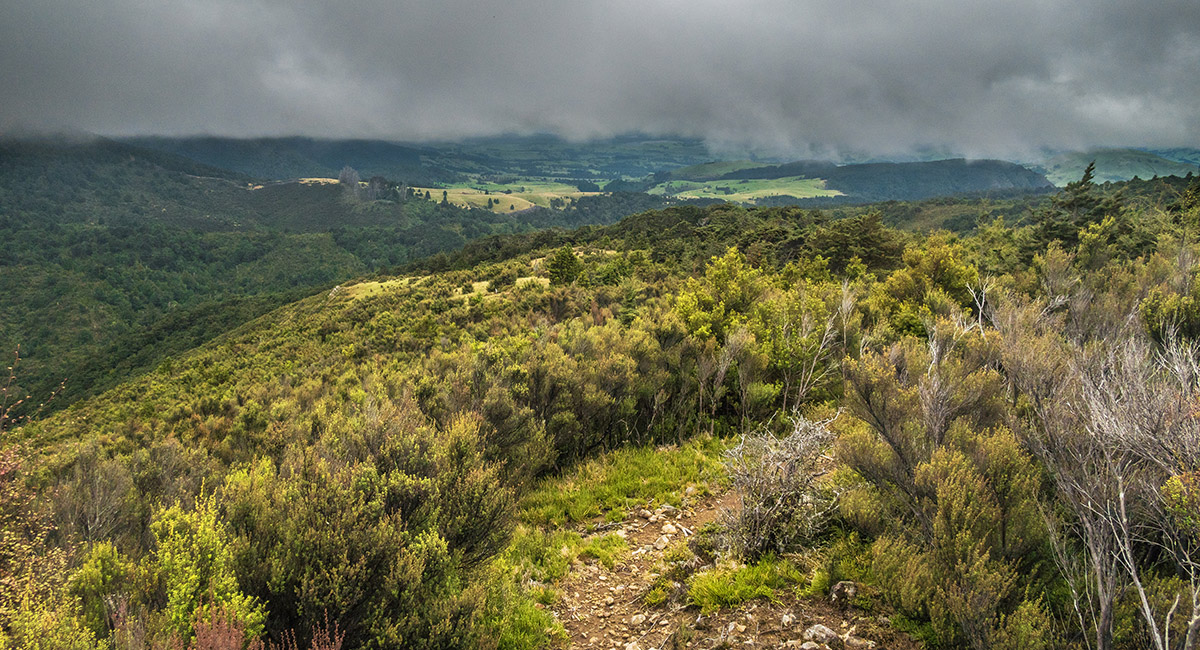
The view north from about 900m, south of Middle Stream

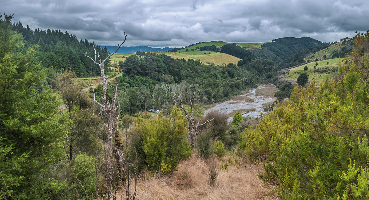
At about 650m, looking east to the trail head and Waipawa River

Read about it Worth sweating for #16 NZ Photographer Aug 22
To order a print or web resolution file of any image you see in this slide show, just right click the image, click “Copy Image URL” and paste in to the “Your message” box of our Contact Us form. Please also note, for each image, if you want a print or web resolution file. We will get back to you as soon as possible to confirm price and payment details.
Open Contact Us in a new window to paste Image URL(s) easily