Mountain landscapes – NZ South Island
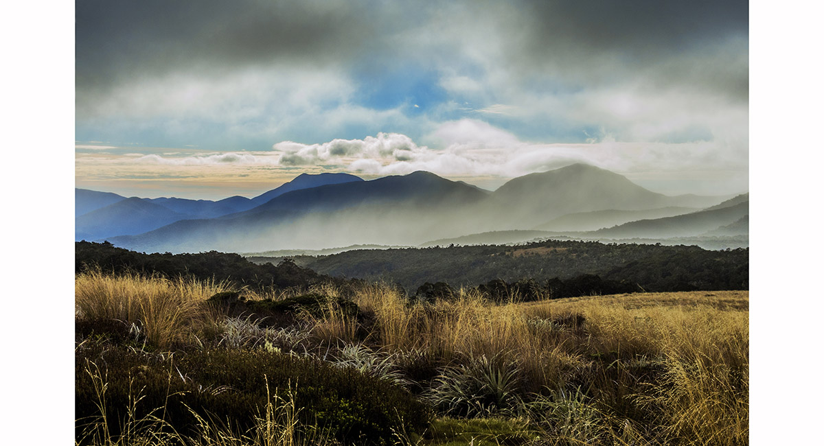
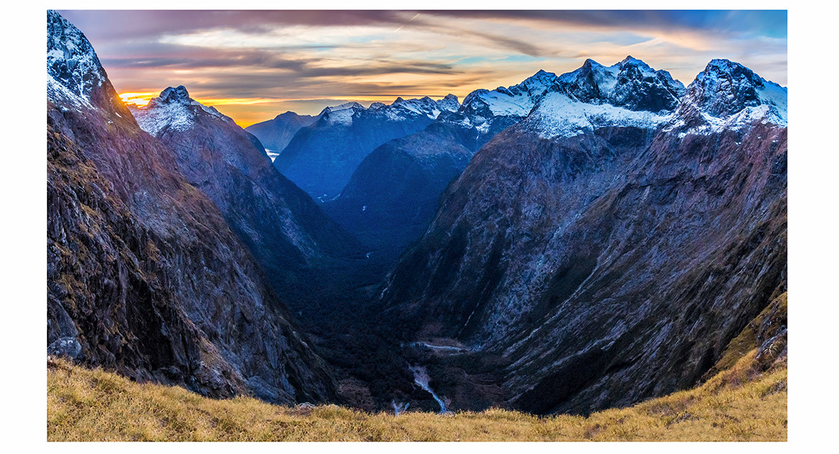
View east from Starvation Ridge (1,200m) to the Arthur Range, Kahurangi National Park


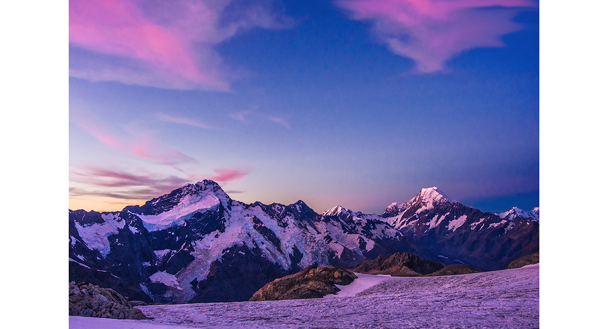
Sunset view north and east, from near Balloon Hut, Kahurangi National Park

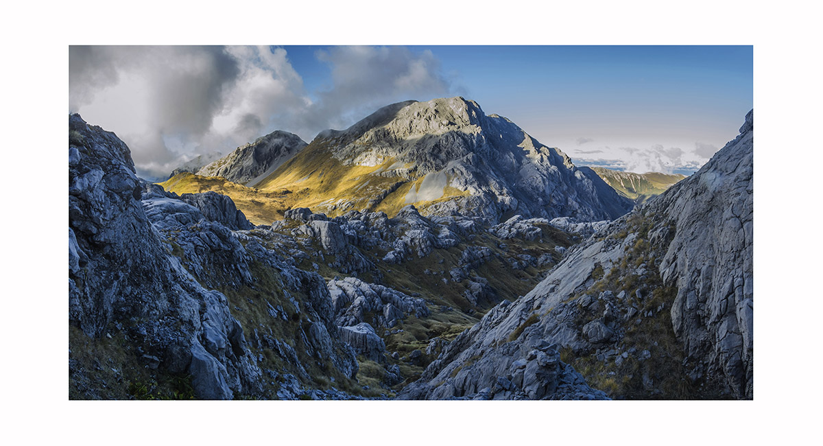
Mt Bell bathed in dusk light, Kahurangi National Park

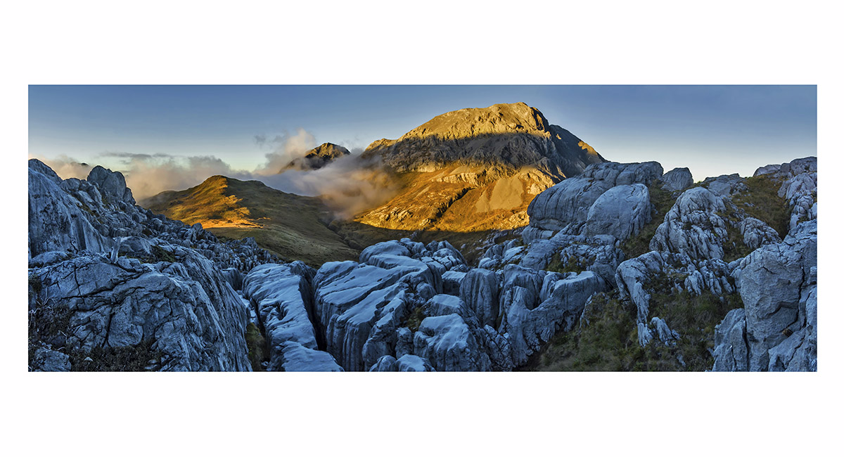
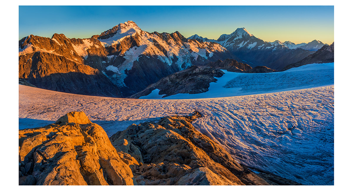
Mt Bell, from about 1,600m on Mt Owen, Kahurangi National Park

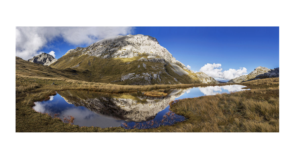
Mount Bell, reflected in a tarn, Kahurangi National Park

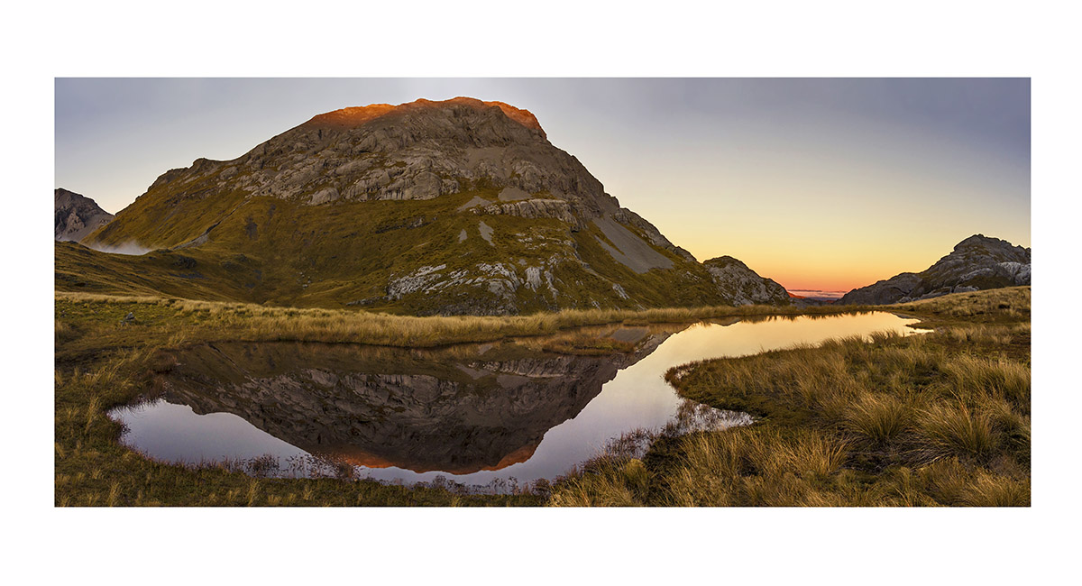
Mount Bell, reflected in a tarn at dusk, Kahurangi National Park

View northwest, from about 110m, above Richmond, to Mount Arthur (right - 1,795m) and the Twins (left - 1,809 and 1,796m)

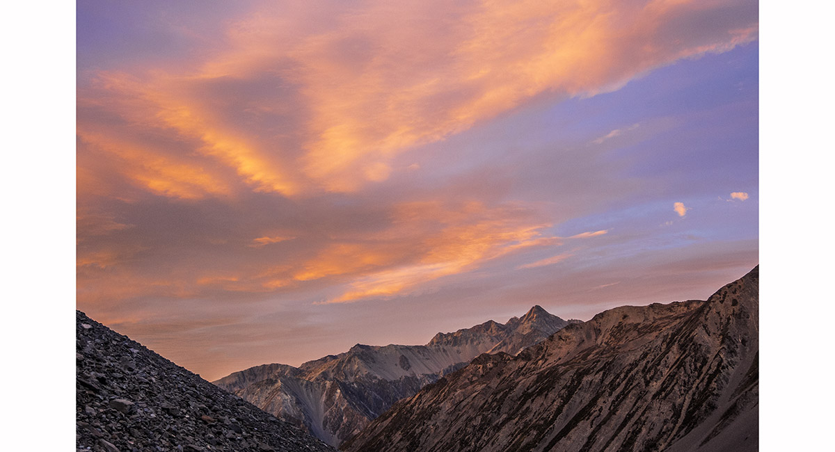
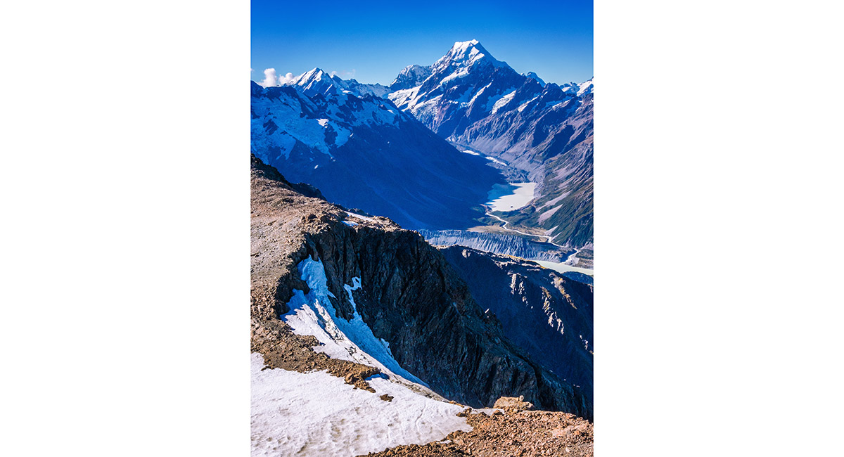
Dawn view looking south west to Mount Alba (2,360m), from the scree slope beneath the South West Ridge of Cloudy Peak (2,403m), Canterbury

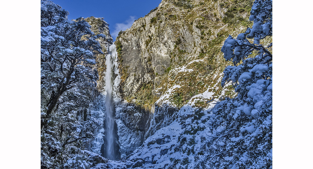
The Punchbowl, Arthurs Pass

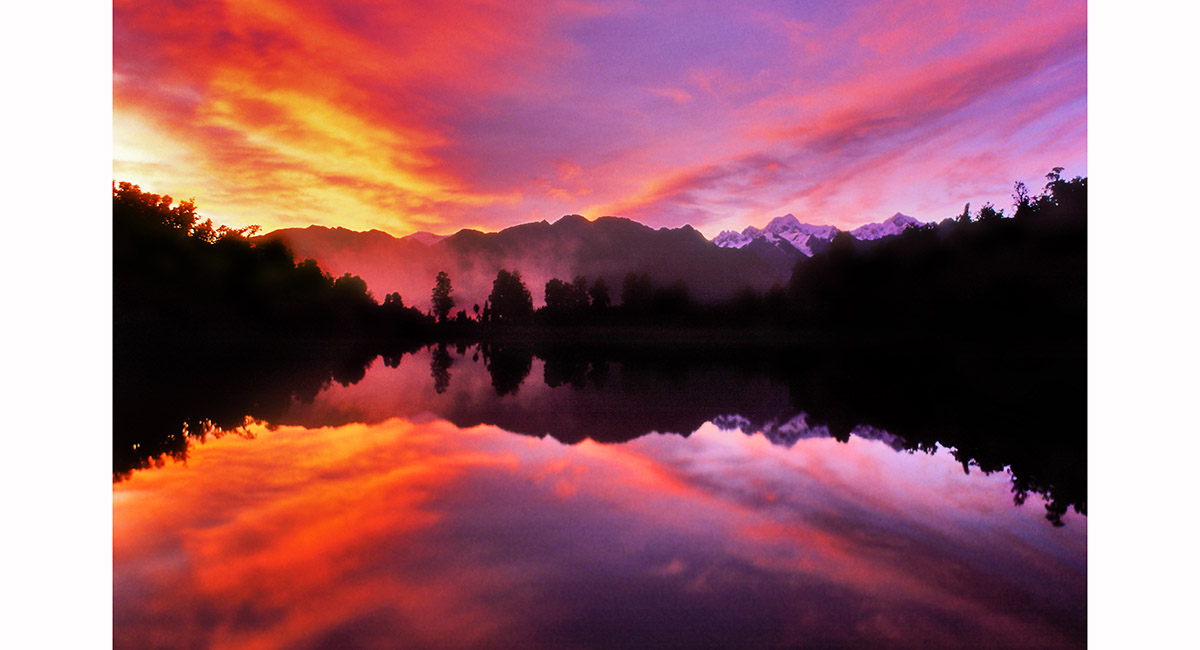
Mounts Cook and Tasman, seen from Lake Matheson at dawn

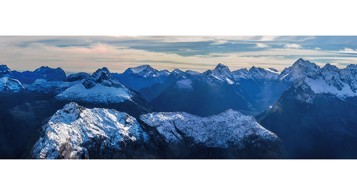
The main divide, from Mount Mallory on the left to Mount Tasman on the right, West Coast

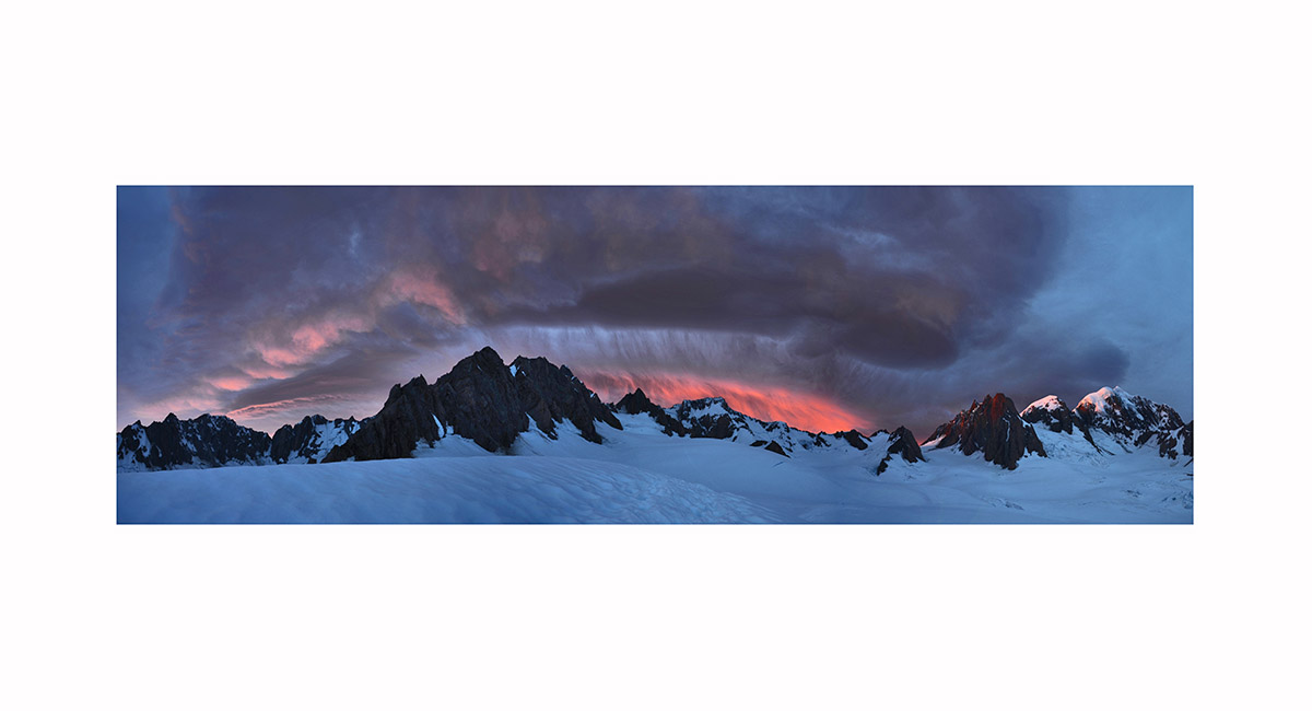
At dawn, from left - Grey Peak (2,882m), Pioneer Pass (2,759m), Mounts Haast (3,114m), Lendenfeld (3,194m) and Tasman (3,497m), West Coast

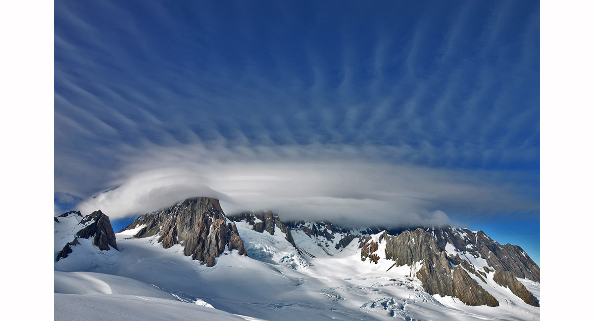
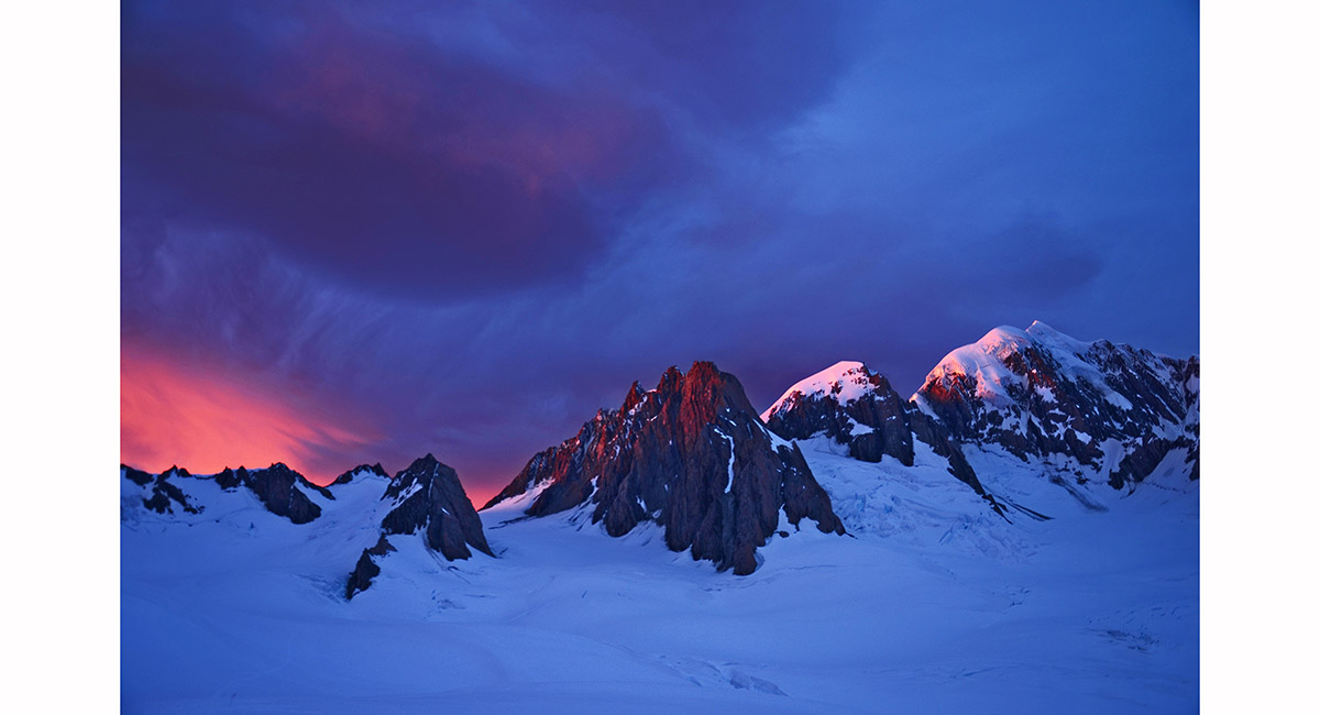
Hogsback and cirrus clouds over Mount Tasman, West Coast


Omarama Lake, MacKenzie Country

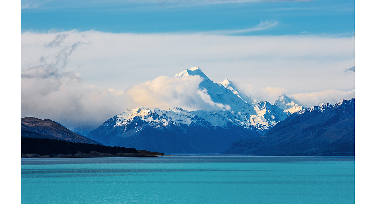
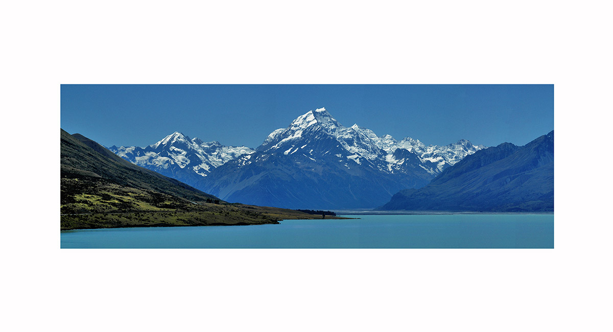
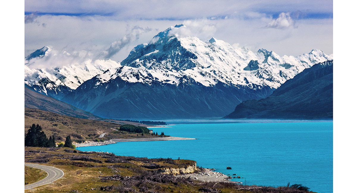
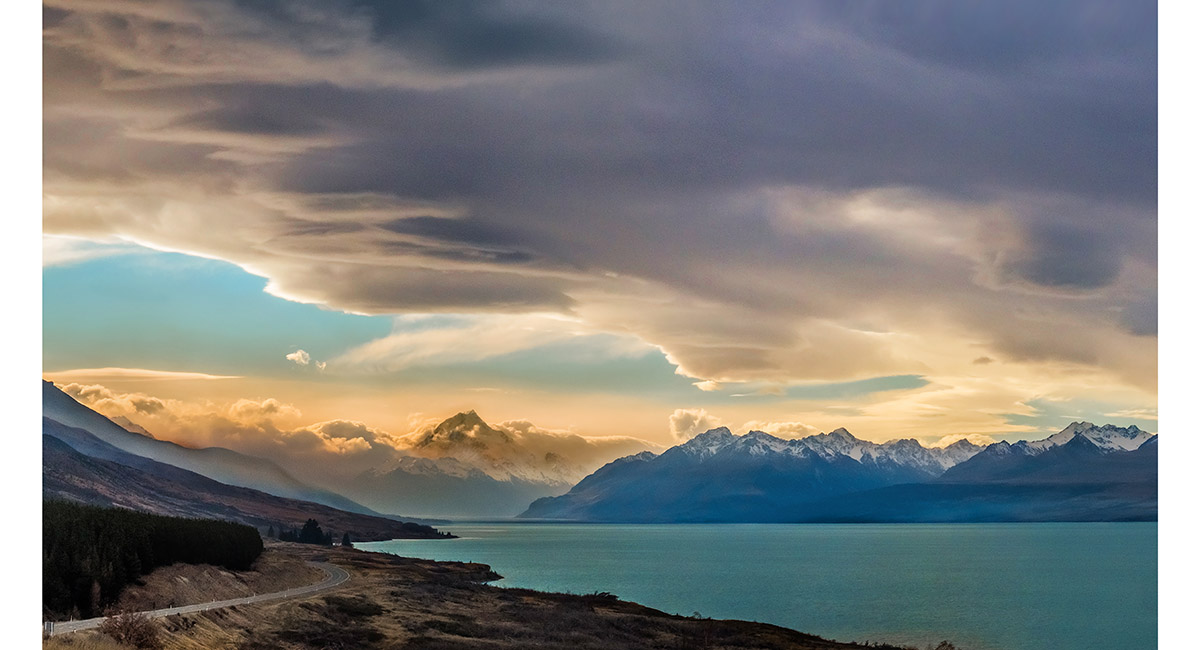
Aoraki Mount Cook, viewed from the far side of Lake Pukaki

Mount Sefton - left, Mt Hicks - peeking from the left shoulder of Aoraki Mount Cook at centre. Right of Aoraki, from left - Mounts Tasman, Lendenfeld, Haast, Haidinger, Douglas and Elie De Beaumont

Aoraki Mount Cook from Peter's Point, on the approach to Mount Cook Village

Aoraki Mount Cook, viewed on the approach to the Village

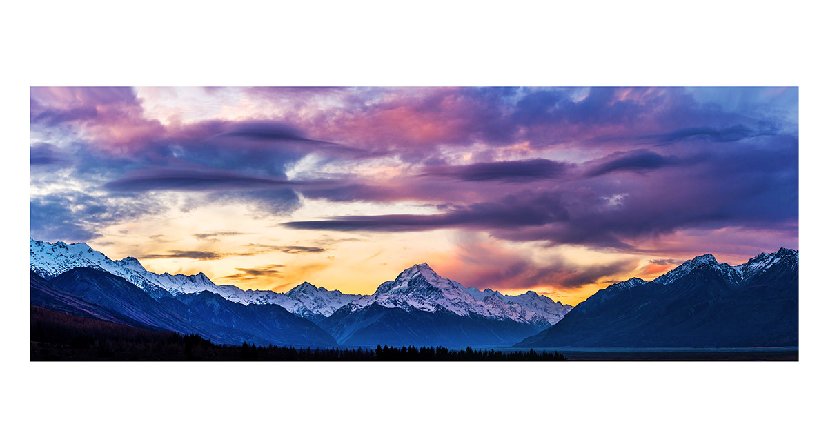
Aoraki Mount Cook and Lake Pukaki at sunset


Aoraki Mount Cook and Lake Pukaki at sunset

Aoraki Mount Cook at sunset

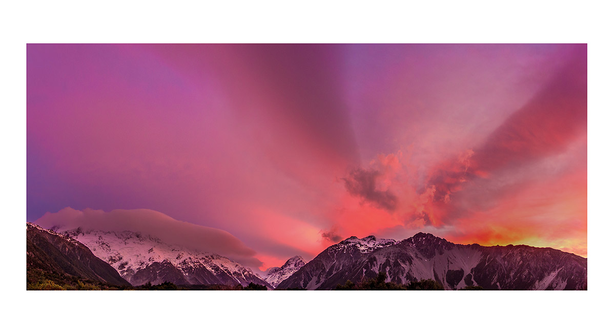
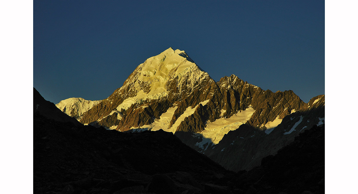
Aoraki Mount Cook at sunset, viewed from near the Hermitage

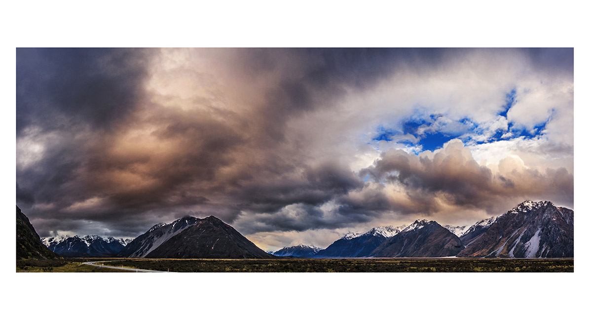
Brooding clouds slowly roll past on the evening before our climb, the view east from Unwin Lodge at dusk, Mt Cook National Park

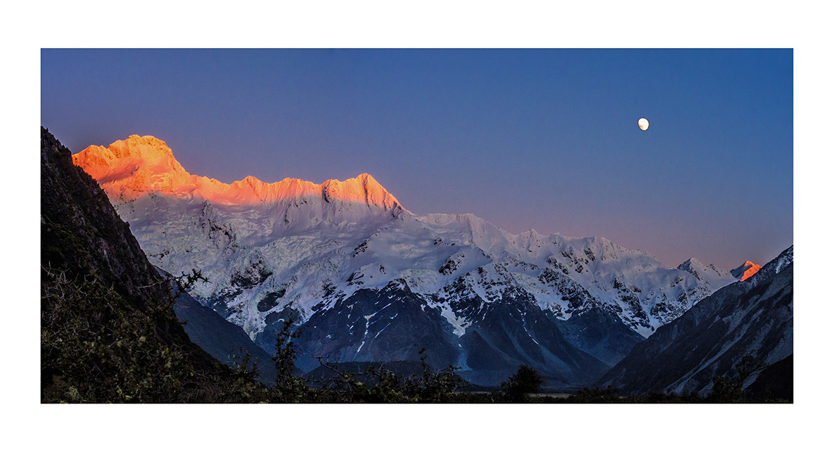
Mount Sefton and the Footstool are bathed in dawn alpenglow as the super moon descends, Mt Cook National Park


From left, Mt Sefton, the Footstool and Aoraki Mt Cook at dawn

Aoraki Mt Cook and Mt Hicks at dawn

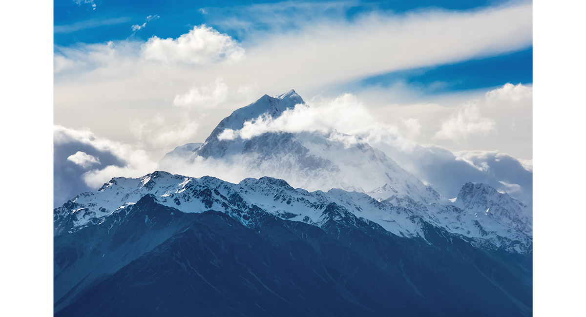
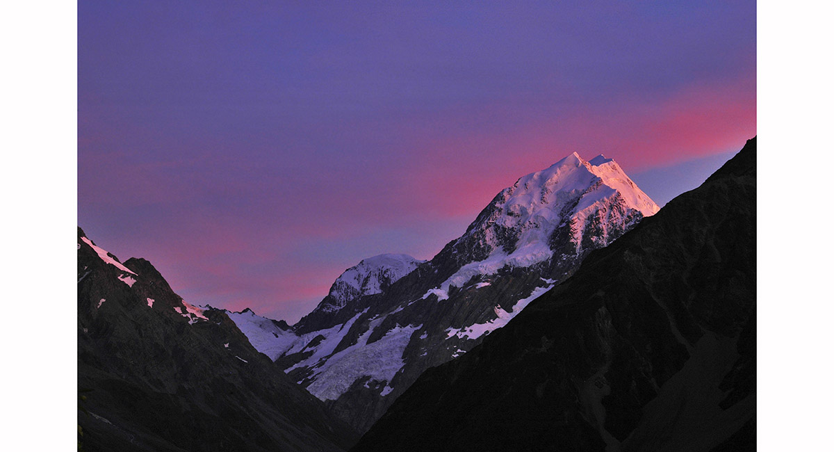
Aoraki Mt Cook at dusk


At sunset - Mt Hicks and Aoraki Mt Cook, viewed from Mueller Hut > North Island landscapes > Roof of the World landscapes

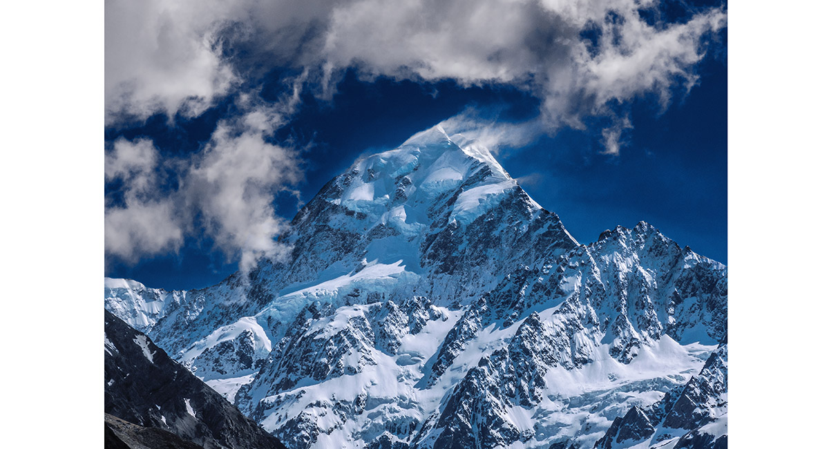
The south face of Aoraki Mt Cook, from Kea Point

Aoraki Mount Cook, viewed from Annette Plateau, Mount Cook National Park

Dusk view of Mounts Sefton, Footstool, La Perouse, Hicks, Cook and the Minarets, viewed from Annette Plateau, Mount Cook National Park


Dusk view of La Perouse, Hicks, Cook, the Minarets and Elie De Beaumont, viewed from Annette Plateau, Mount Cook National Park


Dawn view of Mounts Sefton, Footstool, La Perouse, Hicks, Cook, the Minarets and Elie De Beaumont, viewed from Annette Plateau, Mount Cook National Park


The suns first rays strike Mounts Sefton, Footstool, Cook, the Minarets and Elie De Beaumont. La Perouse and Hicks remain in shadow. Viewed from Annette Plateau, Mount Cook National Park

The suns first rays strike Mounts Sefton, Footstool, Cook, the Minarets and Elie De Beaumont. La Perouse and Hicks remain in shadow. Viewed from Annette Plateau, Mount Cook National Park


Dawn on Annette Plateau, Mount Cook National Park

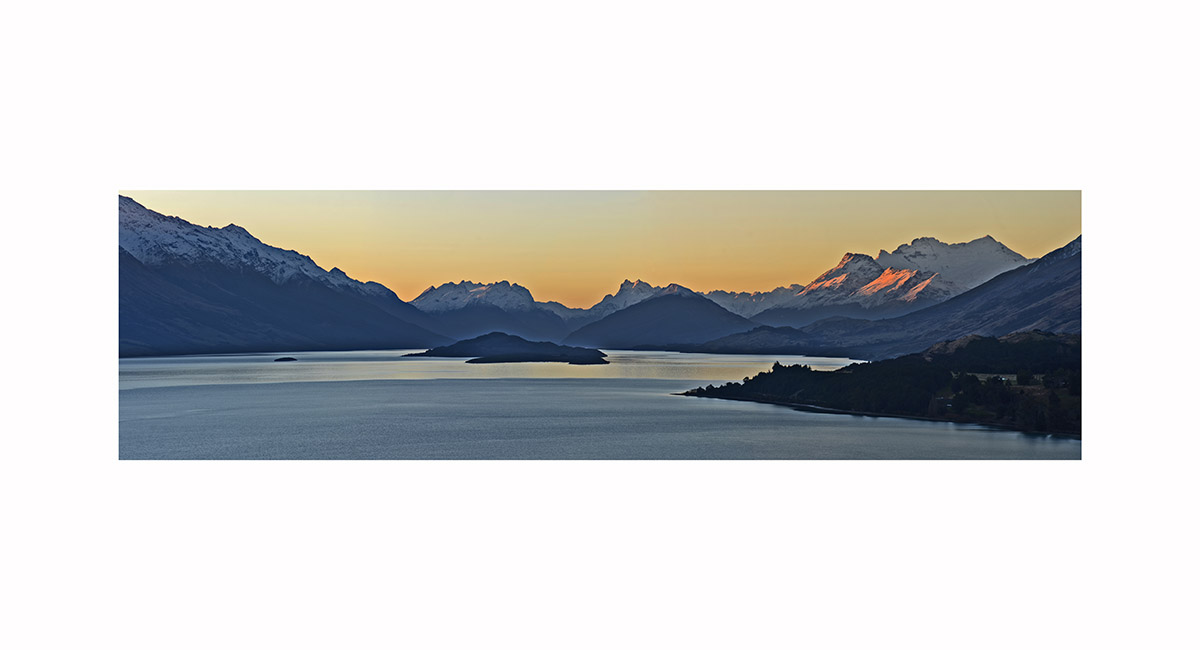
Looking north to Glenorchy and Mt Earnslaw, dusk, Central Otago

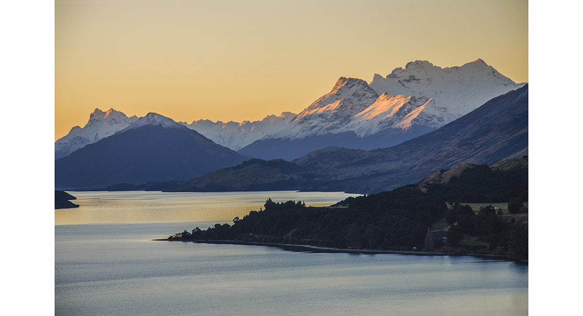
Looking north to Glenorchy and Mt Earnslaw, dusk, Central Otago

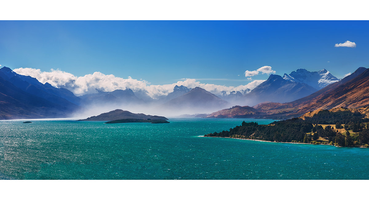
Looking north to Glenorchy and Mt Earnslaw, afternoon

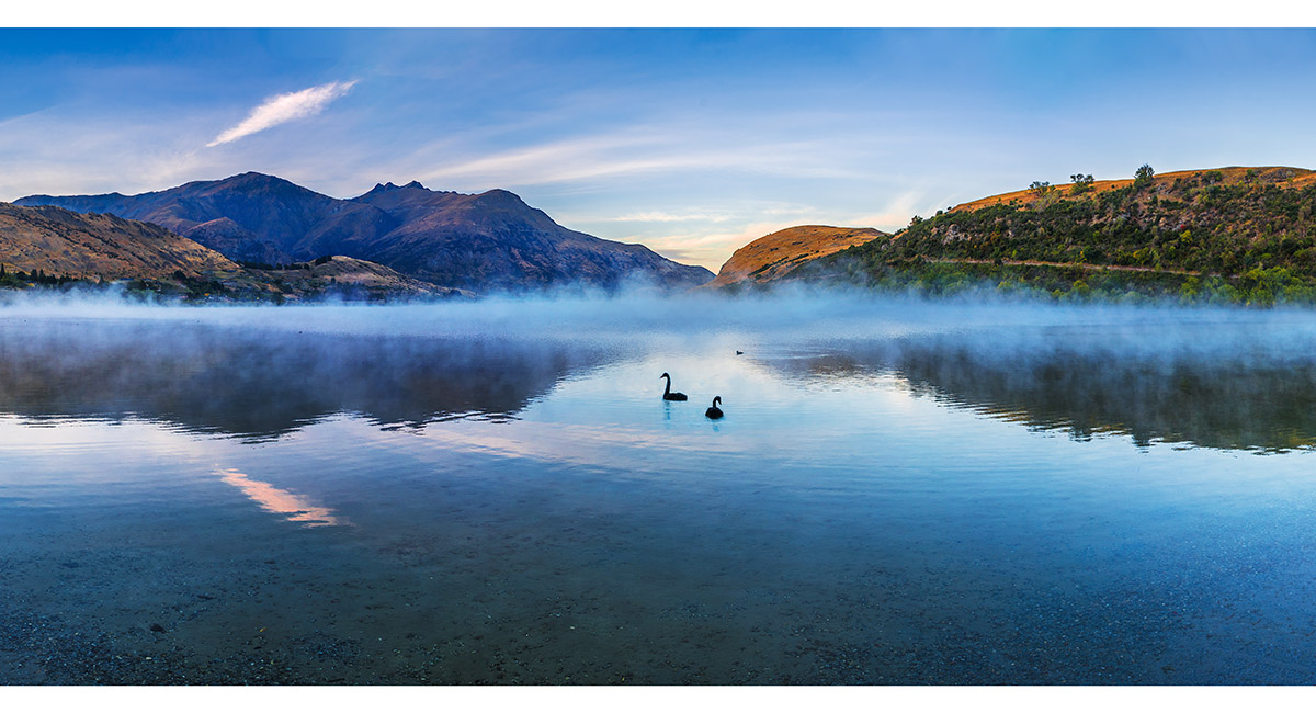
Dawn at the north western end of Lake Hayes, March


Dawn at the north western end of Lake Hayes, March

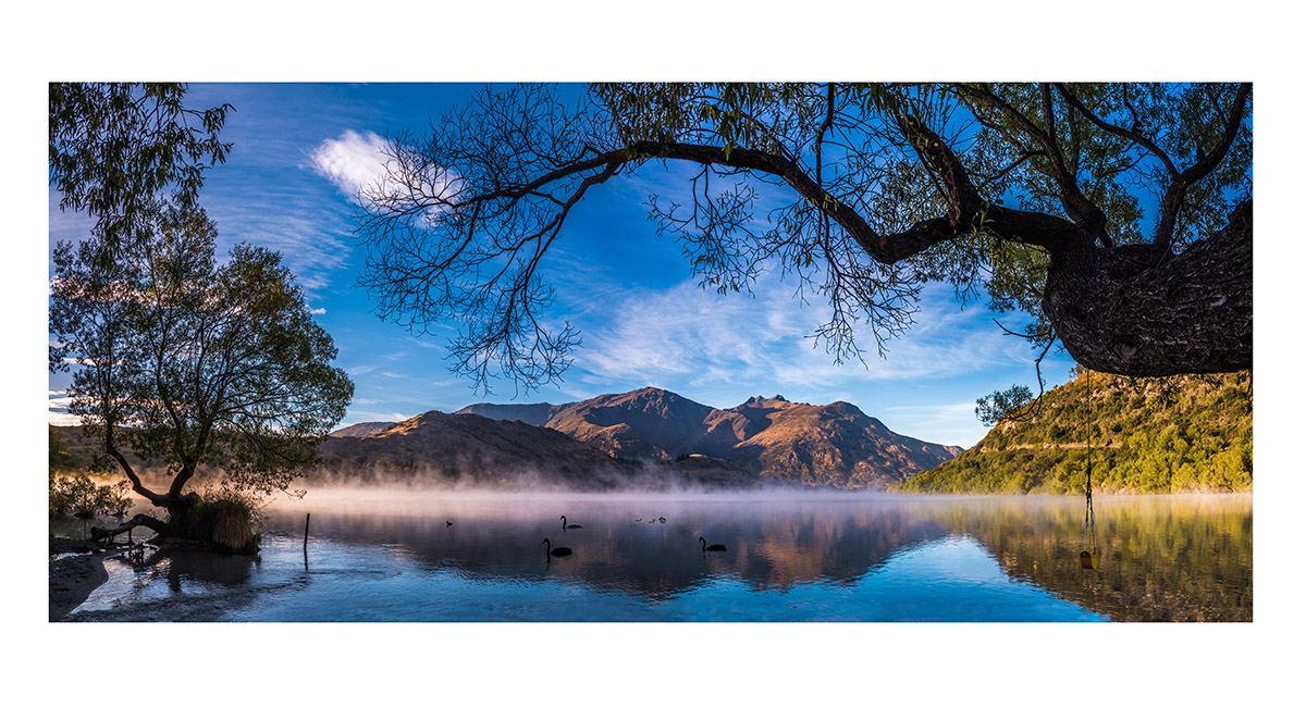
Dawn at the north western end of Lake Hayes, March

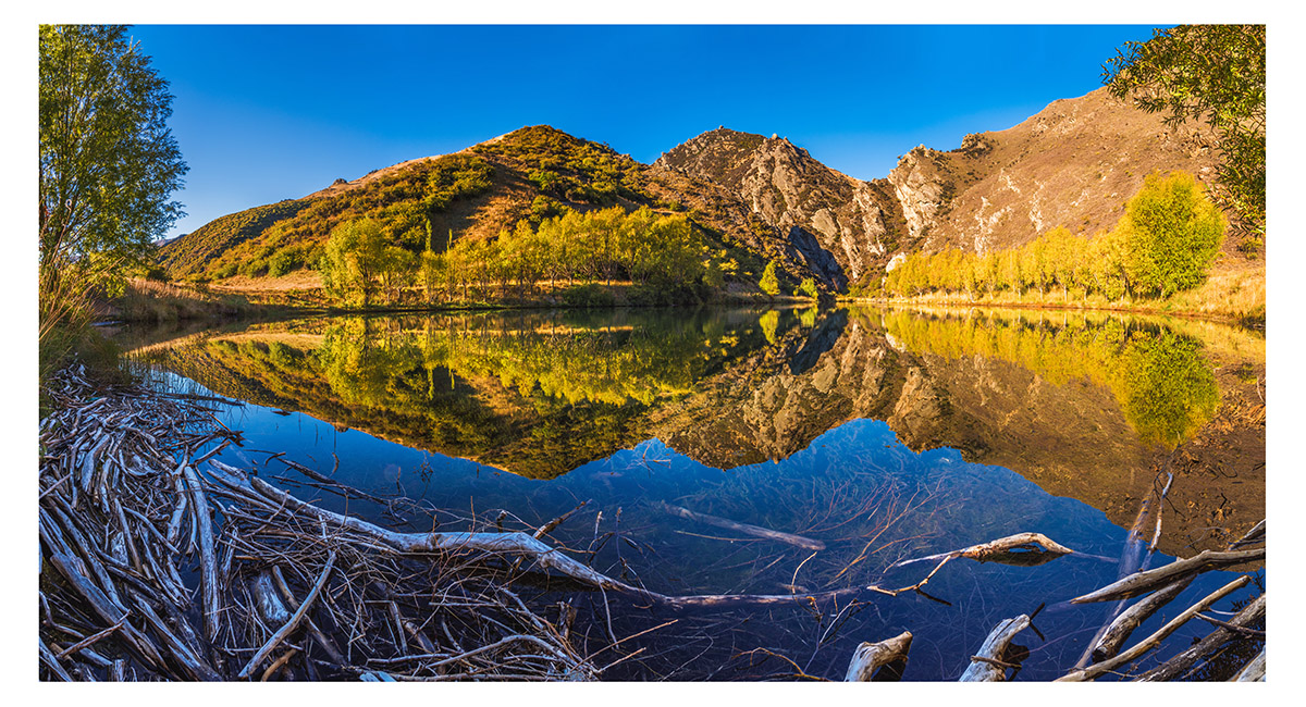
A small lake between Cromwell and Clyde

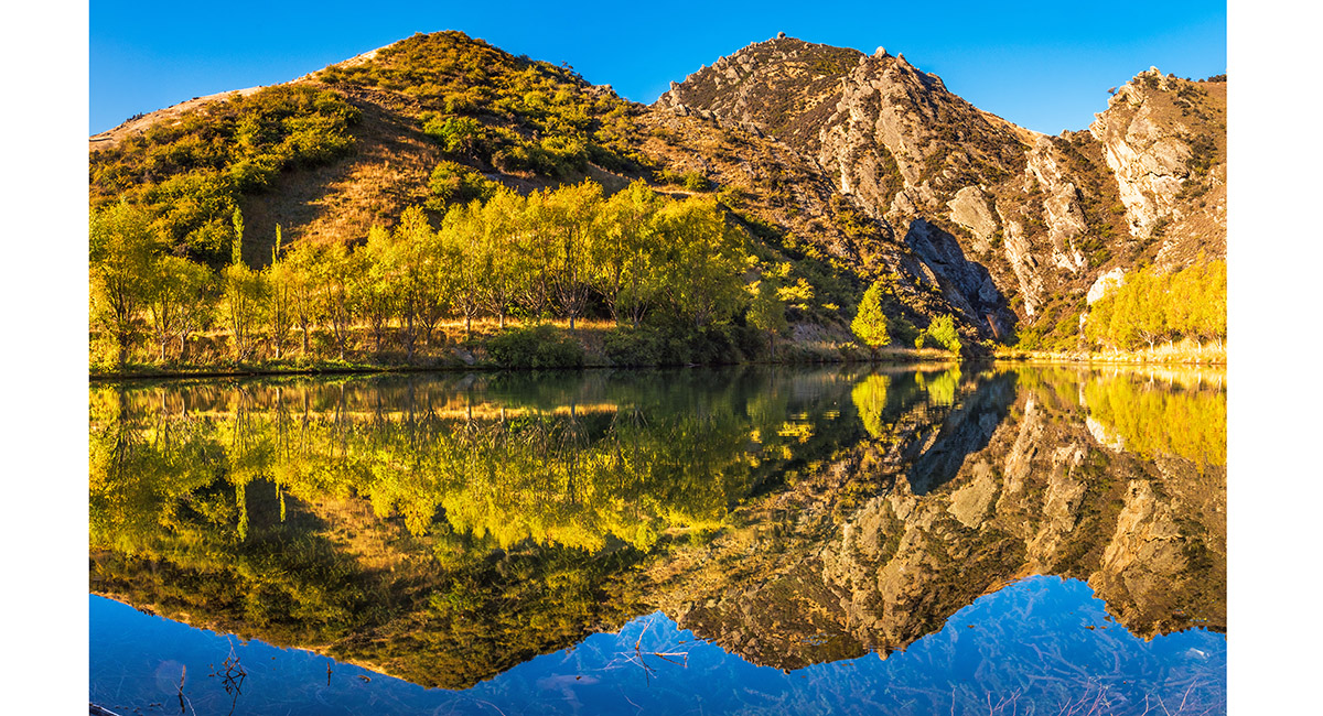
A small lake between Cromwell and Clyde

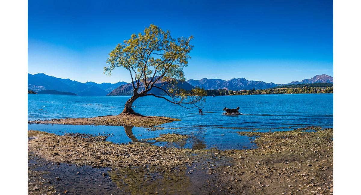
The famed lonely Willow, on the shore of Lake Wanaka

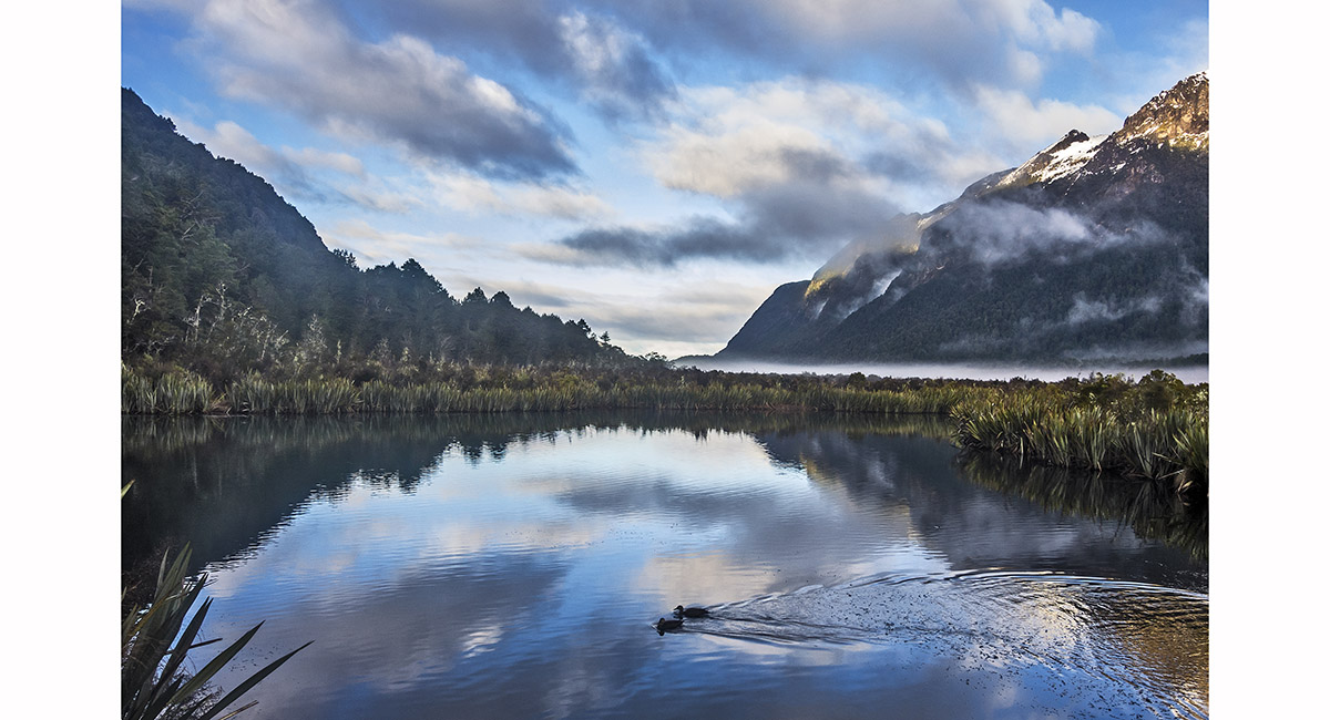
The Mirror Lake, Fiordland

At the Mirror Lake, Fiordland

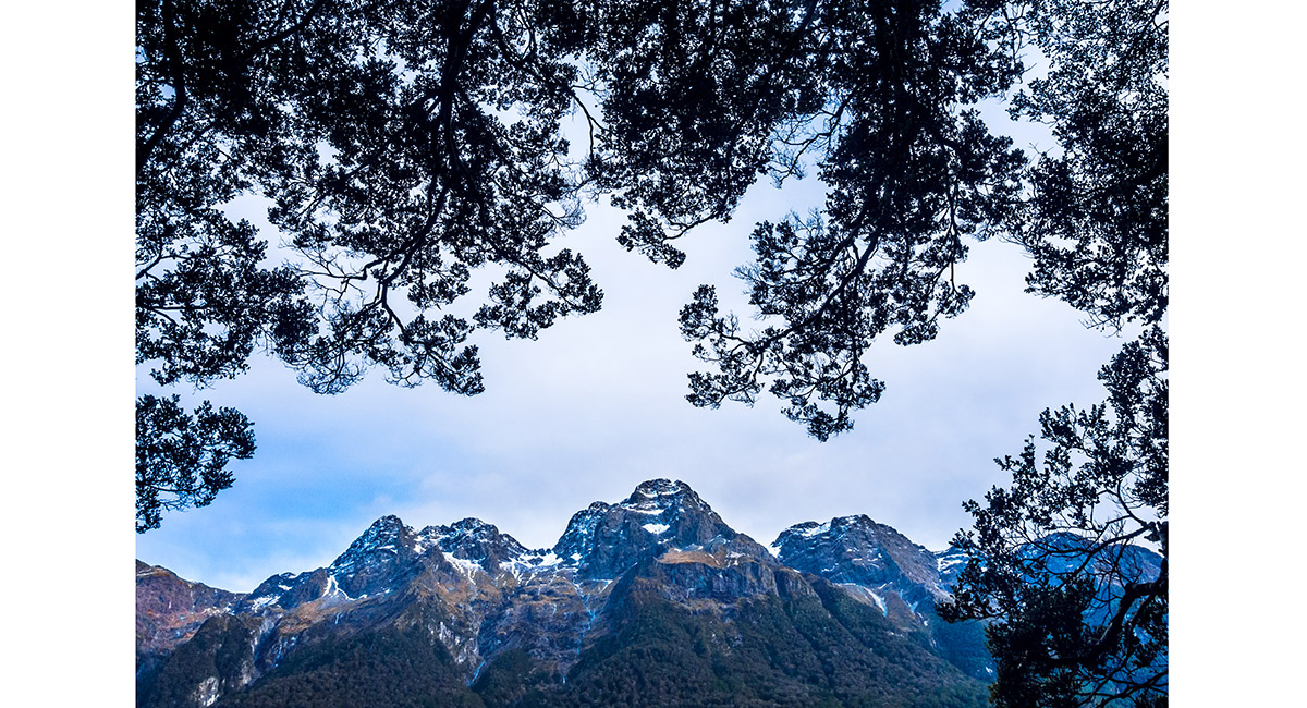
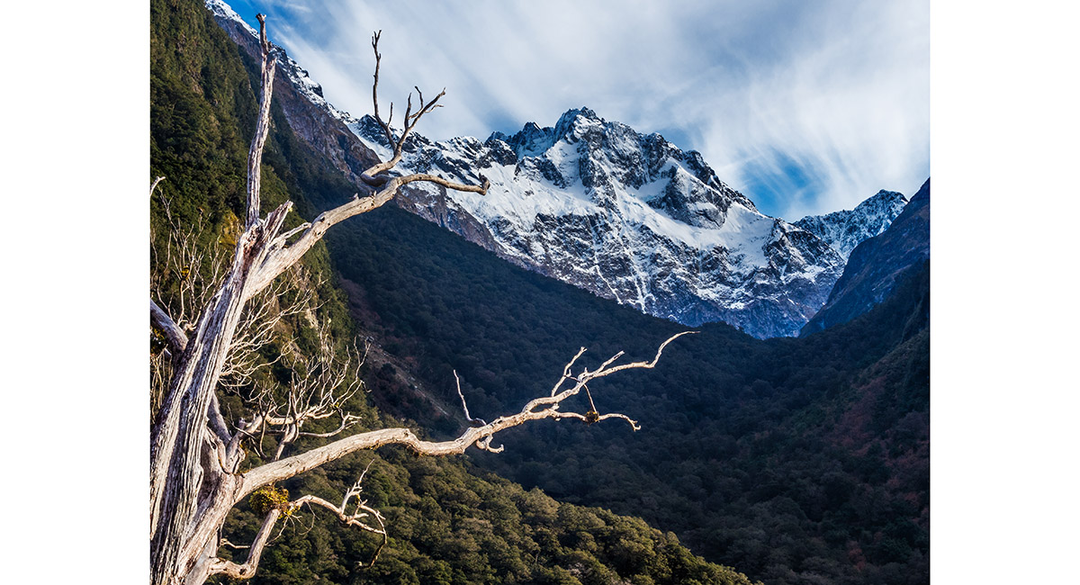
McPherson summit view northwest, Darran Mountains, Fiordland

Just right of bottom centre is Gertrude Saddle, with Barrier Knob, Barrier Peak and Mount Crosscut out to the right. Darran Mountains, Fiordland

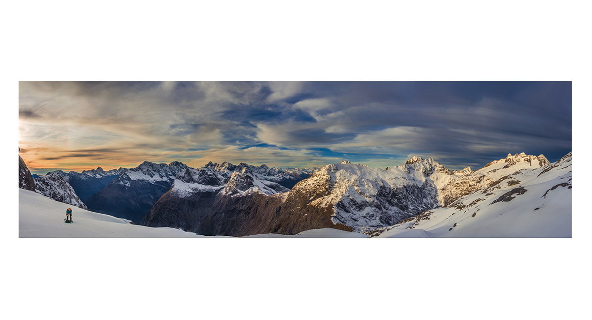
Snow fields beneath Traverse Pass. Barrier Knob (1,879m) is above the climber on the far side of Gertrude Saddle (1,410m), Darran Mountains, Fiordland

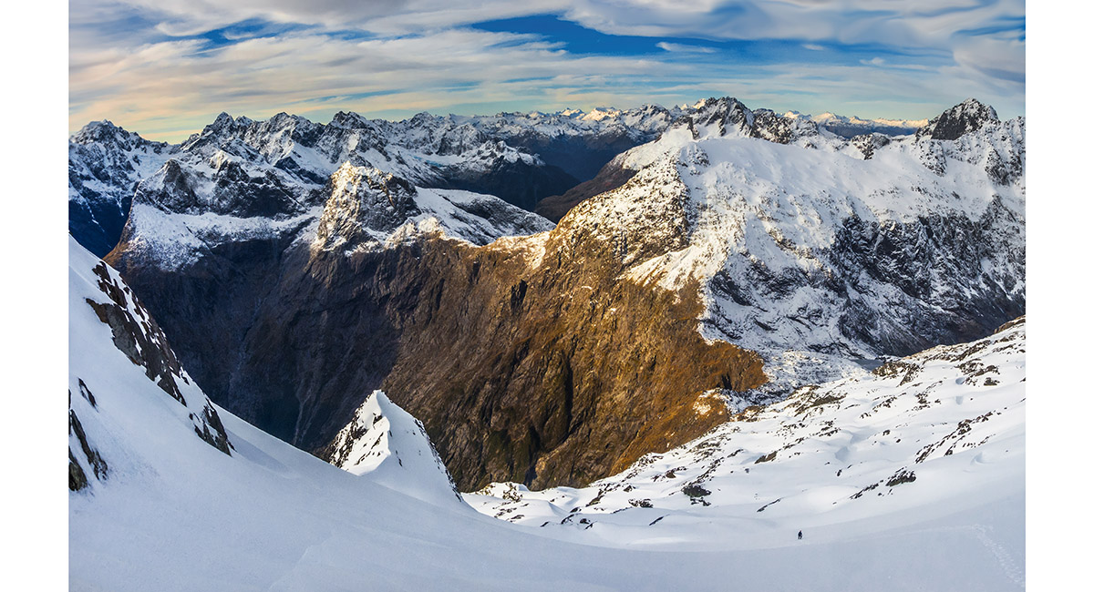
Just south of Gertrude Saddle, looking towards Milford Sound, Darran Mountains, Fiordland

Marian Peak (2,102m) from a viewpoint beside the road, Fiordland

View northwest from Key Summit, to Mount Crosscut (2,263m), Marian Peak (2,102m) and Mount Lyttle (1,899m), Fiordland

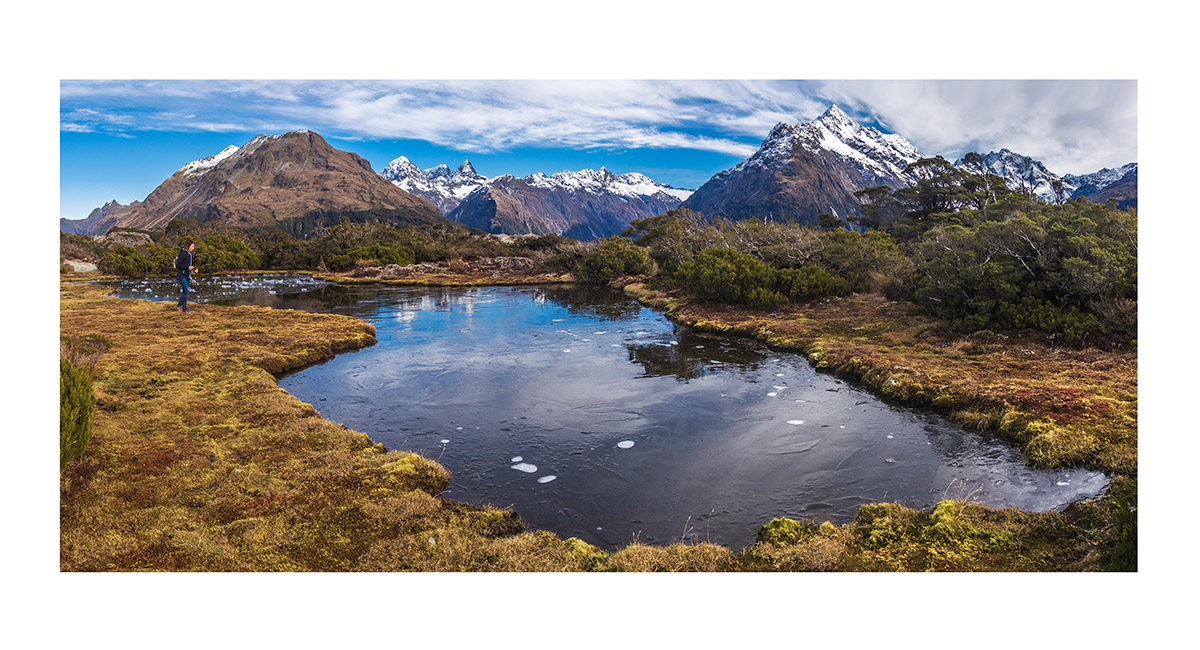
View west from Key Summit, to Mount Suter (2,094m), Mount Christina (2,474m) and Mount Crosscut (2,263m), Fiordland

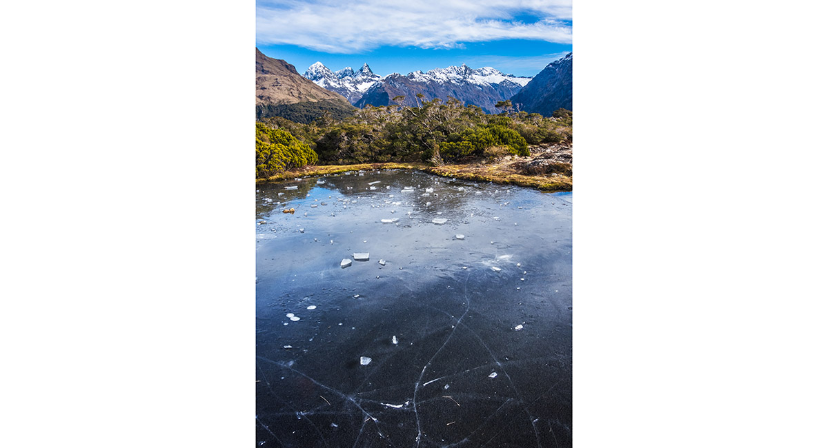
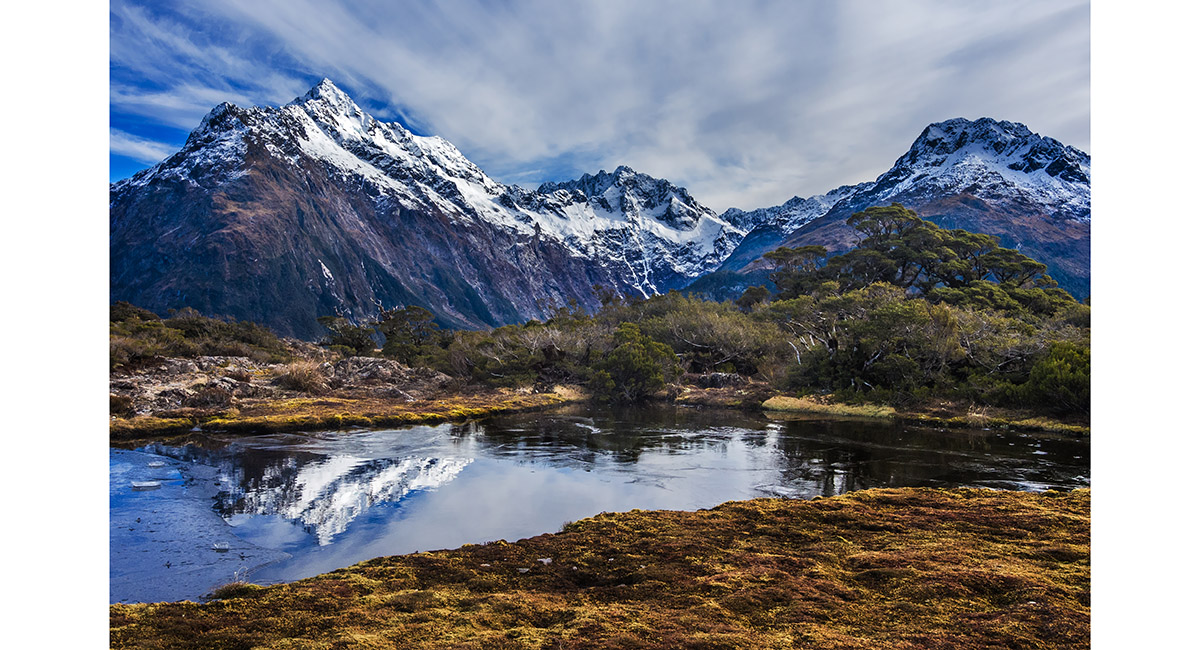
The frozen tarn on Key Summit (918m), Fiordland


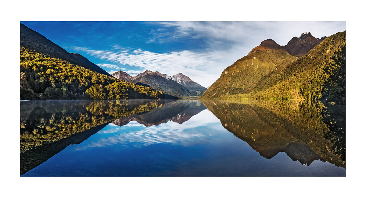
Lake Fergus (483m), viewed from Windy Point, Fiordland

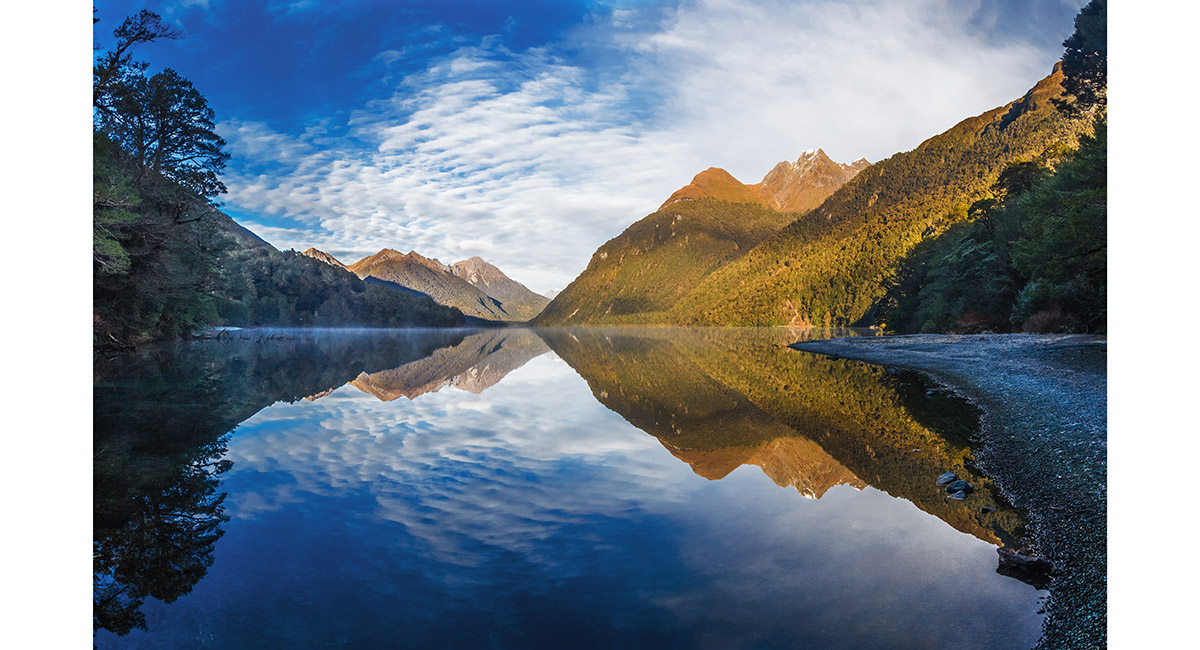
Lake Gunn (477m), viewed from the northern end, Fiordland

Lake Gunn (477m), viewed from the northern end, Fiordland

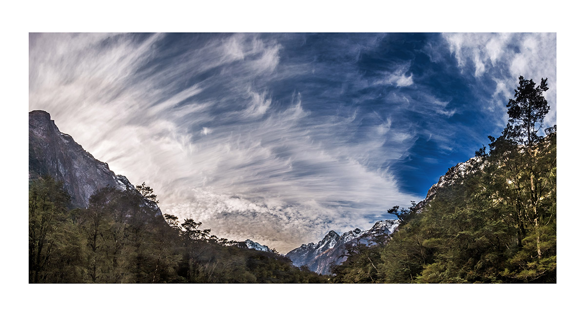
Near Milford Sound, Fiordland

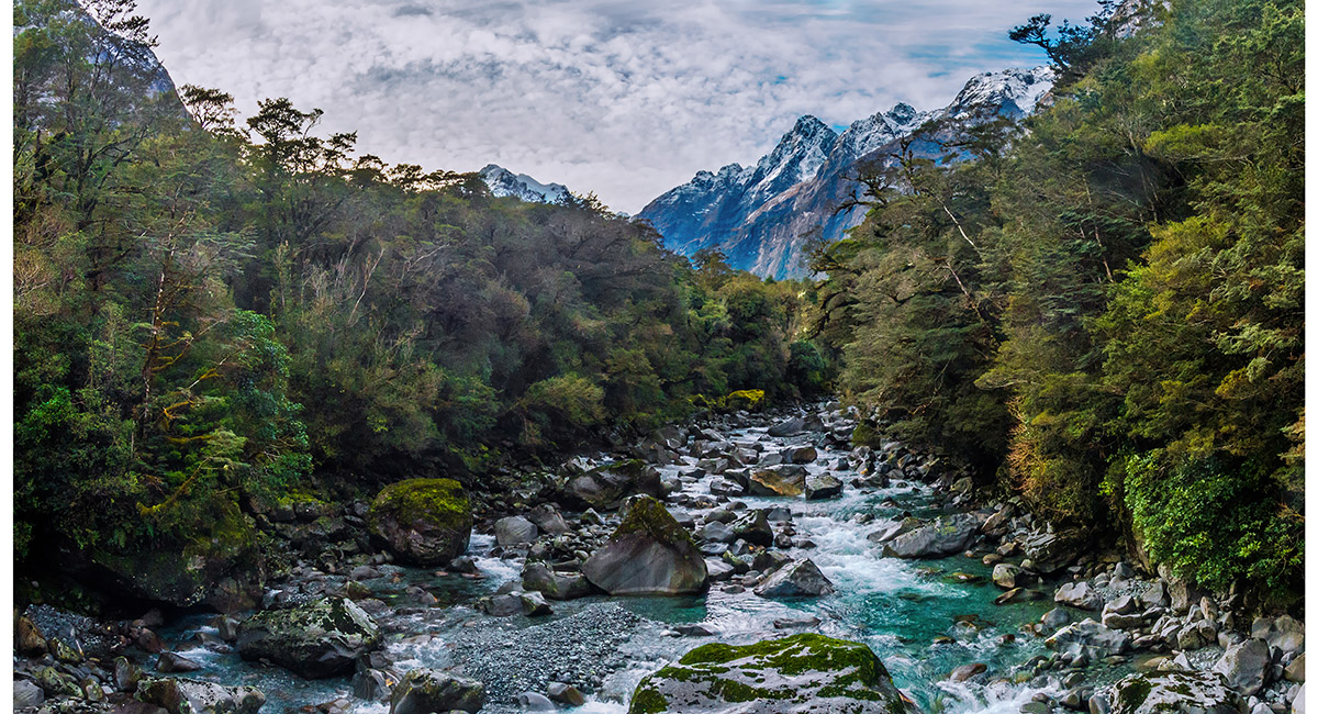
Cleddau Valley, Fiordland

The entrance to Tutoko Valley, Fiordland

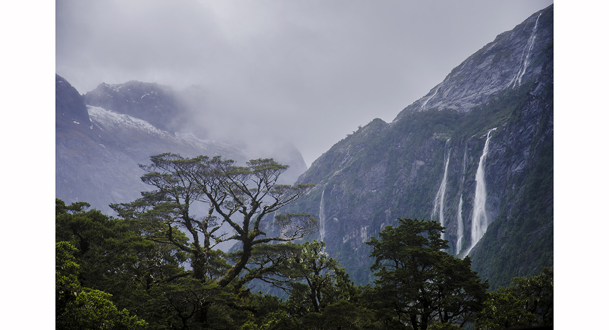
Cloud over Tutoko Valley, Fiordland

Milford Sound, Fiordland

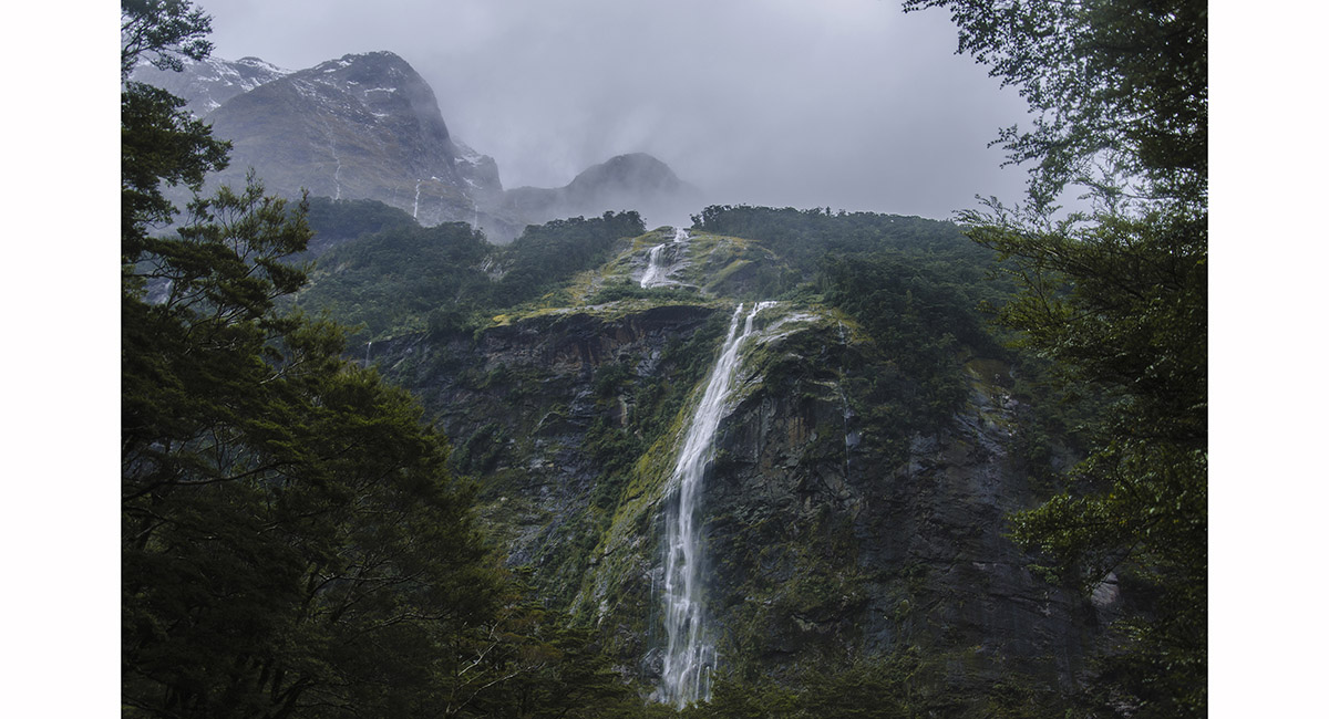
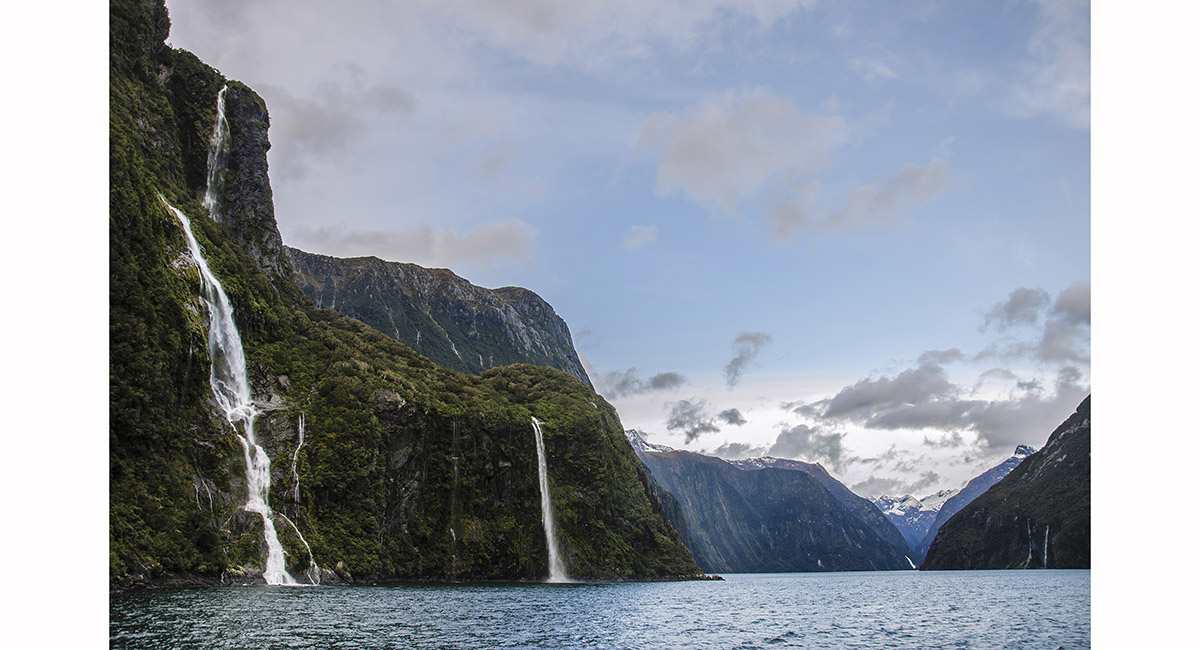
Stirling Falls, Milford Sound, Fiordland


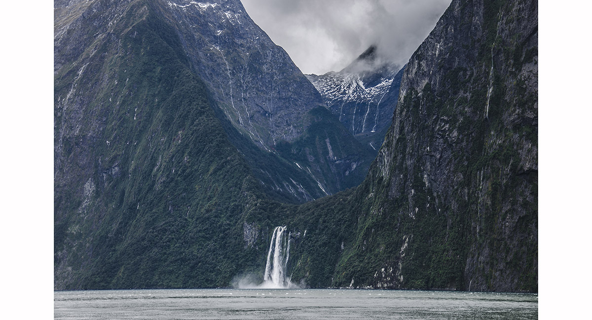
Bowen Falls, Milford Sound

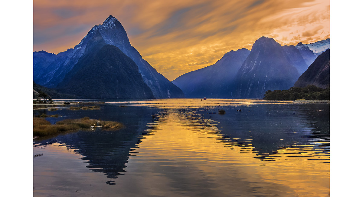
Mitre Peak (1,683m) and Milford Sound, Fiordland > North Island landscapes > Roof of the World landscapes

To order a print or web resolution file of any image you see in this slide show, just right click the image, click “Copy Image URL” and paste in to the “Your message” box of our Contact Us form. Please also note, for each image, if you want a print or web resolution file. We will get back to you as soon as possible to confirm price and payment details.
Open Contact Us in a new window to paste Image URL(s) easily