Mountain landscapes – NZ North Island
Ruapehu and Ngauruhoe from above Purity Hut, Ruahines

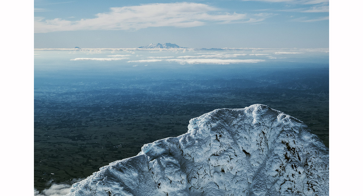
The south eastern aspect of Mt Ruapehu, viewed from the Ruahines

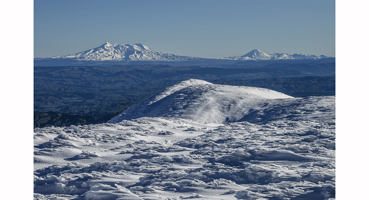
Near the summit of Mangaweka Peak, which is a large flat ridge - Ruapehu and Ngauruhoe to the north west


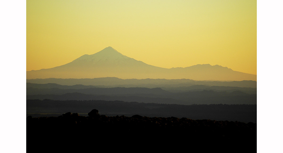
Mt Ruapehu, viewed from farmland near Mangaweka

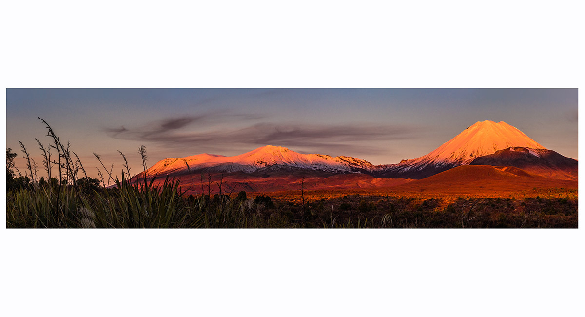
Dawn view, from right, of Mounts Ruapehu (2,797m), Ngauruhoe (2,291m) and Tongariro (1,978m), from Tahurangi Lodge (1,520m)

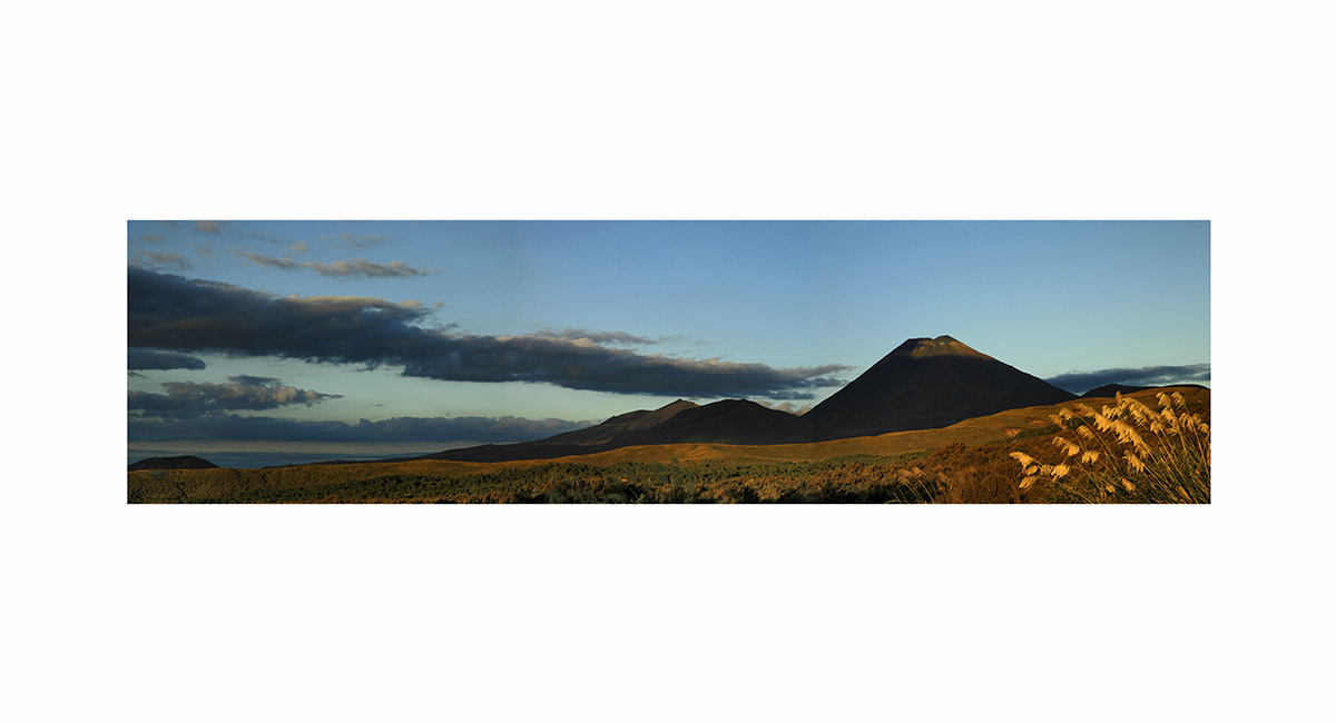
Dawn view of Mounts Ngauruhoe (2,291m, right) and Tongariro (1,978m), from Tahurangi Lodge (1,520m)

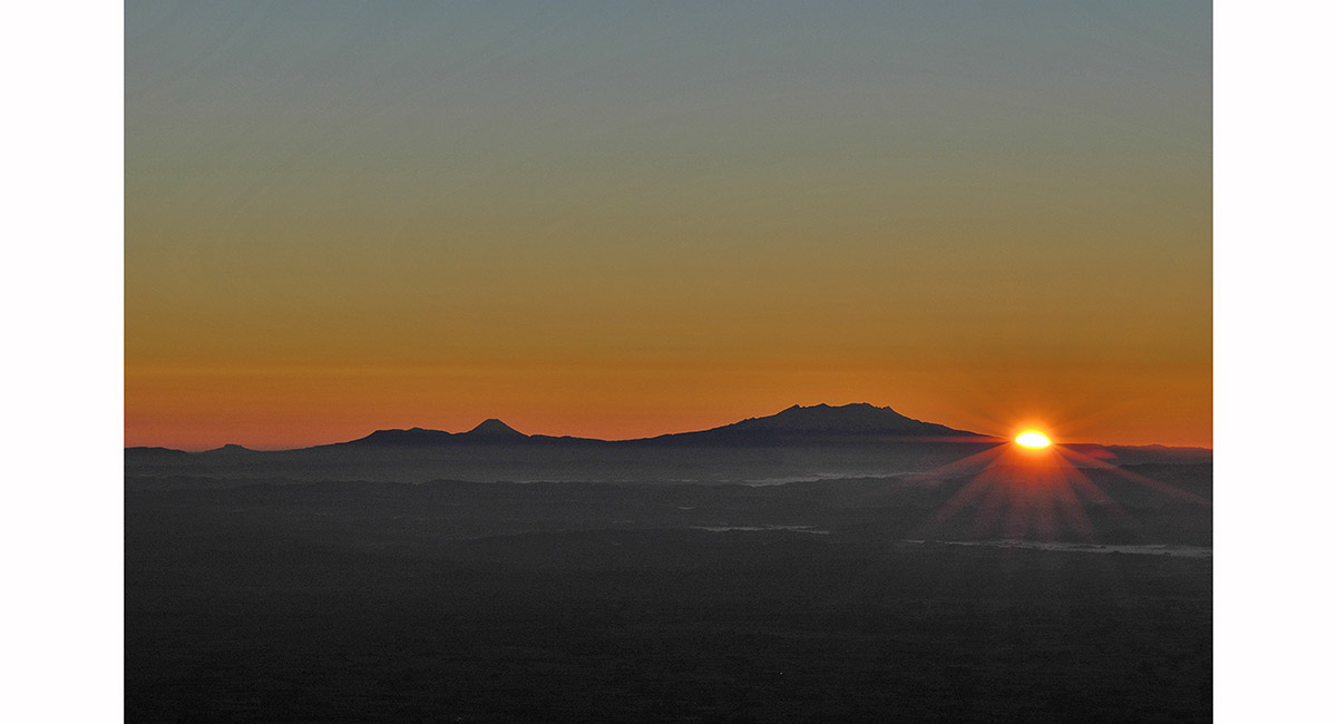
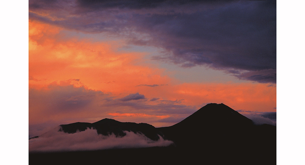
Looking west at sunset, from the car park at the southern access point to the Tongariro Crossing

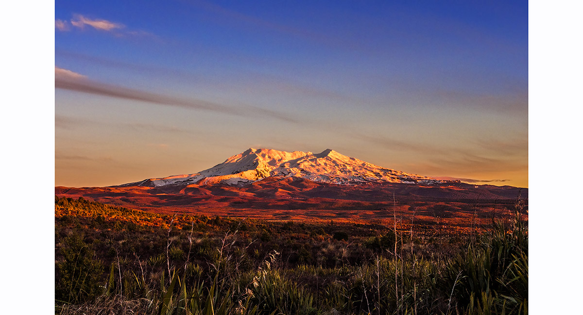
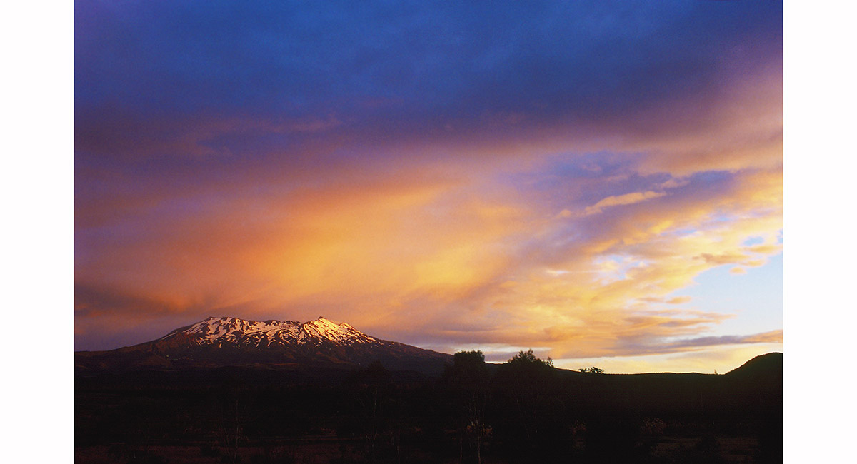
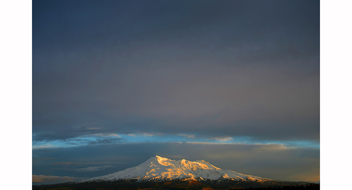
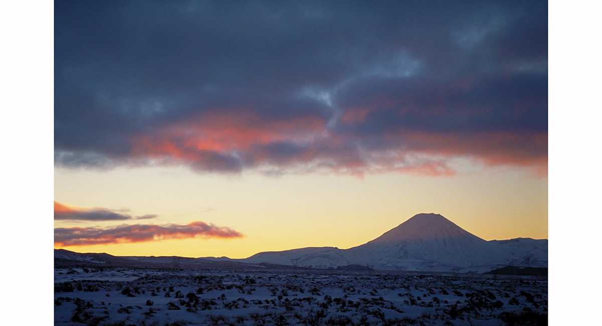
Ruapehu at sunset from near National Park

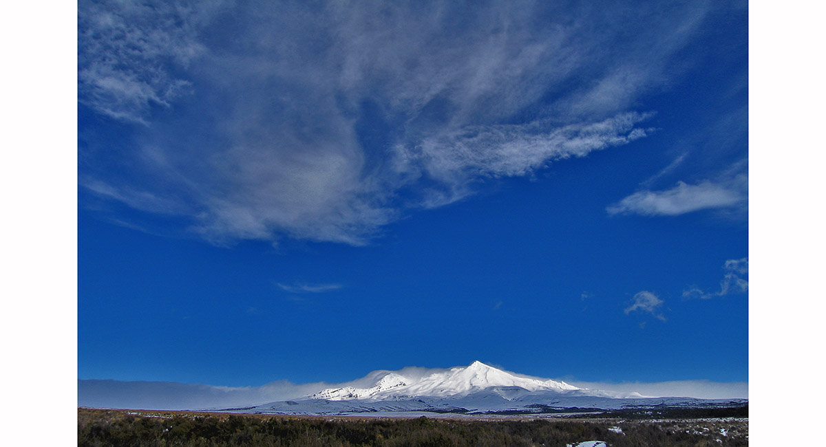
Mount Ruapehu, from the north west

Mount Ruapehu, seen from Waiouru

Mount Ruapehu, seen from the Desert Road

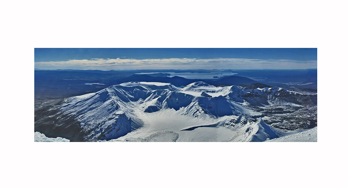
Girdlestone summit view, north and east - from left, Tahurangi (main summit of Mt Ruapehu - 2,797m), Tukino (2,720m), Te HeuHeu (2,732m) and Mitre/Ringatoto (2,591m)

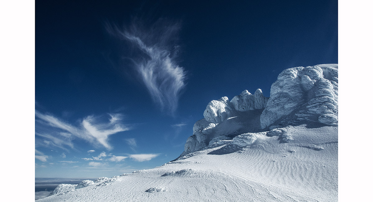
View north to Tahurangi (2,797m), from below the top of Girdlestone, Mt Ruapehu


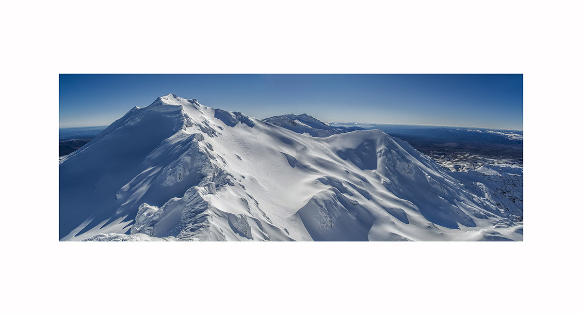
Mt Ruapehu summit view, from left - Paretetaitonga (2,751m), the Dome (2,672m) behind the Crater Lake (2,540m), Tukino (2,720m) and Te HeuHeu (2,732m) with the Cathedral Rocks (2,663m) in front; and Pyramid Peak (2,645m), to the right of the Lake


Mt Ruapehu summit view, from left - the flanks of Paretetaitonga (2,751m), the Dome (2,672m) behind the Crater Lake (2,540m), Tukino (2,720m) and Te HeuHeu (2,732m) with the Cathedral Rocks (2,663m) in front; and Pyramid Peak (2,645m), to the right of the Lake

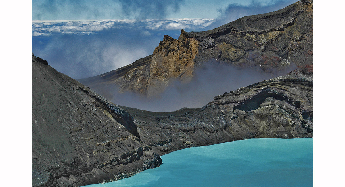
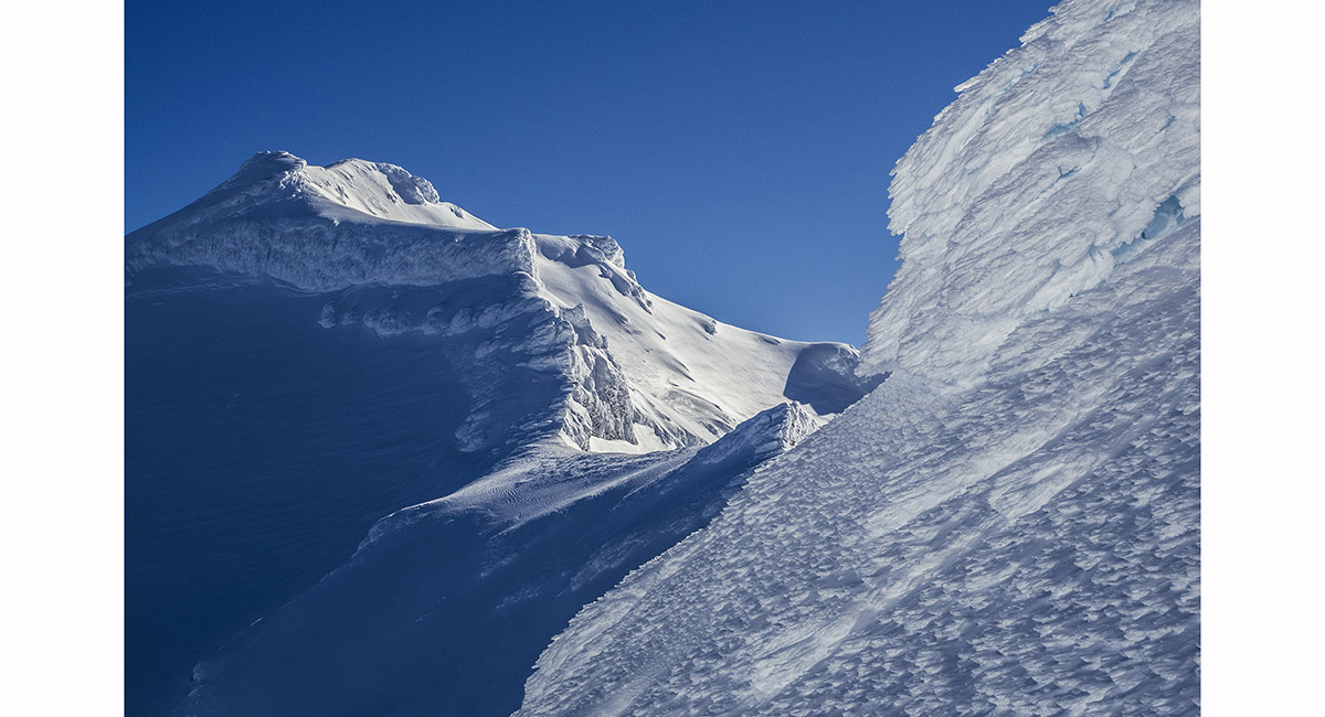
A section of the Crater Lake rim, just right of Pyramid Peak, Mt Ruapehu

South end crater lake shore view, to the Dome and Pyramid Peak, Mt Ruapehu


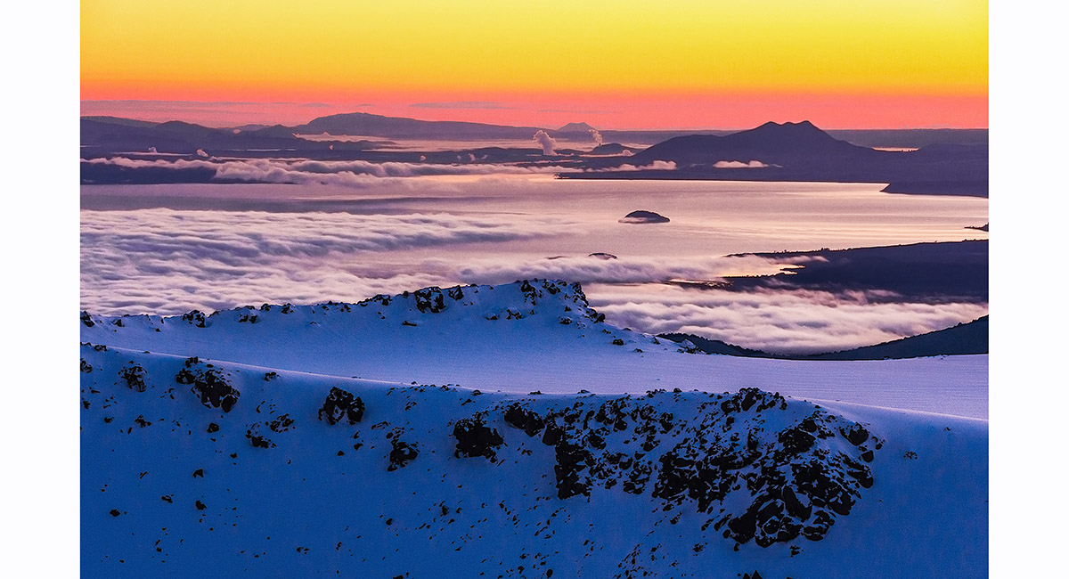
Dawn view from Tukino Village of Te HeuHeu, Mt Ruapehu

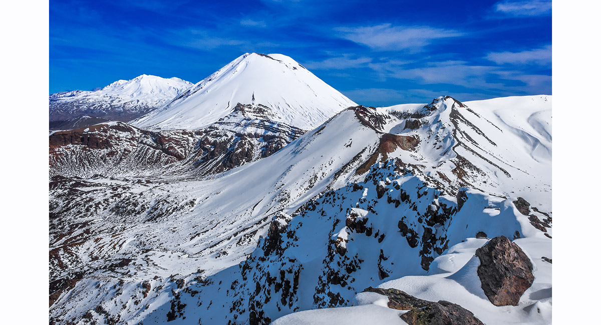
Mounts Tongariro and Ngauruhoe, seen from the west

Mount Ngauruhoe, from the eastern perspective

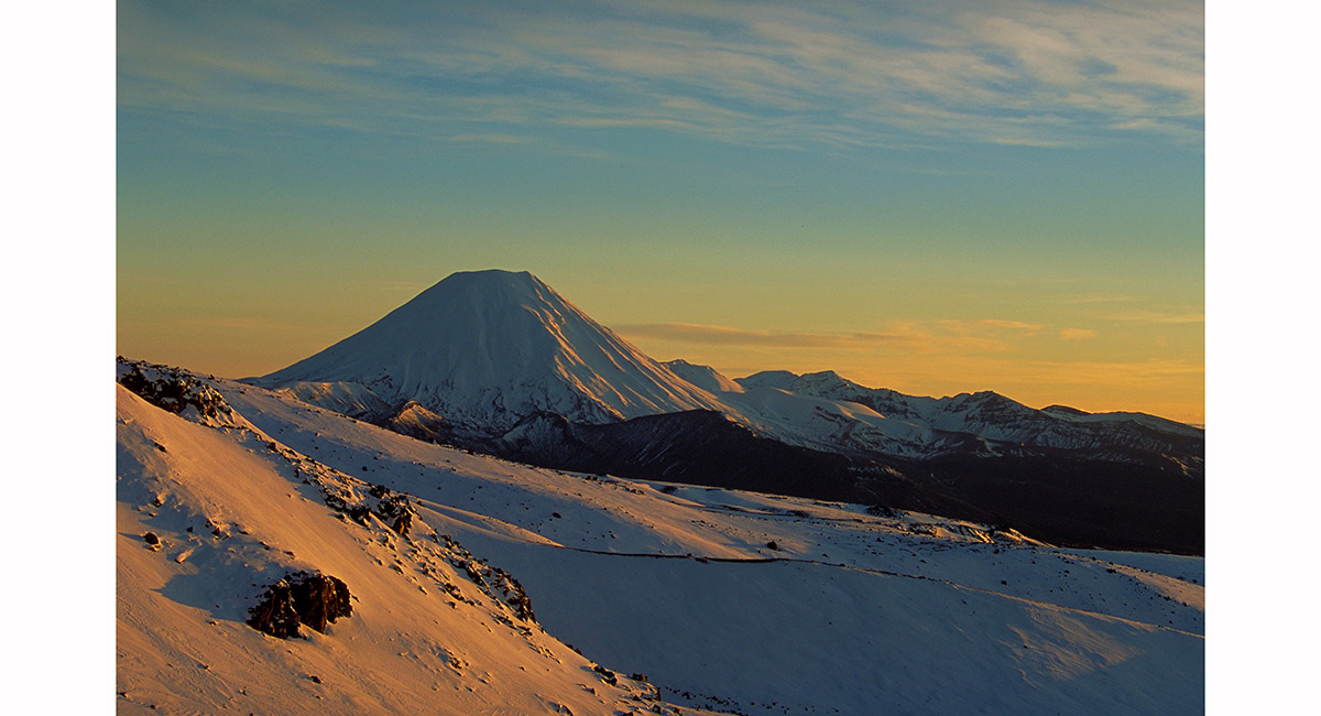
Tongariro and Ngauruhoe at sunset from near National Park

Mounts Ngauruhoe and Tongariro, from the Grand Chateau

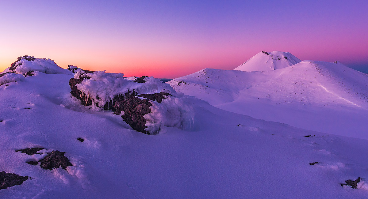
Mount Ngauruhoe, at dawn from Tukino Village, Mt Ruapehu

Mount Ngauruhoe, at dawn from Tukino Village, Mt Ruapehu

Mount Ngauruhoe, at dawn from Tukino Village, Mt Ruapehu

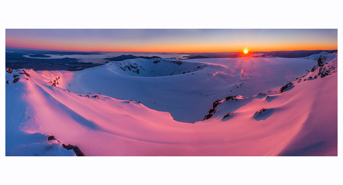
Dawn on North Crater's southern rim (1,909m), looking north, Tongariro National Park


Dawn on North Crater's southern rim (1,909m), looking east, Tongariro National Park

Dawn on North Crater's southern rim (1,909m). Tongariro's (1,967m) and Ngauruhoe's (2,287m) summits behind

Dawn on North Crater's southern rim (1,909m), looking northwest, Tongariro National Park

Mt Ngauruhoe summit view north east. The South Crater is in the foreground, Mount Tongariro at left, the Blue Lake right of centre and Lake Taupo beyond

From left - Ruapehu, Ngauruhoe and Red Crater


Taitai (700m), north east of Mt Hikurangi

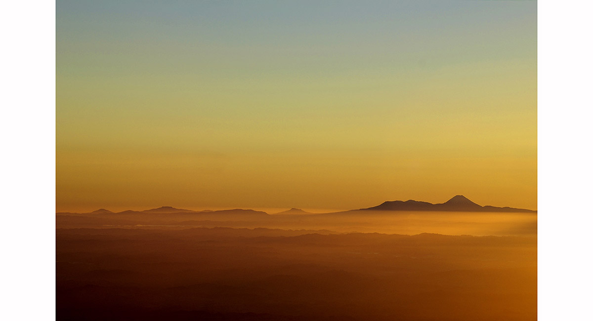
The view east to the Ruahine Range, from near Mangaweka's summit (1,731m) on the Hikurangi Range, Ruahines

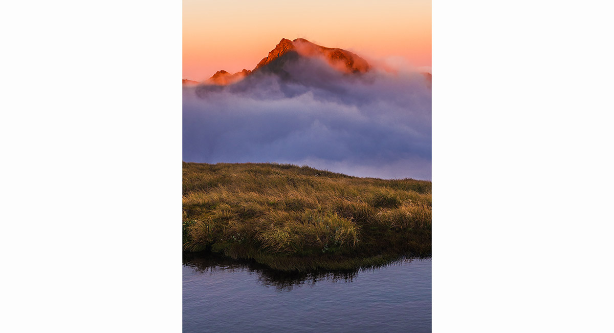
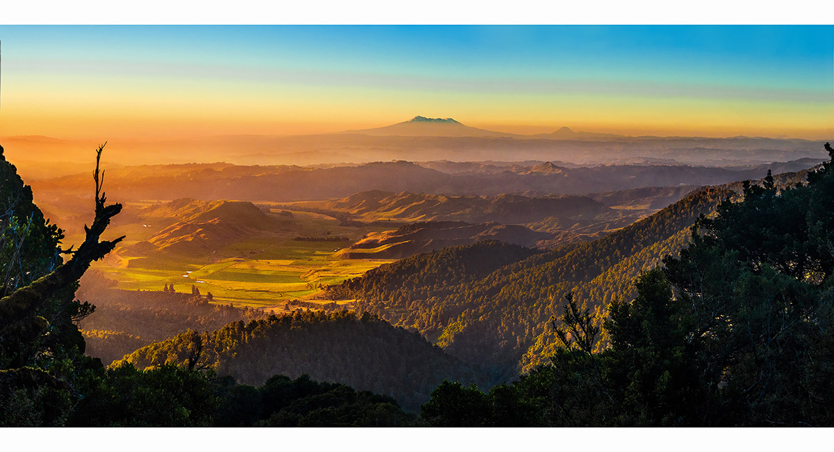
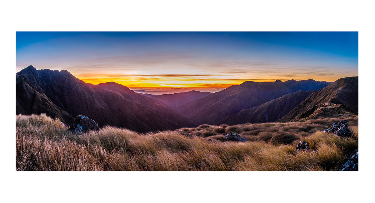
Dawn view east from a campsite near Iron Peg (1,703m), Ruahines

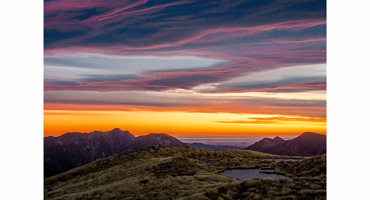
Dawn view east from near Iron Peg (1,703m), Ruahines

Dawn view east from a campsite near Iron Peg (1,703m), Ruahines

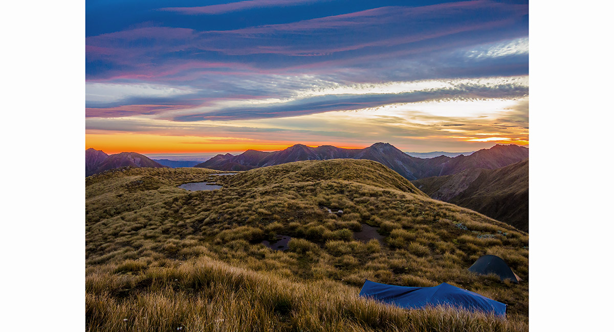
Dawn view northwest from a campsite near Iron Peg (1,703m), Ruahines

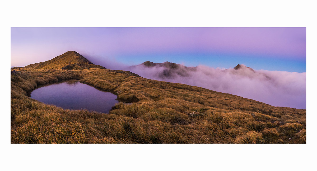
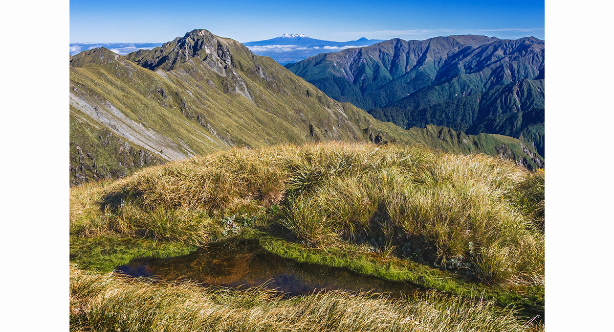
A view across a tarn just north of Tiraha (1,668m) back to Mangaweka (1,731m - centre skyline) and Te Hekenga (1,695m - left), Ruahines

Dawn view on the saddle, west to Taumataemekura (1,682m - left) and Te Hekenga (1,695m - right), Ruahines

Dawn view on the saddle, west to Taumataemekura (1,682m - left) and Te Hekenga (1,695m - right), Ruahines

Dawn view on the saddle, west to Te Hekenga (1,695m), Ruahines

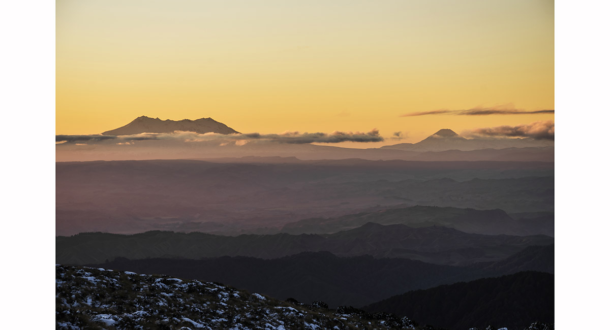
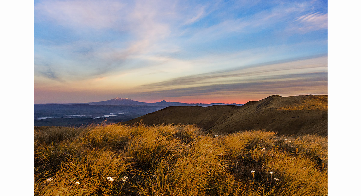
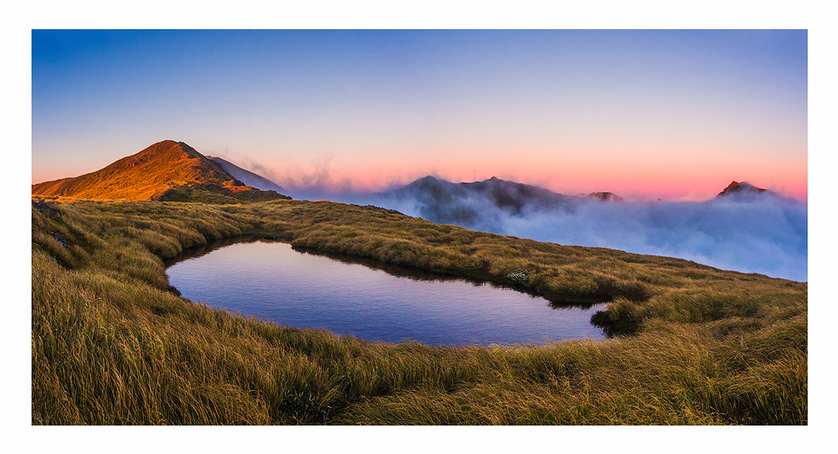
Dawn view on the saddle, west to Te Hekenga (1,695m - left), Mount Ruapehu (2,797m - centre) and Mangaweka (1,731m - right), Ruahines


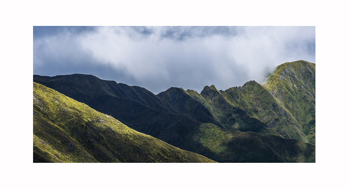
Summit view from Tiraha, looking north along Sawtooth ridge, now completely engulfed in cloud. On the far side is Ohuinga, Ruahines

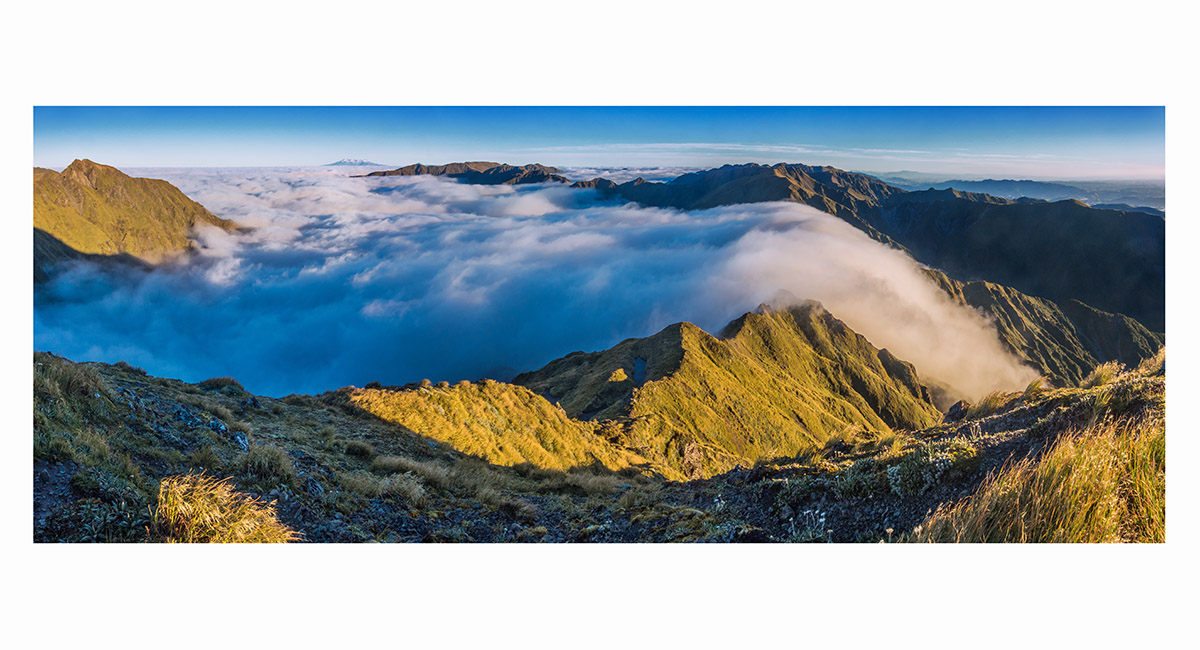
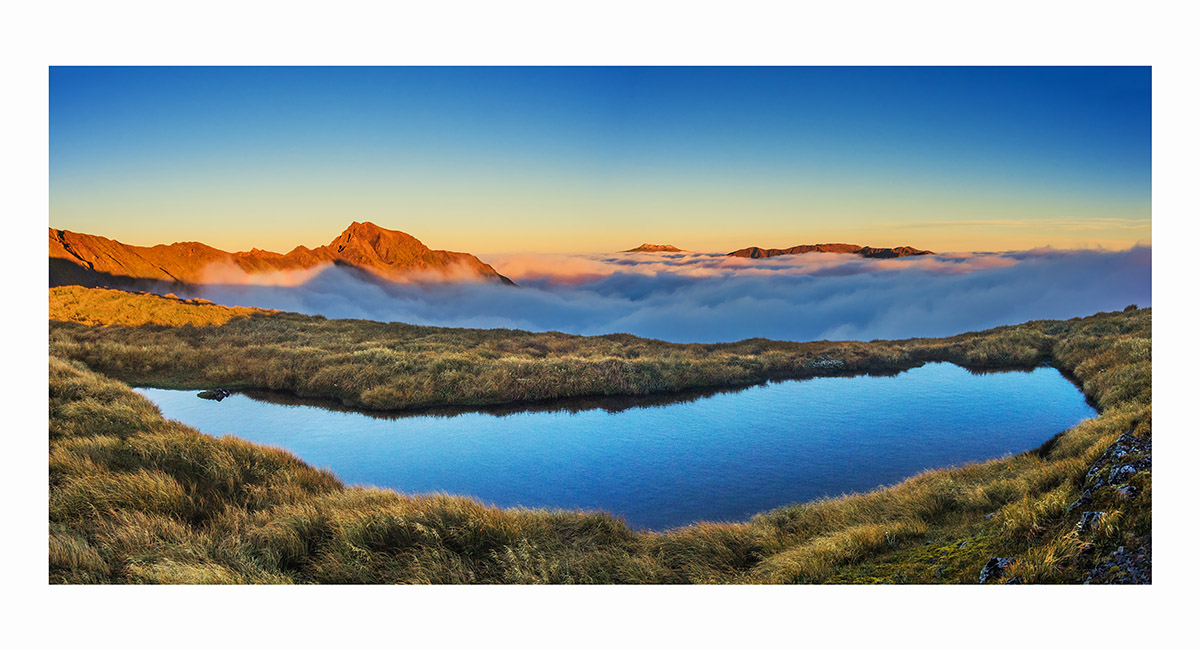
Summit view from Tiraha, looking west to Te Hekenga (left), Mount Ruapehu and Mangaweka (left of centre skyline) and north along Sawtooth Ridge, completely engulfed in cloud, with Ohuinga on the far side, Ruahines

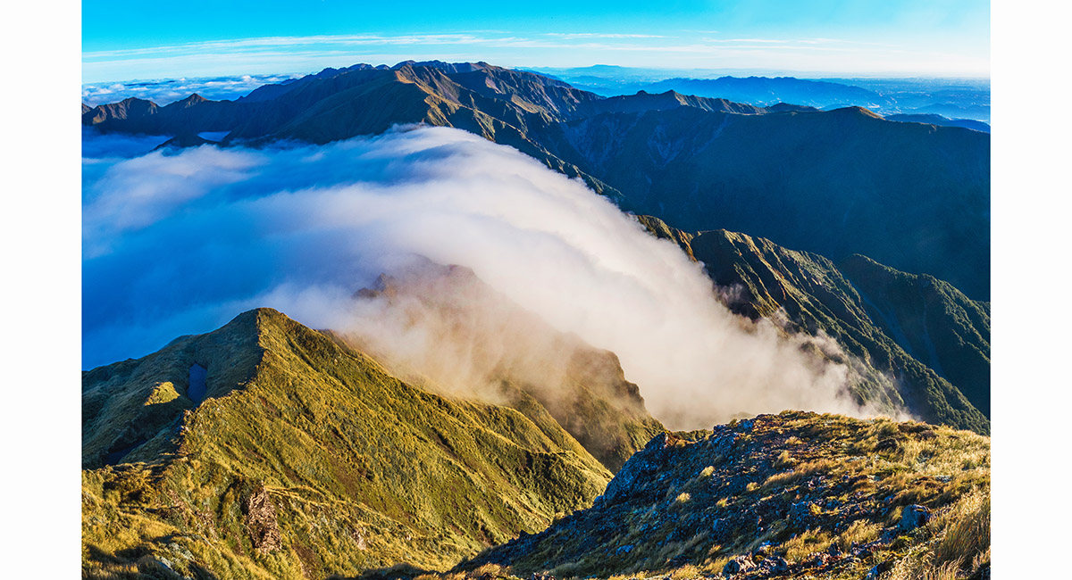
Summit view from Tiraha, looking north along Sawtooth ridge, engulfed in cloud. On the far side is Ohuinga, Ruahines

From left - Te Hekenga, Mount Ruapehu, Mount Ngauruhoe, Iron Peg and Mangaweka, on the approach to Taumataemekura, Ruahines

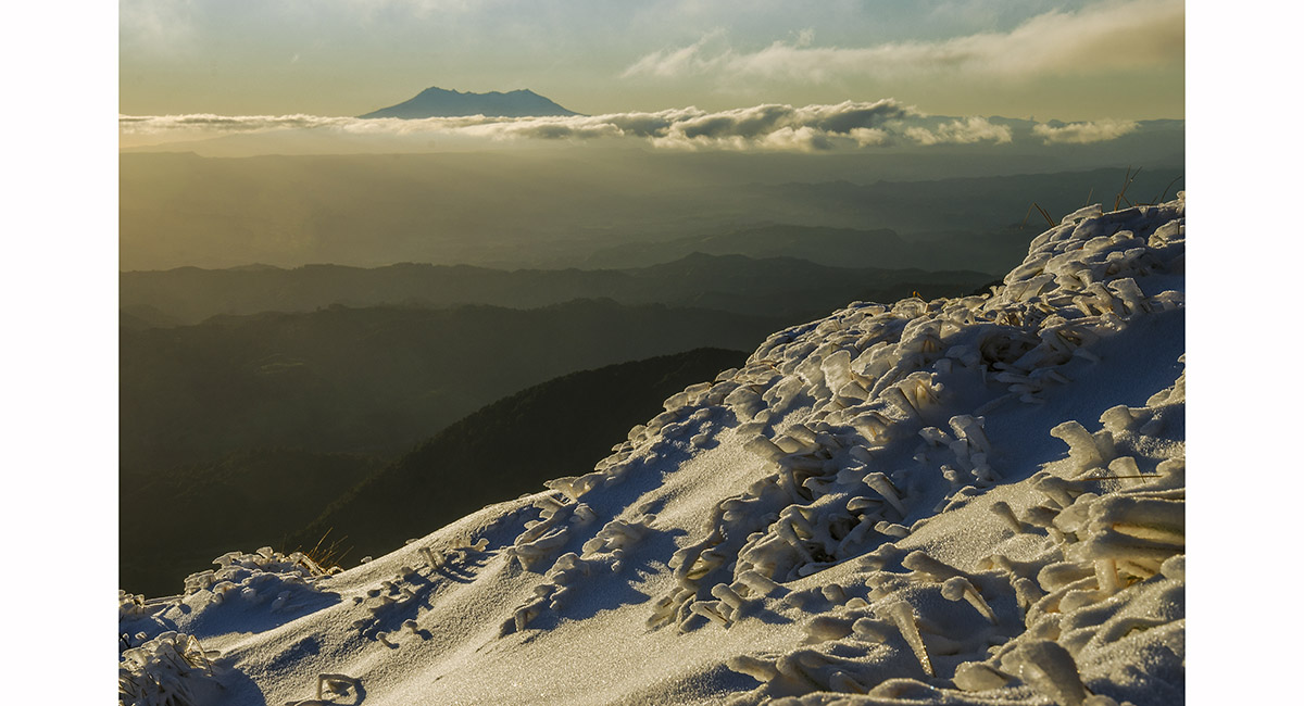
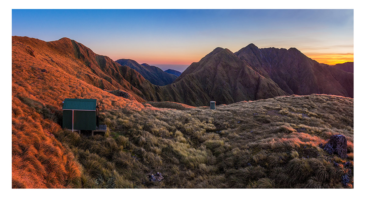
Campsite view at dusk to Mount Ruapehu, above Kelly Knight Hut, Ruahines

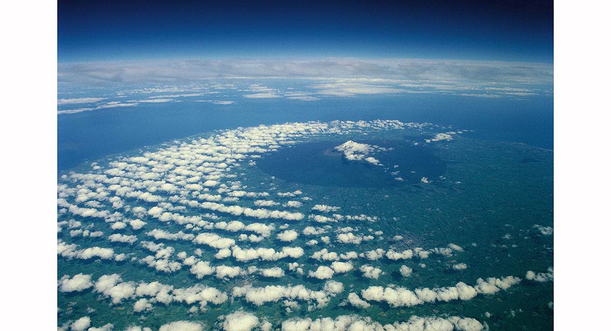
Mt Taranaki, viewed from a 737, from the east

Mt Taranaki, viewed from a 737, from the east

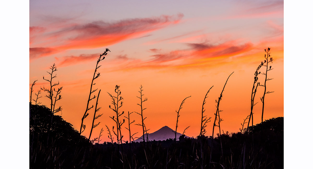
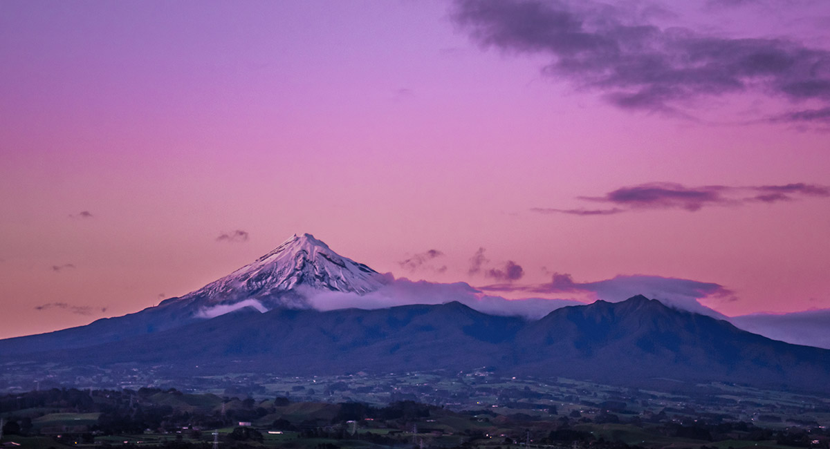
Mount Taranaki, viewed from near (Tongariro) National Park at sunset

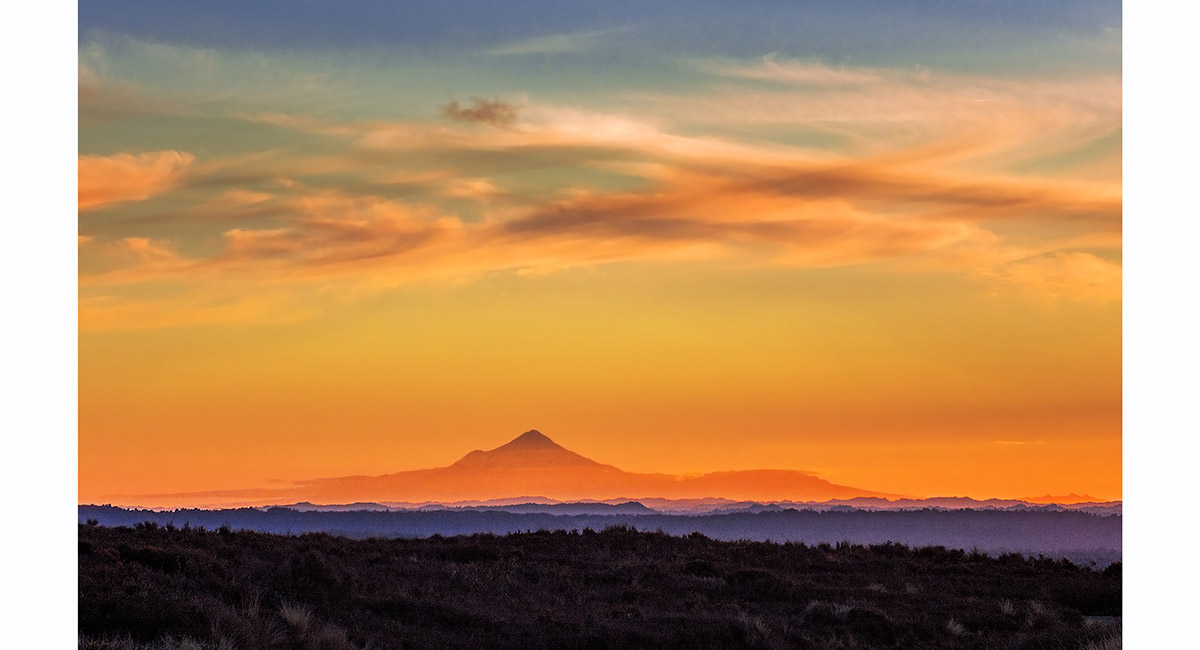
Mount Taranaki, viewed from the southern end car park of the Tongariro Crossing at sunset

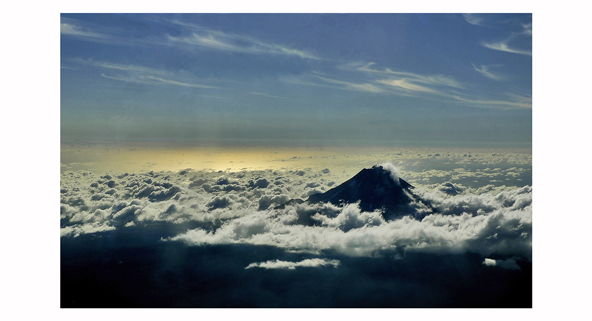
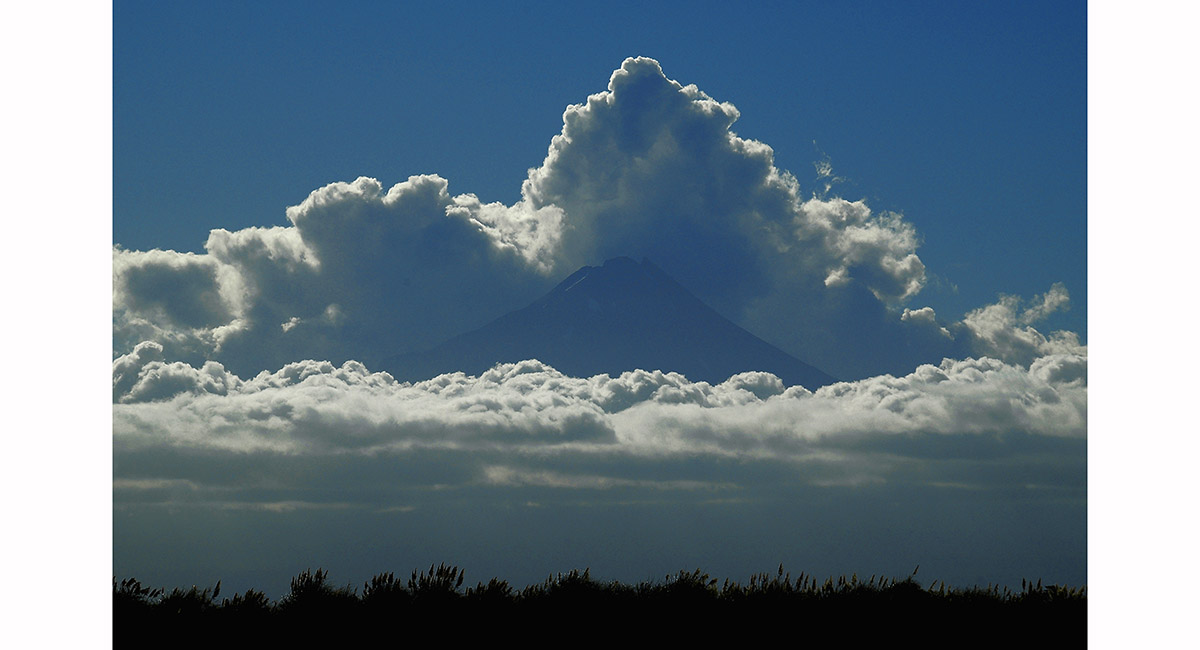
Mt Taranaki, viewed from Mt Tongariro at dusk

Mt Taranaki from the south east

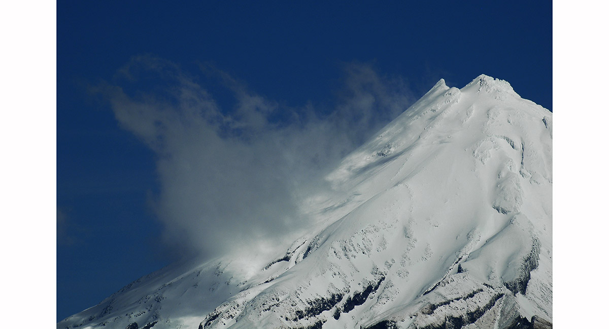
Mt Taranaki from the north - the Sharks Tooth (2,510m, left) and true summit (2,518m)

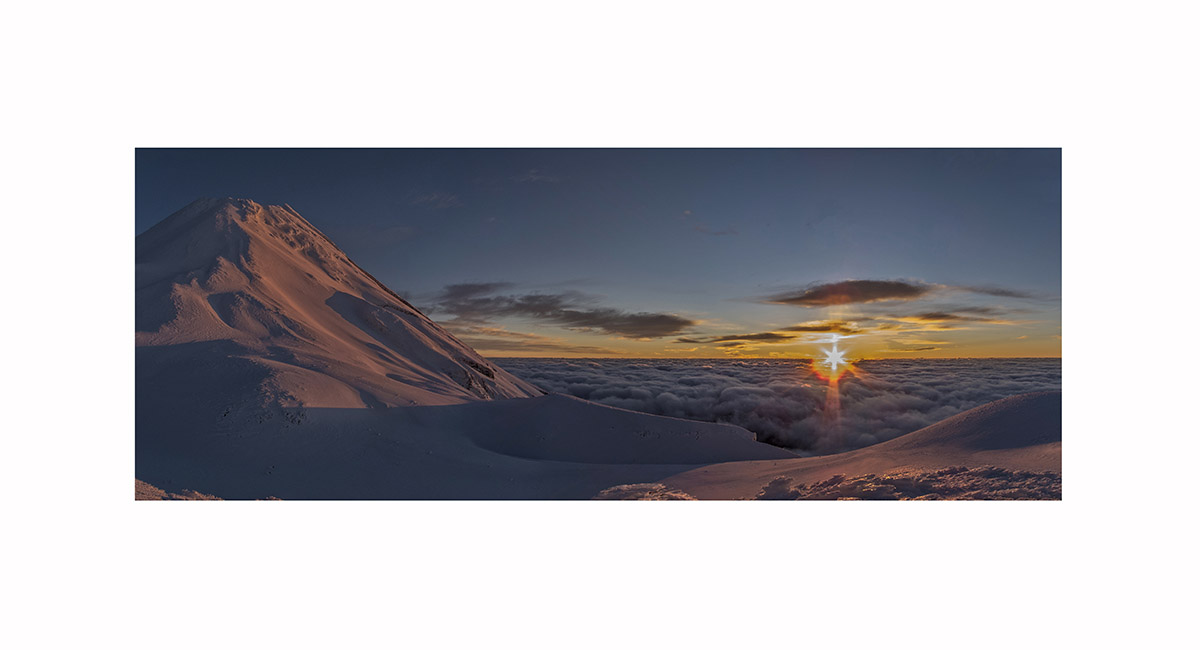
Dawn view, north east from Fanthams Peak to the main summit of Mt Taranaki

Mt Taranaki summit view east, across the Sharks Tooth, to Mts Ruapehu and Ngauruhoe

The main summit and the Sisters, Mt Taranaki

Mount Taranaki, viewed from Paritutu at dawn

Mount Taranaki and the Pouakais, viewed from Paritutu at dawn

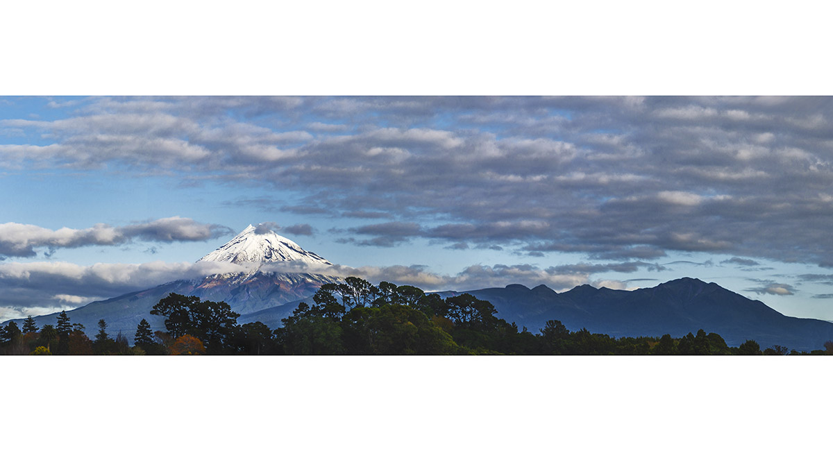
Mount Taranaki and the Pouakais, viewed from Coronation Avenue, New Plymouth

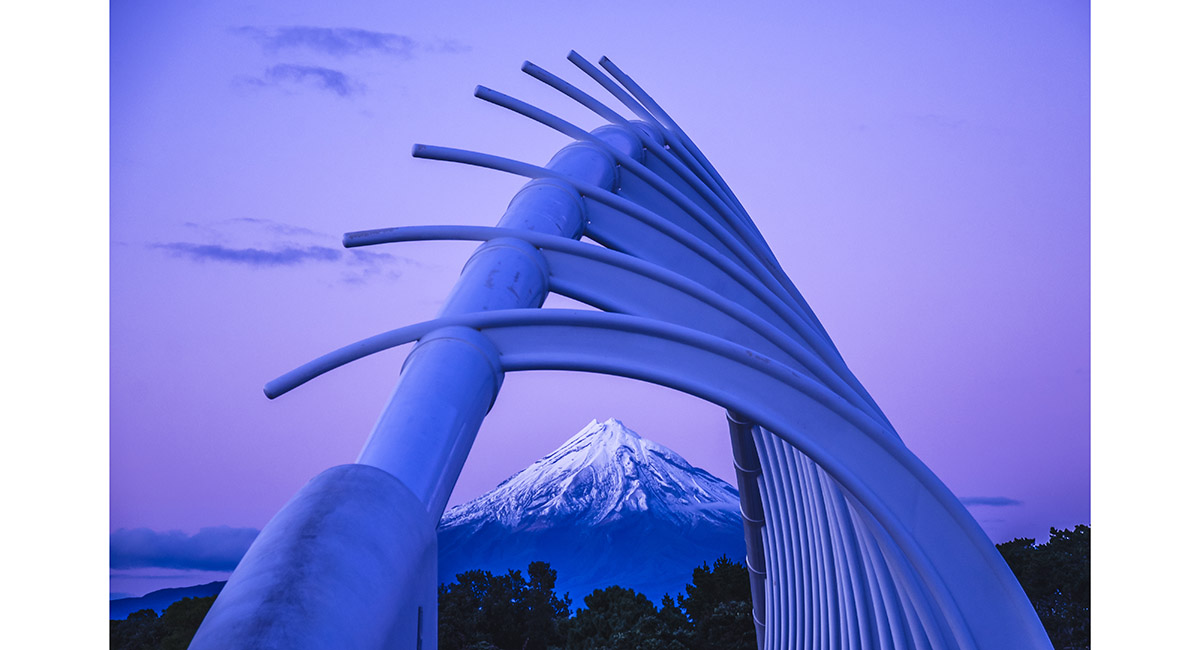
Mount Taranaki and Te Rewa Rewa Bridge, New Plymouth

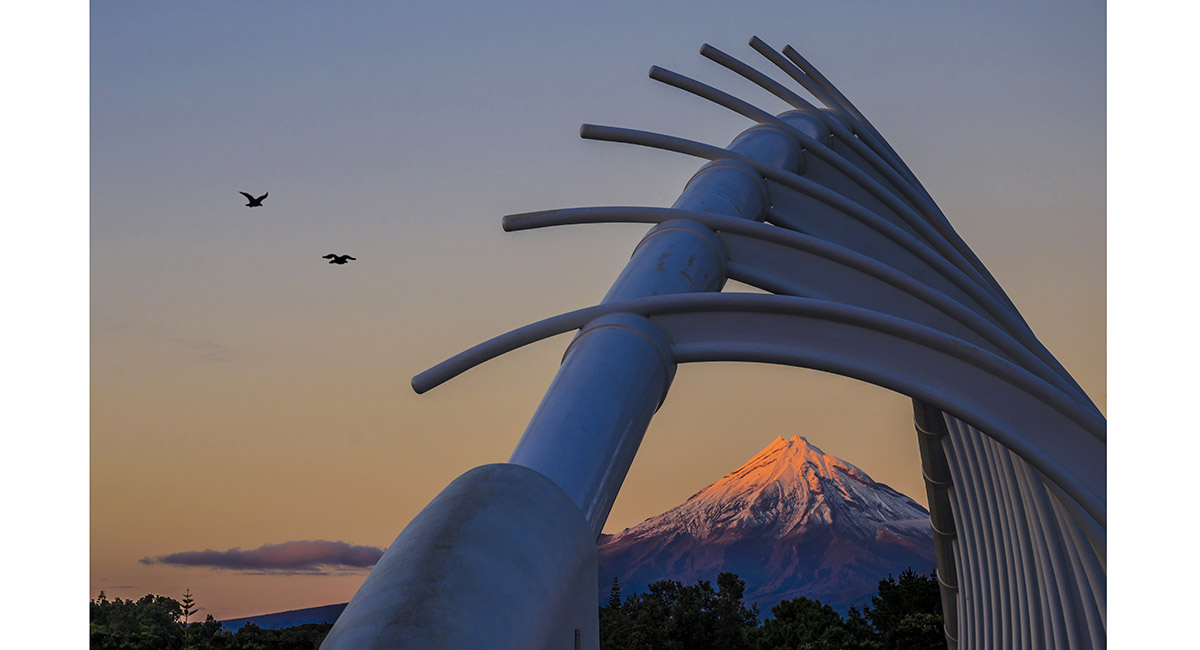
Mount Taranaki and Te Rewa Rewa Bridge, New Plymouth

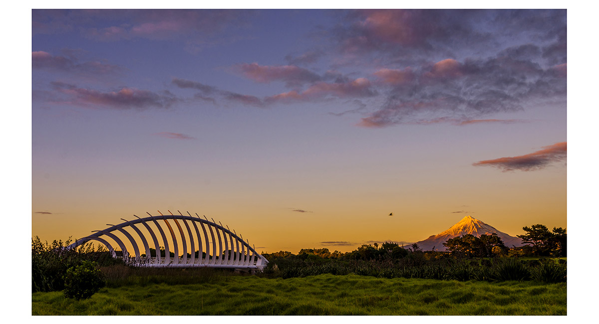
Mount Taranaki and Te Rewa Rewa Bridge, New Plymouth

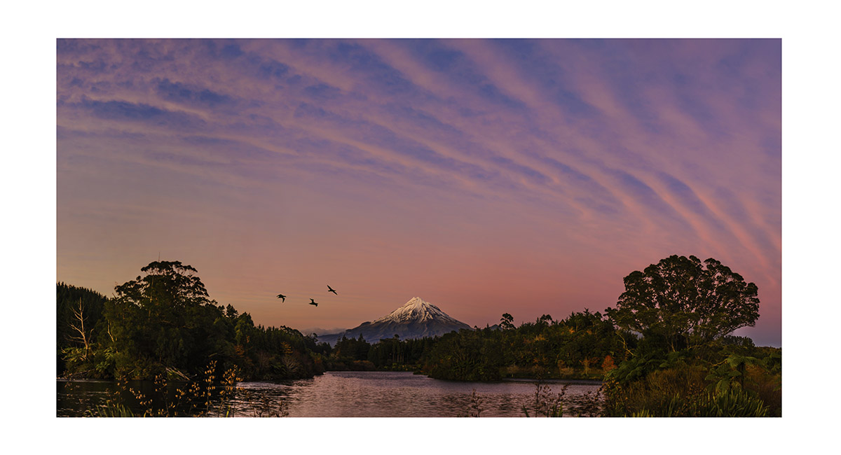
Mount Taranaki, across Lake Mangamahoe at dawn

Mount Taranaki, across Lake Mangamahoe at dawn

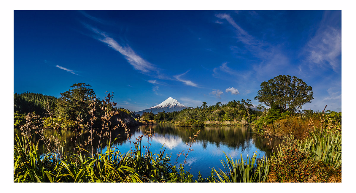
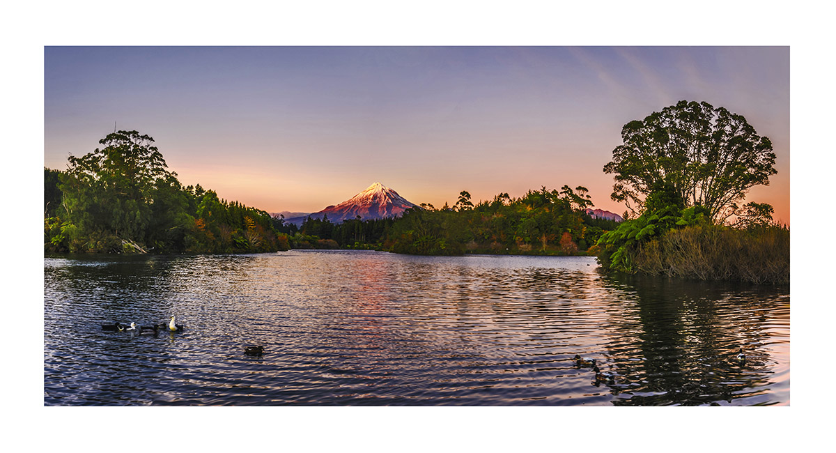
Mount Taranaki, across Lake Mangamahoe

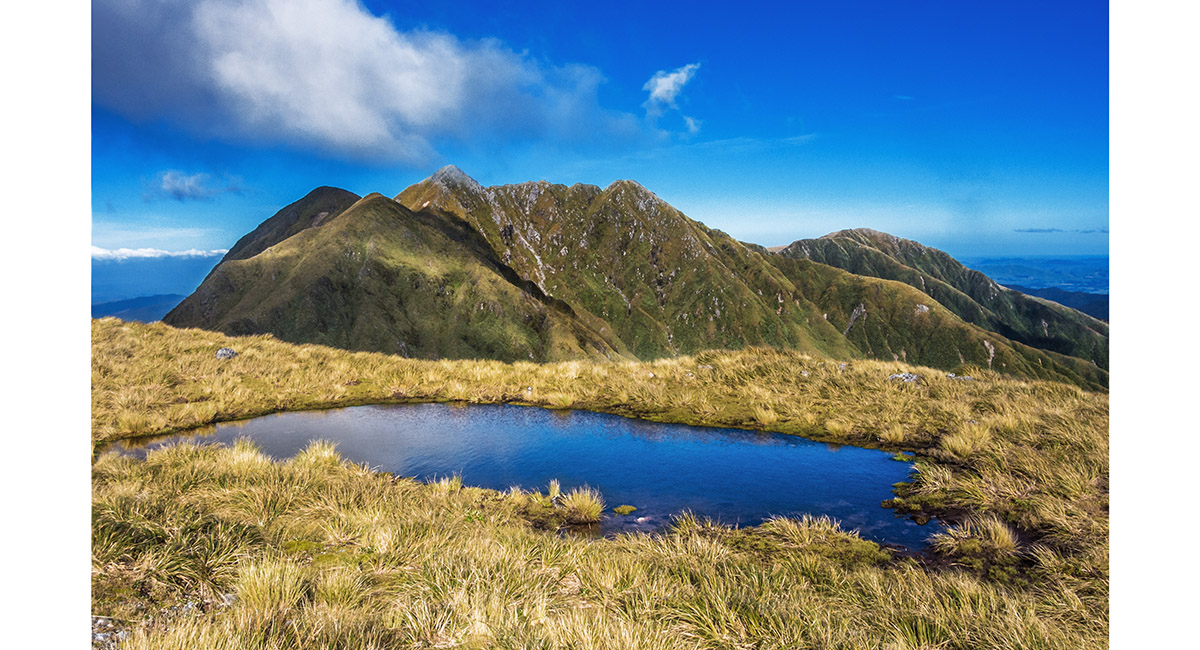
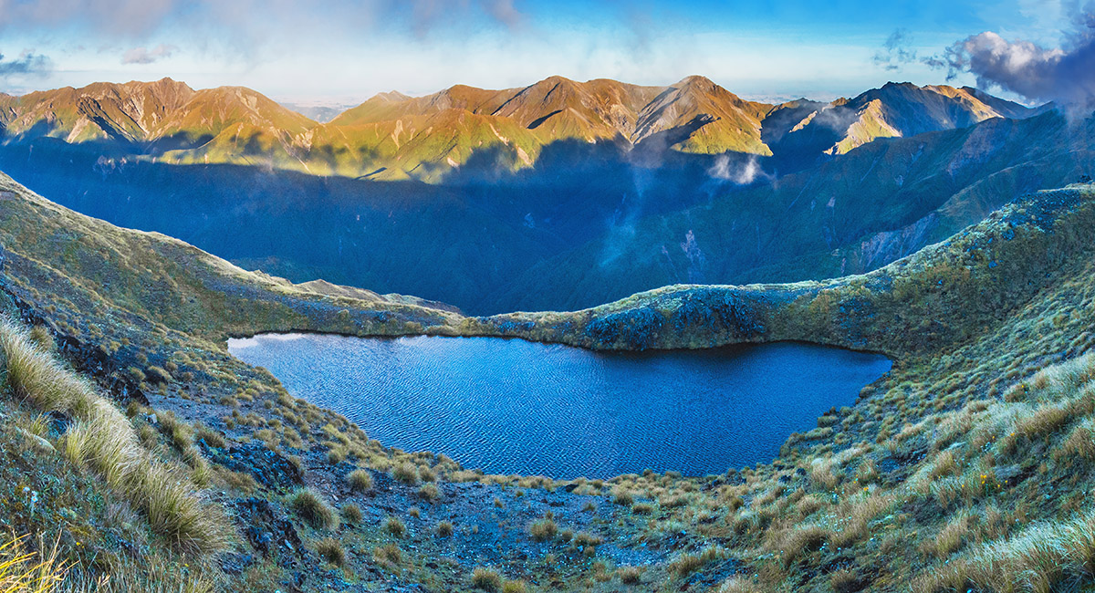
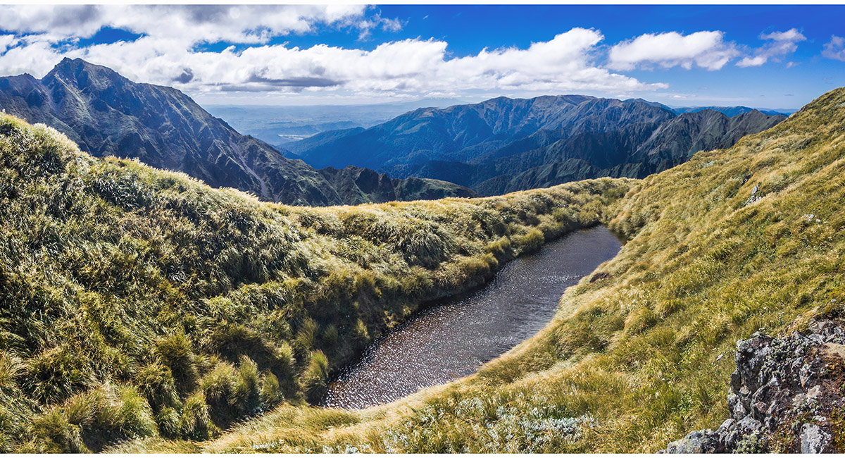
The tarn (1,370m) just above Arete Bivy, with Bannister and the Twins behind, Tararuas

Dawn view south east to the Wairarapa from Arete Bivy, with Bannister left, Tararuas

Arete Bivy at dawn, with the Twins directly above the Throne and Bannister summit and low peak, Tararuas


View south west down the Park Valley, from the saddle just above Arete Bivy. Thompson (1,448m) is centre, with Lancaster (1,504m) left of centre, Tararuas

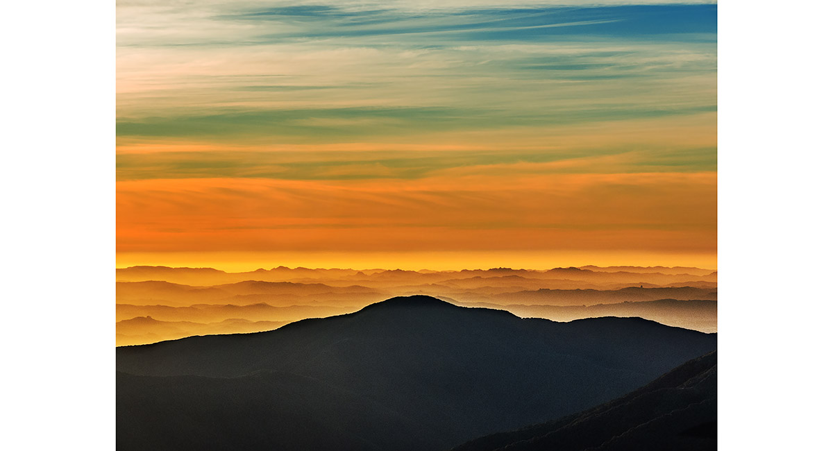
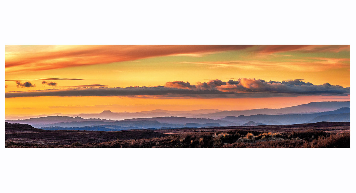
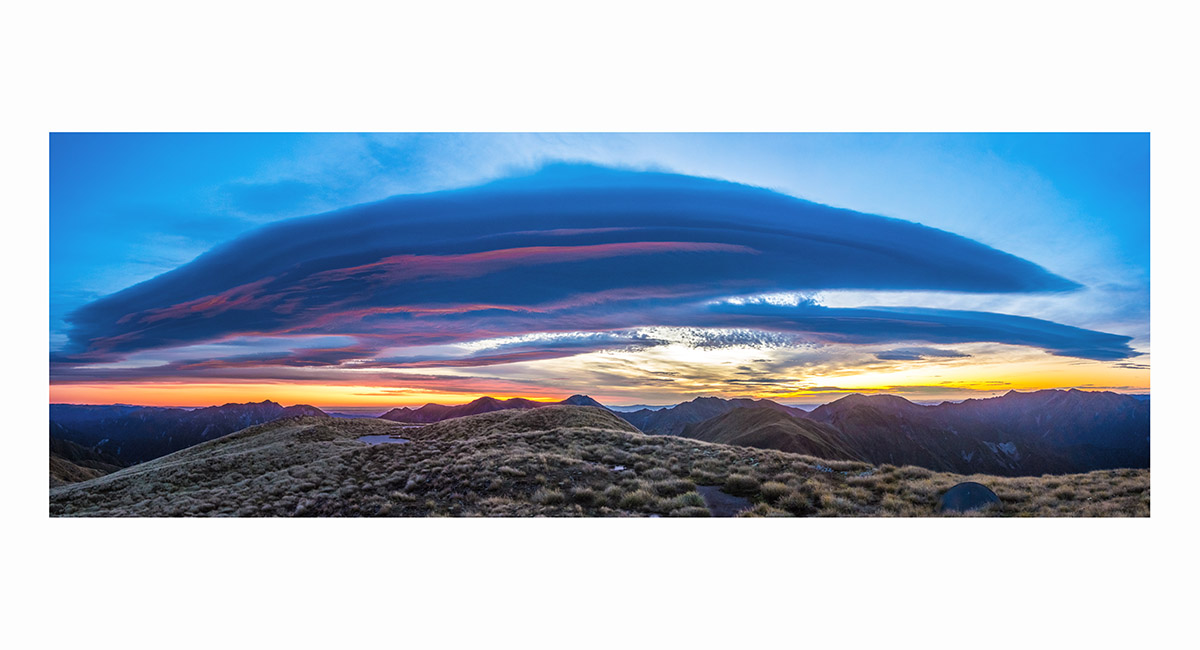
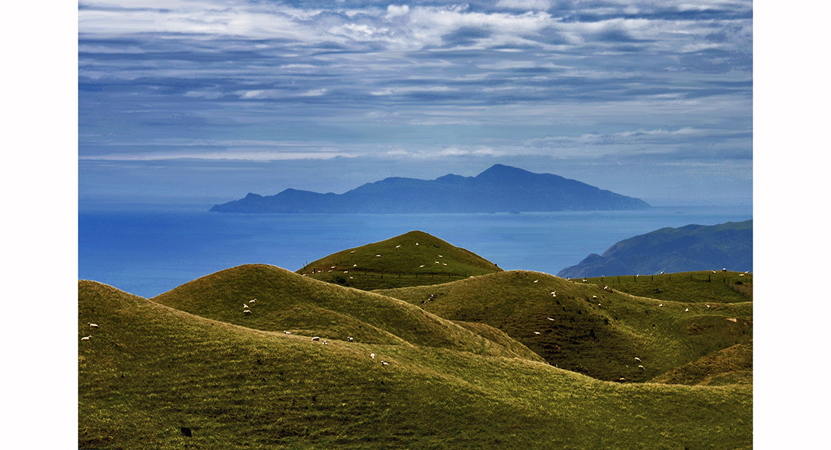
Sunrise over the Blue Range, with the low hills of the Wairarapa in the distance, Tararuas

The Broken Axe Pinnacles (1,425m) and McGregor (1,540m - far right), Tararuas

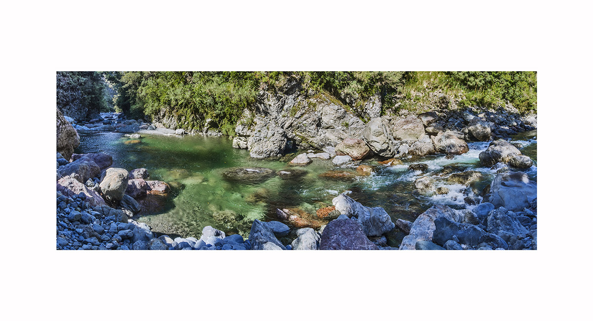
View on the Waingawa River descent from Mitre Flats Hut, Tararuas


The Kaikouras and more at sunset, from Elder Hut, Tararuas

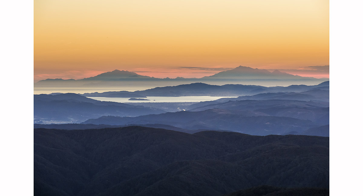
The Kaikouras at sunset, from Elder Hut, Tararuas


To order a print or web resolution file of any image you see in this slide show, just right click the image, click “Copy Image URL” and paste in to the “Your message” box of our Contact Us form. Please also note, for each image, if you want a print or web resolution file. We will get back to you as soon as possible to confirm price and payment details.
Open Contact Us in a new window to paste Image URL(s) easily