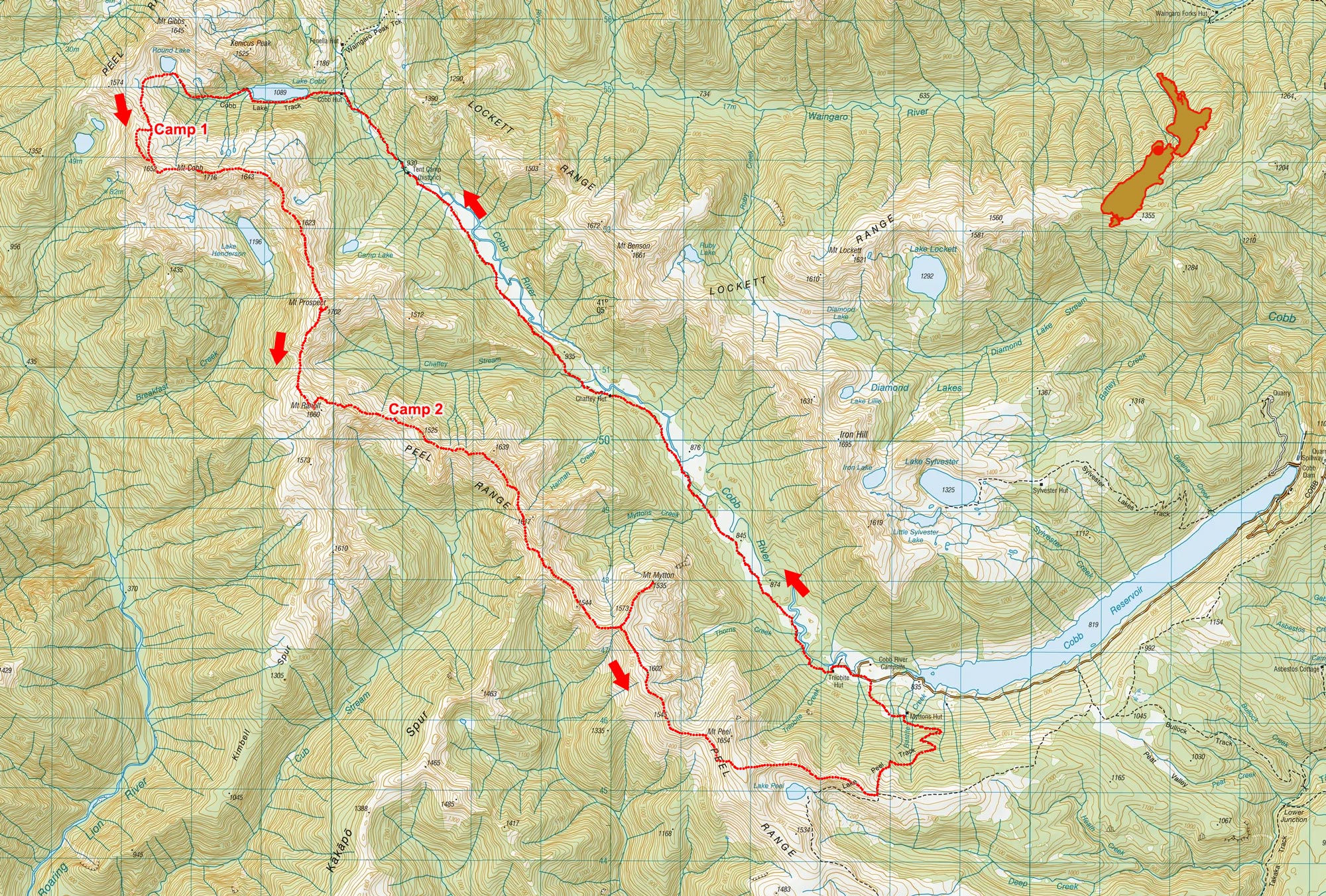
Peel Range traverse, January 2026
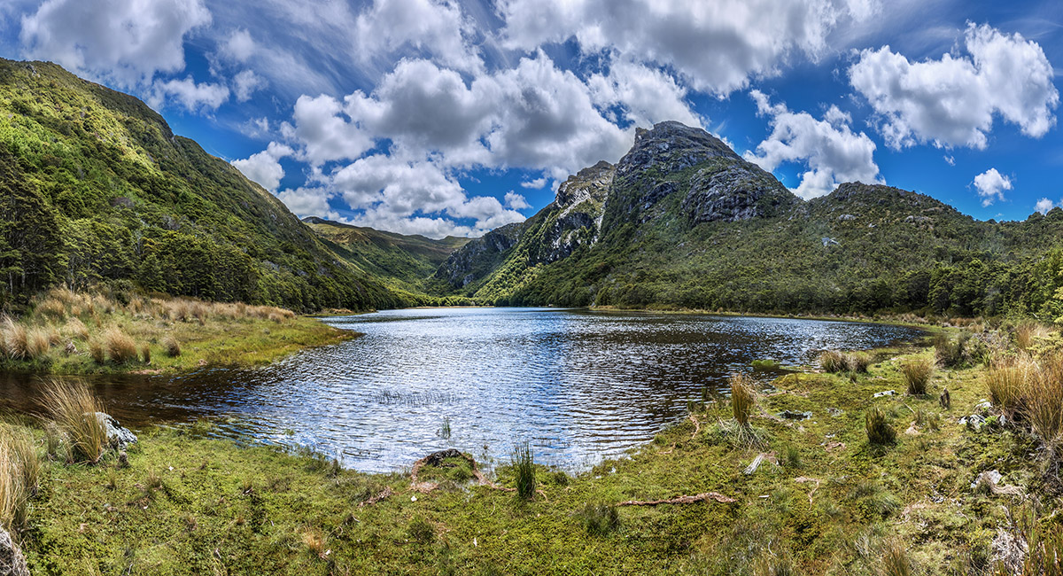
A view across Lake Cobb from its eastern end

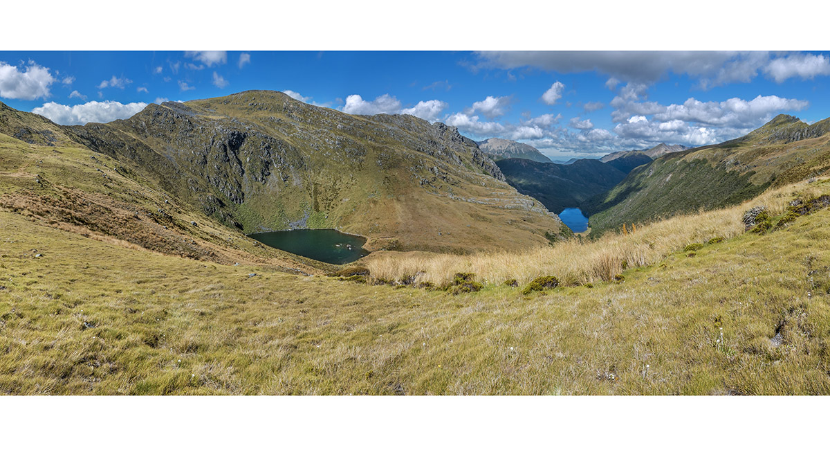
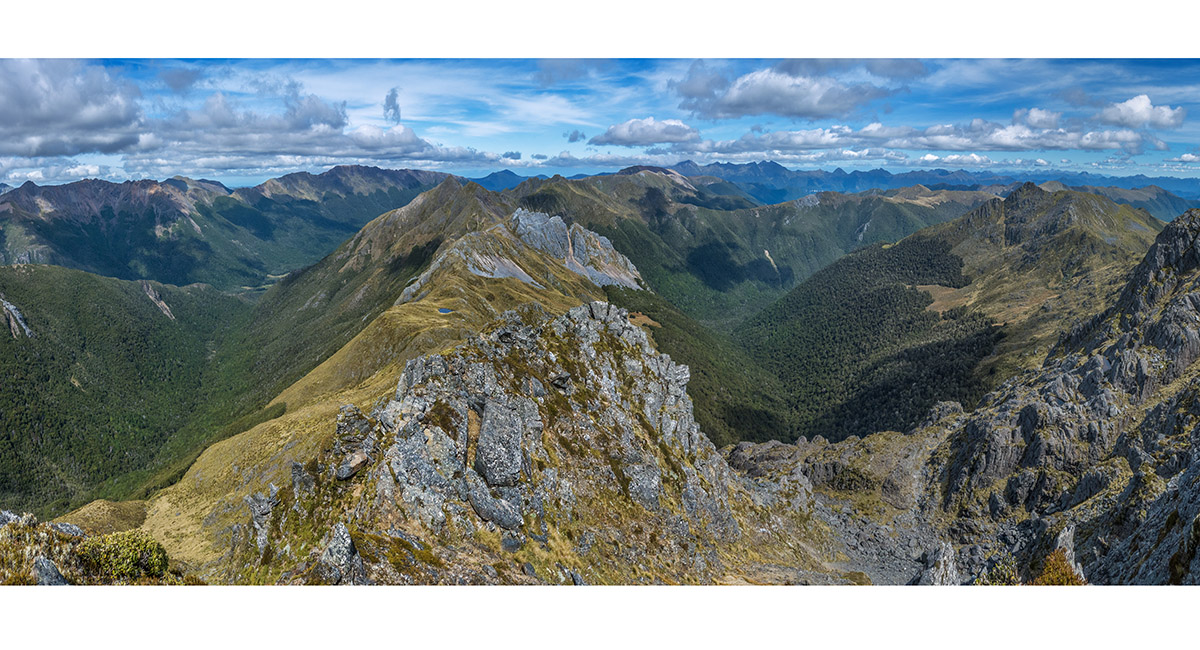
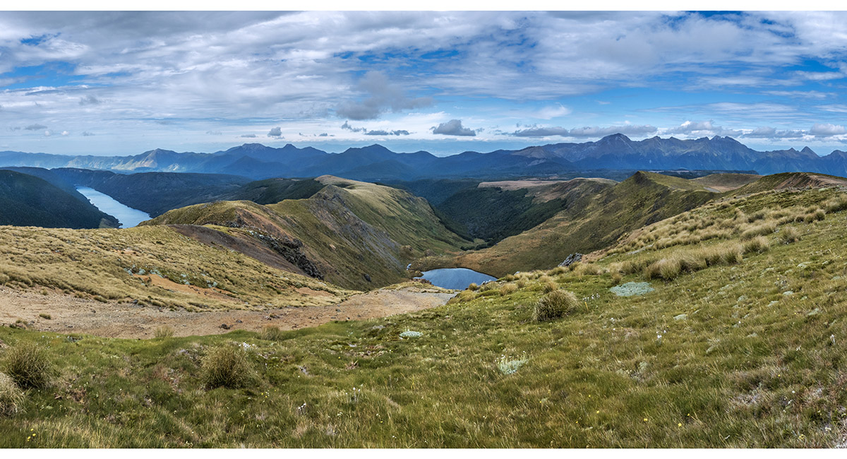
At about 1,400m, heading south, with Round Lake (1,300m, left) and Lake Cobb (1,089m, right)

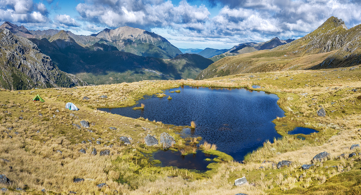
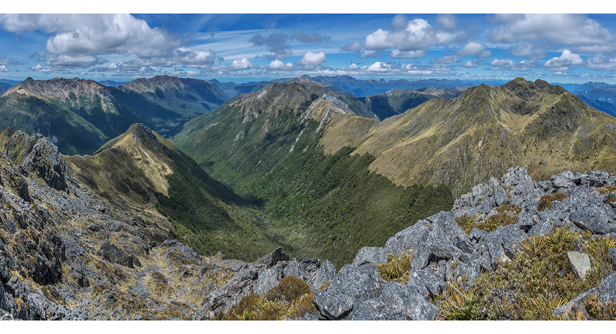
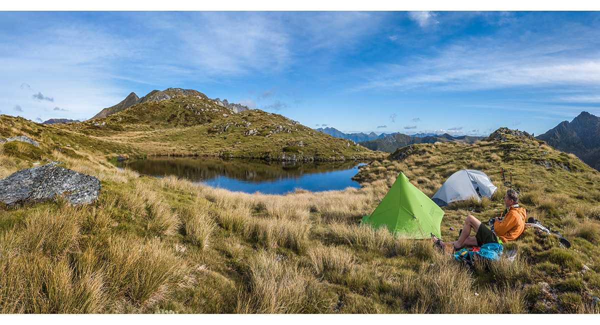
A view east from our tarn camp at 1,520m, with Mt Cobb (1,716m) far right and Mt Snowdon (1,859m) left of centre

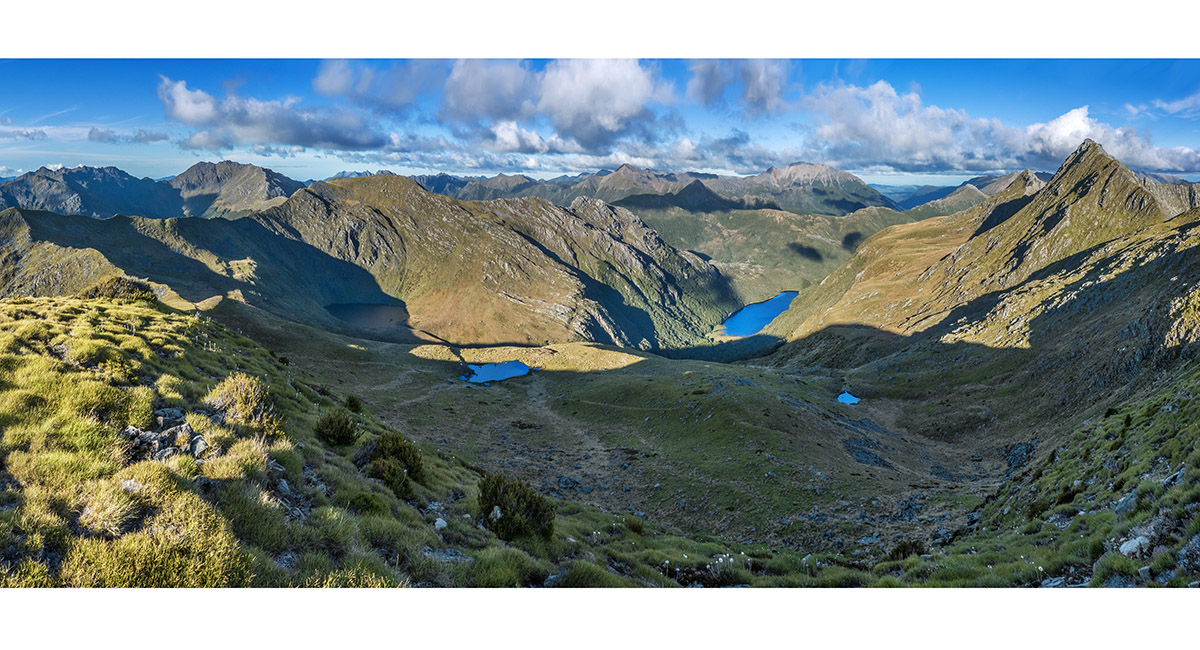
An evening view from 1,640m, above camp (mid left) and Lake Cobb (mid right). Mt Cobb (1,716m) is far right - the highest point on the Peel Range. Mt Gibbs (1,645m) is mid left

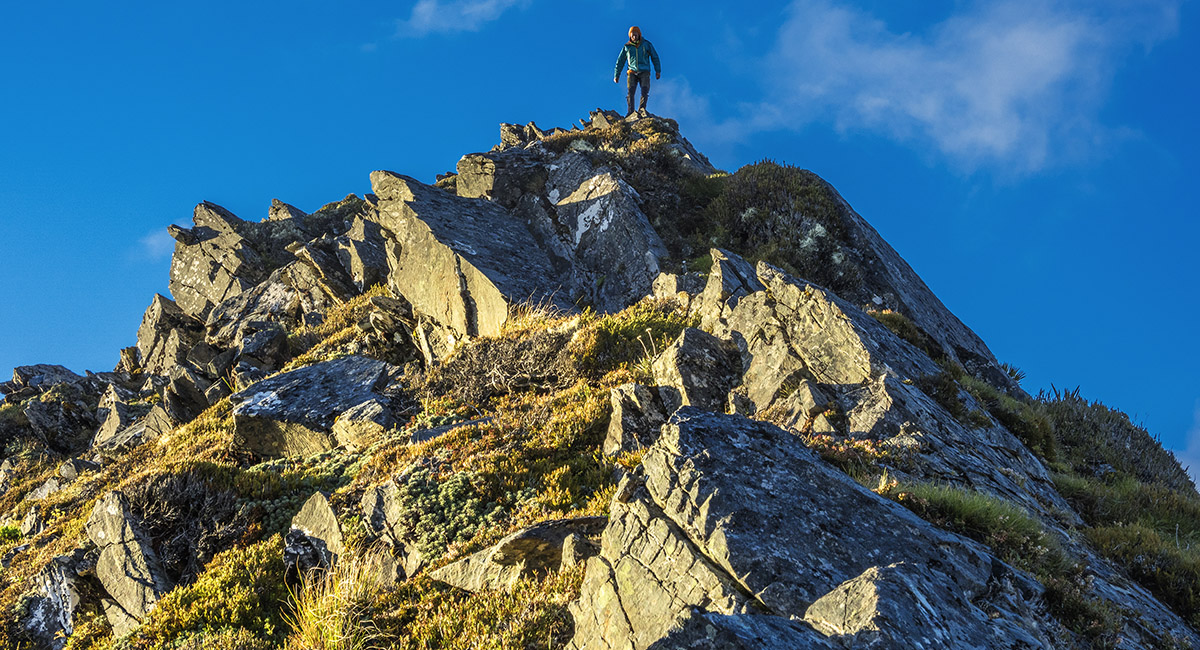
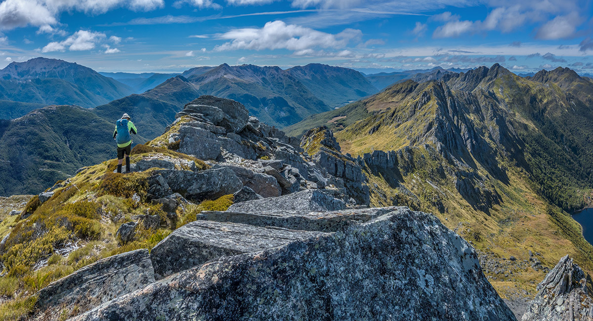
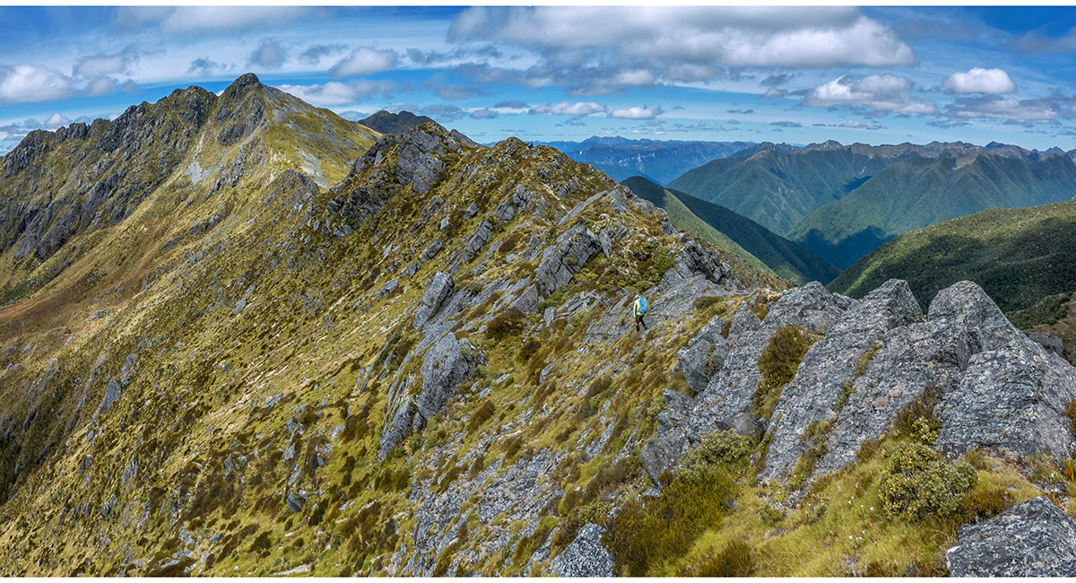
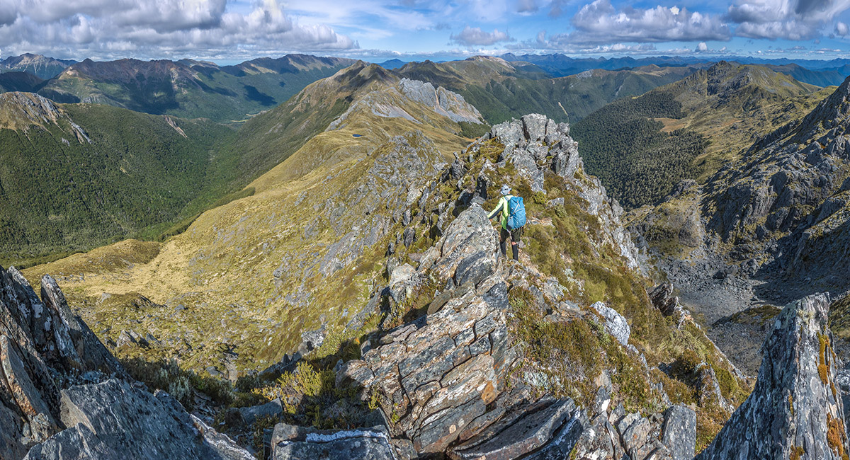
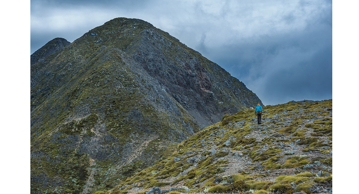
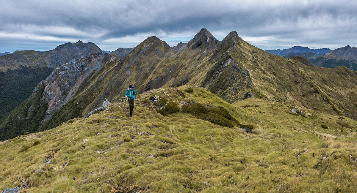
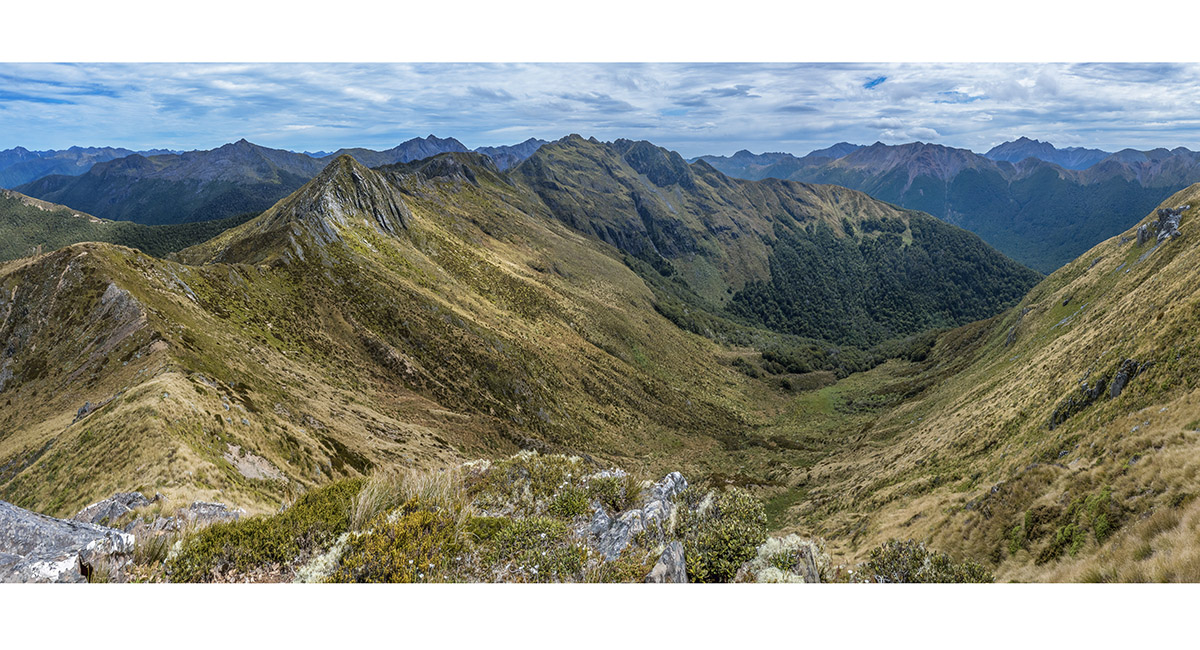
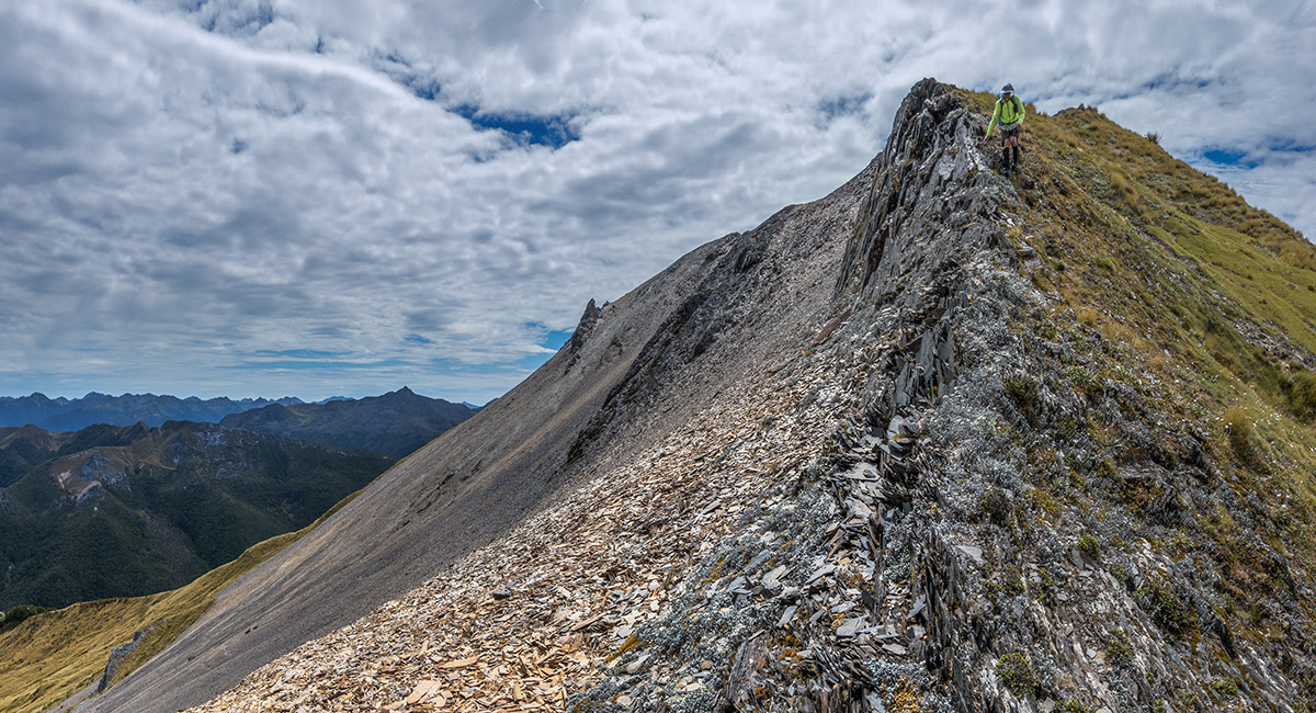
On the main range a little north of Pt1652 - a taste of the steep rocky terrain that dominates the Peel Range

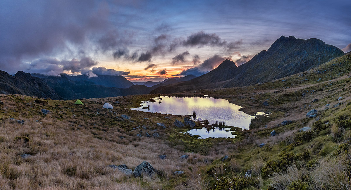
Dawn at camp 1, looking east


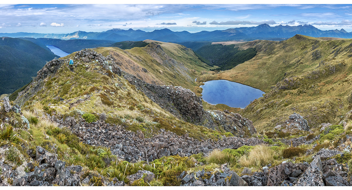
Dawn above camp, looking east to Round Lake left, Lake Cobb centre and our tarn camp right. Pt1652 and Mt Cobb are top right

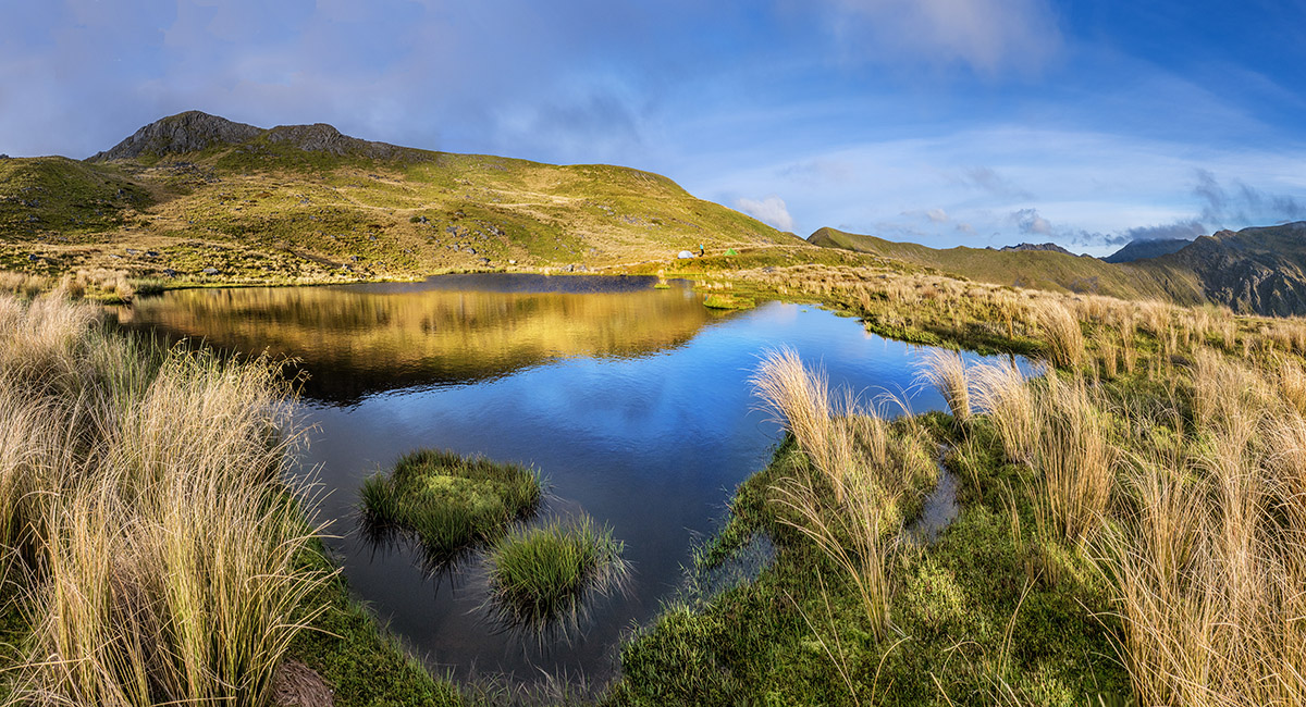
Morning at camp 1


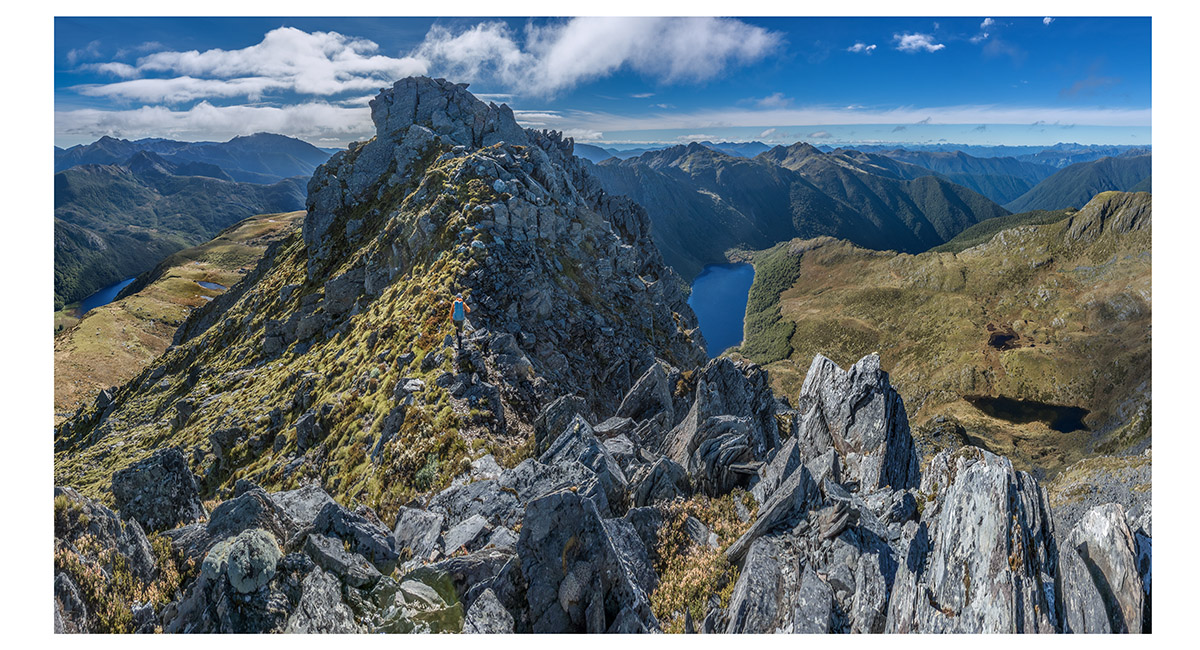
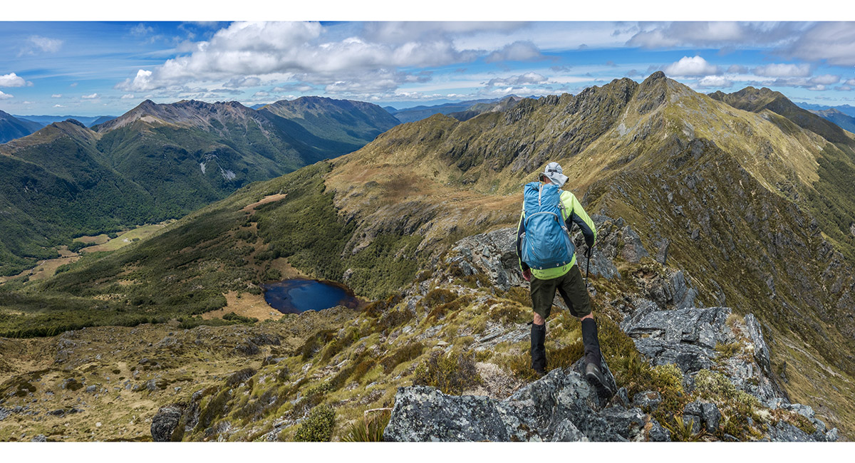
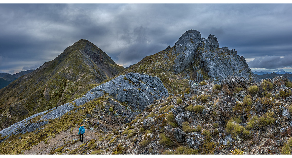
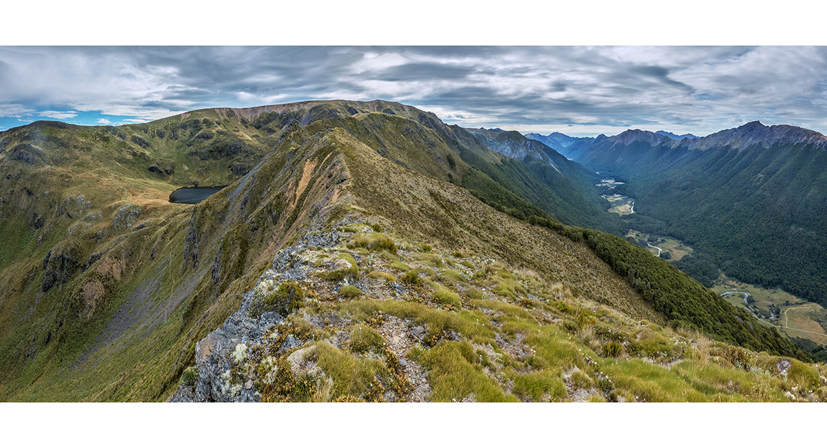
Heading east along the Peel Range towards Pt1652 (out of picture). Mt Cobb is far right

Heading east towards Mt Cobb, with Lake Henderson (1,196m) coming into view at right. Our rocky route of the day stretches right from Mt Cobb

Approaching the summit of Mt Cobb


Mt Cobb Summit (1,716m) view northwest, back the way we'd come. Round Lake centre and Lake Cobb mid right

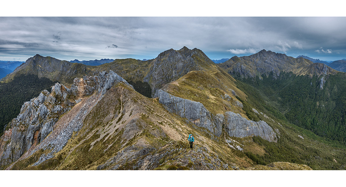
Mt Cobb Summit (1,716m) view east to Pt1643. Pt1623 is left of the far end of Lake Henderson and Mt Prospect (1,702m) beyond the lake


Departing Mt Cobb with Pt1643 ahead

Climbing Pt1643

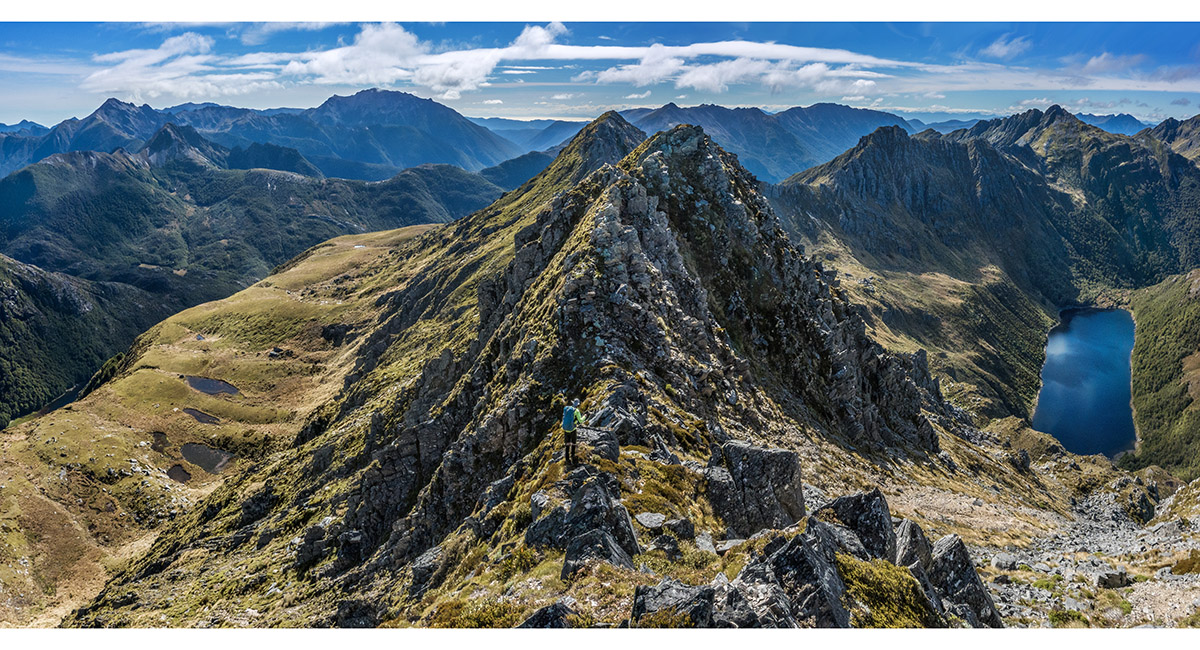
Looking back west beyond Pt1643. Round Lake and Mt Gibbs are at right

Climbing over the rocky tops of Pt1643. Beyond this a bit of sidling just below the eastern (left) side of the ridge was needed at times. Beyond the dip is Pt1623, then Mt Prospect


Still on the main ridge east of Pt1643

Some sidling just east/left of the ridge on the approach to Pt1623

Nearing Pt1623


Climbing Pt1623

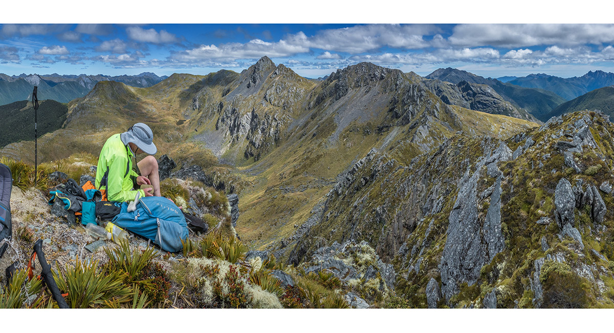
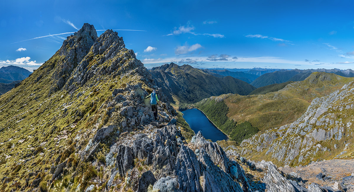
Taking a break on Pt1623, looking southeast to Mt Prospect, with Camp Lake mid left

South of Pt1623, with Camp Lake (1,270m) below left and Mt Prospect top right

Following the ridge towards Mt Prospect (top left)


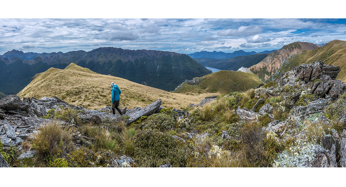
Summit view from Mt Prospect (1,702m), looking northwest along the Peel Range. Lake Henderson left

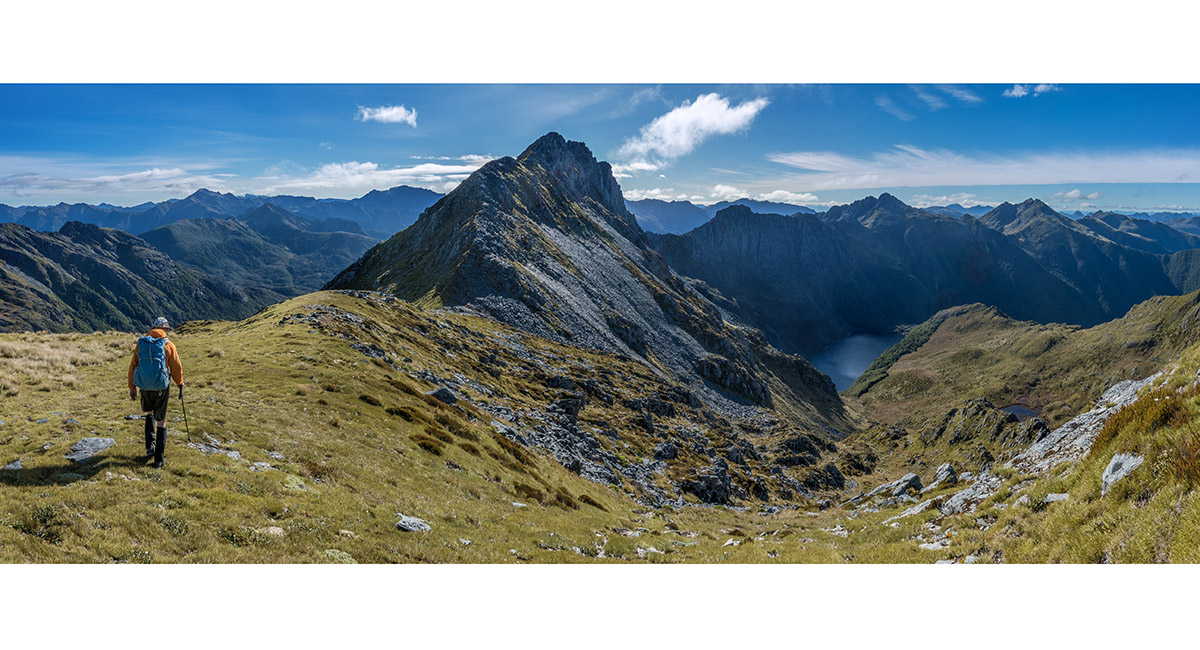
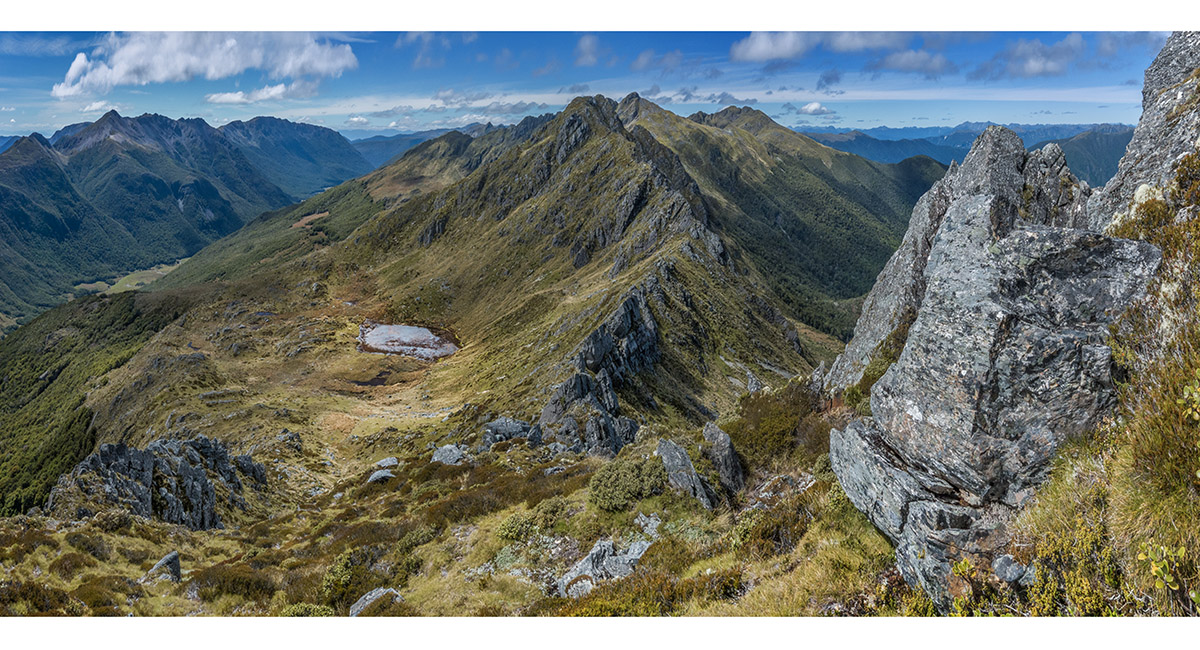
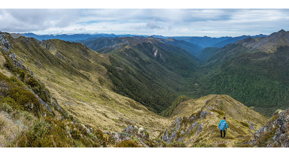
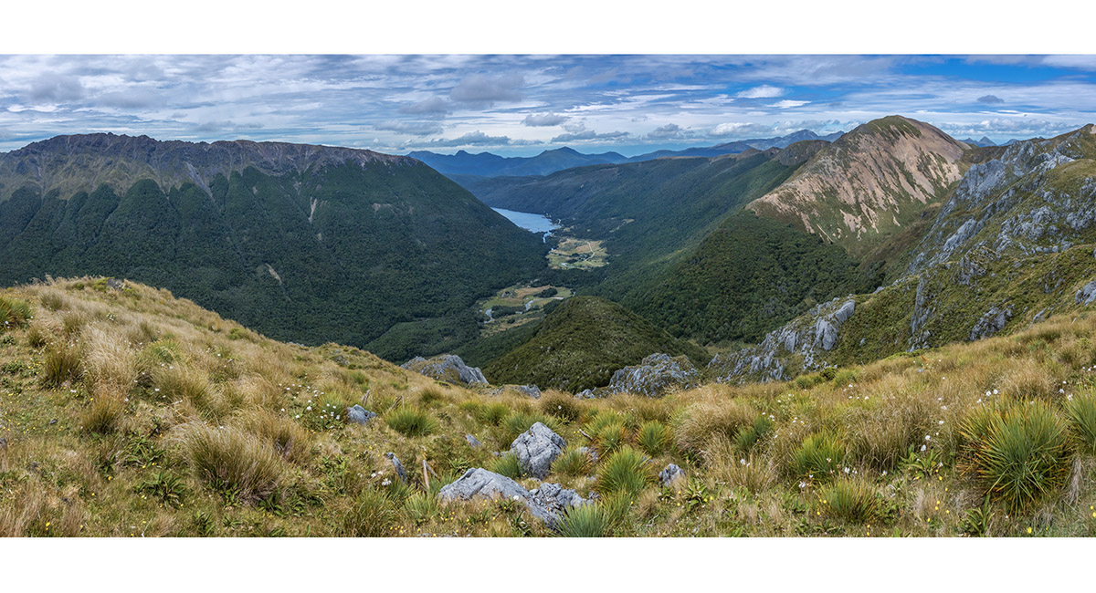
Summit view from Mt Prospect (1,702m), looking south along the Peel Range over the terrain still to come. Our camp 2 is mid upper centre on a tussock-covered section of the ridge before the steep karst formation

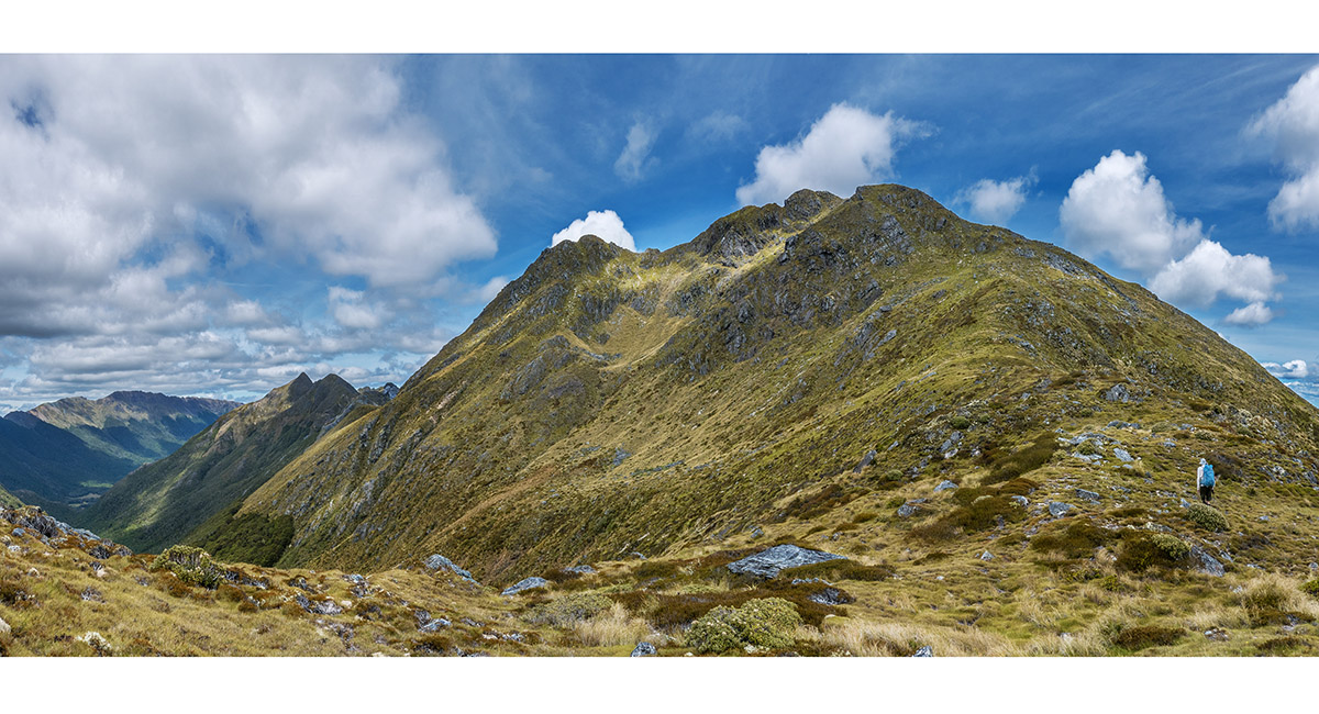
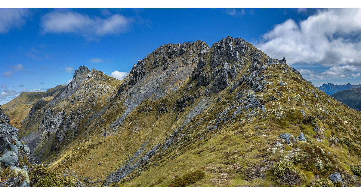
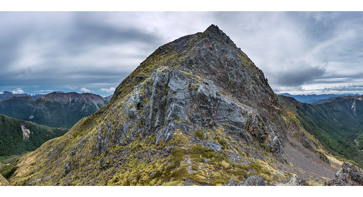
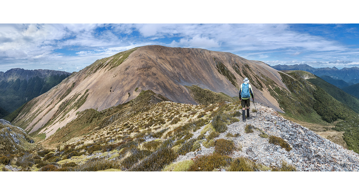
Approaching Mt Ranolf (1,660m). Just beyond the summit is a small notch - right of centre skyline here. We found this impassable so were forced to descend very steeply down the northern flanks and then to sidle back up to the ridge

Beyond Mt Ranolf things got quite unruly. This view east from the main ridge beyond Mt Ranolf shows our camp 2 beside the tarn left of centre. I pondered the strange location for a tarn, before plunging left off the rocky ridge again to enable more forward sidling

Back on the main ridge for a short stretch before another impassable obstacle forced us back off to the left for more sidling


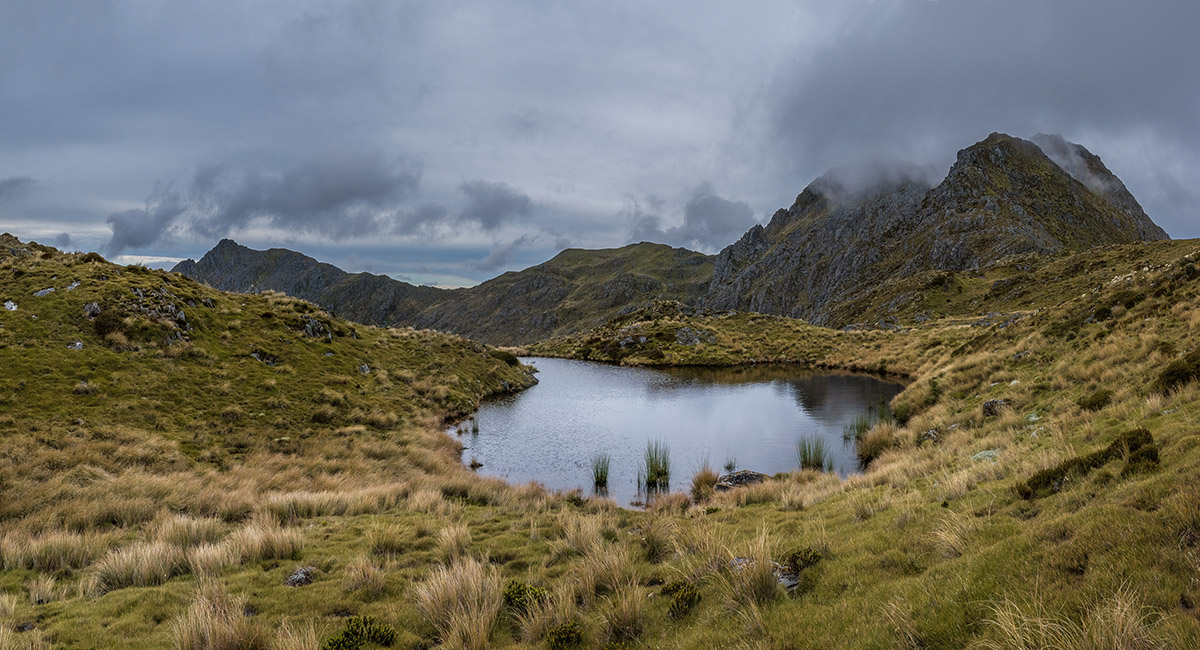
A view east, approaching camp 2 beside this tarn on the main ridge at 1,470m

A view east from camp 2

It was very windy overnight and dawn was claggy. This is the view back towards Mt Ranolf as we set off again


A view east on the approach to Pt1525

A view east on the approach to Pt1525

A view east on the approach to Pt1525

A view west from the flanks of Pt1525, back the way we'd come. Camp 2 was just in front of Mt Ranolf, now free of cloud, centre

Nearing the top of Pt1525


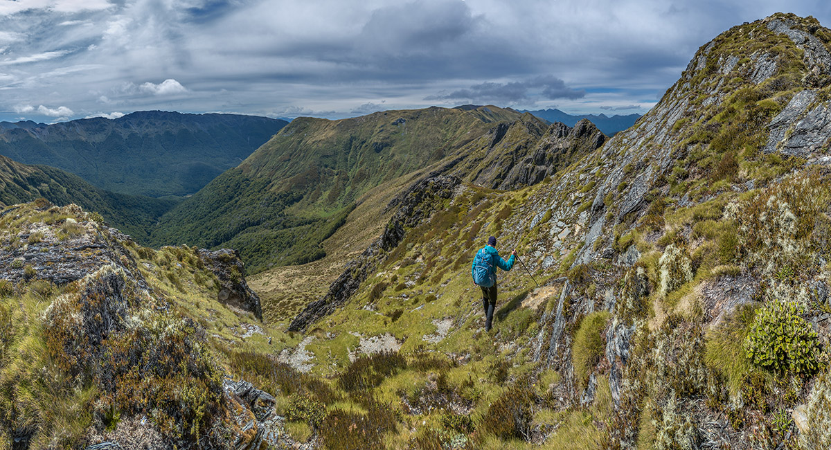
A view east from Pt1525 to Pt1639, which is a steep rocky scramble that we elected to avoid, particularly as the descent on the other side looked still more intimidating. Instead we sidled on this west side to rejoin the ridge at the saddle at centre


Another view back to Mt Ranolf from Pt1525


Here Bruce sidles on the west (right) side of the main ridge, aiming for the 1,500m dip mid centre, in front of Pt1617

Nearing Pt1617, looking back west along the main ridge past Pt1639 to Mt Ranolf left skyline

The section of main ridge south of Pt1617 through to the saddle east of Pt1544 (and it's beast just beyond it) was not for us - very steep and exposed. So this time we sidled on the east side. Here Bruce descends to easier ground on that east side

On the east-side sidle


A view back across the east-side sidle

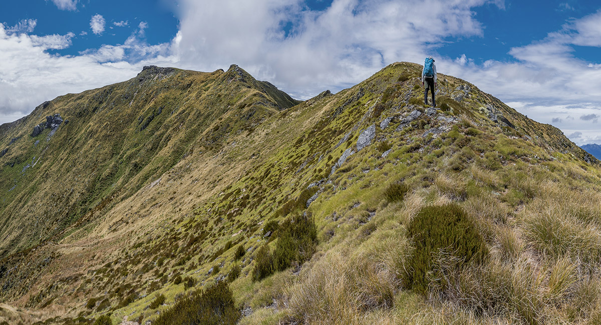
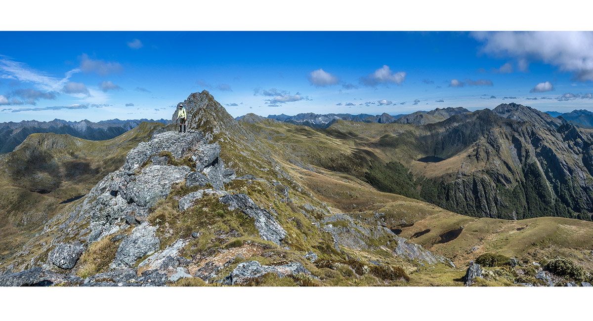
Now back on the main ridge beyond Pt1544, looking towards Pt1573 on the left skyline. From here the Peel Range mellows significantly

A view from east of Pt1573, looking northwest back along the rugged main range

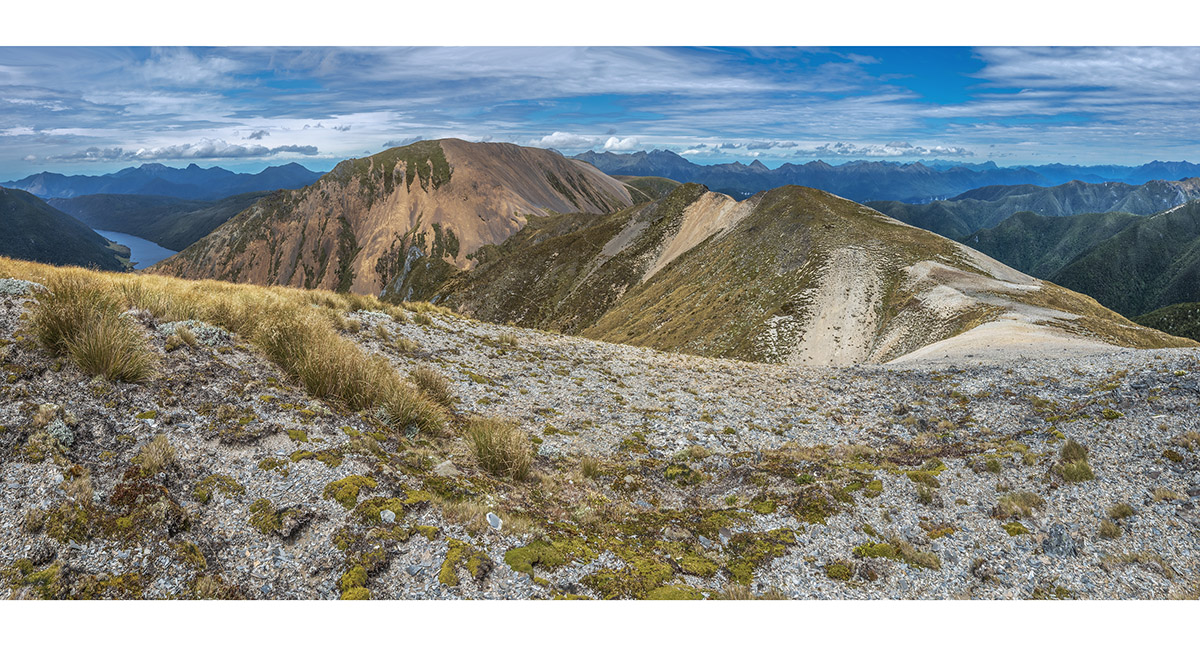
A view beyond Pt1573, northeast to the tussock top of Mt Mytton (1,535m), with Lockett Range beyond. Cobb Reservoir is in the distance, with the red flanks of Mt Peel at right

A view from Mt Mytton to Lockett Range (left), Cobb Reservoir (819m, centre) and Mt Peel (1,654m, right)

On the main ridge, approaching Mt Peel

Still a few craggy spots on the main ridge to get past

Mt Peel ahead. We climbed it via an upward sidle to the steep scrub chute right of centre

A view from Mt Peel to Cobb Reservoir (left) and Lake Peel (1,350m, centre). Wharepapa/Arthur Range stretches from Mt Campbell, across the skyline to Loveridge Peak far right

A view from the high northern route around Lake Peel


Approaching the last high point of the northern route past Lake Peel, before it joins the Lake Peel Track

A view northwest, back along the northern route above Lake Peel, with the broad top of Mt Peel stretching left from centre, and Cobb Valley to the right

To order a print or web resolution file of any image you see in this slide show, just right click the image, click “Copy Image URL” and paste in to the “Your message” box of our Contact Us form. Please also note, for each image, if you want a print or web resolution file. We will get back to you as soon as possible to confirm price and payment details.
Open Contact Us in a new window to paste Image URL(s) easily