Gomorrah, Sodom and Cowin Spur, January 2025
A view to Mt Patriarch, centre skyline, from about 1,000m on Chummies Track

A view to John Reid Hut (1,240m) from 1,400m, on the saddle directly north of the hut. The Mt Owen group are on the left skyline

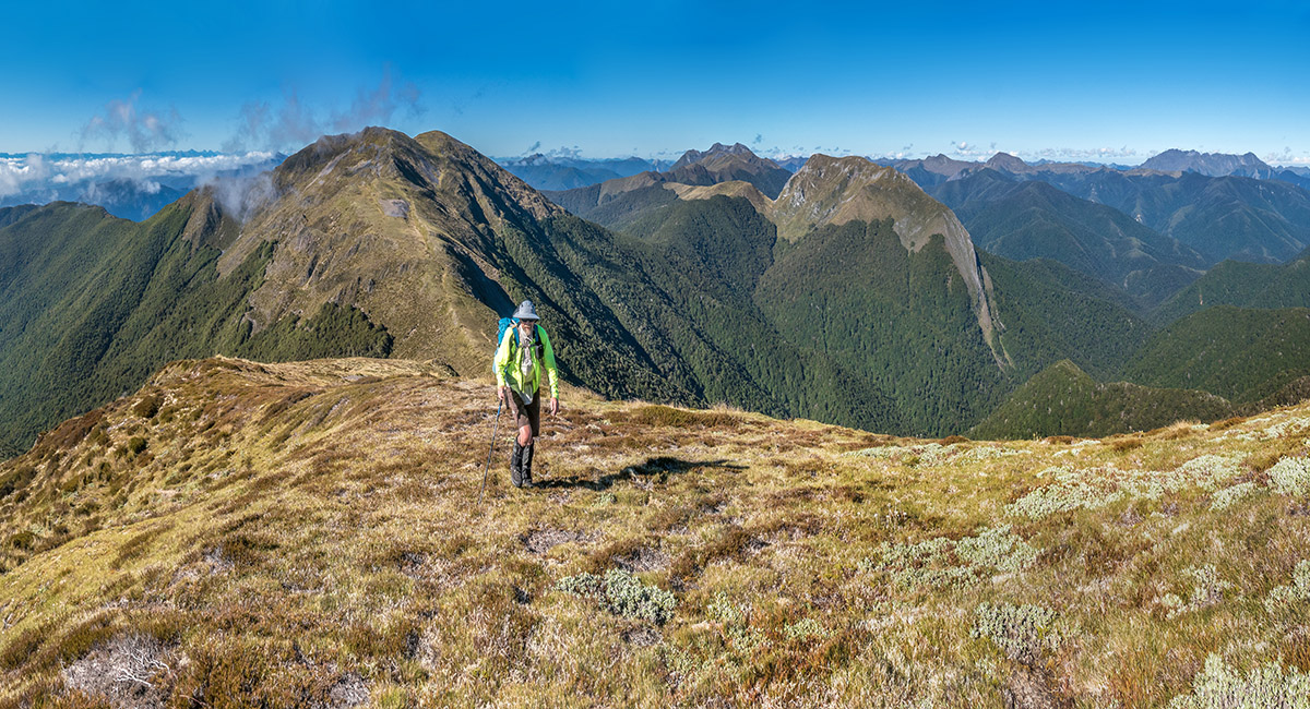
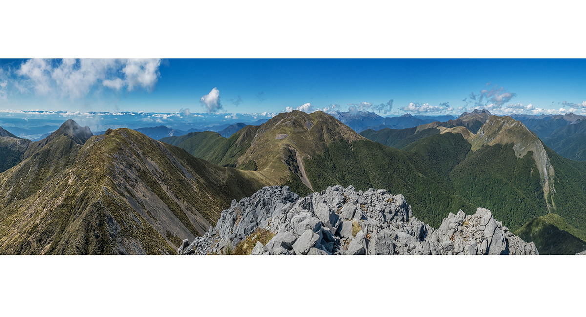
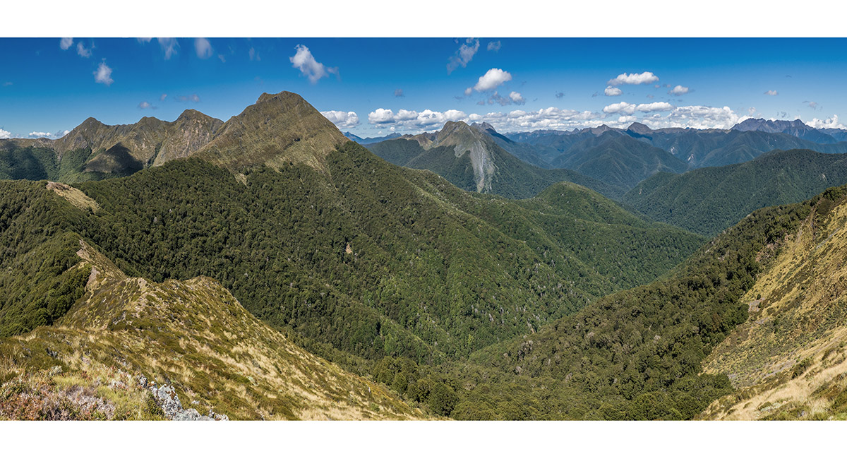
From the saddle, looking north to Mt Baldy (1,542m) centre, Pt 1463 far left, Mt Sodom and Mt Gomorrah, mid right skyline and Pt 1364 far right

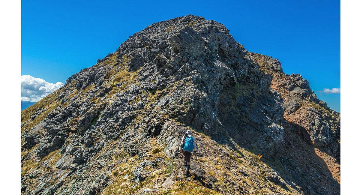
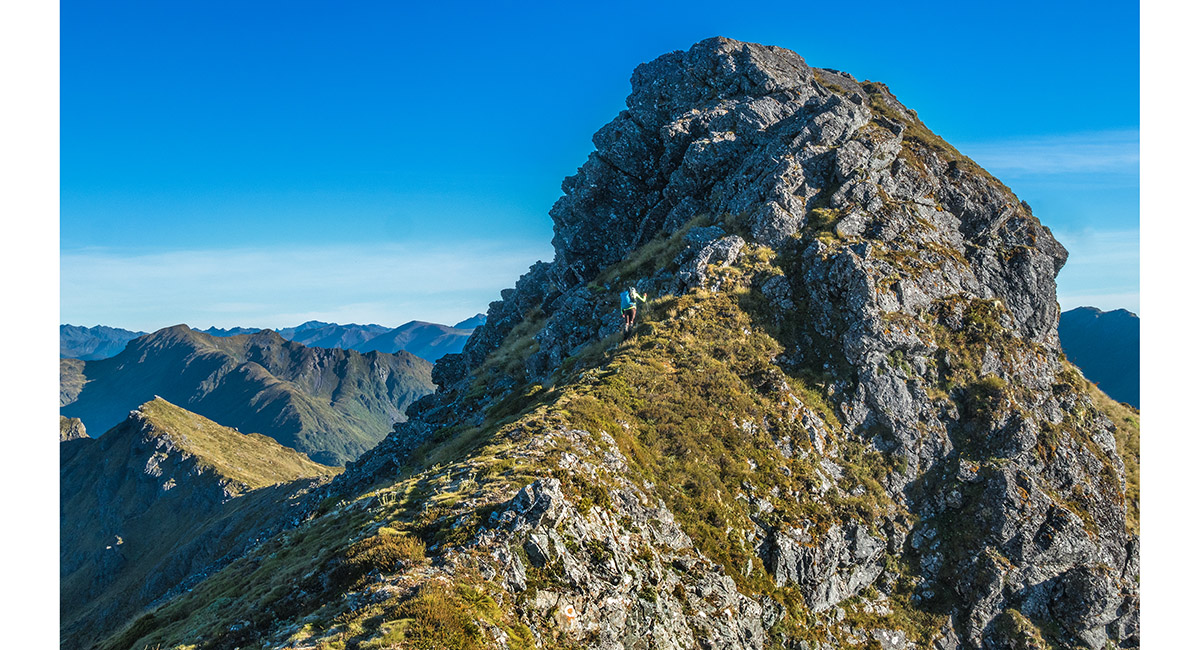
The first of several bush scrambles along our route, this one south of Pt 1364

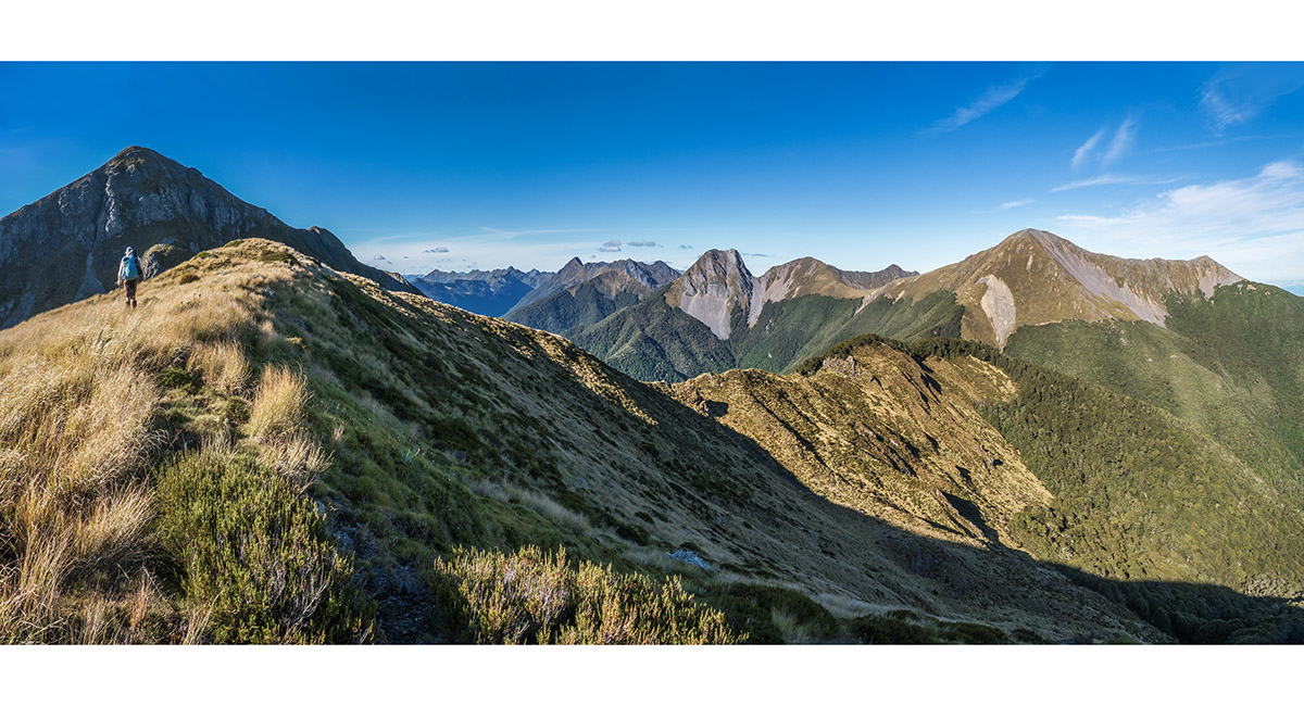
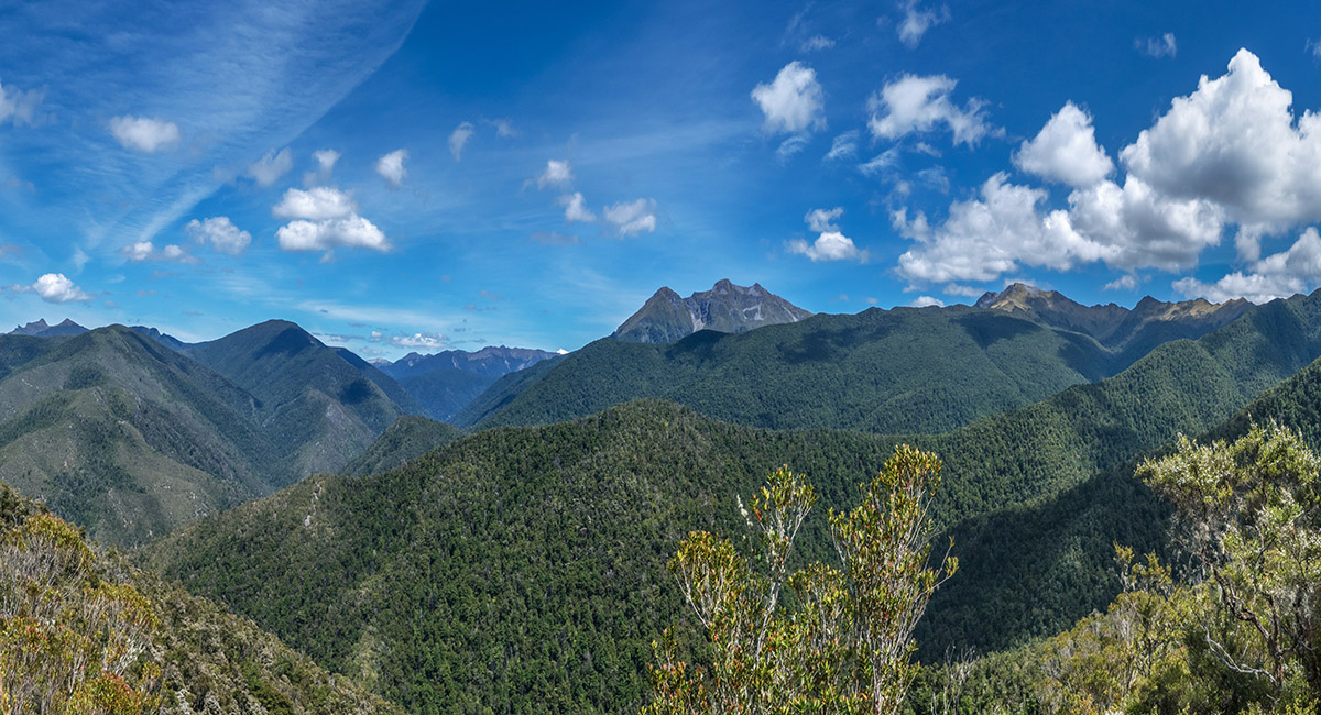
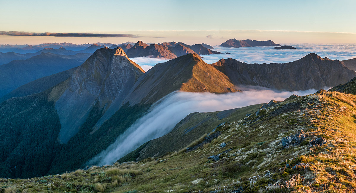
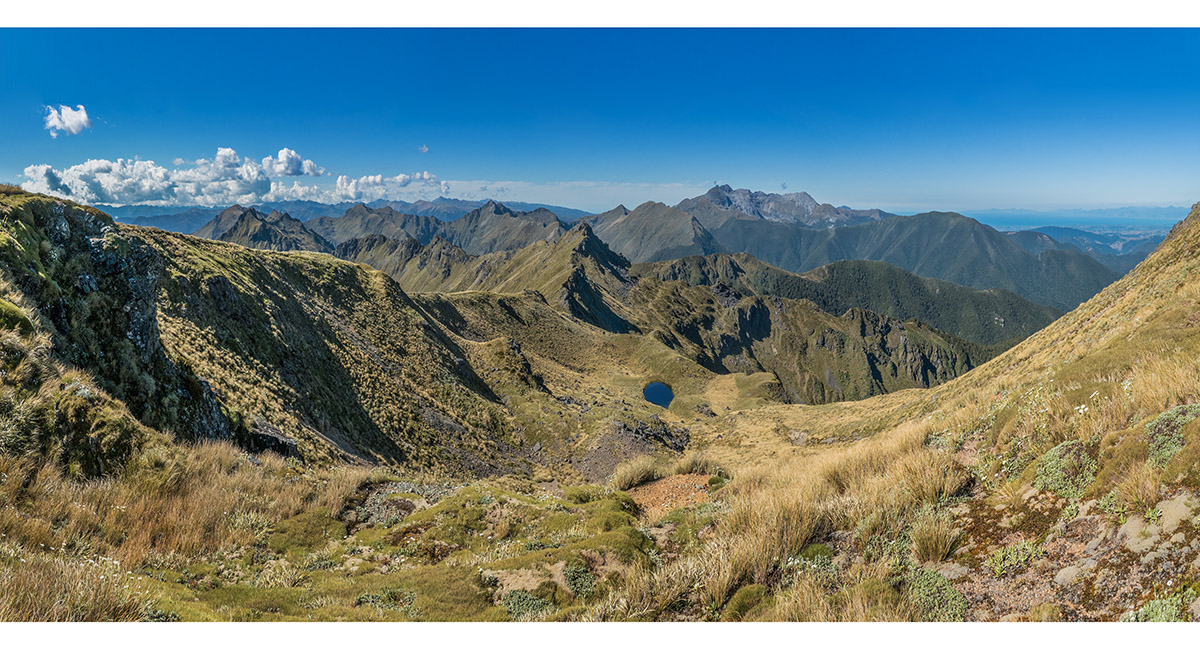
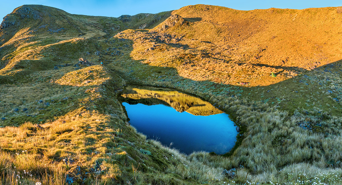
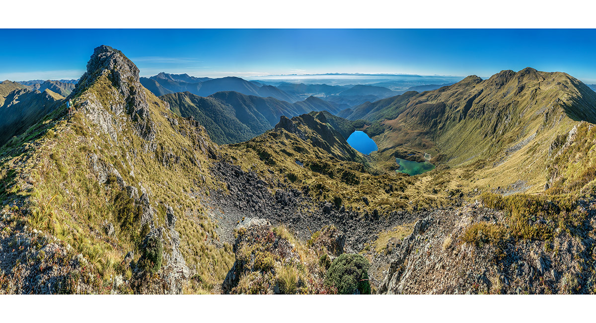
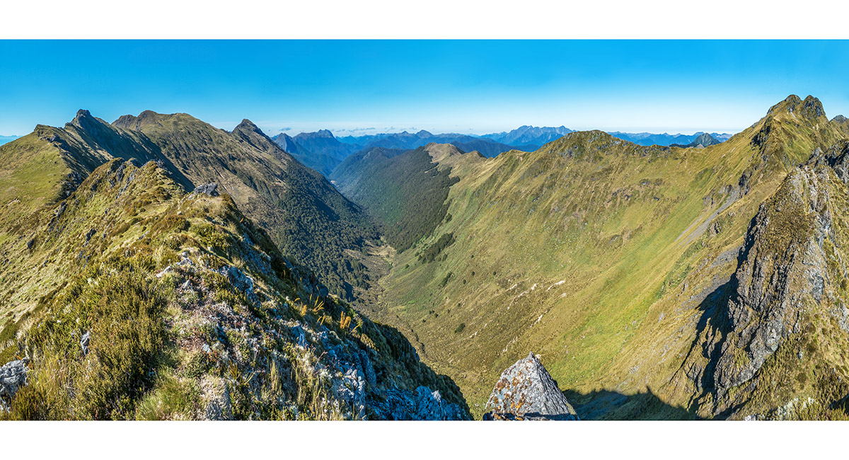
North of Pt 1364, with Mt Baldy (1,542m) left, Mt Sodom (1,565m) centre and Mt Gomorrah (1,592m) right

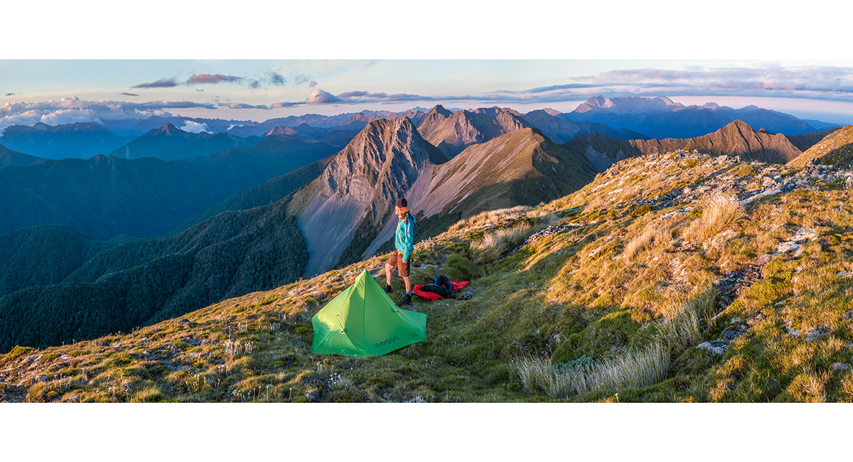
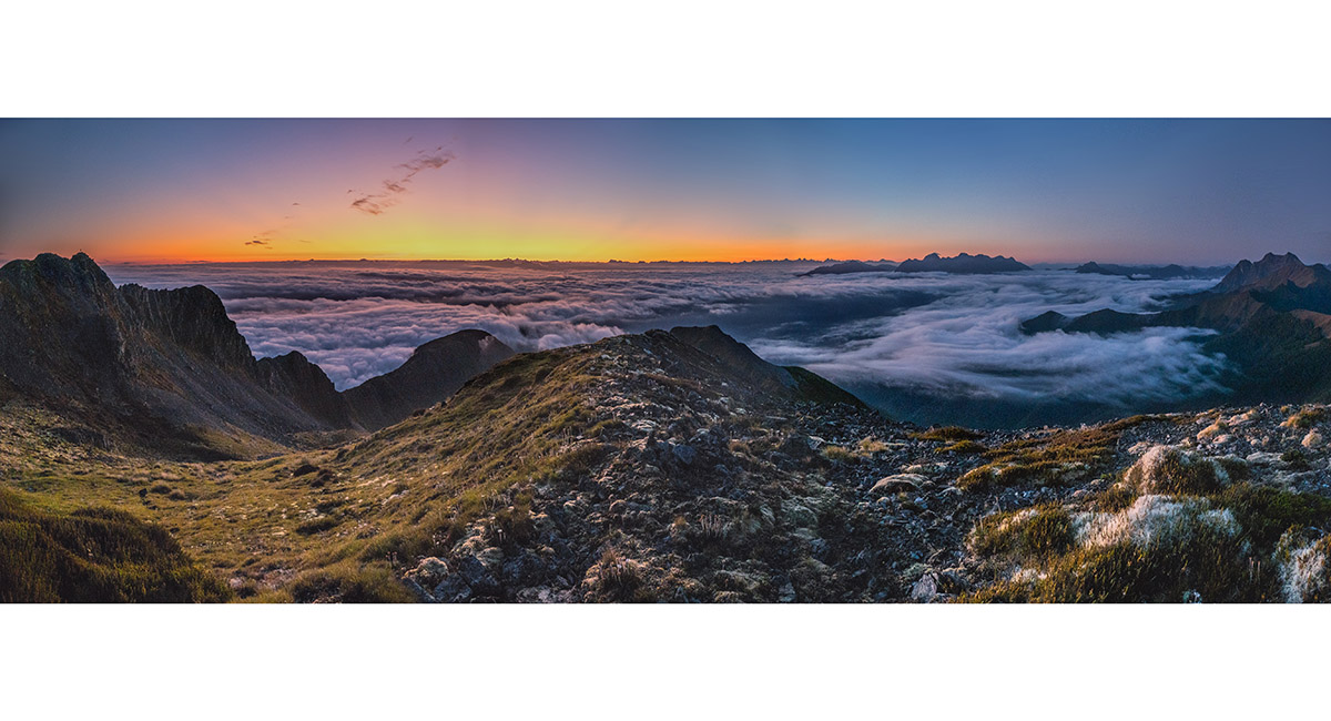
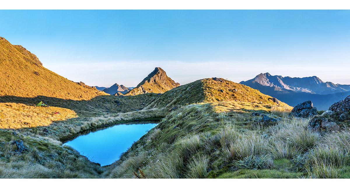
A dusk view north from our bivvy on top of Mt Gomorrah. Mt Sodom is directly behind Bruce and The Twins/Mt Arthur group are on the right skyline

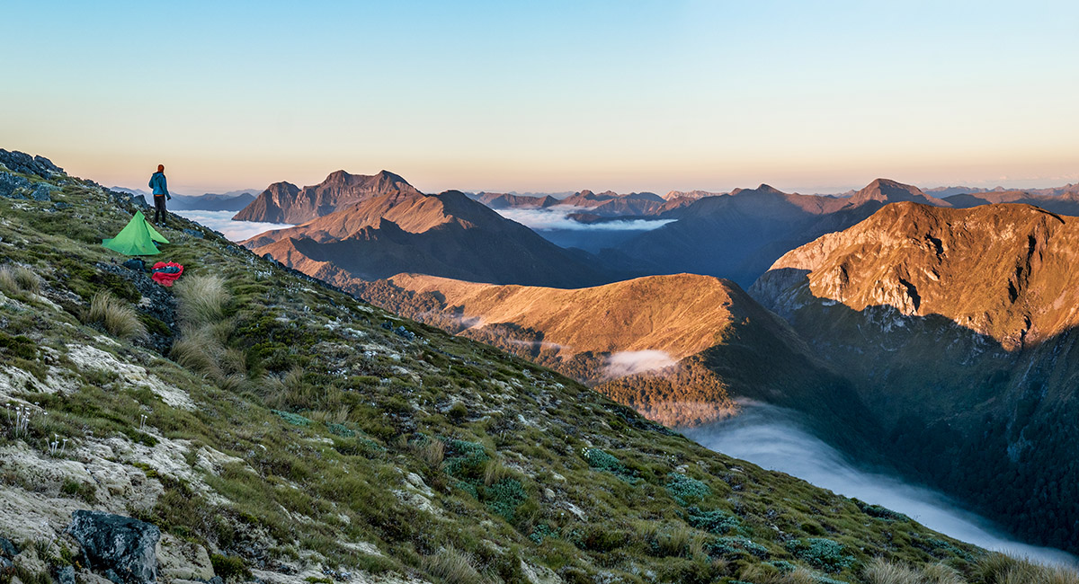
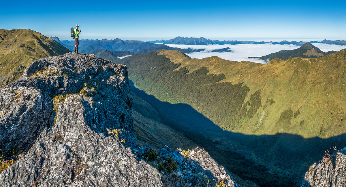
Our sunset view southwest to Mt Patriarch (1,701m) far left and Luna Ridge

Sunset view to Mt Sodom, right foreground and beyond to Mt Olive (1,445m)

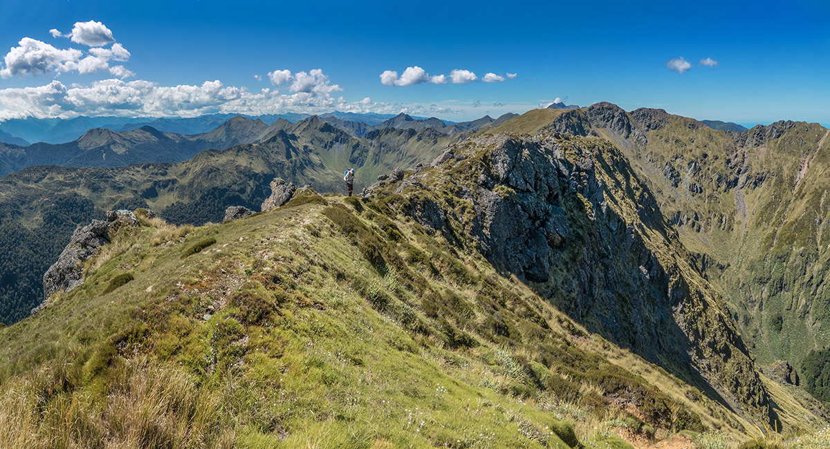
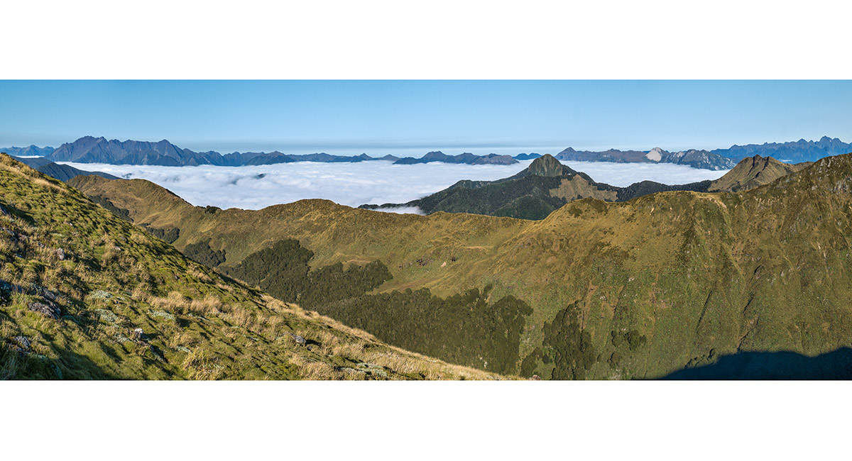
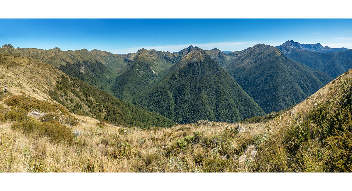
East to west dawn view from Mt Gomorrah, with Mt Gomorrah Trig far left, the Mt Owen Group mid right skyline and Mt Patriarch far right

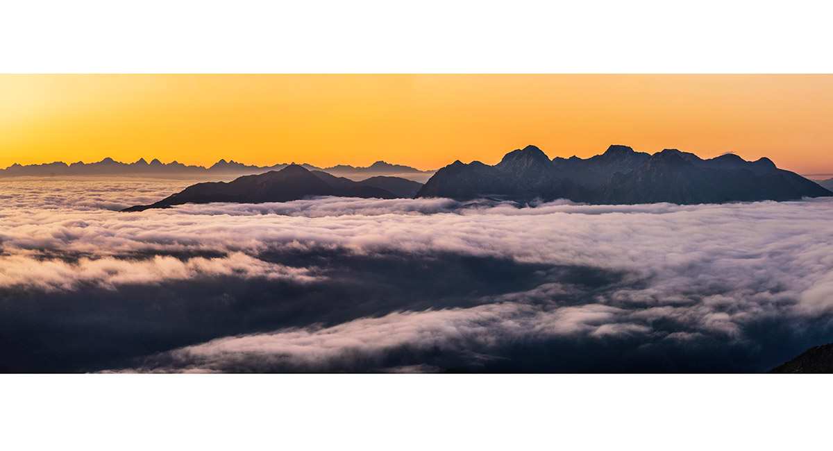
A closer look at the Mt Owen Group

Dawn view north from Mt Gomorrah to Mt Sodom centre, then right to Pt 1633 and Mt Star (1,588m), then The Twins/Mt Arthur group far right skyline

Dawn view south to Mt Patriarch

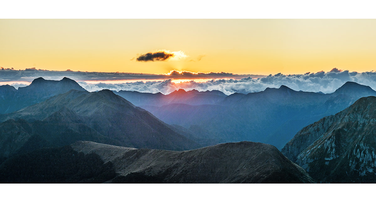
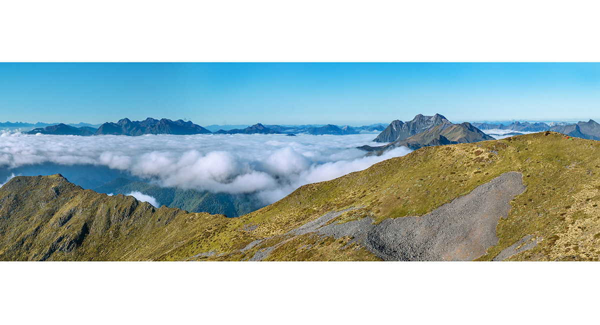
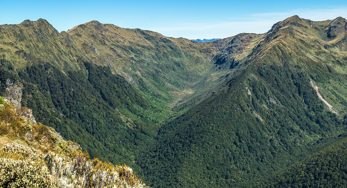
Dawn cloud rising from the east side pours over the saddle north of Mt Gomorrah and south of Pt 1541

Cloud also comes up and over on the south side of Mt Gomorrah, with Mt Patriarch behind. Mt Baldy is sunlit at right

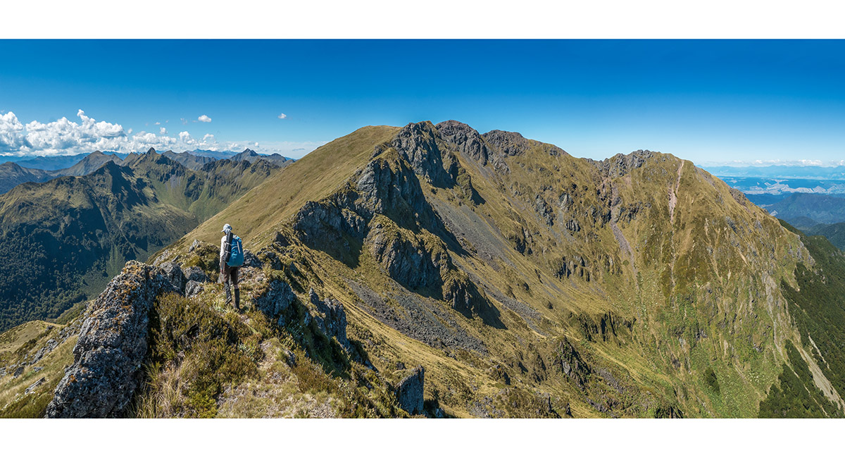
A view back from Mt Gomorrah Trig to the main summit and our bivvy site. The Mt Owen group is on the left skyline and Mt Patriarch mid right

On our northward descent of Mt Gomorrah towards to Pt 1541

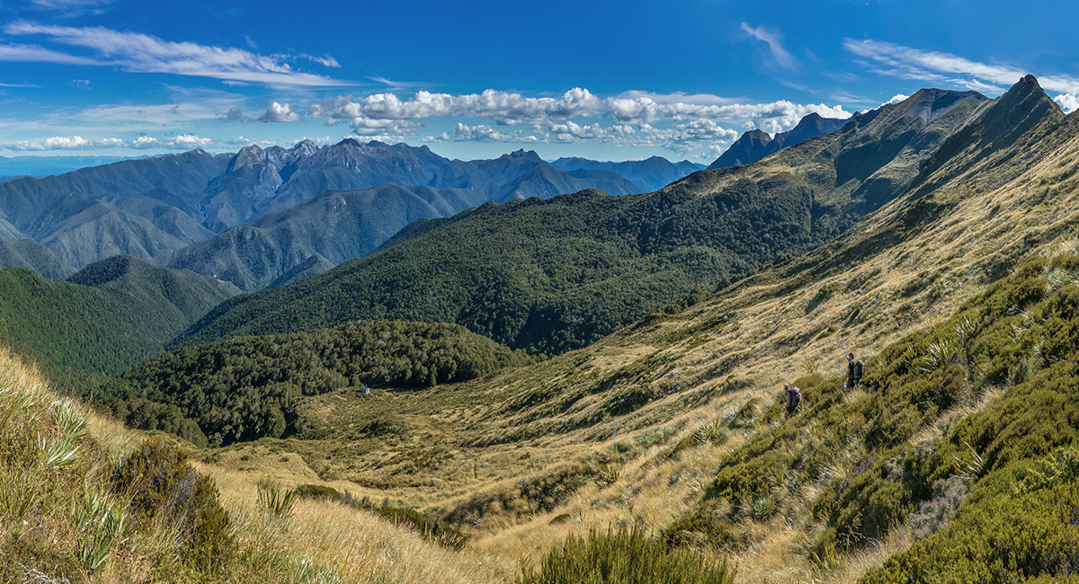
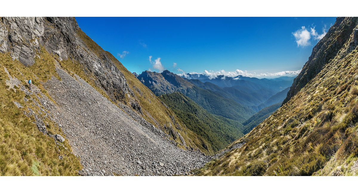
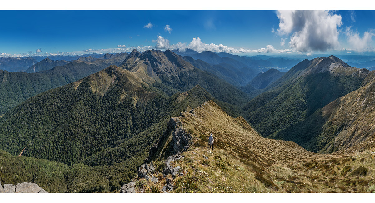
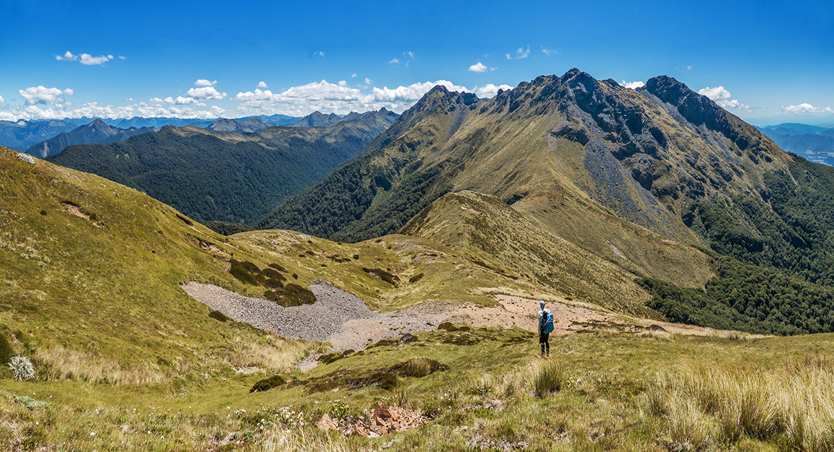
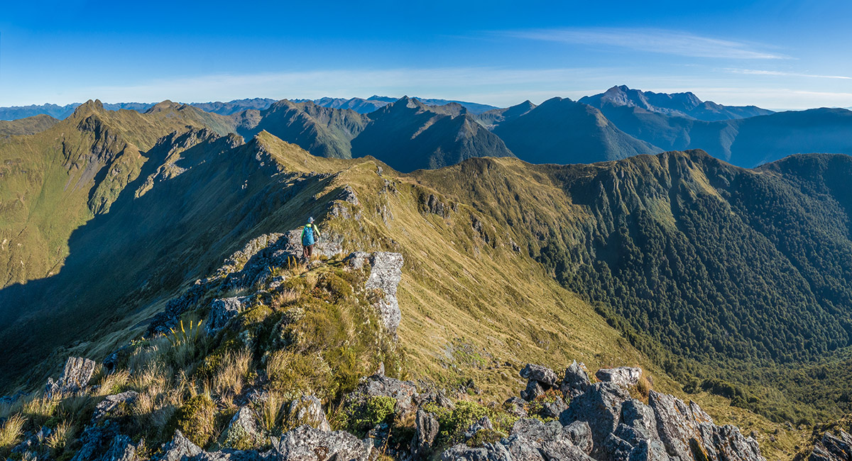
On Pt 1541, looking south back to Mt Gomorrah (left), Mt Patriarch centre, Mt Baldy and Mt Kendall (1,762m), far right skyline

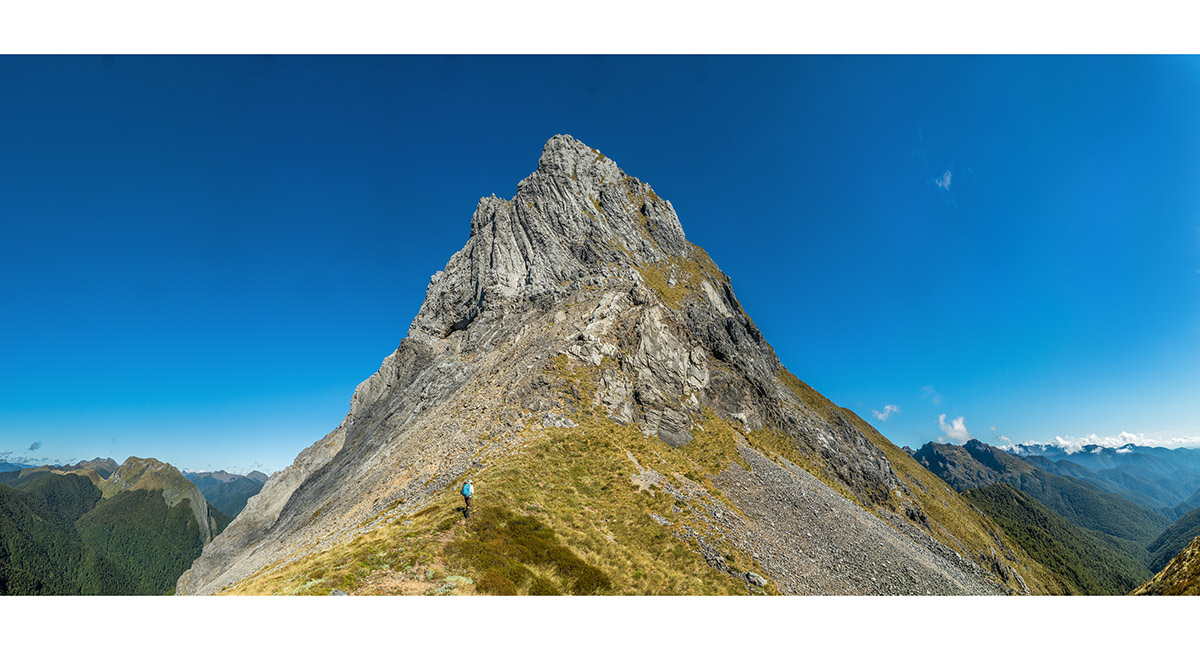
Climbing out of the saddle northwest of Pt 1541 to begin the traverse under the east side of Mt Sodom. This is steep terrain

The east side traverse heads around and up to access the northeast ridge of Mt Sodom at about 1,460m

Now looking up the northeast ridge of Mt Sodom on our ascent without packs. Pt 1541 is mid left

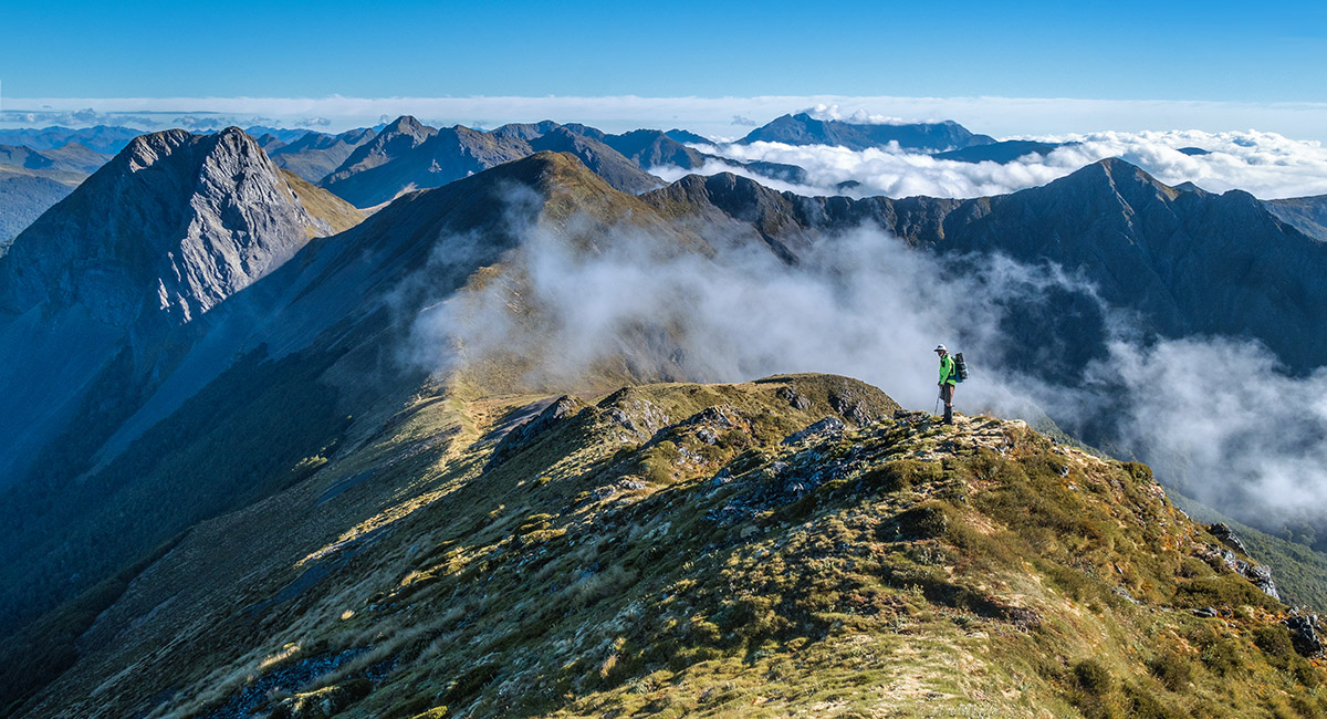
The main summit view south from Mt Sodom, with Pt 1541 left, Mt Gomorrah centre and Mt Baldy and distant Mt Patriarch right

Looking north from Mt Sodom, over Pt 1458 to Mt Star, and further to Pt 1633. Mt Arthur is in cloud centre skyline

Looking back up Mt Sodom's northeast ridge, right, on our way to Skeet Saddle (1,280m)

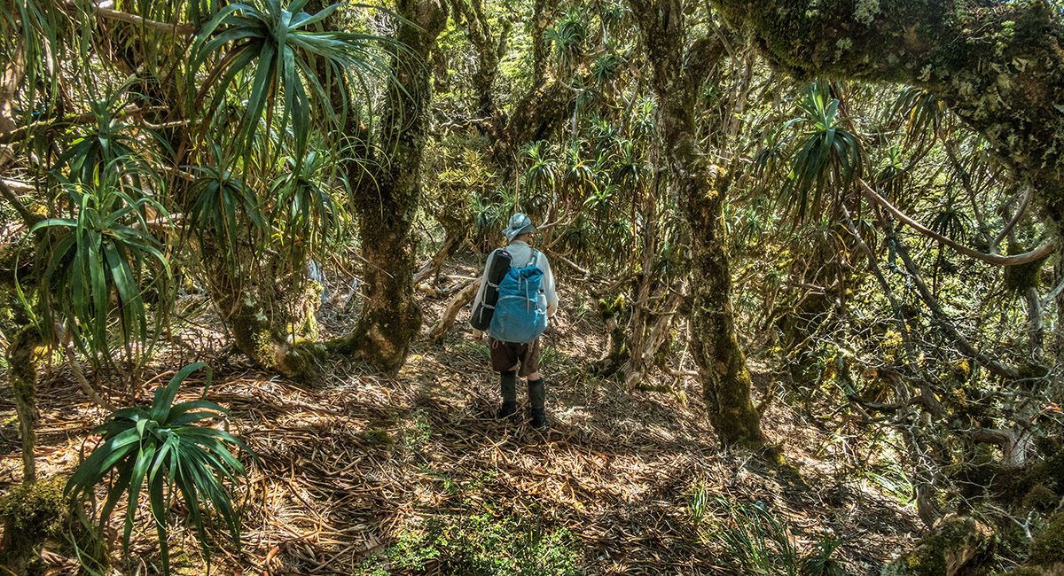
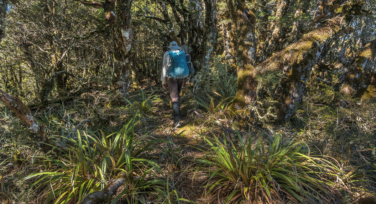
Back in the bush briefly near Pt 1337 and Skeet Saddle

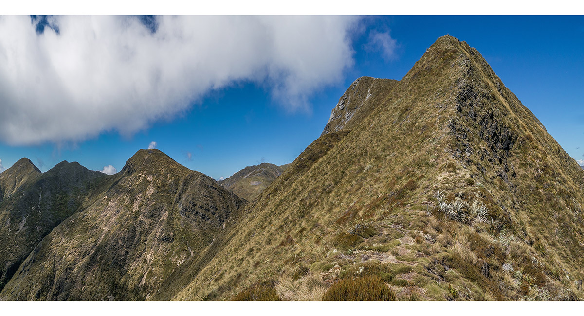
A view south from near the top of Pt 1458, looking over Skeet Saddle to Mt Sodom, near left, Mt Baldy and Mt Patriarch centre and Mt Kendall far right

Headed north for Hough Saddle (1,306m), with Mt Star mid right and Pt 1633 centre. The route traverses the steep western slope of Mt Star to a saddle at 1,500m, where it crosses to the east side to traverse back onto the main ridge south of Pt 1633

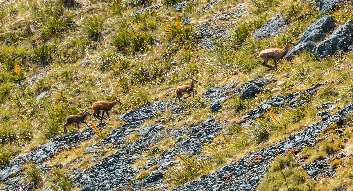
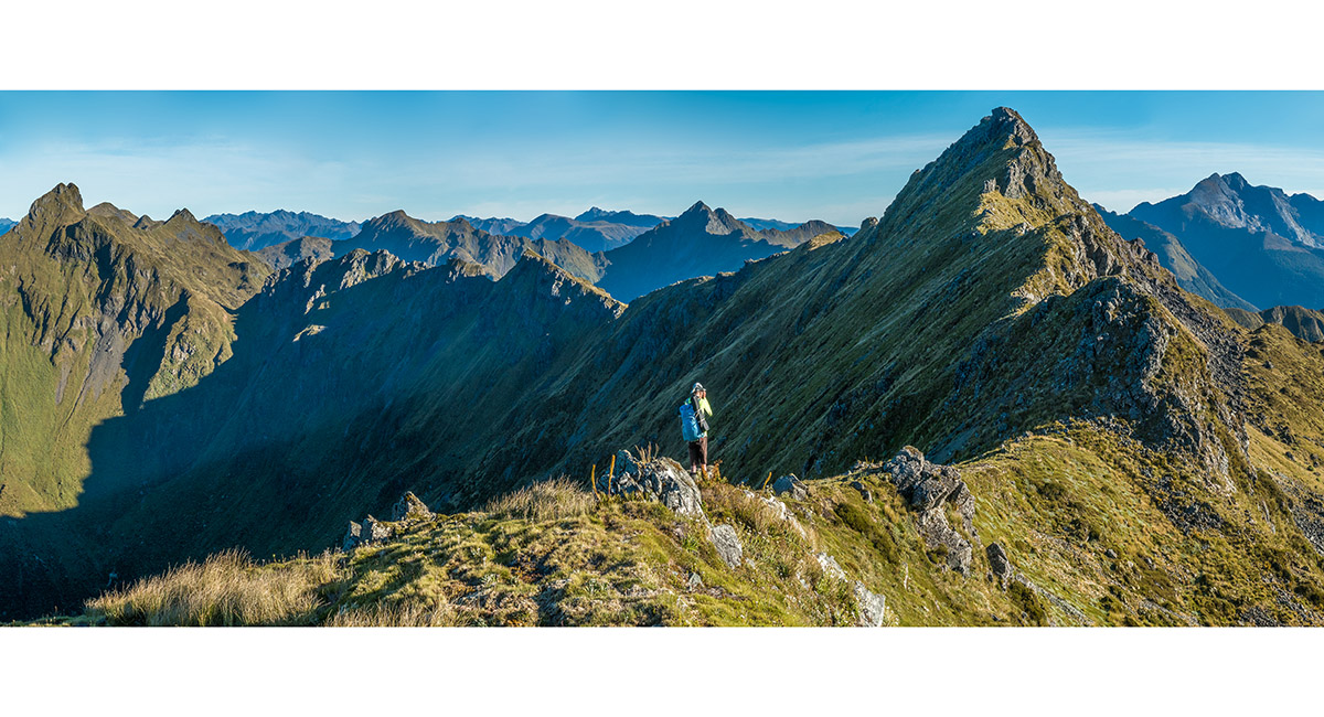
Some locals above us on the western side of Mt Star

In the 1,500m saddle north of Mt Star, with the east-side traverse to the ridge before Pt 1633 ahead. Distant right is Pt 1622. Our second bivvy would be at a tarn to the north of and beneath Pt 1622

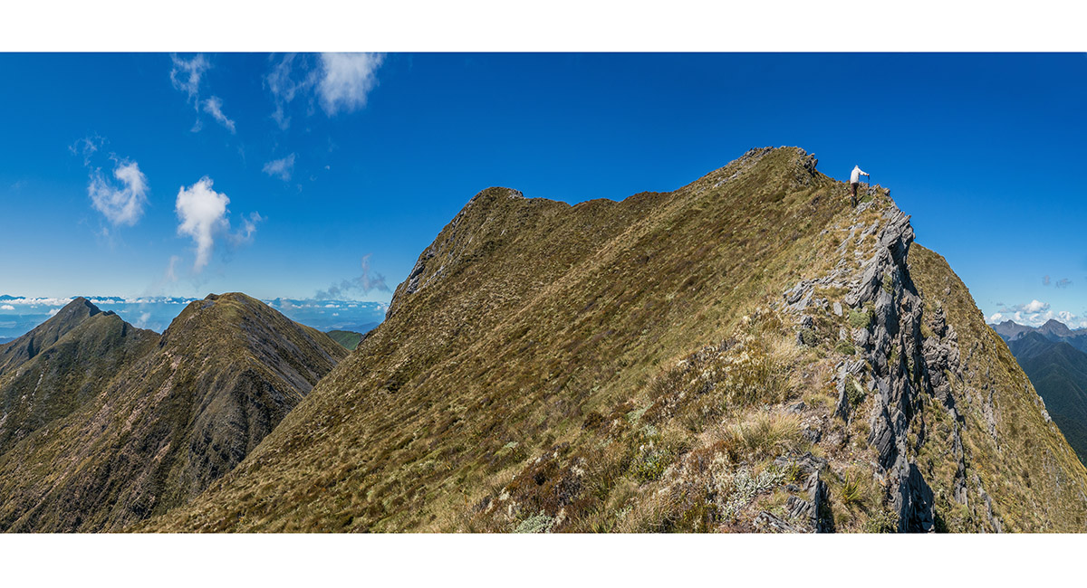
Climbing Pt 1633

North of Pt 1633, heading towards Pt 1622 on the right skyline

Getting closer to Pt 1622

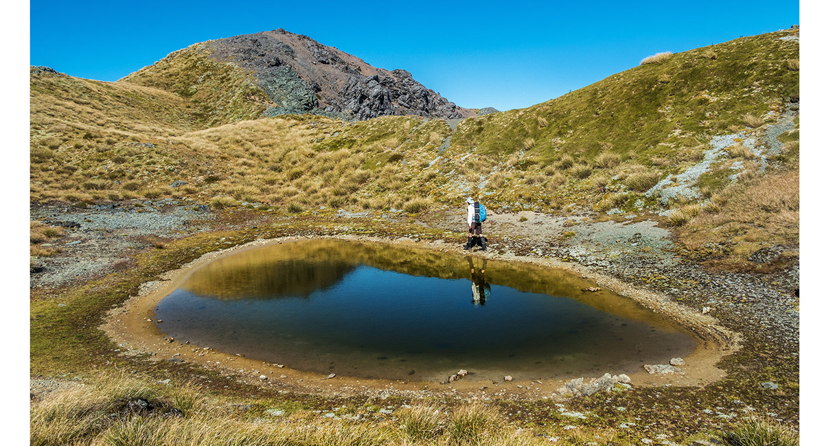
Passing a small tarn at 1,590m near the broad top of Pt 1622

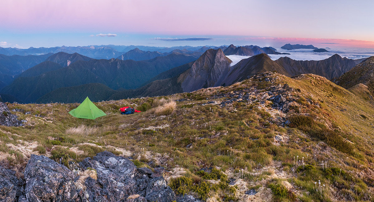
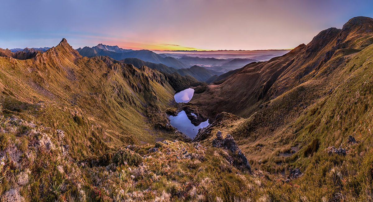
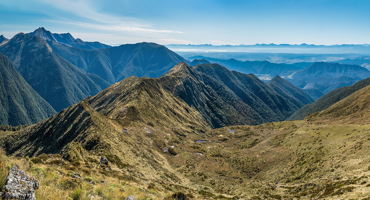
With Pt 1622 out of picture to the right, 80m below is our tarn bivvy spot, with The Twins and Mt Arthur mid-right skyline

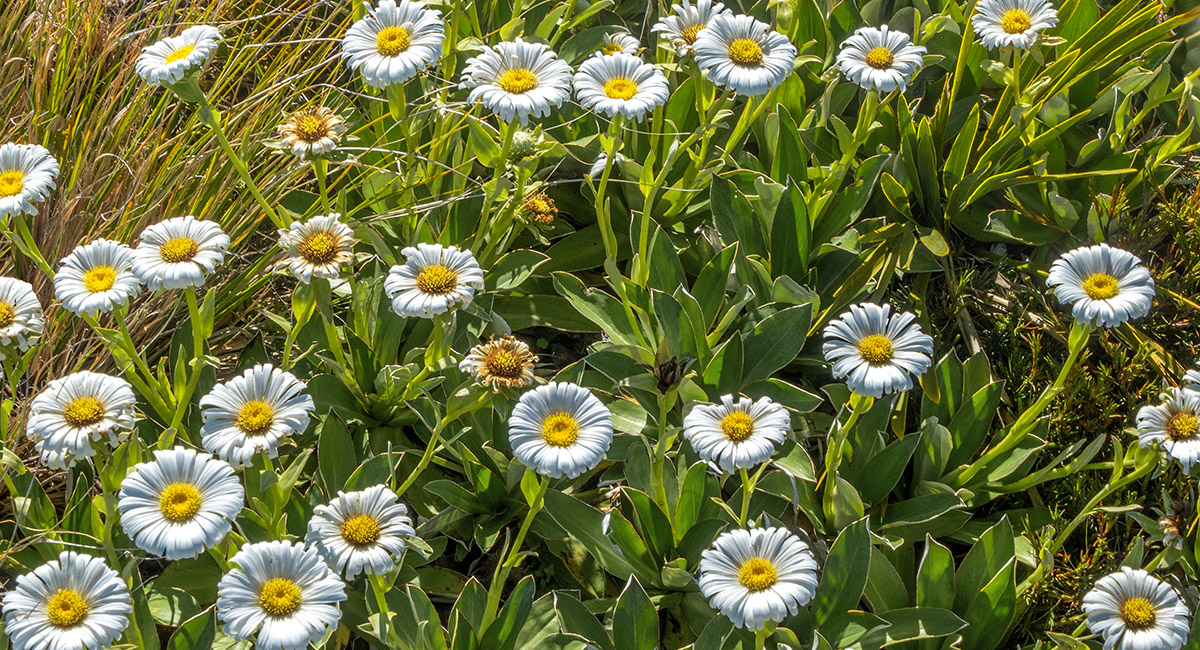
The alpine daisies were out in force in the bright sunlight

A dawn view east to two much larger tarns 300m below us. Tasman Bay and the Richmond Range are on the distant skyline


A closer look at the Richmond Range skyline, taking in Purple Top far right, Mt Sunday centre, to Saddle Hill left


Dawn view of The Twins and Mt Arthur

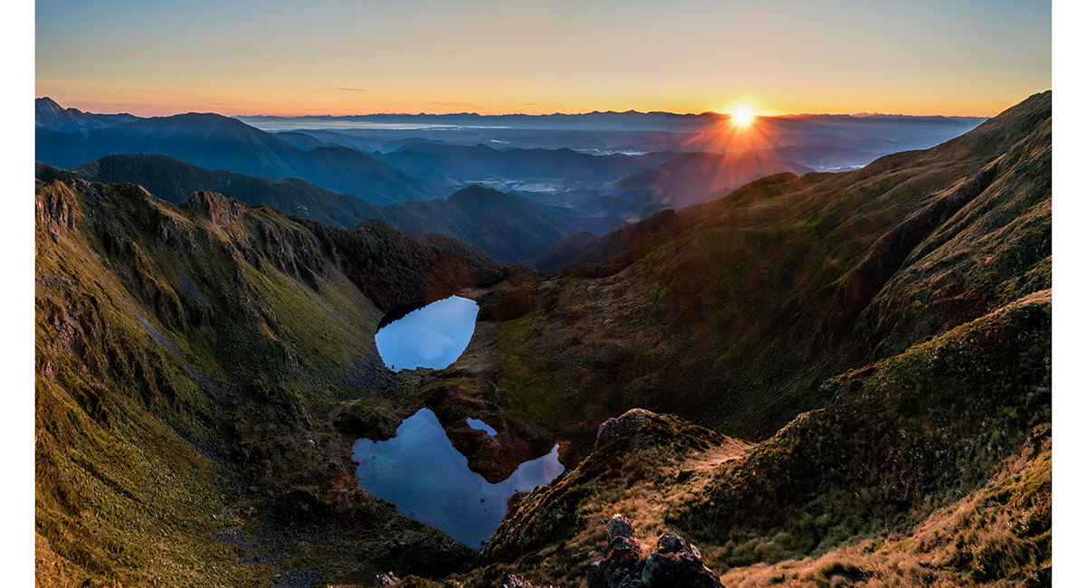
Here comes the sun

A view looking east across the tarn and our bivvy site to Pt 1622, top left

Now looking north across the tarn to our route for the day

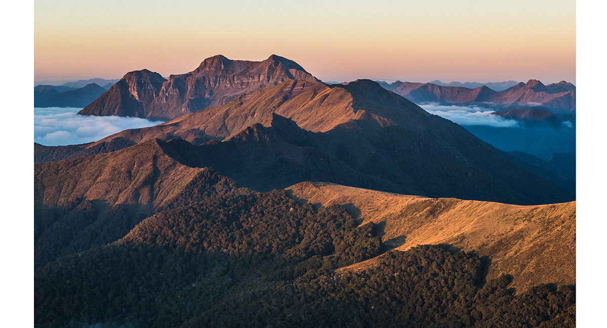
Back on the main ridge, looking west to Mt Kendall, left

Approaching Pt 1497, mid left beyond the immediate 1,560m un-named pointy rise, which marks the western upper end of Cowin Spur. At left the main range continues over craggy terrain to Pt 1563, far left

A broader view looking north to Cowin Spur and Mt Arthur, and east to Tasman Bay. Pt 1622 is far right/south

Climbing un-named point 1,560m, with Pt 1497 beyond at left

On top of un-named point 1,560m, looking south and west, with Mt Kendall centre

Nearing Pt 1497, with Cowin Spur stretching right, over Pt 1394, with Mt Arthur behind. The main range extends to Pt 1563, far left


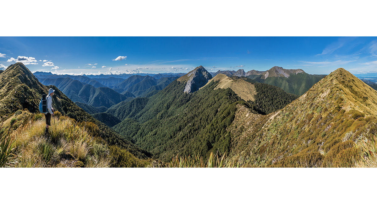
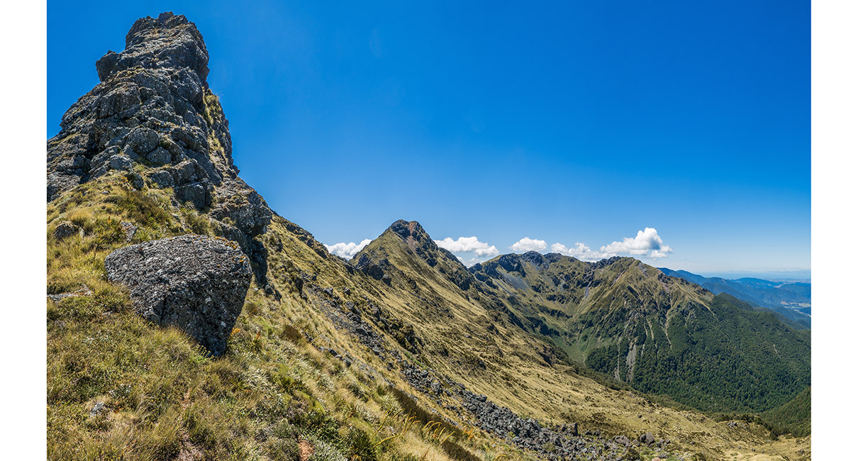
On top of Pt 1497, looking along the main range over the craggy section to Pt 1563, then further north to Baton Saddle, right of centre

The view back south from Pt 1497, down Crow River valley to distant Mt Patriarch, left of centre and Mt Kendall, right of centre skyline. Pt 1563 is far right

Looking east down Cowin Spur. The Twins and Mt Arthur top left

A view west from Pt 1394 on Cowin Spur, to the main range, with Pt 1597 far left, Baton Saddle (1,370m) left of centre and The Twins and Mt Arthur right

Baton Saddle, viewed from near Pt 1394 on Cowin Spur

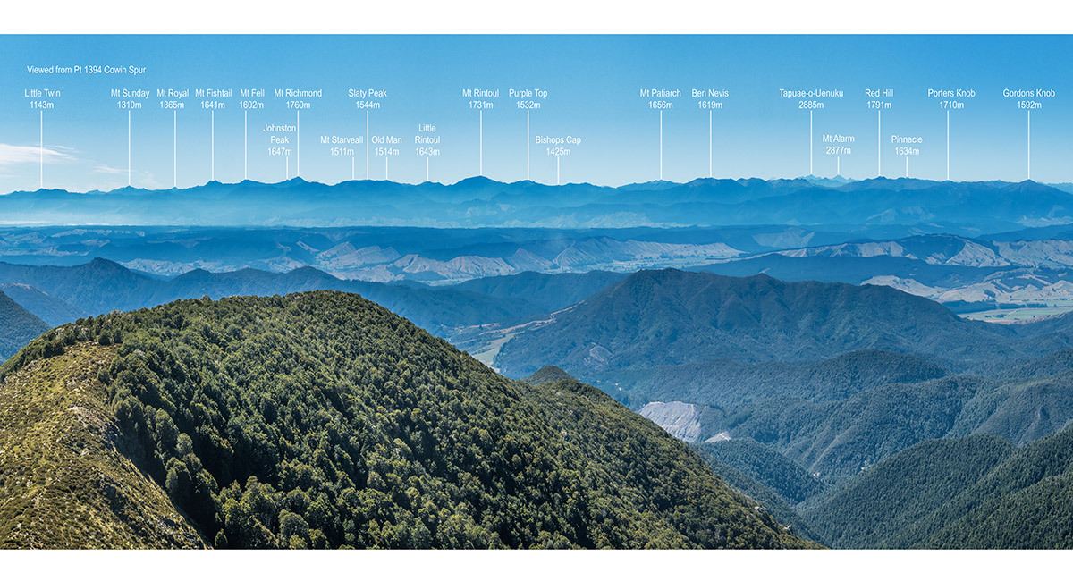
The Richmond Range, viewed from near Pt 1394 on Cowin Spur

Read about it Captivating Photography Jun/Jul 2025
To order a print or web resolution file of any image you see in this slide show, just right click the image, click “Copy Image URL” and paste in to the “Your message” box of our Contact Us form. Please also note, for each image, if you want a print or web resolution file. We will get back to you as soon as possible to confirm price and payment details.
Open Contact Us in a new window to paste Image URL(s) easily