Mitre Peak, January 2018
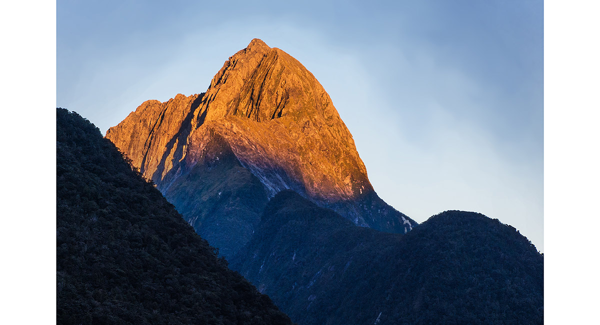
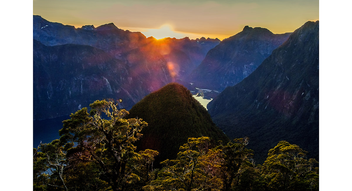
Mitre Peak (1,683m) at dawn

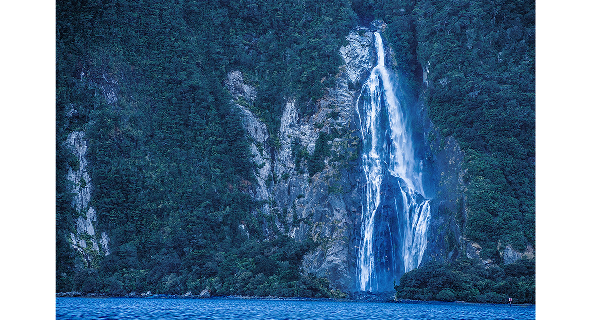
Bowen Falls (163m)

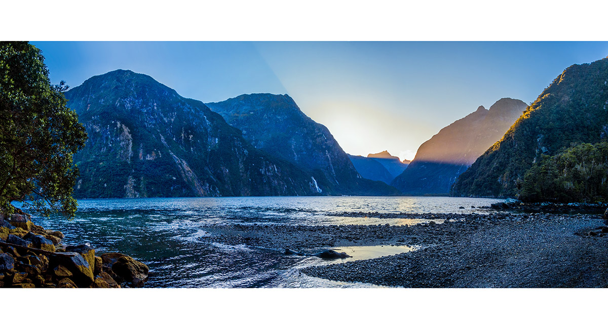
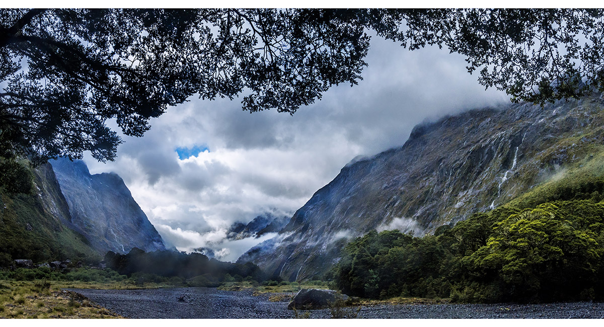
Looking back to Milford Sound before plunging in to the dense Fiordland bush

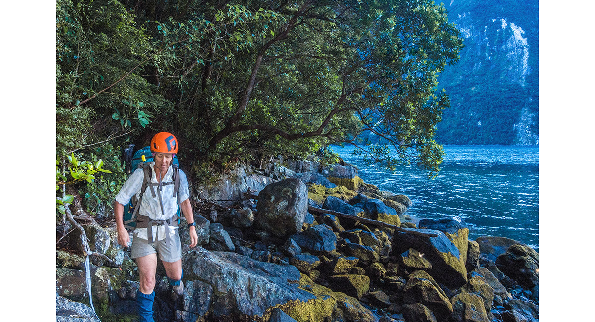
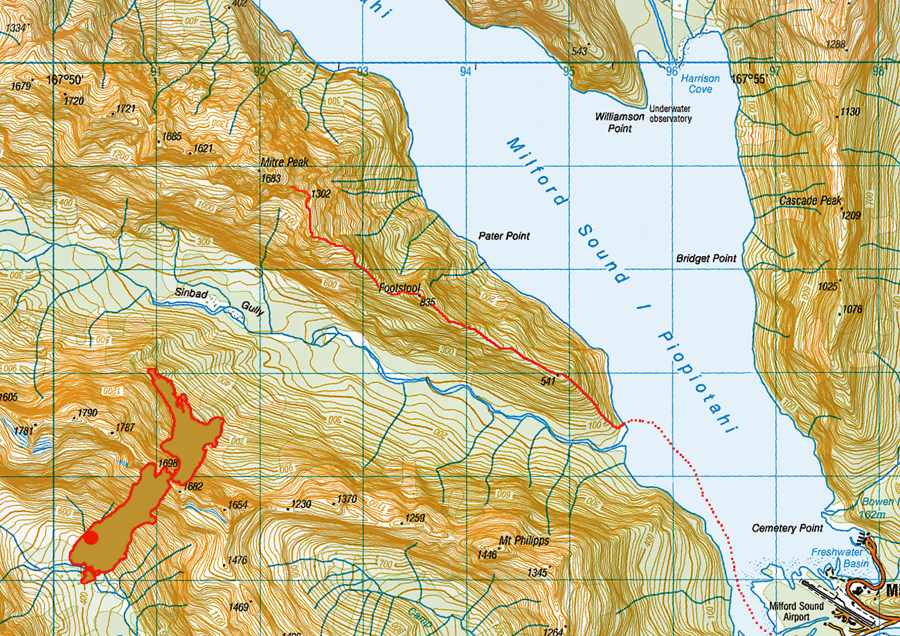
Heading to the trail head just north of Sinbad Gully stream, after our water taxi dropoff

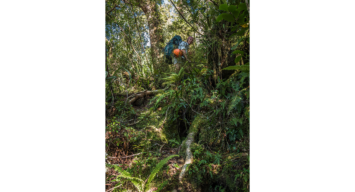
Climbing often near vertical bush on the first steep section up to the 541m point

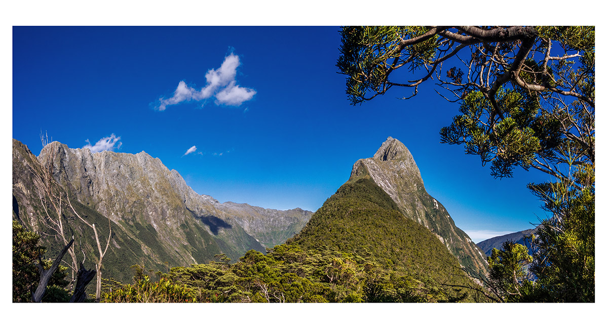
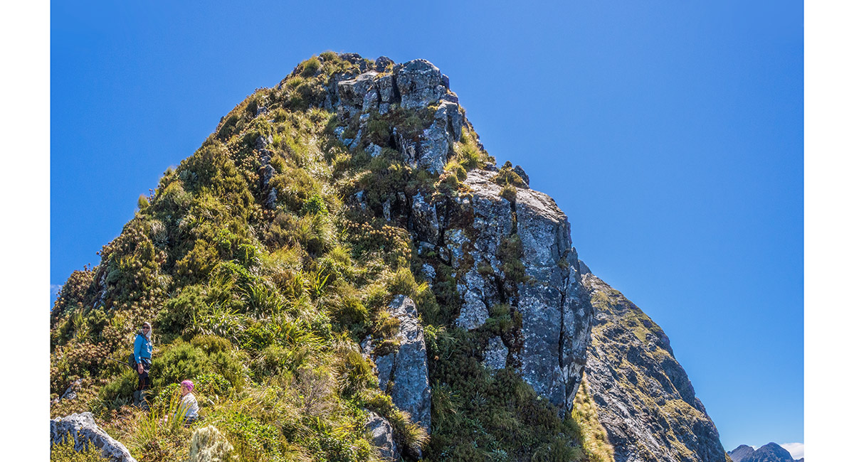
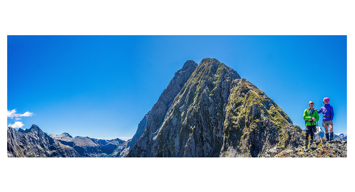
Our first good view of the upper section of Mitre Peak from the Footstool (835m)

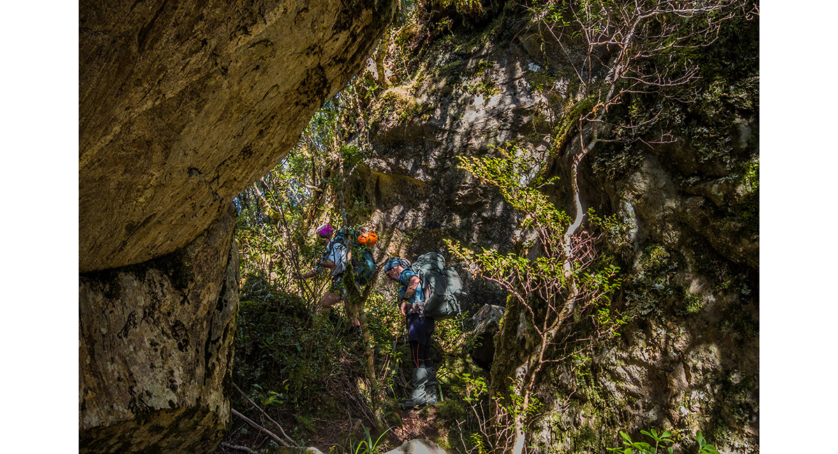
Back into the dense bush, dropping about 150m before climbing again to 730m to our campsite

Leaving the bushline at about 950m

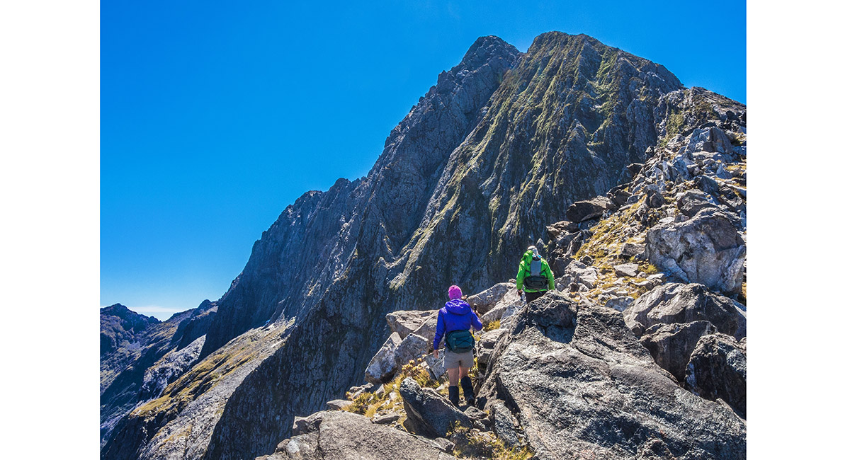
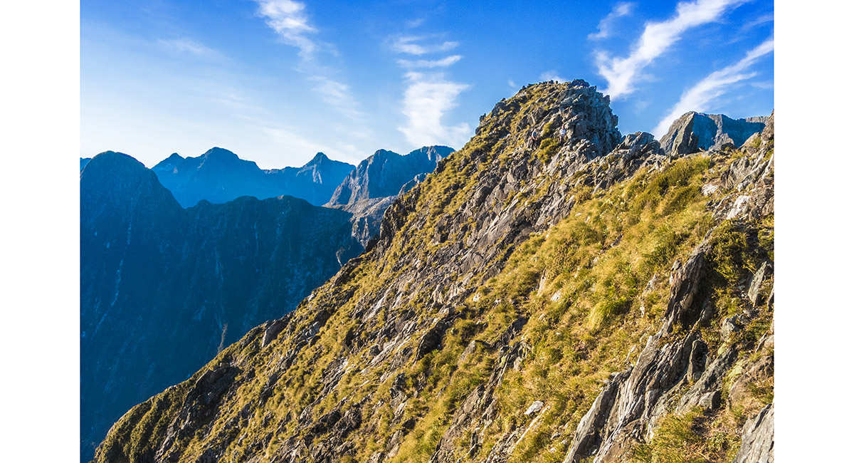
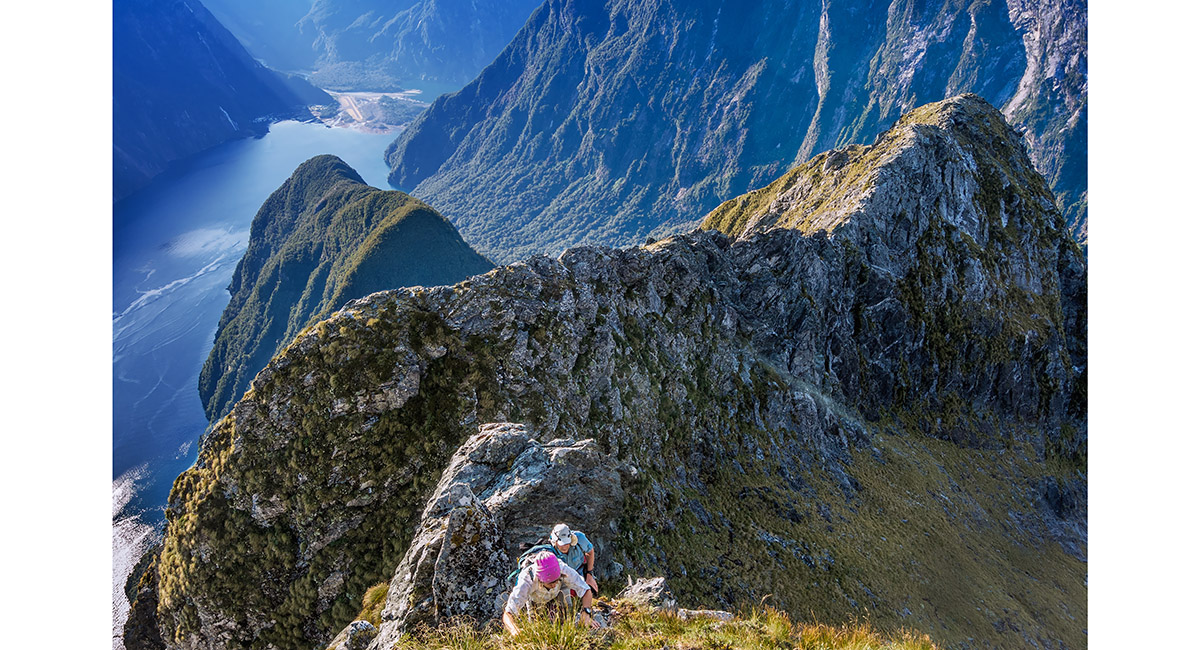
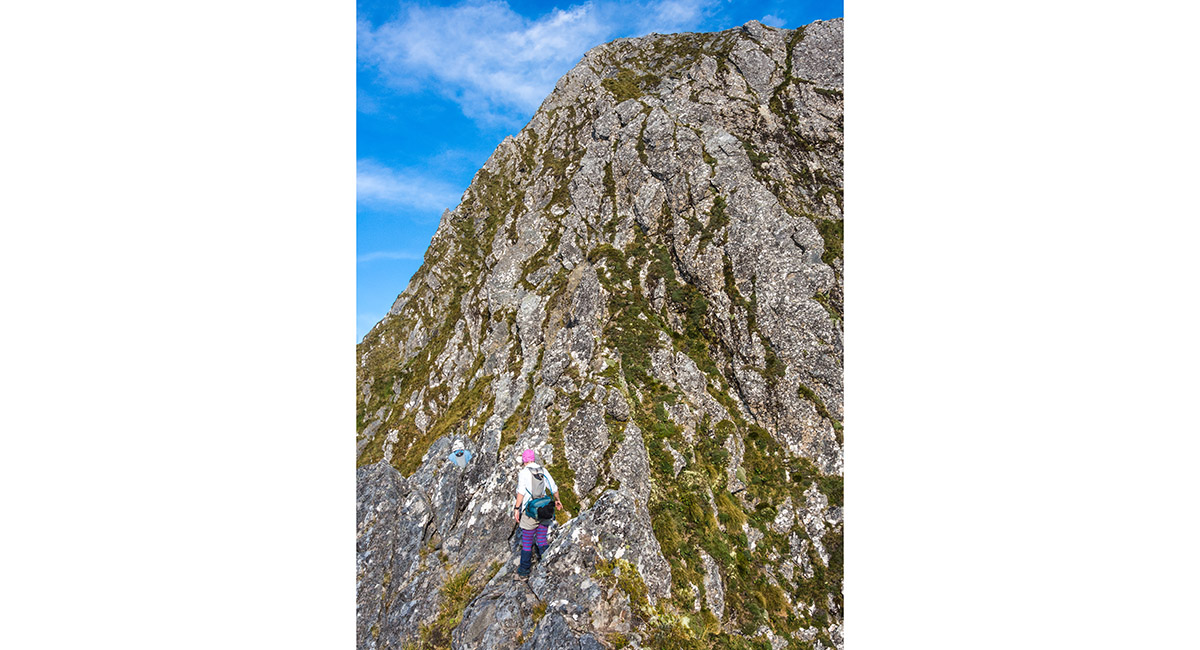
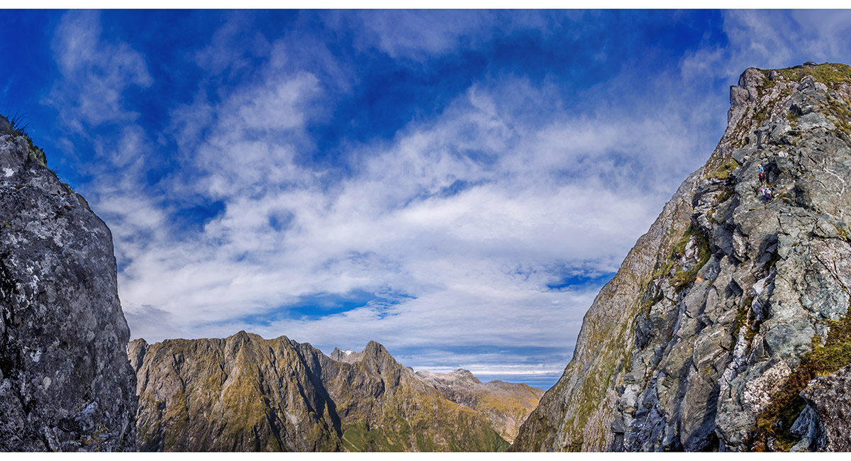
Looking north west up the ridge to a steep snowgrass covered section leading to the jagged, relatively horizontal ridge section

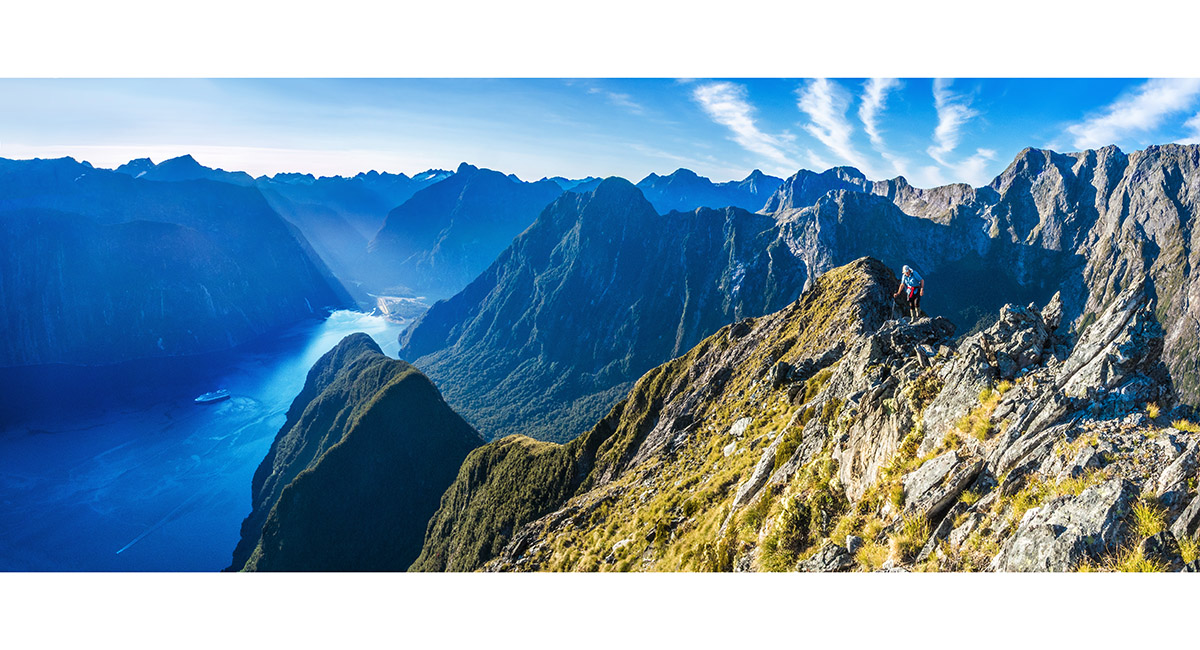
At the base of the horizontal section, looking back down the ridge to Milford Sound

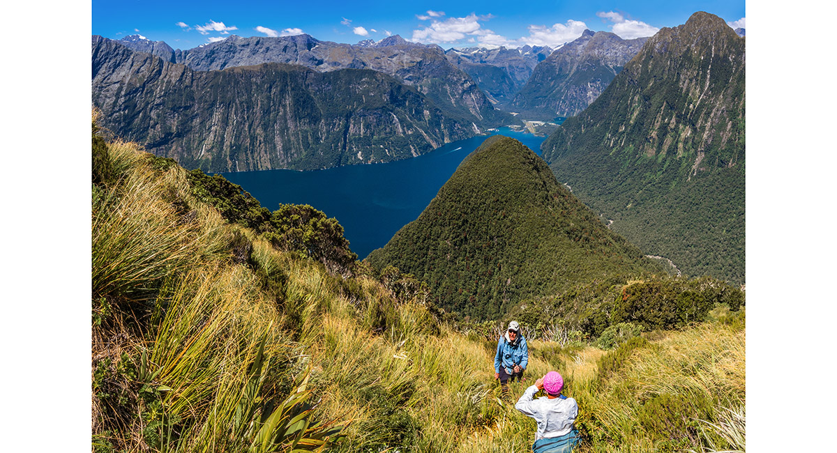
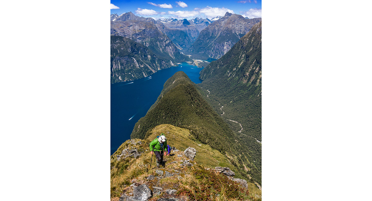
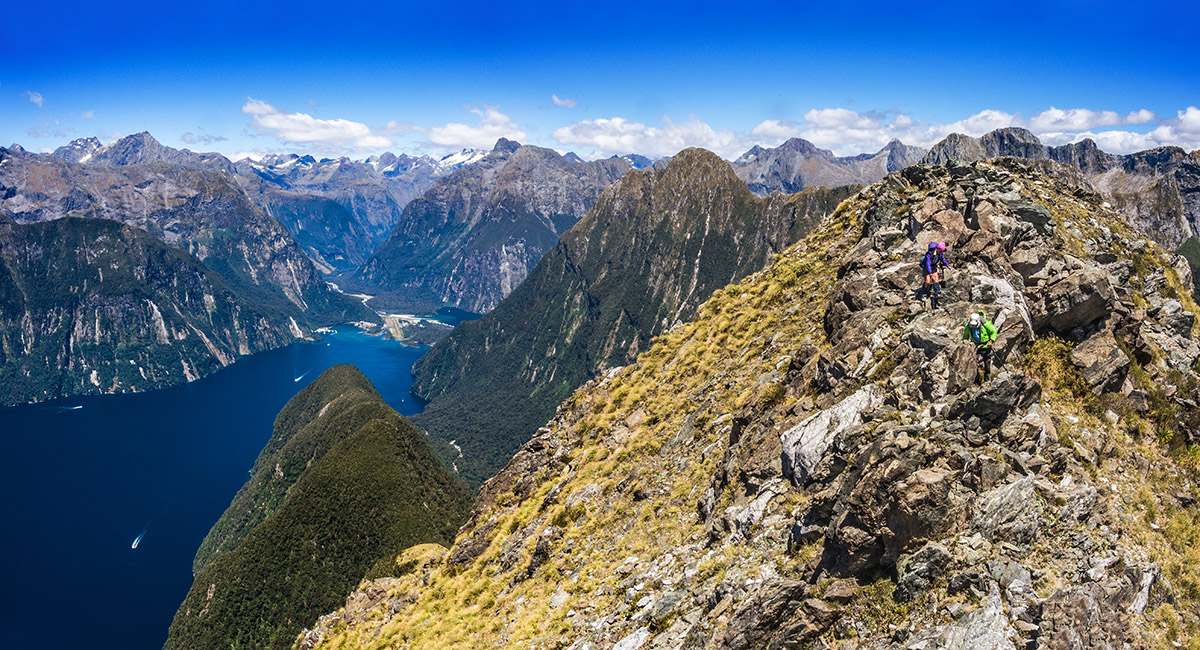
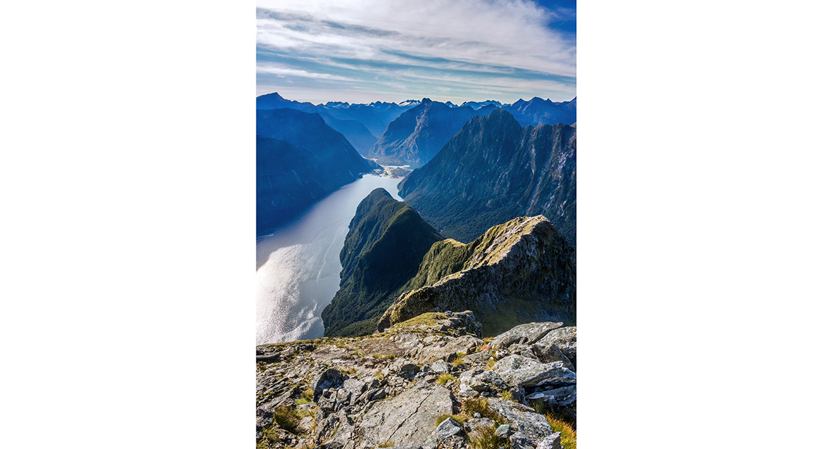
At about 1,150m on the horizontal ridge, looking south east to Milford Sound

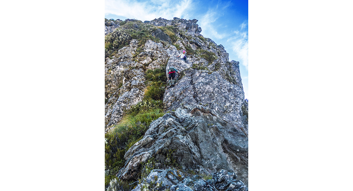
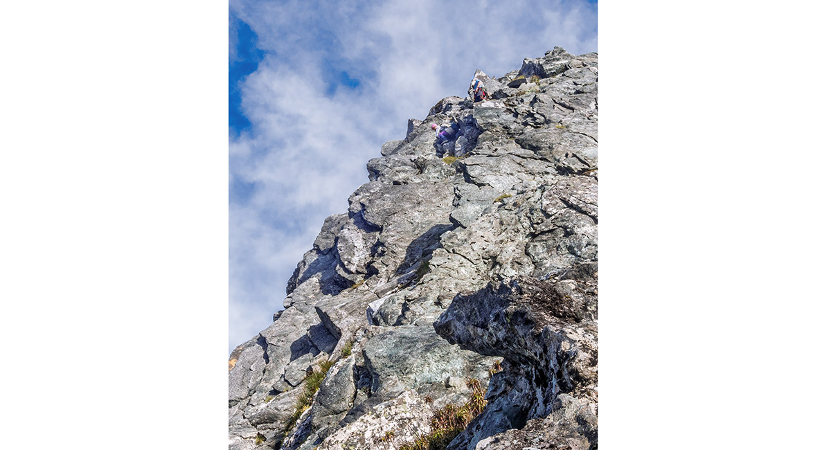
Near the notch at the far end of the horizontal section, about 1,250m

Near the notch at the far end of the horizontal section, about 1,250m

Looking back down the ridge from near the notch at about 1,250m

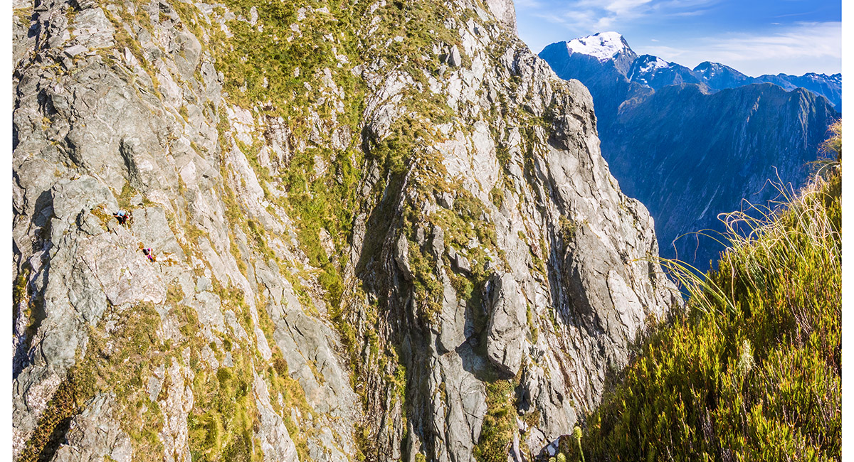
Just before the notch at 1,300m, with the upper section of Mitre Peak behind


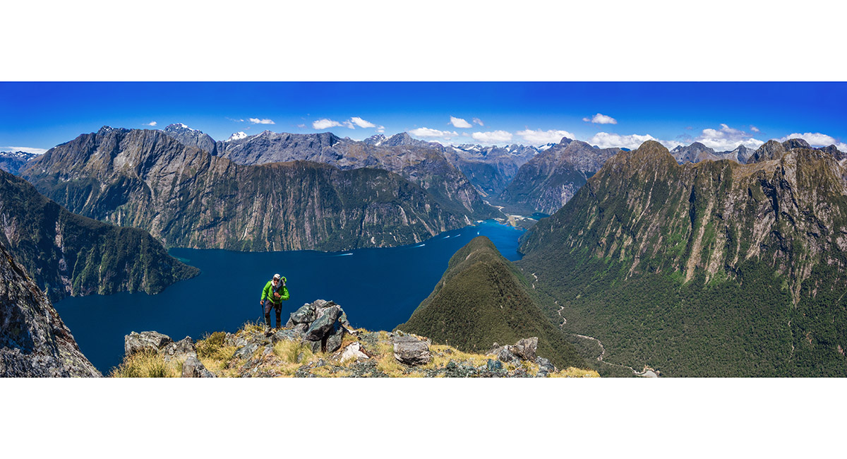
A view down the ridge to Milford Sound from about 1,250m

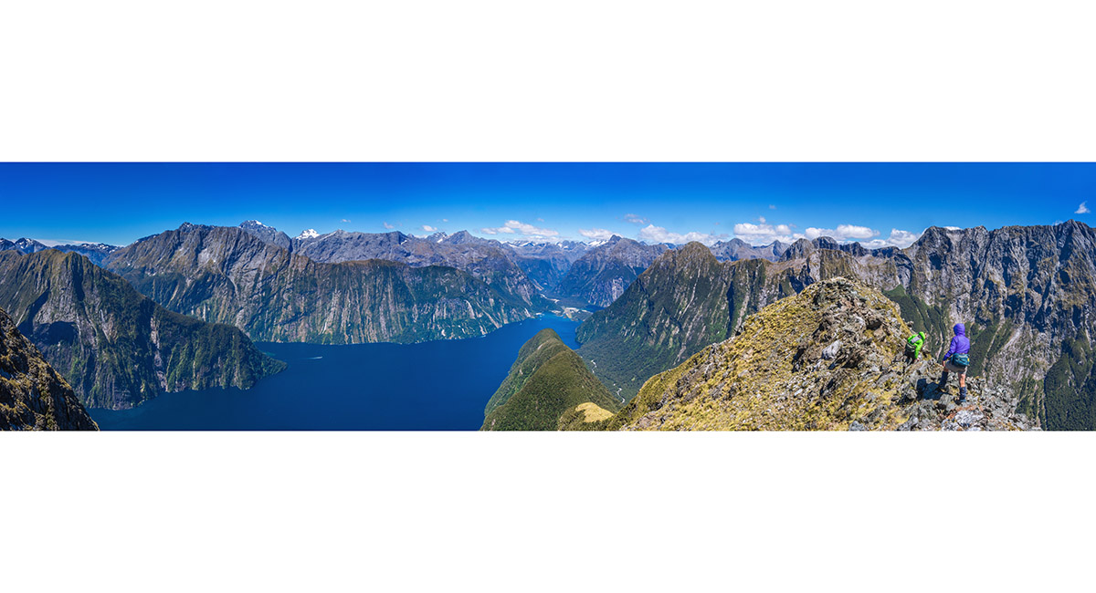
A view down the ridge to Milford Sound from about 1,200m

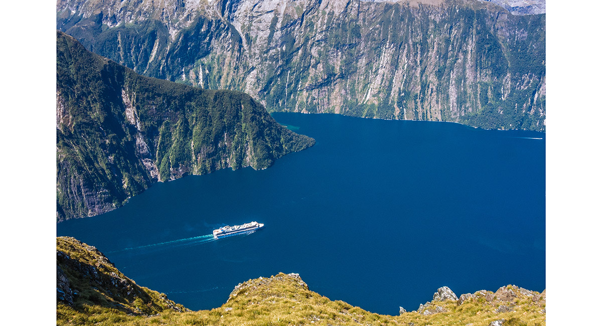
Over a vertical kilometre below a gigantic cruise ship looks like a bath tub toy

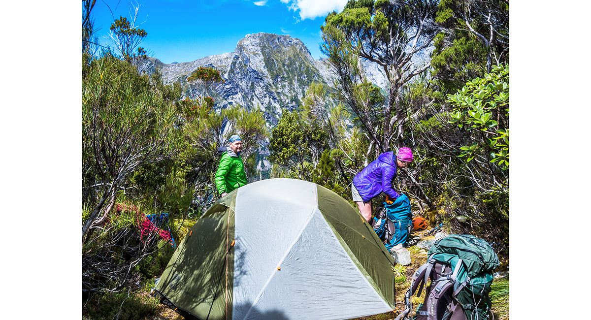
Our camp at 730m

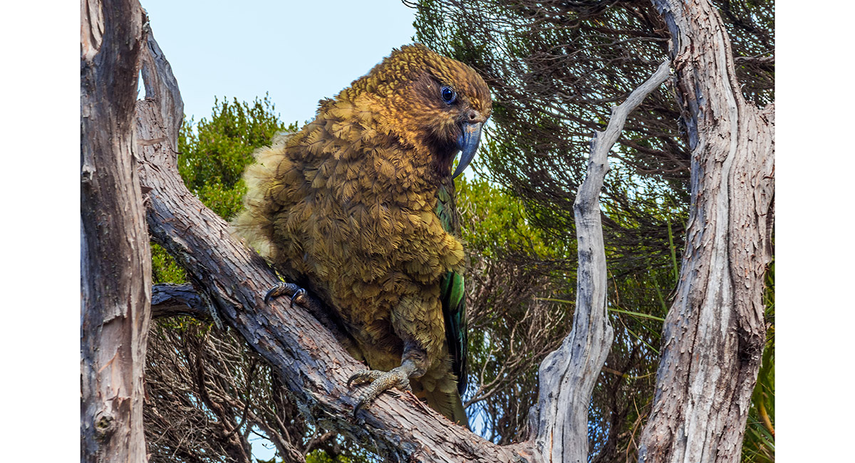
One of the locals pays us a visit at camp

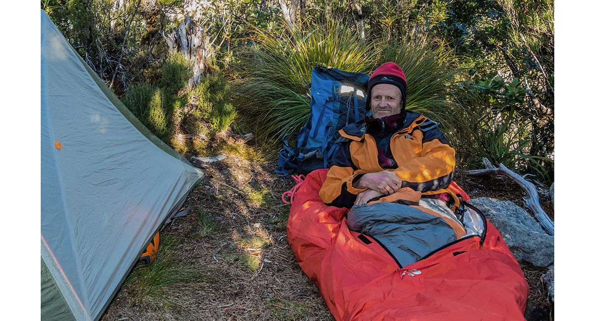
Bivvying down for the night, along with several thousand sand flies

Dawn from just above the tree line, looking back to Milford Sound. Up we went again now that the wind had dropped overnight

A view back down the ridge from about 1,300m, just before the notch

A view back down the ridge from about 1,300m, just before the notch


Looking down from the east side of the notch, with the crux of the upper section of Mitre Peak stretching upwards on the far side

A view from the bottom of the notch looking up the east (lower) side

Leaving the steepest crux portion directly above the notch, at about 1,350m


Leaving the steepest crux portion directly above the notch, at about 1,350m

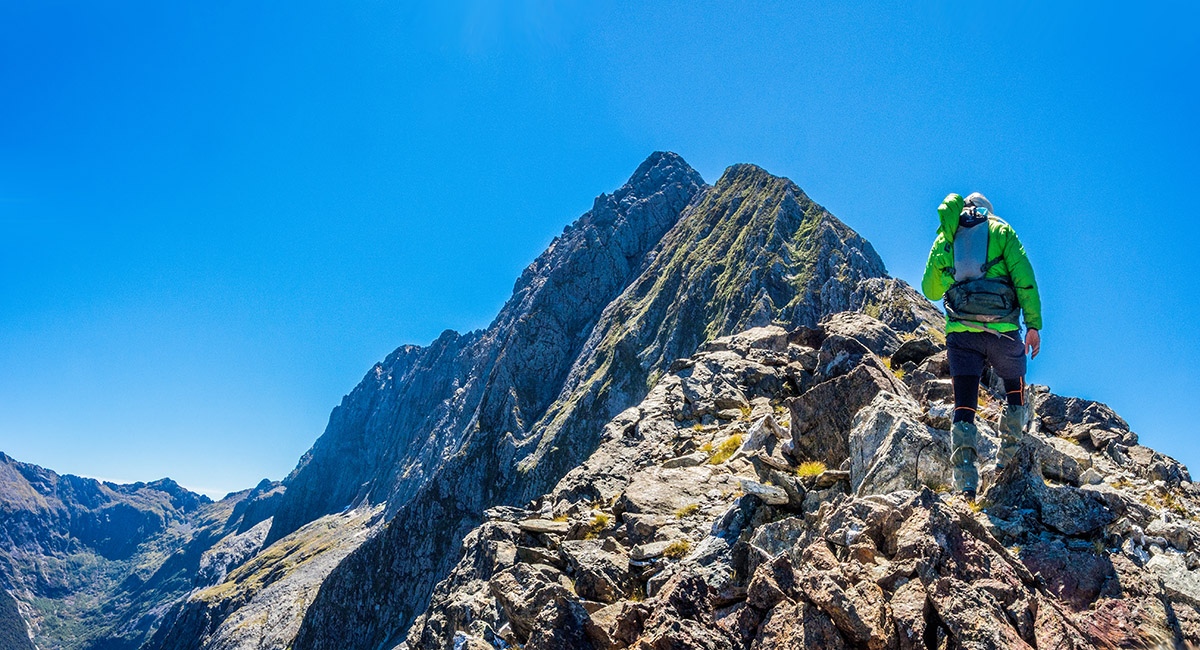
Looking up the ridge at about 1,430m - the point where we decided to turn around because the climb was taking too long for us to be able to make our 5pm water taxi pickup, if we had continued


The view back down Mitre Peak's knife edged ridge from our high point at 1,430m

Looking down to the notch from the its upper side

Descending the crux on the upper side of the notch

Descending the crux on the upper side of the notch

Descending the crux on the upper side of the notch

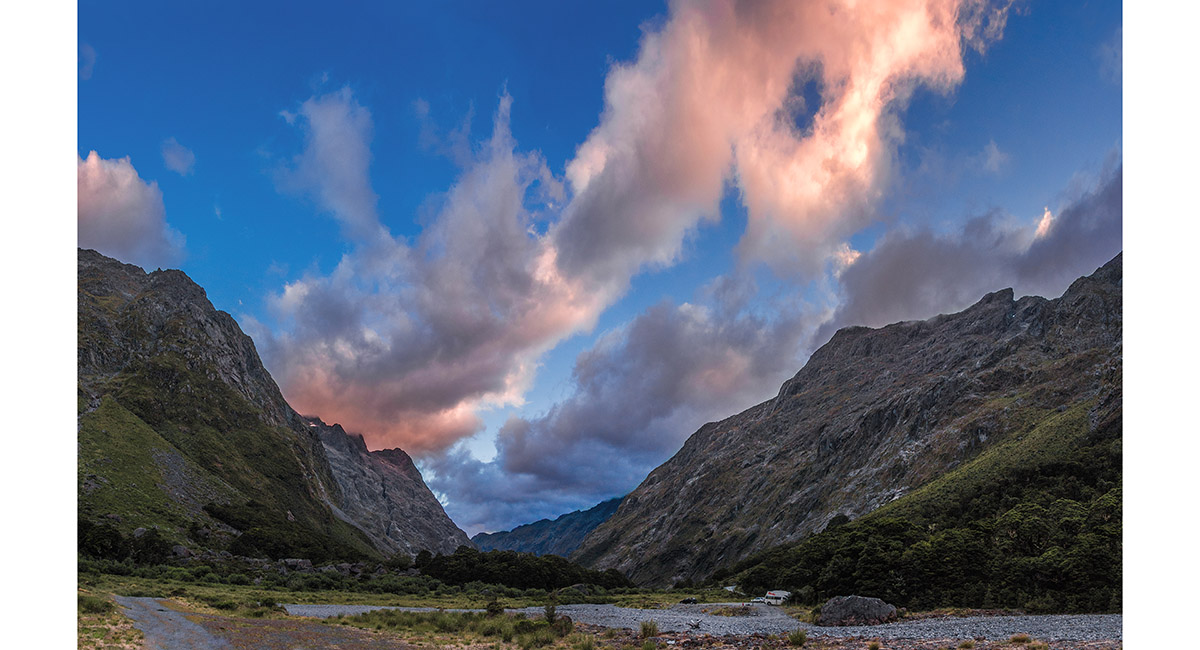
Looking north from Homer Hut, our base before and after the climb, at sunset

Looking north from Homer Hut, early morning

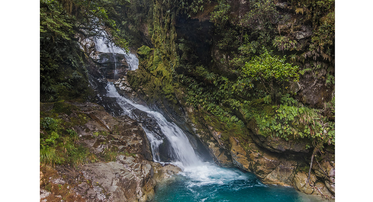
Christie Falls, about 9km south east of Homer Hut along the Milford Road

Read about it Above the fiord Vertigo Jan 18 Above the fiord Wilderness Magazine Oct 19
![]()
To order a print or web resolution file of any image you see in this slide show, just right click the image, click “Copy Image URL” and paste in to the “Your message” box of our Contact Us form. Please also note, for each image, if you want a print or web resolution file. We will get back to you as soon as possible to confirm price and payment details.
Open Contact Us in a new window to paste Image URL(s) easily