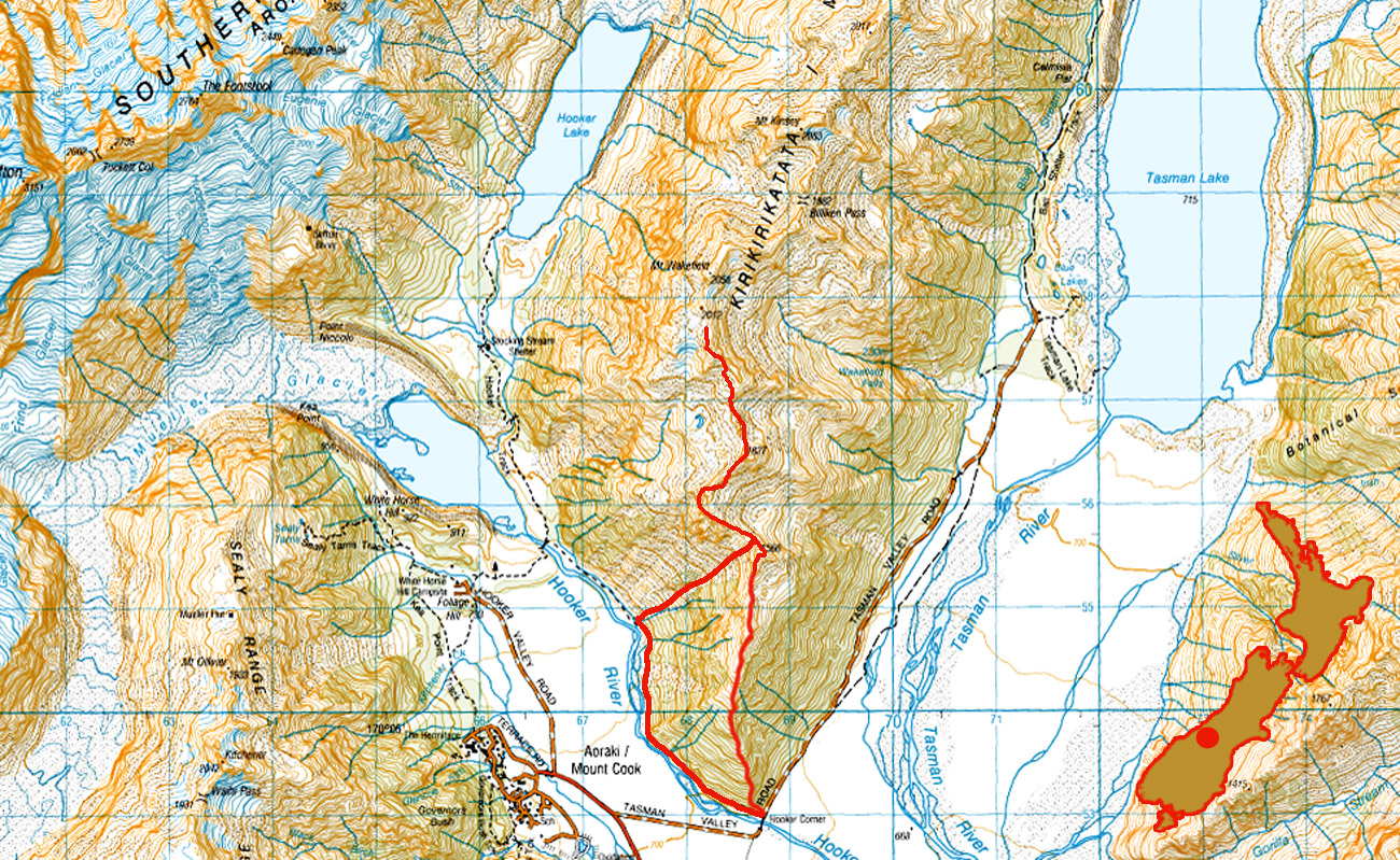
Mount Wakefield, November 2016
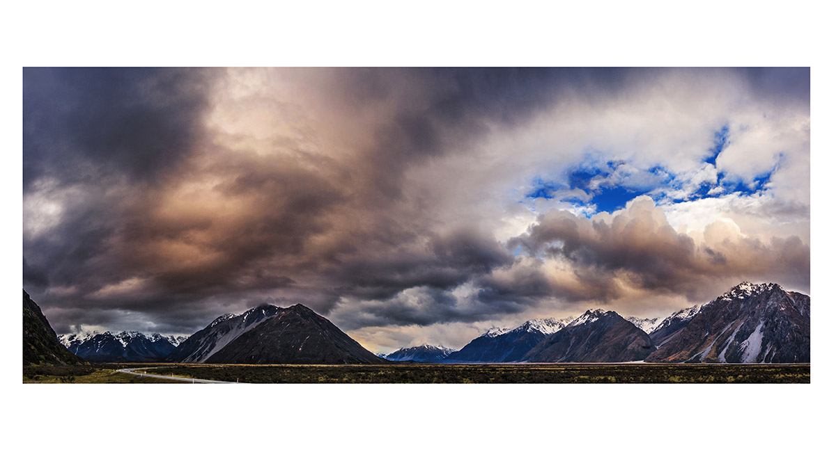
Brooding clouds slowly roll past on the evening before our climb, the view east from Unwin Lodge at dusk

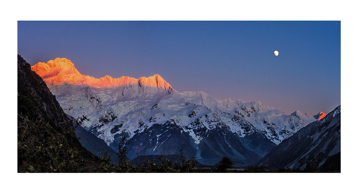
A clear weather window at last. Mount Sefton and the Footstool are bathed in dawn alpenglow as the super moon descends


At about 1,400m on Wakefield Ridge, looking south to Lake Pukaki, with Mount Sealy (2,627m) dominating the skyline


At about 1,450m on Wakefield Ridge, looking to Mount Sefton


At about 1,450m on Wakefield Ridge, looking at the Sealy Range and Mount Sefton, far right


At about 1,500m on Wakefield Ridge, looking to Mount Sefton and the Footstool


Mount Sefton and the Footstool, with the terminal lake of Mueller Glacier below


At about 1,500m on Wakefield Ridge, looking north east to the Malte Brun Range


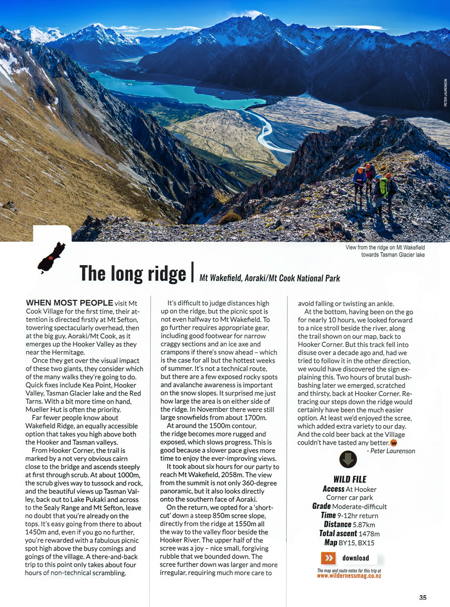
At about 1,600m on Wakefield Ridge, looking north east to the terminal lake of the Tasman Glacier with, from left, the Minarets, Elie De Beaumont, The Malte Brun Range, Murchison River and the Liebig Range (Nun's Veil with a cloud plume)


At about 1,650m on Wakefield Ridge, looking north to an 1,800m high point


At about 1,700m on Wakefield Ridge, looking south back down the ridge to Lake Pukaki


At about 1,800m on Wakefield Ridge, looking north west towards the summit, with Mount Sefton and the Footstool at left


At about 1,900m on Wakefield Ridge, looking south to the Sealy Range


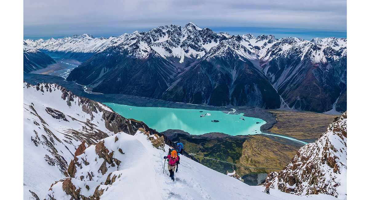
Near 2,000m on Wakefield Ridge, looking down to Mueller Lake, Mount Sefton and the Sealy Range

Approaching 2,000m on Wakefield Ridge, looking north east to Nun's Veil and the Liebig Range


At about 2,000m on Wakefield Ridge, looking south to Lake Pukaki


At about 2,000m on Wakefield Ridge, looking north and east. The summit area of Mount Wakefield is ahead, with Aoraki Mount Cook looming above


Near the summit of Mount Wakefield, with Mount Alex in the foreground and Aoraki Mount Cook beyond


Aoraki Mount Cook


On the descent back down the ridge


On the descent back down the ridge


The 850m scree slope we chose to take as our "shortcut" down to the Hooker River


Looking back up the first half of the scree slope


All 850 metres of our scree descent from Wakefield Ridge to the Hooker River. The last member of our party is the tiny blue dot above the scrub patch mid left. From here we chose to go down the true left of the river, grovelling along the heavily overgrown "Neely there yet" trail for a couple of hours. Wiser souls will go right and take the suspension bridge

Read about it – A different perspective Wilderness Magazine June 2017 The long ridge Wilderness Magazine December 2018 Mt Wakefield Wilderness Magazine June 2026
![]()
To order a print or web resolution file of any image you see in this slide show, just right click the image, click “Copy Image URL” and paste in to the “Your message” box of our Contact Us form. Please also note, for each image, if you want a print or web resolution file. We will get back to you as soon as possible to confirm price and payment details.
Open Contact Us in a new window to paste Image URL(s) easily