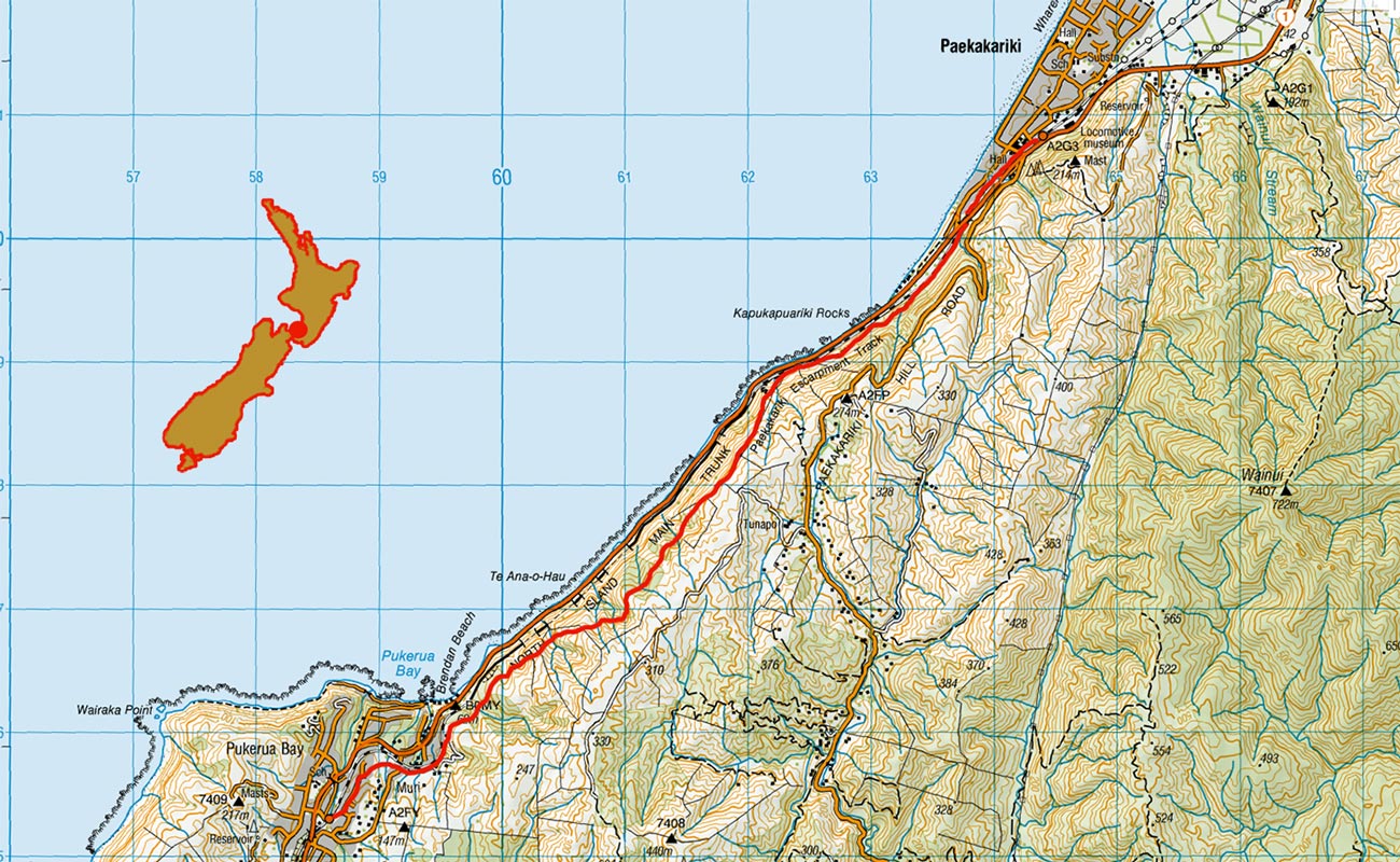
Te Araroa trail
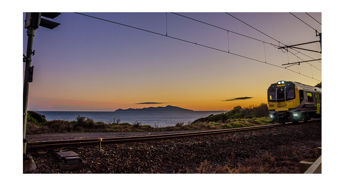
Beside the train tracks at the southern (Pukerua Bay) end point of the trail, view to Kapiti Island, June 2016


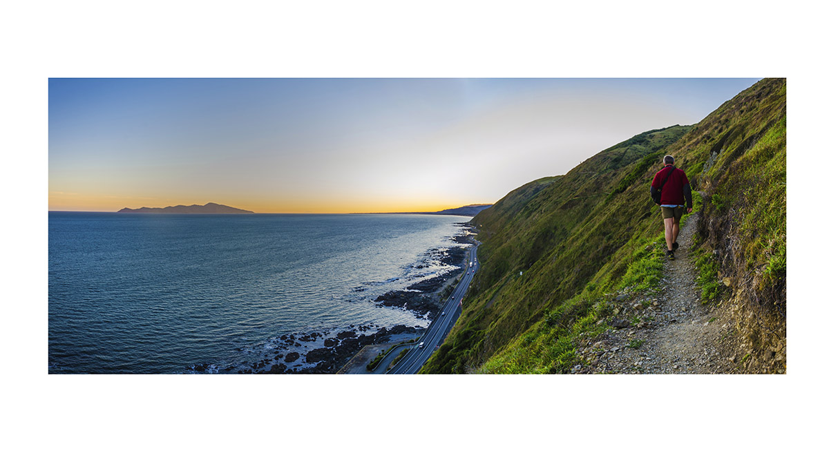
At about 100m above sea level looking northwest to Kapiti Island


Kapiti Island


About a third of the way along the route heading north, here at about 80m above sea level, at the first of two suspension bridges

Heading north, with Kapiti Island


At about 80m above sea level, at the second of two suspension bridges, just before the main climb up the highpoint at 210m, which is also about half way


A viewpoint on the descent towards Paekakariki


Looking back to Pukerua Bay


Kapiti Island

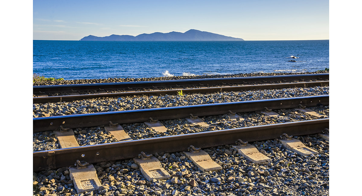
Back down beside the railway tracks, about 3kms before Paekakariki (the northern end point)


On a second dawn visit in December 2017


At about 80m above sea level, at the second of two suspension bridges, just before the main climb up the highpoint at 210m, which is also about half way


At about 80m above sea level, at the secondsuspension bridge


Heading north, with Kapiti Island


Kapiti Island


Encountering some locals in the small forest at about 150m


Some locals in the small forest


On the steep staircase leading to the high point and halfway point


Near the high point, with Pukerua Bay behind


Kapiti Island


Beginning the descent towards Paekakariki

Read about it – Above the madding crowd Wilderness Magazine Aug 16
![]()
To order a print or web resolution file of any image you see in this slide show, just right click the image, click “Copy Image URL” and paste in to the “Your message” box of our Contact Us form. Please also note, for each image, if you want a print or web resolution file. We will get back to you as soon as possible to confirm price and payment details.
Open Contact Us in a new window to paste Image URL(s) easily