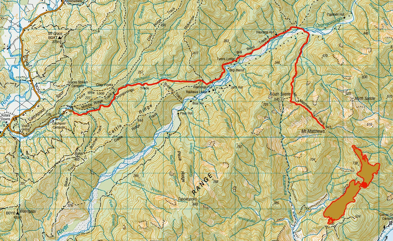
Mount Matthews, August 2017

View to the south coast from above the South Saddle (545m) at about 640m


Looking southeast to the summit of Mt Matthews


In goblin forest below the summit of Mt Matthews


In goblin forest below the summit of Mt Matthews


At the slip at 870m near the summit


Summit view (941m) south to Ocean Beach


Summit view (941m) south west to Tapuae o Uenuku and the Seaward Kaikouras


A little summit indulgence


View northeast near the summit to the North Saddle (620m)


View northeast near the summit to the North Saddle


View northeast near the summit to the North Saddle


On the descent above the South Saddle, looking northwest to McKerrow (706m)


On the descent above the South Saddle, looking northwest to Wellington


Back down at 640m above the South Saddle, looking south to Mt Matthews' summit (left) and the south coast


Back down at 640m above the South Saddle, looking northwest to McKerrow (706m)


On the descent below the South Saddle


On the descent below the South Saddle


Back down at Matthews Stream


Descending beside Matthews Stream


Descending beside Matthews Stream, with Mt Matthews behind


At the junction of Matthews Stream and Orongorongo River


One of several river crossings on the stream bed route along Orongorongo River


One of several river crossings on the stream bed route along Orongorongo River


One of several river crossings on the stream bed route along Orongorongo River


The last river crossing on the streambed route along Orongorongo River

To order a print or web resolution file of any image you see in this slide show, just right click the image, click “Copy Image URL” and paste in to the “Your message” box of our Contact Us form. Please also note, for each image, if you want a print or web resolution file. We will get back to you as soon as possible to confirm price and payment details.
Open Contact Us in a new window to paste Image URL(s) easily
![]()